close
-
Layers w
- Weather Layers
- Pro
- Pro
- Pro
- Pro
- Pro
- Pro
- More Layers
- Pro
- Pro
- Pro
- Pro
-
Upgrade to

3D
Trail Conditions
- Unknown
- Snow Groomed
- Snow Packed
- Snow Covered
- Snow Cover Partial
- Freeze/thaw Cycle
- Icy
- Prevalent Mud
- Wet
- Variable
- Ideal
- Dry
- Very Dry
Trail Flow (Ridden Direction)
Trailforks scans users ridelogs to determine the most popular direction each trail is ridden. A good flowing trail network will have most trails flowing in a single direction according to their intension.
The colour categories are based on what percentage of riders are riding a trail in its intended direction.
The colour categories are based on what percentage of riders are riding a trail in its intended direction.
- > 96%
- > 90%
- > 80%
- > 70%
- > 50%
- < 50%
- bi-directional trail
- no data
Trail Last Ridden
Trailforks scans ridelogs to determine the last time a trail was ridden.
- < 2 days
- < 1 week
- < 2 weeks
- < 1 month
- < 6 months
- > 6 months
Trail Ridden Direction
The intended direction a trail should be ridden.
- Downhill Only
- Downhill Primary
- Both Directions
- Uphill Primary
- Uphill Only
- One Direction
Contribute Details
Colors indicate trail is missing specified detail.
- Description
- Photos
- Description & Photos
- Videos
Trail Popularity ?
Trailforks scans ridelogs to determine which trails are ridden the most in the last 9 months.
Trails are compared with nearby trails in the same city region with a possible 25 colour shades.
Think of this as a heatmap, more rides = more kinetic energy = warmer colors.
- most popular
- popular
- less popular
- not popular
ATV/ORV/OHV Filter
Max Vehicle Width
inches
US Cell Coverage
Legend

Radar Time
Activity Recordings
Trailforks uses anonymized public activity data.
?
Activity Recordings
Trailforks uses anonymized public activity data.
?
Personal Heatmap
▶
Activity Types
all
/
none
▶
Options
2
Date range
month
–
Winter Trails
Warning
A routing network for winter maps does not exist. Selecting trails using the winter trails layer has been disabled.
Missing Trails
Most Popular
Least Popular
Trails are colored based on popularity. The more popular a trail is, the more red. Less popular trails trend towards green.
Jump Magnitude Heatmap
Heatmap of where riders jump on trails. Zoom in to see individual jumps, click circles to view jump details.
BC Backroad Status
![map legend]()
Service Road Atlas is a free to use, community-driven service for viewing and creating reports on the numerous back-country service roads around B.C. and Alberta.

Slope Aspect
Direction the slope faces
Trails Deemphasized
Trails are shown in grey.
Only show trails with no bike usage.
Suggested Layers
Based on selected activity type
Save the current map location and zoom level as your default home location whenever this page is loaded.
SaveTwo main areas with single track trails. One is located just west of Laburnum Rd close to the Qualicum Beach Elementary School. This area is well maintained with mainly beginner to intermediate trails. The second area is located near the Pheasant Glen Golf course at the end of Qualicum Rd. Rougher more technical,intermediate trails. Not much elevation in either area but still lots of fun.
Activities Click to view
- Mountain Bike
216 trails
- E-Bike
204 trails
- Gravel Bike
0 trails
- Adaptive Bike
0 trails
- Winter Fat Bike
0 trails
- Horse
48 trails
- Hike
224 trails
- Trail Running
223 trails
- Dirtbike/Moto
63 trails
- ATV/ORV/OHV
11 trails
- Snowshoe
132 trails
- Nordic Ski
10 trails
Region Details
- 53
- 6
- 62
- 86
- 7
- 1
Region Status
Open as of 2 daysLocal Trail Association
Stats
- Avg Trail Rating
- Trails (view details)
- 288
- Trails Mountain Bike
- 220
- Trails E-Bike
- 204
- Trails Horse
- 48
- Trails Hike
- 224
- Trails Trail Running
- 223
- Trails Dirtbike/Moto
- 63
- Trails Observed Trials
- 1
- Trails ATV/ORV/OHV
- 11
- Trails Snowshoe
- 132
- Trails Nordic Ski
- 10
- Total Distance
- 86 miles
- Total Descent
- 11,417 ft
- Total Vertical
- 3,398 ft
- Highest Trailhead
- 3,472 ft
- Reports
- 3,063
- Photos
- 990
- Ridden Counter
- 20,599
Sub Regions
-
Laburnum Road
- 1
- 21
- 25
-
Pheasant Glen
- 5
- 33
- 58
- 7
-
Upper Little Qualicum River Woodlands
- 1
- 1
Popular Qualicum Beach Mountain Biking Trails
• 100 ★ 4.0 • 2,028 ft • 38 ft • 191 •
Popular blue difficulty singletrack. This mountain bike primary trail can be used both directions with a 38 ft blue climb. It features jump. On average it takes 3 minutes to complete this trail.
• 100 ★ 3.0 • 645 ft • 44 ft • 188 •
Popular green difficulty singletrack. This mountain bike primary trail can be used both directions. On average it takes minutes to complete this trail.
• 95 ★ 3.0 • 1,027 ft • 21 ft • 186 •
Popular green difficulty singletrack. This mountain bike primary trail can be used both directions. On average it takes 1 minutes to complete this trail.
• 95 ★ 3.0 • 476 ft • 15 ft • 170 •
Popular green difficulty singletrack. This mountain bike primary trail can be used both directions with a 15 ft green climb. On average it takes minutes to complete this trail.
Qualicum Beach Mountain Bike Routes
9 miles • 618 ft • 27 • Loop •
A good introduction to all things Pheasant Glen. Trails are mainly Blue rated but some of the newer trails...
6 miles • 420 ft • 23 • Loop •
This mountain bike (or hiking route) captures most of the southeastern section of Pheasant Glen, avoiding...
6 miles • 480 ft • 23 • Loop •
Introduction to Pheasant Glen riding area - Intermediate Rider Makes use of the southeastern section of...
★ 3.0 • 23 miles • 1,039 ft • 1 • Loop •
This route encompasses gravel logging roads (Qualicum Beach to Whiskey Creek. It passes through Little...
★ 2.5 • 34 miles • 1,568 ft • 1 • Loop •
This Gravel Bike Route leaves Qualicum Beach via Claymore/Melrose Roads to Whiskey Creek, passes through...
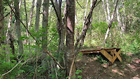
Photos of Qualicum Beach Mountain Bike
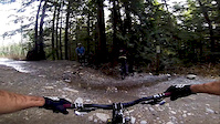
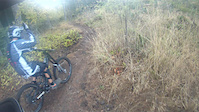
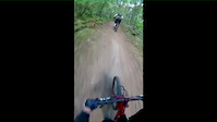
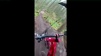
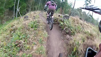
Videos of Qualicum Beach Mountain Bike
trail: Front Door
0:08 |
33 |
Jun 5, 2023
trail: Old School
5:32 |
151 |
Dec 11, 2017
trail: Old School
4:22 |
55 |
Oct 31, 2016
trail: Double D
4:39 |
313 |
Aug 30, 2014
trail: Double D
2:08 |
177 |
Jul 27, 2014

trail: Double D
3:00 |
246 |
Jul 19, 2014
trail: Double D
4:47 |
300 |
Apr 5, 2014
trail: Double D
3:42 |
168 |
Mar 23, 2014
Recent Trail Reports
| status | trail | date | condition | info | user |
|---|---|---|---|---|---|
| Back Door | Jun 22, 2026 @ 9:18pm (America/Vancouver) 2 days | Dry | rapid-roy TrailsBC | ||
| Bennett to Miraloma | Jun 18, 2026 @ 9:54am (America/Vancouver) Jun 18, 2026 | Dry | rapid-roy TrailsBC | ||
| Backdoor Climb and Connector | Jun 18, 2026 @ 9:54am (America/Vancouver) Jun 18, 2026 | Dry | rapid-roy TrailsBC | ||
| Goose Shit | Jun 16, 2026 @ 7:14pm (America/Vancouver) Jun 16, 2026 | Ideal | rapid-roy TrailsBC | ||
| Wildwood | Jun 15, 2026 @ 2:14pm (America/Vancouver) Jun 15, 2026 | Very Dry | Robin-L-H | ||
| PG 3 | Jun 14, 2026 @ 8:28am (America/Vancouver) Jun 14, 2026 | Dry | rapid-roy TrailsBC | ||
| PG4 | Jun 14, 2026 @ 8:28am (America/Vancouver) Jun 14, 2026 | Dry | rapid-roy TrailsBC | ||
| Stubby | Jun 14, 2026 @ 8:28am (America/Vancouver) Jun 14, 2026 | Dry | rapid-roy TrailsBC | ||
| Brushcut | Jun 14, 2026 @ 8:28am (America/Vancouver) Jun 14, 2026 | Dry | rapid-roy TrailsBC | ||
| Hamilton Door | Jun 14, 2026 @ 8:28am (America/Vancouver) Jun 14, 2026 | Dry | rapid-roy TrailsBC |
Activity Feed
| username | action | type | title | date |
|---|---|---|---|---|
| rojerebike | vote | trail | activity #97695766 | Jun 24, 2026 @ 7:22am 5 hours |
| rapid-roy | add | report | activity #97603861 | Jun 22, 2026 @ 9:18pm 2 days |
| rojerebike | wishlist | region | activity #97443932 | Jun 20, 2026 @ 5:08pm Jun 20, 2026 |
| rojerebike | wishlist | region | activity #97443609 | Jun 20, 2026 @ 5:02pm Jun 20, 2026 |
| rapid-roy | add | report | activity #97337187 and 1 more | Jun 19, 2026 @ 12:25pm Jun 19, 2026 |
Recent Comments
| username | type | title | comment | date |
|---|---|---|---|---|
| report | Nice, ok didn’t see the pix. I will... | Jun 19, 2026 @ 9:51am Jun 19, 2026 | ||
| report | Uhhh what does? On gooseshit? | Jun 19, 2026 @ 9:50am Jun 19, 2026 | ||
| report | Looks awesome! | Jun 18, 2026 @ 6:54pm Jun 18, 2026 | ||
| report | You are the riddle guy | May 16, 2026 @ 1:55pm May 16, 2026 | ||
| report | Uhh icy? And heed? I’m confused | May 16, 2026 @ 1:52pm May 16, 2026 |
Local Badges
-

10 Green Trails127 awarded -

10 Blue Trails132 awarded -

Epic Ride Climb 2k12 awarded -

Climbing 10k Badge26 awarded -

Climbing 100k Badge1 awarded -

Epic Ride Descent 2k11 awarded
Bike & Skill Parks
| name | type | city | rating |
|---|---|---|---|
| Erik Goetzinger BMX Park | skill park | Qualicum Beach |
Activity Type Stats
| activitytype | trails | distance | descent | descent distance | total vertical | rating | global rank | state rank | photos | reports | routes | ridelogs |
|---|---|---|---|---|---|---|---|---|---|---|---|---|
| Mountain Bike | 216 | 50 miles | 5,436 ft | 22 miles | 3,399 ft | #895 | #48 | 937 | 3,053 | 5 | 13,102 | |
| E-Bike | 204 | 44 miles | 4,167 ft | 19 miles | 3,363 ft | #1,654 | #47 | 9 | 2,864 | 1 | 389 | |
| Horse | 48 | 5 miles | 394 ft | 2 miles | 262 ft | #1,502 | #52 | 84 | 6 | |||
| Hike | 224 | 59 miles | 7,943 ft | 25 miles | 3,399 ft | #559 | #34 | 19 | 2,987 | 1 | 2,399 | |
| Trail Running | 223 | 53 miles | 5,430 ft | 23 miles | 3,399 ft | #1,620 | #57 | 4 | 2,974 | 1,240 | ||
| Dirtbike/Moto | 63 | 28 miles | 2,956 ft | 10 miles | 1,578 ft | #30 | #11 | 19 | 233 | 1 | 1,184 | |
| Observed Trials | 1 | 1,857 ft | 75 ft | 902 ft | 118 ft | 10 | 2 | |||||
| ATV/ORV/OHV | 11 | 6 miles | 361 ft | 2 miles | 1,558 ft | #541 | #41 | 61 | 49 | |||
| Snowshoe | 132 | #593 | #46 | 53 | 6 | |||||||
| Nordic Ski | 10 | #1,137 | #49 | 2 | 8 | 34 |
Frequently Asked Questions About Qualicum Beach
▼
What are the best places to ride in Qualicum Beach?
Qualicum Beach has 6 areas to explore for mountain biking. The top rated areas are:
▼
What are the highest rated mountain biking trails in Qualicum Beach?
The highest rated mountain biking trails in Qualicum Beach are:
- PG1 (4.3/5)
- A - Side (4.3/5)
- Jimbo (4.2/5)
- Backdoor Climb - 8 Ball Connector (4.2/5)
- Jellyfish (4.2/5)
▼
What is the best time of the year to ride in Qualicum Beach?
Based on ride log data, the most popular months to ride in Qualicum Beach are:
- July (196 activities)
- August (174 activities)
- October (167 activities)
▼
Where can I park to ride in Qualicum Beach?
There are 16 parking locations listed in Qualicum Beach. The most popular parking spots are: View all parking and trailhead locations on the map to plan your visit.
Activities
- Qualicum Beach Mountain Biking Trails
- Qualicum Beach E-Biking Trails
- Qualicum Beach Horseback Trails
- Qualicum Beach Hiking Trails
- Qualicum Beach Trail Running Trails
- Qualicum Beach Dirtbiking Trails
- Qualicum Beach ATVing/Offroading Trails
- Qualicum Beach Snowshoeing Trails
- Qualicum Beach Nordic Skiing Trails
Trails
Points of Interest
- 8B - D03 Drop, Small Medium, 22" TTF
- PB - 01AF Medium A-Frame TTF
- BS - AF02 A-Frame, Small TTF
- LN - B01 Bridge, Medium TTF
- 8B - D05 Elevated (doubled) Skinny Drop TTF
- "Floating" Boardwalk
- BC - B01 Small Bridge TTF
- KS - B01 Bridge, Medium TTF
- Eagle View Lookout Viewpoint
- 8B - AF01 A-Frame, Medium TTF
- Mount Cokely (5,285 ft)
- By mountainbiker1029 & contributors
- Admins: FOPG
- #7169 - 20,255 views
- qualicum beach activity log | embed map of Qualicum Beach mountain bike trails | qualicum beach mountain biking points of interest polygons
Downloading of trail gps tracks in kml & gpx formats is enabled for Qualicum Beach.
You must login to download files.