close
-
Layers w
- Weather Layers
- Pro
- Pro
- Pro
- Pro
- Pro
- Pro
- More Layers
- Pro
- Pro
- Pro
- Pro
-
Upgrade to

3D
Trail Conditions
- Unknown
- Snow Groomed
- Snow Packed
- Snow Covered
- Snow Cover Partial
- Freeze/thaw Cycle
- Icy
- Prevalent Mud
- Wet
- Variable
- Ideal
- Dry
- Very Dry
Trail Flow (Ridden Direction)
Trailforks scans users ridelogs to determine the most popular direction each trail is ridden. A good flowing trail network will have most trails flowing in a single direction according to their intension.
The colour categories are based on what percentage of riders are riding a trail in its intended direction.
The colour categories are based on what percentage of riders are riding a trail in its intended direction.
- > 96%
- > 90%
- > 80%
- > 70%
- > 50%
- < 50%
- bi-directional trail
- no data
Trail Last Ridden
Trailforks scans ridelogs to determine the last time a trail was ridden.
- < 2 days
- < 1 week
- < 2 weeks
- < 1 month
- < 6 months
- > 6 months
Trail Ridden Direction
The intended direction a trail should be ridden.
- Downhill Only
- Downhill Primary
- Both Directions
- Uphill Primary
- Uphill Only
- One Direction
Contribute Details
Colors indicate trail is missing specified detail.
- Description
- Photos
- Description & Photos
- Videos
Trail Popularity ?
Trailforks scans ridelogs to determine which trails are ridden the most in the last 9 months.
Trails are compared with nearby trails in the same city region with a possible 25 colour shades.
Think of this as a heatmap, more rides = more kinetic energy = warmer colors.
- most popular
- popular
- less popular
- not popular
ATV/ORV/OHV Filter
Max Vehicle Width
inches
US Cell Coverage
Legend

Radar Time
Activity Recordings
Trailforks uses anonymized public activity data.
?
Activity Recordings
Trailforks uses anonymized public activity data.
?
Personal Heatmap
▶
Activity Types
all
/
none
▶
Options
2
Date range
month
–
Winter Trails
Warning
A routing network for winter maps does not exist. Selecting trails using the winter trails layer has been disabled.
Missing Trails
Most Popular
Least Popular
Trails are colored based on popularity. The more popular a trail is, the more red. Less popular trails trend towards green.
Jump Magnitude Heatmap
Heatmap of where riders jump on trails. Zoom in to see individual jumps, click circles to view jump details.
BC Backroad Status
![map legend]()
Service Road Atlas is a free to use, community-driven service for viewing and creating reports on the numerous back-country service roads around B.C. and Alberta.

Slope Aspect
Direction the slope faces
Trails Deemphasized
Trails are shown in grey.
Only show trails with no bike usage.
Suggested Layers
Based on selected activity type
Save the current map location and zoom level as your default home location whenever this page is loaded.
Save
No description for Queenstown has been added yet!
Login or register to submit one.
Activities Click to view
- Mountain Bike
231 trails
- E-Bike
107 trails
- Gravel Bike
1 trails
- Adaptive Bike
0 trails
- Winter Fat Bike
0 trails
- Hike
159 trails
- Trail Running
162 trails
- Dirtbike/Moto
5 trails
- ATV/ORV/OHV
4 trails
- Snowmobile
8 trails
- Snowshoe
5 trails
- Downhill Ski
86 trails
- Backcountry Ski
60 trails
- Nordic Ski
32 trails
Region Details
- 12
- 5
- 26
- 60
- 17
- 33
- 19
Region Status
Caution as of 14 hoursStats
- Avg Trail Rating
- Trails (view details)
- 304
- Trails Mountain Bike
- 232
- Trails E-Bike
- 107
- Trails Gravel Bike
- 1
- Trails Horse
- 1
- Trails Hike
- 159
- Trails Trail Running
- 162
- Trails Dirtbike/Moto
- 5
- Trails ATV/ORV/OHV
- 4
- Trails Snowmobile
- 8
- Trails Snowshoe
- 5
- Trails Downhill Ski
- 86
- Trails Backcountry Ski
- 60
- Trails Nordic Ski
- 32
- Total Distance
- 349 miles
- Total Descent
- 117,443 ft
- Total Vertical
- 6,469 ft
- Highest Trailhead
- 6,517 ft
- Reports
- 2,847
- Photos
- 3,861
- Ridden Counter
- 158,674
Articles

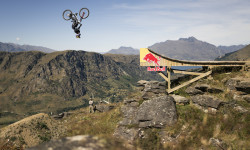
Natural Selection Bike Aotearoa Delivers; Ingersoll and Goomes Crowned Champs
May 7, 2026 from pinkbike.com
From Nicholi Rogatkin’s world-first big bike Twister to a doubled women’s field, the 2026 Aotearoa stop proved that freeride's "natural"...

Results: Natural Selection Bike Aotearoa 2026
May 5, 2026 from pinkbike.com
Who took the win in the second annual big mountain freeride competition in New Zealand?
Official Trailer: Natural Selection Bike Aotearoa Premieres Tomorrow on Pinkbike & Red Bull TV
May 4, 2026 from pinkbike.com
The wait is almost over. Here is a taste of what went down at Mt. Dewar before the 2026 Natural Selection Bike Aotearoa premieres worldwide tomorrow.
Video: Hannah Bergemann Puts a Freeride Twist on Queenstown in 'Inversion'
Apr 30, 2026 from pinkbike.com
Hannah Bergemann takes on Queenstown’s legendary terrain in her latest project for Transition Bikes.
Sub Regions
-
12 Mile Bush/Bob's Cove
- 1
- 2
-
7 Mile Riding Area
- 5
- 16
- 1
- 3
-
Arrowtown Trails
- 1
- 4
- 1
-
Ben Lomond Trails
- 3
- 6
- 4
- 13
- 12
-
Coronet Peak Ski & Mountain Bike Park
- 1
- 11
- 2
- 1
- 1
-
Fernhill Trails
- 6
- 9
- 2
- 6
-
Gibbston
- 5
- 4
- 1
-
Moonlight/Moke Lake
- 2
- 1
-
Remarkables
- 1
- 2
-
Skippers
- 1
- 2
-
Wakatipu Basin
- 5
- 8
- 5
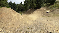
Popular Queenstown Mountain Biking Trails
• 90 ★ 4.4 • 1 mile • 76 ft • 2,390 •
The latest addition to the bike park, this green trail starts from the mid-way clearing and swoops its way down the hill. Wide and flowing with an epic vista of big berms, Lake Wakatipu and the mighty Remarkables. The trail drops out of...
• 95 ★ 4.5 • 1,453 ft • 5 ft • 2,275 •
New layout this season that crosses the access road and links back into , and .
• 100 ★ 4.6 • 3,993 ft • 12 ft • 2,149 •
Custom built by Veritgo Bikes owner Tim Ceci in the mid 90's, specifically to run guided mountain biking trips before Gondola access opened. Around 1.5km long, it's a machine built trail with nice and wide but steeper and rougher...
• 100 ★ 4.6 • 1,234 ft • 11 ft • 2,138 •
Drop in and get your Huck on. Big line of table top jumps for those with a need for speed!
• 95 ★ 4.5 • 3,586 ft • 7 ft • 2,110 •
As the name suggests, it was one of the first trails ever built in Queenstown Bike Park. It follows the path of gold miners from the late 1800's and now serves a different purpose as a great bike trail. It starts off straight and fast...
• 90 ★ 4.4 • 755 ft • 7 ft • 2,110 •
Highly rated popular black diamond difficulty singletrack. This mountain bike primary trail can be used downhill only. On average it takes minutes to complete this trail.
• 75 ★ 3.9 • 1 mile • 2 ft • 2,102 •
Whether you're a beginner or an expert, we recommend your first run of the day be on Hammy's. Built specifically for the opening of Gondola access to Queenstown Bike Park as an introduction to downhill riding, Hammy's track is a great...
• 85 ★ 4.5 • 2,306 ft • 0 ft • 2,065 •
A local favourite! Built by the might Alliance in 2009, ly known as 'Turd Sandwich' due to an unfortunate timing of a toilet call on an exploratory scope of a line by an Alliance member. Renamed for the Queenstown Bike Park it is an old...
Queenstown Mountain Bike Routes
★ 4.7 • 6 miles • 176 ft • 3 • Point to Point •
A really good descent with being the highlight. Ride up the XC track to the top of Coronet then ride all...
★ 4.7 • 7 miles • 2,568 ft • 4 • Point to Point •
An alternative route to utilising as much purpose built singletrac as possible. Allow roughly 3 to 5 hours...
★ 5.0 • 30 miles • 7,859 ft • 2 • Loop •
Grade 3 - Intermediate This is a backcountry mountain bike trail requiring moderate levels of skill and...
★ 4.5 • 8 miles • 141 ft • 4 • Point to Point •
Introducing The ! Combine , , Morning Glory and for one EPIC 1200m descent from the top of Coronet peak...
★ 3.4 • 31 miles • 5,411 ft • 3 • Loop •
The Coronet Loop trail begins in Arrowtown at Butler’s Green, adjacent to the historic Chinese...
★ 5.0 • 23 miles • 1,740 ft • 3 • Point to Point •
A scenic tour through the Wakatipu Basin between historic Arrowtown and Queenstown.
Photos of Queenstown Mountain Bike
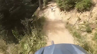
Videos of Queenstown Mountain Bike
0:23 |
6 |
Sep 21, 2025
trail: Huck Yeah!
0:50 |
|
Sep 16, 2024

trail: Dream Track
2:04 |
123 |
May 26, 2024
trail: Mini Dream Jump Line
0:03 |
97 |
Jan 18, 2024
trail: Original
0:08 |
62 |
Feb 21, 2023

trail: Squid Run
0:40 |
|
Oct 11, 2022

0:23 |
142 |
Sep 24, 2021

trail: Huck Yeah!
0:49 |
1152 |
Apr 24, 2021
Current Trail Warnings
| status | trail | date | condition | user | info |
|---|---|---|---|---|---|
| Zoot Track | Jun 12, 2026 @ 1:13pm (Pacific/Auckland) Jun 11, 2026 | Freeze/thaw Cycle | skieralex | lots of frost heave and very muddy at the... | |
| Missing Link - Lower | May 31, 2026 @ 5:36pm (Pacific/Auckland) May 30, 2026 | Freeze/thaw Cycle | QMTBC | Closed for Winter! Please keep off the... | |
| Missing Link - Upper | May 31, 2026 @ 5:36pm (Pacific/Auckland) May 30, 2026 | Freeze/thaw Cycle | QMTBC | Closed for Winter! Please keep off the... |
Recent Trail Reports
| status | trail | date | condition | info | user |
|---|---|---|---|---|---|
| McNearlyGnarly | Jun 19, 2026 @ 4:01pm (Pacific/Auckland) 14 hours | Unknown | elevatetrails | ||
| Wedge Return | Jun 17, 2026 @ 4:09pm (Pacific/Auckland) 3 days | Wet | QMTBC | ||
| Squid Run | Jun 15, 2026 @ 12:56pm (Pacific/Auckland) Jun 14, 2026 | Unknown | elevatetrails | ||
| Jack's Point Trail | Jun 7, 2026 @ 2:37pm (Pacific/Auckland) Jun 6, 2026 | Variable | BarneyNZ | ||
| Kelvin Heights Trail | Jun 7, 2026 @ 2:37pm (Pacific/Auckland) Jun 6, 2026 | Variable | BarneyNZ | ||
| Arthurs Point Trail | Jun 6, 2026 @ 1:20pm (Pacific/Auckland) Jun 5, 2026 | Ideal | BarneyNZ | ||
| Arrow River Bridges Trail | Jun 6, 2026 @ 1:20pm (Pacific/Auckland) Jun 5, 2026 | Variable | BarneyNZ | ||
| Twin Rivers Trail - Shotover to Arrow River | Jun 6, 2026 @ 1:20pm (Pacific/Auckland) Jun 5, 2026 | Variable | BarneyNZ | ||
| Upper Wynyard Express | Jun 5, 2026 @ 8:12am (Pacific/Auckland) Jun 4, 2026 | Ideal | elevatetrails | ||
| 7 Mile/Wilson Bay Track (DOC) | Jun 2, 2026 @ 7:18am (Pacific/Auckland) Jun 1, 2026 | Unknown | elevatetrails |
Activity Feed
| username | action | type | title | date |
|---|---|---|---|---|
| elevatetrails | add | report | activity #97295344 | Jun 18, 2026 @ 9:01pm 14 hours |
| QMTBC | add | report | activity #97161215 | Jun 16, 2026 @ 9:10pm 3 days |
| trailforks | add | video | activity #97053332 | Jun 15, 2026 @ 11:00am Jun 15, 2026 |
| qtbikingdad | like | report | activity #97016802 | Jun 14, 2026 @ 6:10pm Jun 14, 2026 |
| elevatetrails | add | report | activity #97016328 | Jun 14, 2026 @ 5:56pm Jun 14, 2026 |
Recent Comments
| username | type | title | comment | date |
|---|---|---|---|---|
| report | Sick 🤙🤙🤛🤛🤪 super appreciated... | Jun 4, 2026 @ 1:36pm Jun 4, 2026 | ||
| report | Cheers! | May 12, 2026 @ 11:04pm May 12, 2026 | ||
| trail | Very slippery otherwise amazing | Apr 11, 2026 @ 11:42pm Apr 11, 2026 | ||
| report | L | Apr 2, 2026 @ 4:33pm Apr 2, 2026 | ||
| report | Perfectly conserved mars 2026 | Mar 25, 2026 @ 12:45pm Mar 25, 2026 |
Local Badges
-

Epic Ride Climb 2k2,997 awarded -

Climbing 10k Badge509 awarded -

Climbing 100k Badge41 awarded -

Epic Ride Descent 2k4,146 awarded -

Descent 10k Badge633 awarded -

Descent 100k Badge49 awarded
Bike & Skill Parks
| name | type | city | rating |
|---|---|---|---|
| Ben Lomond Trails | bike park | Queenstown | |
| Coronet Peak Ski & Mountain Bike Park | bike park | Queenstown | |
| Wynyard Bike Park | skill park | Queenstown | |
| Gorge Road Jump Park | skill park | Queenstown | |
| Jardine Park | skill park | Queenstown |
Activity Type Stats
| activitytype | trails | distance | descent | descent distance | total vertical | rating | global rank | state rank | photos | reports | routes | ridelogs |
|---|---|---|---|---|---|---|---|---|---|---|---|---|
| Mountain Bike | 231 | 252 miles | 73,645 ft | 123 miles | 4,744 ft | #80 | #6 | 3,686 | 2,789 | 21 | 70,137 | |
| E-Bike | 107 | 161 miles | 36,312 ft | 72 miles | 4,744 ft | #96 | #5 | 25 | 1,887 | 7 | 7,492 | |
| Gravel Bike | 1 | #64 | #49 | 1 | 58 | 1 | 681 | |||||
| Horse | 1 | 3 miles | 154 ft | 2,251 ft | 1,198 ft | 345 | ||||||
| Hike | 159 | 278 miles | 55,364 ft | 117 miles | 5,623 ft | #146 | #4 | 145 | 1,970 | 3 | 5,476 | |
| Trail Running | 162 | 280 miles | 55,741 ft | 117 miles | 5,623 ft | #215 | #7 | 2,023 | 3 | 3,164 | ||
| Dirtbike/Moto | 5 | 15 miles | 1,129 ft | 5 miles | 1,316 ft | #184 | #2 | 348 | 9 | |||
| ATV/ORV/OHV | 4 | 11 miles | 958 ft | 4 miles | 1,125 ft | #76 | #1 | 345 | 18 | |||
| Snowmobile | 8 | 4 miles | 3,278 ft | 4 miles | 2,139 ft | #51 | #1 | 30 | ||||
| Snowshoe | 5 | 8 miles | 4,905 ft | 6 miles | 3,747 ft | #100 | #1 | 30 | 17 | |||
| Downhill Ski | 86 | 31 miles | 33,491 ft | 29 miles | 2,710 ft | #46 | #1 | 3 | 82 | 2,678 | ||
| Backcountry Ski | 60 | 29 miles | 30,030 ft | 26 miles | 4,800 ft | #74 | #2 | 68 | 791 | |||
| Nordic Ski | 32 | 17 miles | 15,387 ft | 14 miles | 4,800 ft | #137 | #2 | 45 | 107 |
Frequently Asked Questions About Queenstown
▼
What are the best places to ride in Queenstown?
Queenstown has 12 areas to explore for mountain biking. The top rated areas are:
▼
What are the highest rated mountain biking trails in Queenstown?
The highest rated mountain biking trails in Queenstown are:
- Salmon Run (4.8/5)
- Rude Rock (4.7/5)
- Squid Run (4.7/5)
- Kachoong (4.7/5)
- McNearlyGnarly (4.7/5)
▼
What is the best time of the year to ride in Queenstown?
Based on ride log data, the most popular months to ride in Queenstown are:
- February (310 activities)
- January (266 activities)
- March (265 activities)
▼
Where can I park to ride in Queenstown?
There are 29 parking locations listed in Queenstown. The most popular parking spots are: View all parking and trailhead locations on the map to plan your visit.
Activities
- Queenstown Mountain Biking Trails
- Queenstown E-Biking Trails
- Queenstown Hiking Trails
- Queenstown Trail Running Trails
- Queenstown Dirtbiking Trails
- Queenstown Snowmobiling Trails
- Queenstown Snowshoeing Trails
- Queenstown Skiing Trails
- Queenstown Backcountry Skiing Trails
- Queenstown Nordic Skiing Trails
Trails
Points of Interest
- Routeburn Flats Wild Camping Site
- Demon Trail Hut Cabin
- Greenstone Hut Cabin
- Steele Creek Lodge
- Lake Alabaster Hut Cabin
- Hidden Falls Hut Cabin
- [falls] Humboldt Falls Other
- Humboldt Falls Lookout Viewpoint
- Routeburn Flats Campsite Camping
- The Eagles' Nest Information
- Mount Tūtoko (2,330 m)
- Mt Larkins (2,274 m)
- Single Cone (2,272 m)
- By brenthillier
 NSMBA TRAILFORKS & contributors
 - Admins: Alps2Ocean-Cycle-Trail, QMTBC, QMTBC, Skippynz, red720, chris-conway, QTWilly
- #4525 - 120,677 views
- queenstown activity log | embed map of Queenstown mountain bike trails | queenstown mountain biking points of interest polygons
Downloading of trail gps tracks in kml & gpx formats is enabled for Queenstown.
You must login to download files.