close
-
Layers w
- Weather Layers
- Pro
- Pro
- Pro
- Pro
- Pro
- Pro
- More Layers
- Pro
- Pro
- Pro
- Pro
-
Upgrade to

3D
Trail Conditions
- Unknown
- Snow Groomed
- Snow Packed
- Snow Covered
- Snow Cover Partial
- Freeze/thaw Cycle
- Icy
- Prevalent Mud
- Wet
- Variable
- Ideal
- Dry
- Very Dry
Trail Flow (Ridden Direction)
Trailforks scans users ridelogs to determine the most popular direction each trail is ridden. A good flowing trail network will have most trails flowing in a single direction according to their intension.
The colour categories are based on what percentage of riders are riding a trail in its intended direction.
The colour categories are based on what percentage of riders are riding a trail in its intended direction.
- > 96%
- > 90%
- > 80%
- > 70%
- > 50%
- < 50%
- bi-directional trail
- no data
Trail Last Ridden
Trailforks scans ridelogs to determine the last time a trail was ridden.
- < 2 days
- < 1 week
- < 2 weeks
- < 1 month
- < 6 months
- > 6 months
Trail Ridden Direction
The intended direction a trail should be ridden.
- Downhill Only
- Downhill Primary
- Both Directions
- Uphill Primary
- Uphill Only
- One Direction
Contribute Details
Colors indicate trail is missing specified detail.
- Description
- Photos
- Description & Photos
- Videos
Trail Popularity ?
Trailforks scans ridelogs to determine which trails are ridden the most in the last 9 months.
Trails are compared with nearby trails in the same city region with a possible 25 colour shades.
Think of this as a heatmap, more rides = more kinetic energy = warmer colors.
- most popular
- popular
- less popular
- not popular
ATV/ORV/OHV Filter
Max Vehicle Width
inches
US Cell Coverage
Legend

Radar Time
Activity Recordings
Trailforks uses anonymized public activity data.
?
Activity Recordings
Trailforks uses anonymized public activity data.
?
Personal Heatmap
▶
Activity Types
all
/
none
▶
Options
2
Date range
month
–
Winter Trails
Warning
A routing network for winter maps does not exist. Selecting trails using the winter trails layer has been disabled.
Missing Trails
Most Popular
Least Popular
Trails are colored based on popularity. The more popular a trail is, the more red. Less popular trails trend towards green.
Jump Magnitude Heatmap
Heatmap of where riders jump on trails. Zoom in to see individual jumps, click circles to view jump details.
BC Backroad Status
![map legend]()
Service Road Atlas is a free to use, community-driven service for viewing and creating reports on the numerous back-country service roads around B.C. and Alberta.

Slope Aspect
Direction the slope faces
Trails Deemphasized
Trails are shown in grey.
Only show trails with no bike usage.
Suggested Layers
Based on selected activity type
Save the current map location and zoom level as your default home location whenever this page is loaded.
Save
No description for Quispamsis has been added yet!
Login or register to submit one.
Activities Click to view
- Mountain Bike
57 trails
- E-Bike
31 trails
- Adaptive Bike
0 trails
- Winter Fat Bike
0 trails
- Hike
55 trails
- Trail Running
57 trails
- Snowshoe
36 trails
Region Details
- 4
- 4
- 17
- 21
- 8
- 1
Region Status
Open as of Jun 9, 2026Local Trail Association
Stats
- Avg Trail Rating
- Trails (view details)
- 55
- Trails Mountain Bike
- 57
- Trails E-Bike
- 31
- Trails Horse
- 1
- Trails Hike
- 55
- Trails Trail Running
- 57
- Trails ATV/ORV/OHV
- 1
- Trails Snowshoe
- 36
- Total Distance
- 20 miles
- Total Descent
- 2,376 ft
- Total Vertical
- 307 ft
- Highest Trailhead
- 328 ft
- Reports
- 361
- Photos
- 55
- Ridden Counter
- 6,467
Sub Regions
-
Millennium Cycle Bike Park
- 10
- 8
- 4
-
Shady Grove
- 8
- 12
- 3
- 1
Popular Quispamsis Mountain Biking Trails
• 95 ★ 5.0 • 4,665 ft • 95 ft • 462 •
The latest installment in the Green Belt beginner loop at ! Built by John Russel and Josh Armstrong.
• 95 ★ 5.0 • 3,392 ft • 76 ft • 409 •
Popular green difficulty family friendly machine groomed. This mountain bike primary trail can be used both directions and has a easy overall physical rating with a 76 ft green climb. Trail visibility is always easy to follow. On average it takes 6 minutes to complete this trail.
• 90 ★ 5.0 • 4,016 ft • 63 ft • 333 •
is a machine built flow trail for beginners and experts alike. Built by John Russel of Dirt Simple, Josh Armstrong, and various other volunteers, the trail ventures through a beautiful cedar section of the forest along the Palmer Brook,...
• 100 ★ 5.0 • 1,788 ft • 31 ft • 287 •
Popular blue difficulty family friendly singletrack. This mountain bike primary trail can be used both directions and has a moderate overall physical rating with a 31 ft blue climb. It features berm, bridge and log ride. Winter use: Groomed Smooth snow grooming. Trail visibility is always easy to follow. On average it takes 3 minutes to complete this trail.
• 85 ★ 4.9 • 4,193 ft • 103 ft • 276 •
Mostly a fun flowy trail. There are a few rock gardens rideable when you have the line. Roots are tame with the exception of a few short sections and the trail is well packed. The black diamond rating is due to the climbs at the start...
• 90 ★ 5.0 • 1,450 ft • 26 ft • 267 •
A few spots to work the handlebars, a few sharp turns, a few roots but overall a fun flowy cross-country trail.
• 85 ★ 4.7 • 2 miles • 219 ft • 241 •
This is a brand new addition to the network that was a large undertaking by various members of the community. It has 5 bridges to navigate on a scenic lap of MacFarlane Lake, and opens up the option for many future add-ons. The surface...
• 90 ★ 5.0 • 1,903 ft • 63 ft • 240 •
Popular blue difficulty singletrack. This mountain bike primary trail can be used both directions. It features bridge. On average it takes 4 minutes to complete this trail.
Quispamsis Mountain Bike Routes
7 miles • 693 ft • 12 • Loop •
This event is being sanctioned by VeloNB and is a Fun Day race in which participants can complete 1 lap, 2...
8 miles • 735 ft • 22 •
This is a route designed to hit a lot of the blue trails at Shady
6 miles • 468 ft • 11 • Out & Back •
Explore some of Shady's best new trails. Thank you to all the workers and volunteers for the hard work on...
Photos of Quispamsis Mountain Bike
Videos of Quispamsis Mountain Bike
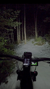
trail: Ridgeline
0:44 |
51 |
Jan 23, 2024
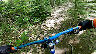
trail: Fiddler's Green
0:45 |
485 |
Mar 20, 2020
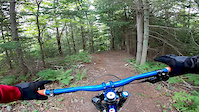
trail: Bees Knees
0:47 |
408 |
Mar 20, 2020
Recent Trail Reports
| status | trail | date | condition | info | user |
|---|---|---|---|---|---|
| Screaming Carrot Demon | Jun 9, 2026 @ 1:30pm (America/Halifax) Jun 9, 2026 | Unknown | Perupak3 | ||
| Shady Grove | Apr 29, 2026 @ 7:05pm (America/Halifax) Apr 29, 2026 | Ideal | yoinked | ||
| Knotty Dog | Apr 29, 2026 @ 7:05pm (America/Halifax) Apr 29, 2026 | Ideal | yoinked | ||
| Who's There? | Apr 29, 2026 @ 7:05pm (America/Halifax) Apr 29, 2026 | Ideal | yoinked | ||
| Knock Knock | Apr 29, 2026 @ 7:05pm (America/Halifax) Apr 29, 2026 | Ideal | yoinked | ||
| Apres Vous | Sep 5, 2025 @ 3:57pm Sep 5, 2025 | Dry | paulloeffelholz | ||
| Off Kilter | Sep 5, 2025 @ 3:57pm Sep 5, 2025 | Dry | paulloeffelholz | ||
| Kona's Climb | Sep 5, 2025 @ 3:57pm Sep 5, 2025 | Dry | paulloeffelholz | ||
| Leaky Fawcett | Sep 5, 2025 @ 3:57pm Sep 5, 2025 | Dry | paulloeffelholz | ||
| Huntin' In Here | Sep 5, 2025 @ 3:57pm Sep 5, 2025 | Dry | paulloeffelholz |
Activity Feed
| username | action | type | title | date |
|---|---|---|---|---|
| Perupak3 | add | report | activity #96611181 | Jun 9, 2026 @ 9:30am Jun 9, 2026 |
| sbose | add | karma | activity #95443006 | May 24, 2026 @ 1:49pm May 24, 2026 |
| DanHBsWMV | wishlist | route | activity #95307690 | May 23, 2026 @ 5:29am May 23, 2026 |
| yoinked | add | karma | activity #93887235 | May 2, 2026 @ 12:44pm May 2, 2026 |
| yoinked | add | report | activity #93674154 and 3 more | Apr 29, 2026 @ 3:05pm Apr 29, 2026 |
Recent Comments
| username | type | title | comment | date |
|---|---|---|---|---|
| trail | I’m | Dec 1, 2024 @ 9:36am Dec 1, 2024 | ||
| report | V vascular k Xbox. Mmmylb Kooning kicks. ... | Nov 10, 2024 @ 6:38am Nov 10, 2024 | ||
| report | Thank you for reporting! | Mar 3, 2024 @ 4:06pm Mar 3, 2024 | ||
| trail | This trail features a 3 or 4 foot wooden drop... | Feb 25, 2024 @ 6:01pm Feb 25, 2024 | ||
| trail | This trail has some well built wooden features... | Feb 25, 2024 @ 5:54pm Feb 25, 2024 |
Local Badges
-

Epic Ride Climb 2k2 awarded -

Climbing 10k Badge34 awarded -

Climbing 100k Badge3 awarded -

Epic Ride Descent 2k2 awarded -

Descent 10k Badge34 awarded -

Descent 100k Badge3 awarded
Activity Type Stats
| activitytype | trails | distance | descent | descent distance | total vertical | rating | global rank | state rank | photos | reports | routes | ridelogs |
|---|---|---|---|---|---|---|---|---|---|---|---|---|
| Mountain Bike | 57 | 20 miles | 2,375 ft | 9 miles | 308 ft | #1,411 | #5 | 144 | 360 | 4 | 11,231 | |
| E-Bike | 31 | 13 miles | 1,434 ft | 5 miles | 299 ft | #4,972 | #8 | 301 | 278 | |||
| Horse | 1 | 1 mile | 135 ft | 3,740 ft | 92 ft | 51 | ||||||
| Hike | 55 | 20 miles | 2,375 ft | 9 miles | 308 ft | #6,527 | #16 | 4 | 358 | 674 | ||
| Trail Running | 57 | 20 miles | 2,375 ft | 9 miles | 308 ft | #5,905 | #14 | 1 | 357 | 440 | ||
| ATV/ORV/OHV | 1 | 3,533 ft | 171 ft | 2,474 ft | 171 ft | 1 | 52 | 4 | ||||
| Snowshoe | 36 | 9 miles | 1,063 ft | 4 miles | 276 ft | #725 | #3 | 23 | 102 |
Frequently Asked Questions About Quispamsis
▼
What are the best places to ride in Quispamsis?
Quispamsis has 2 areas to explore for mountain biking. The top rated areas are:
▼
What are the highest rated mountain biking trails in Quispamsis?
The highest rated mountain biking trails in Quispamsis are:
- Shady Grove (4.4/5)
- Apres Vous (4.3/5)
- Slug Popper (4.3/5)
- Ridgeline (4.3/5)
- Kona's Climb (4.2/5)
▼
What is the best time of the year to ride in Quispamsis?
Based on ride log data, the most popular months to ride in Quispamsis are:
- July (147 activities)
- June (99 activities)
- August (92 activities)
▼
Where can I park to ride in Quispamsis?
There are 4 parking locations listed in Quispamsis. The most popular parking spots are: View all parking and trailhead locations on the map to plan your visit.
Activities
Trails
- By marciwebb & contributors
- Admins: ChrisNorfolk, themikekowalski, alexisberube, KTA
- #21656 - 6,945 views
- quispamsis activity log | embed map of Quispamsis mountain bike trails | quispamsis mountain biking points of interest
Downloading of trail gps tracks in kml & gpx formats is enabled for Quispamsis.
You must login to download files.