close
-
Layers w
- Weather Layers
- Pro
- Pro
- Pro
- Pro
- Pro
- Pro
- More Layers
- Pro
- Pro
- Pro
- Pro
-
Upgrade to

3D
Trail Conditions
- Unknown
- Snow Groomed
- Snow Packed
- Snow Covered
- Snow Cover Partial
- Freeze/thaw Cycle
- Icy
- Prevalent Mud
- Wet
- Variable
- Ideal
- Dry
- Very Dry
Trail Flow (Ridden Direction)
Trailforks scans users ridelogs to determine the most popular direction each trail is ridden. A good flowing trail network will have most trails flowing in a single direction according to their intension.
The colour categories are based on what percentage of riders are riding a trail in its intended direction.
The colour categories are based on what percentage of riders are riding a trail in its intended direction.
- > 96%
- > 90%
- > 80%
- > 70%
- > 50%
- < 50%
- bi-directional trail
- no data
Trail Last Ridden
Trailforks scans ridelogs to determine the last time a trail was ridden.
- < 2 days
- < 1 week
- < 2 weeks
- < 1 month
- < 6 months
- > 6 months
Trail Ridden Direction
The intended direction a trail should be ridden.
- Downhill Only
- Downhill Primary
- Both Directions
- Uphill Primary
- Uphill Only
- One Direction
Contribute Details
Colors indicate trail is missing specified detail.
- Description
- Photos
- Description & Photos
- Videos
Trail Popularity ?
Trailforks scans ridelogs to determine which trails are ridden the most in the last 9 months.
Trails are compared with nearby trails in the same city region with a possible 25 colour shades.
Think of this as a heatmap, more rides = more kinetic energy = warmer colors.
- most popular
- popular
- less popular
- not popular
ATV/ORV/OHV Filter
Max Vehicle Width
inches
US Cell Coverage
Legend

Radar Time
Activity Recordings
Trailforks uses anonymized public activity data.
?
Activity Recordings
Trailforks uses anonymized public activity data.
?
Personal Heatmap
▶
Activity Types
all
/
none
▶
Options
2
Date range
month
–
Winter Trails
Warning
A routing network for winter maps does not exist. Selecting trails using the winter trails layer has been disabled.
Missing Trails
Most Popular
Least Popular
Trails are colored based on popularity. The more popular a trail is, the more red. Less popular trails trend towards green.
Jump Magnitude Heatmap
Heatmap of where riders jump on trails. Zoom in to see individual jumps, click circles to view jump details.
BC Backroad Status
![map legend]()
Service Road Atlas is a free to use, community-driven service for viewing and creating reports on the numerous back-country service roads around B.C. and Alberta.

Slope Aspect
Direction the slope faces
Trails Deemphasized
Trails are shown in grey.
Only show trails with no bike usage.
Suggested Layers
Based on selected activity type
Save the current map location and zoom level as your default home location whenever this page is loaded.
Save
No description for Rabbit Valley has been added yet!
Login or register to submit one.
 google parking directions
google parking directions Activities Click to view
- Mountain Bike
34 trails
- E-Bike
28 trails
- Horse
18 trails
- Hike
39 trails
- Trail Running
37 trails
- Dirtbike/Moto
29 trails
- ATV/ORV/OHV
20 trails
Region Details
- 19
- 8
- 7
Region Status
Open as of Apr 4, 2026Local Trail Association
Stats
- Avg Trail Rating
- Trails (view details)
- 36
- Trails Mountain Bike
- 34
- Trails E-Bike
- 28
- Trails Horse
- 18
- Trails Hike
- 39
- Trails Trail Running
- 37
- Trails Dirtbike/Moto
- 29
- Trails ATV/ORV/OHV
- 20
- Total Distance
- 61 miles
- Total Descent
- 5,241 ft
- Total Vertical
- 972 ft
- Highest Trailhead
- 5,312 ft
- Reports
- 64
- Photos
- 9
- Ridden Counter
- 6,572
Popular Rabbit Valley Mountain Biking Trails
• 75 ★ 4.0 • 1 mile • 47 ft • 698 •
Popular blue difficulty mixed. This multi-use trail can be used both directions. On average it takes 7 minutes to complete this trail. A license is required to use this trail.
• 55 ★ 4.0 • 1 mile • 122 ft • 400 •
ATV doubletrack that parallels the rabbit valley road and gives access to campsites.
• 60 ★ 0.0 • 2,989 ft • 32 ft • 340 •
Moderately popular green difficulty doubletrack. This multi-use trail can be used both directions. On average it takes 3 minutes to complete this trail. A license is required to use this trail.
• 45 ★ 0.0 • 2,674 ft • 61 ft • 93 •
Moderately popular blue difficulty mixed. This multi-use trail can be used both directions. On average it takes 5 minutes to complete this trail.
• 45 ★ 4.0 • 1 mile • 93 ft • 57 •
Short but fun! It's best done in the direction shown by trailforks. It has some short steep uphills, so keep your speed up as you approach them. The drops are small (unless you're going fast) and optional. It ends with a fun roller...
• 20 ★ 0.0 • 2 miles • 425 ft • 51 • • moto
Less popular green difficulty singletrack. This dirtbike/moto primary trail can be used both directions. Trail visibility is always easy to follow. On average it takes 17 minutes to complete this trail.
• 40 ★ 0.0 • 1 mile • 24 ft • 50 •
Moderately popular green difficulty doubletrack. This multi-use trail can be used both directions. On average it takes 10 minutes to complete this trail.
• 45 ★ 3.0 • 2 miles • 105 ft • 43 • • moto
Moderately popular blue difficulty singletrack. This dirtbike/moto primary trail can be used both directions. On average it takes 11 minutes to complete this trail.
Rabbit Valley Mountain Bike Routes
★ 4.5 • 32 miles • 3,172 ft • 4 • Loop •
Fairly tight loop with 2-track connections. A few technical and difficult sections, but mostly quite...
★ 4.0 • 32 miles • 2,673 ft • 11 • Loop •
Big loop taking in Western Rim, Adobe, Overlook, and Harley's Dome. Mostly single-track with 2-track and a...
37 miles • 3,884 ft • 9 • Loop •
This route incorporates most all of the single-track and some double track trails in this region located...
14 miles • 1,418 ft • 5 • Loop •
The Western Rim Trail in Fruita, Colorado, offers an epic 14.3-mile mountain bike adventure with...
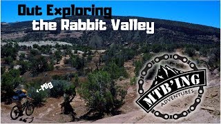
Videos of Rabbit Valley Mountain Bike
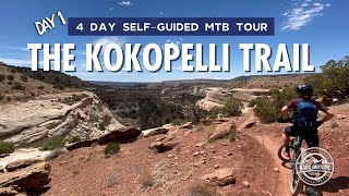
trail: Rabbit Valley 2 (Kokopelli)
15:24 |
316 |
May 21, 2021 , Fruita

trail: Rabbit Valley #2
11:38 |
537 |
Oct 11, 2019 , Fruita
youtuber
![Rabbit Valley 2018 (Fruita, CO) Mountain Biking]()

trail: Rabbit Valley #5
7:10 |
438 |
May 30, 2018 , Fruita
youtuber
![Rabbit Valley 2018 (Fruita, CO) Mountain Biking]()

trail: Rabbit Valley #8
7:10 |
684 |
May 30, 2018 , Fruita
youtuber
![Rabbit Valley 2018 (Fruita, CO) Mountain Biking]()
trail: Rabbit Valley #3 East
7:10 |
537 |
May 30, 2018 , Fruita
Recent Trail Reports
| status | trail | date | condition | info | user |
|---|---|---|---|---|---|
| Rabbit Valley #2 | Mar 27, 2026 @ 9:54am (America/Denver) Mar 27, 2026 | Dry | delmue | ||
| Kokopelli (Rabbit Valley) | Mar 27, 2026 @ 9:54am (America/Denver) Mar 27, 2026 | Dry | delmue | ||
| BLM Route 742C | Dec 13, 2025 @ 12:29pm (America/Denver) Dec 13, 2025 | Ideal | maynardco | ||
| Rabbit Valley #6 | May 23, 2025 @ 12:03am May 23, 2025 | Unknown | trailforks Trailforks | ||
| Rabbit Valley #3 | Sep 25, 2024 @ 9:36am Sep 25, 2024 | Dry | brucerioux WACH NEMBA | ||
| Kokopelli (Rabbit Valley) | Sep 11, 2024 @ 11:20am Sep 11, 2024 | Dry | RCRGIRL | ||
| Knowles Overlook | Sep 11, 2024 @ 11:20am Sep 11, 2024 | Dry | RCRGIRL | ||
| Kokopelli (Rabbit Valley) | Apr 20, 2024 @ 3:10am Apr 20, 2024 | Dry | willerules | ||
| Kokopelli (Rabbit Valley) | Apr 20, 2024 @ 3:10am Apr 20, 2024 | Dry | willerules | ||
| Rabbit Valley 2 (Kokopelli) | Apr 13, 2023 @ 2:06am Apr 13, 2023 | Dry | anniek COPMOBA-GVT |
Activity Feed
| username | action | type | title | date |
|---|---|---|---|---|
| Bmxtar | add | photo | activity #95288735 | May 22, 2026 @ 9:13pm May 22, 2026 |
| BCRides | wishlist | trail | activity #93798425 | May 1, 2026 @ 11:11am May 1, 2026 |
| deborah48H47 | wishlist | route | activity #93581601 | Apr 28, 2026 @ 8:12am Apr 28, 2026 |
| michele999 | wishlist | route | activity #93540116 | Apr 27, 2026 @ 2:20pm Apr 27, 2026 |
| johntaube | wishlist | route | activity #93386218 | Apr 25, 2026 @ 1:15pm Apr 25, 2026 |
Recent Comments
| username | type | title | comment | date |
|---|---|---|---|---|
| trail | I'm a local mountain biker and moto rider I do... | Dec 26, 2024 @ 3:43pm Dec 26, 2024 | ||
| trail | Most of this route is now completely... | Feb 27, 2024 @ 1:22pm Feb 27, 2024 | ||
| trail | Great ride, better to do it counter clockwise... | Sep 16, 2023 @ 8:41am Sep 16, 2023 | ||
| trail | Great ride for a post winter bike… some... | Apr 25, 2023 @ 3:25pm Apr 25, 2023 | ||
| trail | Just rained, bottoms of whoops muddy. The rest dry | Apr 15, 2023 @ 10:53am Apr 15, 2023 |
Nearby Areas
| name | distance | ||||
|---|---|---|---|---|---|
| Western Rim | 16 | 4 km | |||
| Kokopelli Loops | 13 | 15 | 6 | 2 | 9.6 km |
| Highline Lake State Park | 3 | 6 | 13.4 km | ||
| James M. Robb – Colorado River State Park - Fruita Section | 35 | 15.6 km | |||
| Redlands | 27 | 14 | 1 | 22.3 km |
Local Badges
-

Completionist0 awarded
Activity Type Stats
| activitytype | trails | distance | descent | descent distance | total vertical | rating | global rank | state rank | photos | reports | routes | ridelogs |
|---|---|---|---|---|---|---|---|---|---|---|---|---|
| Mountain Bike | 34 | 57 miles | 4,918 ft | 24 miles | 837 ft | #7,263 | #2,784 | 5 | 64 | 5 | 566 | |
| E-Bike | 28 | 54 miles | 4,823 ft | 23 miles | 837 ft | #645 | #604 | 61 | 3 | 49 | ||
| Horse | 18 | 29 miles | 2,116 ft | 13 miles | 522 ft | #1,531 | #789 | 6 | 1 | |||
| Hike | 39 | 61 miles | 5,243 ft | 26 miles | 971 ft | #4,138 | #1,476 | 64 | 1 | 211 | ||
| Trail Running | 37 | 52 miles | 4,603 ft | 24 miles | 971 ft | #3,925 | #1,099 | 64 | 1 | 37 | ||
| Dirtbike/Moto | 29 | 55 miles | 4,823 ft | 23 miles | 837 ft | #542 | #160 | 4 | 14 | 3 | 22 | |
| ATV/ORV/OHV | 20 | 31 miles | 2,818 ft | 15 miles | 837 ft | #483 | #177 | 8 | 2 |
Frequently Asked Questions About Rabbit Valley
▼
What are the highest rated mountain biking trails in Rabbit Valley?
The highest rated mountain biking trails in Rabbit Valley are:
- Rabbit Valley #2 (4/5)
- Rabbit Valley 2 (Kokopelli) (4/5)
- Rabbit Valley #6 (4/5)
- Utah Line (3.8/5)
- Rabbit Valley #1 (3.6/5)
▼
What is the best time of the year to ride in Rabbit Valley?
Based on ride log data, the most popular months to ride in Rabbit Valley are:
- April (22 activities)
- November (10 activities)
- May (8 activities)
▼
Where can I park to ride in Rabbit Valley?
There are 7 parking locations listed in Rabbit Valley. The most popular parking spots are: View all parking and trailhead locations on the map to plan your visit.
▼
What is the longest trail in Rabbit Valley?
The longest trail in Rabbit Valley is Rabbit Valley #8 at 5.7 miles. View all trails sorted by distance.
Activities
Trails
- By markholloway
 Trailforks Map Team & contributors
 - Admins: COPMOBA-GVT, COPMOBA-GVT, COPMOBA-GVT
- #22855 - 8,938 views
- rabbit valley activity log | embed map of Rabbit Valley mountain bike trails | rabbit valley mountain biking points of interest
Downloading of trail gps tracks in kml & gpx formats is enabled for Rabbit Valley.
You must login to download files.