close
-
Layers w
- Weather Layers
- Pro
- Pro
- Pro
- Pro
- Pro
- Pro
- More Layers
- Pro
- Pro
- Pro
- Pro
-
Upgrade to

3D
Trail Conditions
- Unknown
- Snow Groomed
- Snow Packed
- Snow Covered
- Snow Cover Partial
- Freeze/thaw Cycle
- Icy
- Prevalent Mud
- Wet
- Variable
- Ideal
- Dry
- Very Dry
Trail Flow (Ridden Direction)
Trailforks scans users ridelogs to determine the most popular direction each trail is ridden. A good flowing trail network will have most trails flowing in a single direction according to their intension.
The colour categories are based on what percentage of riders are riding a trail in its intended direction.
The colour categories are based on what percentage of riders are riding a trail in its intended direction.
- > 96%
- > 90%
- > 80%
- > 70%
- > 50%
- < 50%
- bi-directional trail
- no data
Trail Last Ridden
Trailforks scans ridelogs to determine the last time a trail was ridden.
- < 2 days
- < 1 week
- < 2 weeks
- < 1 month
- < 6 months
- > 6 months
Trail Ridden Direction
The intended direction a trail should be ridden.
- Downhill Only
- Downhill Primary
- Both Directions
- Uphill Primary
- Uphill Only
- One Direction
Contribute Details
Colors indicate trail is missing specified detail.
- Description
- Photos
- Description & Photos
- Videos
Trail Popularity ?
Trailforks scans ridelogs to determine which trails are ridden the most in the last 9 months.
Trails are compared with nearby trails in the same city region with a possible 25 colour shades.
Think of this as a heatmap, more rides = more kinetic energy = warmer colors.
- most popular
- popular
- less popular
- not popular
ATV/ORV/OHV Filter
Max Vehicle Width
inches
US Cell Coverage
Legend

Radar Time
Activity Recordings
Trailforks uses anonymized public activity data.
?
Activity Recordings
Trailforks uses anonymized public activity data.
?
Personal Heatmap
▶
Activity Types
all
/
none
▶
Options
2
Date range
month
–
Winter Trails
Warning
A routing network for winter maps does not exist. Selecting trails using the winter trails layer has been disabled.
Missing Trails
Most Popular
Least Popular
Trails are colored based on popularity. The more popular a trail is, the more red. Less popular trails trend towards green.
Jump Magnitude Heatmap
Heatmap of where riders jump on trails. Zoom in to see individual jumps, click circles to view jump details.
BC Backroad Status
![map legend]()
Service Road Atlas is a free to use, community-driven service for viewing and creating reports on the numerous back-country service roads around B.C. and Alberta.

Slope Aspect
Direction the slope faces
Trails Deemphasized
Trails are shown in grey.
Only show trails with no bike usage.
Suggested Layers
Based on selected activity type
Save the current map location and zoom level as your default home location whenever this page is loaded.
Save
No description for Rajcza has been added yet!
Login or register to submit one.
This region uses the Uk/Euro style trail grading system.
Activities Click to view
- Mountain Bike
35 trails
- E-Bike
12 trails
- Gravel Bike
0 trails
- Adaptive Bike
0 trails
- Winter Fat Bike
0 trails
- Horse
1 trails
- Hike
32 trails
- Trail Running
32 trails
- Observed Trials
0 trails
- Snowshoe
0 trails
- Downhill Ski
0 trails
- Backcountry Ski
0 trails
- Nordic Ski
0 trails
Region Details
- 12
- 1
- 12
- 9
Region Status
Open as of Jun 1, 2026Stats
- Avg Trail Rating
- Trails (view details)
- 34
- Trails Mountain Bike
- 35
- Trails E-Bike
- 12
- Trails Horse
- 1
- Trails Hike
- 32
- Trails Trail Running
- 32
- Total Distance
- 54 miles
- Total Descent
- 19,241 ft
- Total Vertical
- 2,321 ft
- Highest Trailhead
- 3,942 ft
- Reports
- 216
- Photos
- 154
- Ridden Counter
- 3,556
Sub Regions
-
Rycerka Górna
- 2
- 1
Popular Rajcza Mountain Biking Trails
• 100 ★ 5.0 • 3 miles • 263 ft • 189 • • hike
Highly rated popular blue difficulty singletrack. This hike primary trail can be used downhill only. On average it takes 29 minutes to complete this trail.
• 95 ★ 4.6 • 2 miles • 110 ft • 174 • • hike
Highly rated popular blue difficulty singletrack. This hike primary trail can be used downhill primary. On average it takes 28 minutes to complete this trail.
• 45 ★ 5.0 • 2 miles • 230 ft • 69 • • hike
Przepiękny singletrack po czerwonym szlaku, trawersujący zbocze, z pięknym widokiem, potem z dużą ekspozycją, a na koniec po igliwiu świerkowym
• 75 ★ 4.7 • 5,155 ft • 88 ft • 65 • • hike
The upper part singletrack, the lower doubletrack.
• 65 ★ 3.0 • 5 miles • 458 ft • 57 • • hike
Moderately popular blue difficulty doubletrack. This hike primary trail can be used downhill primary with a 458 ft blue climb. On average it takes 49 minutes to complete this trail.
• 80 ★ 3.0 • 2 miles • 152 ft • 38 • • hike
Popular blue difficulty doubletrack. This hike primary trail can be used downhill primary. On average it takes 12 minutes to complete this trail.
• 55 ★ 4.7 • 3,499 ft • 10 ft • 32 • • hike
Moderately popular red difficulty singletrack. This hike primary trail can be used downhill only and has a moderate overall physical rating. On average it takes 3 minutes to complete this trail.
Rajcza Mountain Bike Routes
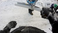
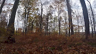
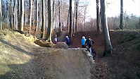
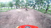
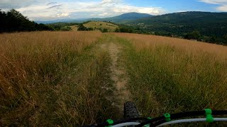
Photos of Rajcza Mountain Bike
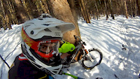
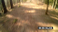
Videos of Rajcza Mountain Bike
trail: Zabawa
0:41 |
72 |
Jan 6, 2017
trail: Zabawa
4:06 |
86 |
Oct 31, 2016
trail: Zabawa
0:55 |
115 |
Dec 29, 2015
trail: Zabawa
2:03 |
256 |
Mar 6, 2015
trail: Zabawa
0:33 |
110 |
Jun 2, 2014
trail: Zabawa
0:22 |
228 |
Mar 30, 2014

trail: Zabawa
0:19 |
506 |
Aug 5, 2012
trail: Ozna
9:13 |
40 |
Apr 27, 2025 , Rajcza
Recent Trail Reports
| status | trail | date | condition | info | user |
|---|---|---|---|---|---|
| Praszywka Wielka | Jun 1, 2026 @ 2:25pm (Europe/Warsaw) Jun 1, 2026 | Unknown | Euhenio | ||
| Skalanka Trawers | May 31, 2026 @ 11:30am (Europe/Bratislava) May 31, 2026 | Variable | slavio | ||
| Wreszczówka | Sep 13, 2025 @ 2:05pm (Europe/Warsaw) Sep 13, 2025 | Wet | Zerrek | ||
| Wielka Racza from Rycerka | Aug 13, 2025 @ 6:07pm Aug 13, 2025 | Ideal | kocnere | ||
| Bendoszka Trawers | Aug 13, 2025 @ 6:07pm Aug 13, 2025 | Ideal | kocnere | ||
| Przegibek | Aug 13, 2025 @ 6:07pm Aug 13, 2025 | Ideal | kocnere | ||
| Kikula | Aug 13, 2025 @ 6:07pm Aug 13, 2025 | Ideal | kocnere | ||
| Bugaj | Aug 13, 2025 @ 6:07pm Aug 13, 2025 | Ideal | kocnere | ||
| Mała Racza | Aug 13, 2025 @ 6:07pm Aug 13, 2025 | Ideal | kocnere | ||
| Kowolówka | Jul 13, 2025 @ 3:53am Jul 13, 2025 | Variable | r85 |
Activity Feed
| username | action | type | title | date |
|---|---|---|---|---|
| r85 | add | photo | activity #96319976 | Jun 5, 2026 @ 2:01pm Jun 5, 2026 |
| Euhenio | add | report | activity #96010567 | Jun 1, 2026 @ 5:25am Jun 1, 2026 |
| slavio | add | report | activity #96001106 | May 31, 2026 @ 11:28pm May 31, 2026 |
| Witekzl3sWx | checkin | trail | activity #95700781 | May 28, 2026 @ 5:48am May 28, 2026 |
| Witekzl3sWx | ridden | trail | activity #95700780 | May 28, 2026 @ 5:48am May 28, 2026 |
Recent Comments
| username | type | title | comment | date |
|---|---|---|---|---|
| report | Jedno może dwa drzewa powalone przy których... | Jul 27, 2025 @ 6:44am Jul 27, 2025 | ||
| trail | Najlepszy dzikus w okolicy | Jul 13, 2025 @ 4:27am Jul 13, 2025 | ||
| trail | Fantastyczne widoki na odcinkach bezleśnych,... | Apr 26, 2025 @ 1:12pm Apr 26, 2025 | ||
| trail | Trail, który dostarcza mnóstwa wrażeń i... | Jul 8, 2024 @ 7:02am Jul 8, 2024 | ||
| trail | Fajny singiel wśród pięknej przyrody | Jun 25, 2024 @ 1:00pm Jun 25, 2024 |
Local Badges
-

10 Blue Trails11 awarded -

Epic Ride Climb 2k83 awarded -

Climbing 10k Badge15 awarded -

Climbing 100k Badge1 awarded -

Epic Ride Descent 2k83 awarded -

Descent 10k Badge16 awarded
Activity Type Stats
| activitytype | trails | distance | descent | descent distance | total vertical | rating | global rank | state rank | photos | reports | routes | ridelogs |
|---|---|---|---|---|---|---|---|---|---|---|---|---|
| Mountain Bike | 35 | 54 miles | 19,242 ft | 32 miles | 2,320 ft | #3,041 | #58 | 154 | 216 | 1 | 2,409 | |
| E-Bike | 12 | 14 miles | 4,954 ft | 9 miles | 1,234 ft | #4,014 | #332 | 159 | 282 | |||
| Horse | 1 | #759 | #265 | 22 | ||||||||
| Hike | 32 | 51 miles | 18,297 ft | 30 miles | 2,320 ft | #3,692 | #65 | 216 | 824 | |||
| Trail Running | 32 | 52 miles | 17,582 ft | 30 miles | 2,320 ft | #3,431 | #58 | 202 | 128 |
Frequently Asked Questions About Rajcza
▼
What are the best places to ride in Rajcza?
Rajcza has 1 areas to explore for mountain biking. The top rated areas are:
▼
What are the highest rated mountain biking trails in Rajcza?
The highest rated mountain biking trails in Rajcza are:
- Mała Racza (4.5/5)
- Kowolówka (4.5/5)
- Trawers Pod Przysłopami (4.3/5)
- Tajemny Rycerka 1 (4.3/5)
- Kikula (4.3/5)
▼
What is the best time of the year to ride in Rajcza?
Based on ride log data, the most popular months to ride in Rajcza are:
- June (12 activities)
- August (10 activities)
- July (6 activities)
▼
Where can I park to ride in Rajcza?
Check the Rajcza trail map for trailhead and parking information. Community members regularly update access and parking details for trails in the area.
Activities
Trails
- By micolai
 TRAILFORKS Poland & contributors
 - Admins: apply
- #16385 - 3,887 views
- rajcza activity log | embed map of Rajcza mountain bike trails | rajcza mountain biking points of interest
Downloading of trail gps tracks in kml & gpx formats is enabled for Rajcza.
You must login to download files.