close
-
Layers w
- Weather Layers
- Pro
- Pro
- Pro
- Pro
- Pro
- Pro
- More Layers
- Pro
- Pro
- Pro
- Pro
-
Upgrade to

3D
Trail Conditions
- Unknown
- Snow Groomed
- Snow Packed
- Snow Covered
- Snow Cover Partial
- Freeze/thaw Cycle
- Icy
- Prevalent Mud
- Wet
- Variable
- Ideal
- Dry
- Very Dry
Trail Flow (Ridden Direction)
Trailforks scans users ridelogs to determine the most popular direction each trail is ridden. A good flowing trail network will have most trails flowing in a single direction according to their intension.
The colour categories are based on what percentage of riders are riding a trail in its intended direction.
The colour categories are based on what percentage of riders are riding a trail in its intended direction.
- > 96%
- > 90%
- > 80%
- > 70%
- > 50%
- < 50%
- bi-directional trail
- no data
Trail Last Ridden
Trailforks scans ridelogs to determine the last time a trail was ridden.
- < 2 days
- < 1 week
- < 2 weeks
- < 1 month
- < 6 months
- > 6 months
Trail Ridden Direction
The intended direction a trail should be ridden.
- Downhill Only
- Downhill Primary
- Both Directions
- Uphill Primary
- Uphill Only
- One Direction
Contribute Details
Colors indicate trail is missing specified detail.
- Description
- Photos
- Description & Photos
- Videos
Trail Popularity ?
Trailforks scans ridelogs to determine which trails are ridden the most in the last 9 months.
Trails are compared with nearby trails in the same city region with a possible 25 colour shades.
Think of this as a heatmap, more rides = more kinetic energy = warmer colors.
- most popular
- popular
- less popular
- not popular
ATV/ORV/OHV Filter
Max Vehicle Width
inches
US Cell Coverage
Legend

Radar Time
Activity Recordings
Trailforks uses anonymized public activity data.
?
Activity Recordings
Trailforks uses anonymized public activity data.
?
Personal Heatmap
▶
Activity Types
all
/
none
▶
Options
2
Date range
month
–
Winter Trails
Warning
A routing network for winter maps does not exist. Selecting trails using the winter trails layer has been disabled.
Missing Trails
Most Popular
Least Popular
Trails are colored based on popularity. The more popular a trail is, the more red. Less popular trails trend towards green.
Jump Magnitude Heatmap
Heatmap of where riders jump on trails. Zoom in to see individual jumps, click circles to view jump details.
BC Backroad Status
![map legend]()
Service Road Atlas is a free to use, community-driven service for viewing and creating reports on the numerous back-country service roads around B.C. and Alberta.

Slope Aspect
Direction the slope faces
Trails Deemphasized
Trails are shown in grey.
Only show trails with no bike usage.
Suggested Layers
Based on selected activity type
Save the current map location and zoom level as your default home location whenever this page is loaded.
Save
No description for Ramona has been added yet!
Login or register to submit one.
Activities Click to view
- Mountain Bike
38 trails
- E-Bike
33 trails
- Gravel Bike
1 trails
- Adaptive Bike
- Horse
19 trails
- Hike
42 trails
- Trail Running
42 trails
Stats
- Avg Trail Rating
- Trails (view details)
- 37
- Trails Mountain Bike
- 38
- Trails E-Bike
- 33
- Trails Gravel Bike
- 1
- Trails Horse
- 19
- Trails Hike
- 42
- Trails Trail Running
- 42
- Trails Dirtbike/Moto
- 3
- Total Distance
- 70 miles
- Total Descent Distance
- 25 miles
- Total Descent
- 7,520 ft
- Total Vertical
- 3,498 ft
- Highest Trailhead
- 4,019 ft
- Reports
- 68
- Photos
- 161
- Ridden Counter
- 1,267
Sub Regions
-
Barnett Ranch County Preserve
- 3
-
Pamo Valley
- 3
- 1
-
Ramona Grasslands County Preserve
- 2
- 1
-
San Diego Country Estates
- 4
- 4
- 1
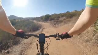
Popular Ramona Mountain Biking Trails
• 100 ★ 4.0 • 3 miles • 171 ft • 155 •
This a part of the managed by the San Dieguito River Park Organization (SDRP.org). It follows a remote section of Santa Ysabel Creek and has scenic views. Bring the kids for nice backcountry ride.
• 80 ★ 3.0 • 3 miles • 212 ft • 103 •
An additional 3.3 miles of Coast to Crest Trail was built in Pamo Valley near Ramona by the San Dieguito River Park. The Pamo Valley trail segment, once a gap in the planned Coast to Crest Trail, connects two existing trails in the...
• 100 ★ 0.0 • 413 ft • 21 ft • 89 •
Short from the Pamo Valley staging area to the and Lower Santa Ysabel Creek Trail
• 50 ★ 5.0 • 1 mile • 73 ft • 55 •
A very fast run down an oak wooded valley. A few tricky sections towards the bottom. Access it by going up the "West Side Road" until you get to the "No Trespassing" signs. The trail depends down to the left. It's so pretty you'll have...
• 60 ★ 0.0 • 2 miles • 955 ft • 37 •
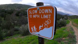
This is the main access for . It is multi-use, but sees heavy hiker traffic especially on weekends. Consider avoiding descending this trail by bike on weekends, and be very courteous at all times. The hike to via the or Trails can be...
• 70 ★ 4.0 • 2 miles • 1,040 ft • 30 •
A steady climb or descent on the old county road through the San Diego River Gorge. Surrounded on both sides by recommended wilderness. Great views, trail has seen better days, but has some rocky fun features. Pets: Dogs are not advised...
• 90 ★ 0.0 • 1 mile • 125 ft • 29 •
Popular green difficulty singletrack. This multi-use trail can be used both directions. On average it takes 9 minutes to complete this trail.
• 80 ★ 5.0 • 2 miles • 176 ft • 28 •
Two mile loop with enough climbing to get the lungs going. Can be dry and loose at times.
Ramona Mountain Bike Routes
Oh, The Places You'll Go! Featured
★ 5.0 • 43 miles • 2,953 ft • 18 • Shuttled •
In his wonderful book, , it's doubtful that the beloved Dr. Seuss had mountain bikes in mind when he wrote...
5 miles • 1,035 ft • 0 •
Steady climp up the fireroad. Quick flowy Canyon run to a downhill course.
Photos of Ramona Mountain Bike
Videos of Ramona Mountain Bike
trail: Gunstage Trail
18:58 |
83 |
Dec 4, 2024 , Ramona
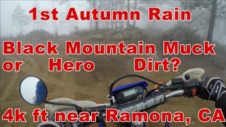
trail: Big Black Mountain Trail
10:05 |
221 |
Mar 8, 2023 , Ramona
trail: Big Black Mountain Trail
3:31 |
195 |
Feb 17, 2023 , Ramona
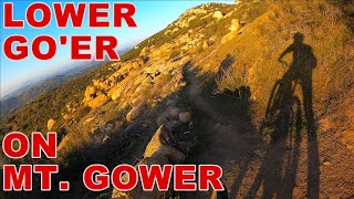
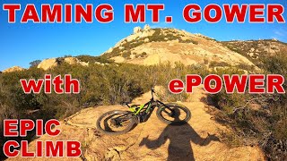
trail: Mt. Gower Traverse
24:22 |
258 |
Dec 17, 2021 , Ramona
trail: Mt. Gower Traverse
24:57 |
218 |
Dec 17, 2021 , Ramona
Recent Trail Reports
Activity Feed
| username | action | type | title | date |
|---|---|---|---|---|
| ev-dog | comment | trail | activity #97140029 | Jun 16, 2026 @ 3:05pm 1 day |
| ev-dog | add | photo | activity #97138453 and 45 more | Jun 16, 2026 @ 2:36pm 1 day |
| ev-dog | add | report | activity #97138421 and 4 more | Jun 16, 2026 @ 2:36pm 1 day |
| ev-dog | update | trail | activity #97129476 and 1 more | Jun 16, 2026 @ 12:06pm 1 day |
| ev-dog | add | trail | activity #97092039 and 6 more | Jun 16, 2026 @ 12:40am 2 days |
Recent Comments
| username | type | title | comment | date |
|---|---|---|---|---|
| trail | Good road that is accessible for almost all... | Jun 16, 2026 @ 3:05pm 1 day | ||
| trail | Parts of this trail are overgrown with plants... | Nov 15, 2025 @ 9:24am Nov 15, 2025 | ||
| trail | To get to the trailhead at the top you must... | Oct 6, 2025 @ 6:56am Oct 6, 2025 | ||
| trail | Updated access information to include permit... | Oct 3, 2025 @ 10:01am Oct 3, 2025 | ||
| trail | Permit is required | Mar 29, 2025 @ 11:39pm Mar 29, 2025 |
Local Badges
-

Epic Ride 50k31 awarded -

Climbing 10k Badge1 awarded -

Mountain Biking 100k Badge0 awarded -

Big Ride 30k65 awarded -

Descent 10k Badge0 awarded -

Descent 100k Badge0 awarded
Bike & Skill Parks
| name | type | city | rating |
|---|---|---|---|
| Barona Oaks MX | skill park | Ramona |
Activity Type Stats
| activitytype | trails | distance | descent | descent distance | total vertical | rating | global rank | state rank | photos | reports | routes | ridelogs |
|---|---|---|---|---|---|---|---|---|---|---|---|---|
| Mountain Bike | 38 | 64 miles | 7,306 ft | 24 miles | 3,497 ft | #4,308 | #1,455 | 114 | 66 | 2,675 | ||
| E-Bike | 33 | 70 miles | 7,520 ft | 25 miles | 3,497 ft | #1,329 | #852 | 18 | 56 | 386 | ||
| Gravel Bike | 1 | #1,352 | 2 | 123 | ||||||||
| Horse | 19 | 28 miles | 1,358 ft | 7 miles | 1,421 ft | #1,594 | #925 | 13 | ||||
| Hike | 42 | 64 miles | 5,433 ft | 20 miles | 3,497 ft | #853 | #388 | 28 | 68 | 602 | ||
| Trail Running | 42 | 64 miles | 5,433 ft | 20 miles | 3,497 ft | #3,602 | #1,075 | 68 | 178 | |||
| Dirtbike/Moto | 3 | 12 miles | 2,182 ft | 7 miles | 1,617 ft | 4 | 1 |
Frequently Asked Questions About Ramona
▼
What are the best places to ride in Ramona?
Ramona has 4 areas to explore for mountain biking. The top rated areas are:
▼
What are the highest rated mountain biking trails in Ramona?
The highest rated mountain biking trails in Ramona are:
- Himmel Canyon Run (4.2/5)
- Wildflower Loop (4.1/5)
- Coast to Crest Trail: Santa Ysabel Creek (4/5)
- Meadow Loop (4/5)
- Guejito Truck Trail (4/5)
▼
What is the best time of the year to ride in Ramona?
Based on ride log data, the most popular months to ride in Ramona are:
- December (16 activities)
- October (12 activities)
- February (12 activities)
▼
Where can I park to ride in Ramona?
There are 5 parking locations listed in Ramona. The most popular parking spots are: View all parking and trailhead locations on the map to plan your visit.
Activities
Trails
- ramona activity log | embed map of Ramona mountain bike trails | ramona mountain biking points of interest
Downloading of trail gps tracks in kml & gpx formats is enabled for Ramona.
You must login to download files.