close
-
Layers w
- Weather Layers
- Pro
- Pro
- Pro
- Pro
- Pro
- Pro
- More Layers
- Pro
- Pro
- Pro
- Pro
-
Upgrade to

3D
Trail Conditions
- Unknown
- Snow Groomed
- Snow Packed
- Snow Covered
- Snow Cover Partial
- Freeze/thaw Cycle
- Icy
- Prevalent Mud
- Wet
- Variable
- Ideal
- Dry
- Very Dry
Trail Flow (Ridden Direction)
Trailforks scans users ridelogs to determine the most popular direction each trail is ridden. A good flowing trail network will have most trails flowing in a single direction according to their intension.
The colour categories are based on what percentage of riders are riding a trail in its intended direction.
The colour categories are based on what percentage of riders are riding a trail in its intended direction.
- > 96%
- > 90%
- > 80%
- > 70%
- > 50%
- < 50%
- bi-directional trail
- no data
Trail Last Ridden
Trailforks scans ridelogs to determine the last time a trail was ridden.
- < 2 days
- < 1 week
- < 2 weeks
- < 1 month
- < 6 months
- > 6 months
Trail Ridden Direction
The intended direction a trail should be ridden.
- Downhill Only
- Downhill Primary
- Both Directions
- Uphill Primary
- Uphill Only
- One Direction
Contribute Details
Colors indicate trail is missing specified detail.
- Description
- Photos
- Description & Photos
- Videos
Trail Popularity ?
Trailforks scans ridelogs to determine which trails are ridden the most in the last 9 months.
Trails are compared with nearby trails in the same city region with a possible 25 colour shades.
Think of this as a heatmap, more rides = more kinetic energy = warmer colors.
- most popular
- popular
- less popular
- not popular
ATV/ORV/OHV Filter
Max Vehicle Width
inches
US Cell Coverage
Legend

Radar Time
Activity Recordings
Trailforks uses anonymized public activity data.
?
Activity Recordings
Trailforks uses anonymized public activity data.
?
Personal Heatmap
▶
Activity Types
all
/
none
▶
Options
2
Date range
month
–
Winter Trails
Warning
A routing network for winter maps does not exist. Selecting trails using the winter trails layer has been disabled.
Missing Trails
Most Popular
Least Popular
Trails are colored based on popularity. The more popular a trail is, the more red. Less popular trails trend towards green.
Jump Magnitude Heatmap
Heatmap of where riders jump on trails. Zoom in to see individual jumps, click circles to view jump details.
BC Backroad Status
![map legend]()
Service Road Atlas is a free to use, community-driven service for viewing and creating reports on the numerous back-country service roads around B.C. and Alberta.

Slope Aspect
Direction the slope faces
Trails Deemphasized
Trails are shown in grey.
Only show trails with no bike usage.
Suggested Layers
Based on selected activity type
Save the current map location and zoom level as your default home location whenever this page is loaded.
Save
No description for Ratingen has been added yet!
Login or register to submit one.
This region uses the Uk/Euro style trail grading system.
Activities Click to view
- Mountain Bike
100 trails
- E-Bike
100 trails
- Adaptive Bike
0 trails
- Winter Fat Bike
0 trails
- Horse
4 trails
- Hike
98 trails
- Trail Running
97 trails
Region Details
- 30
- 48
- 9
- 2
Region Status
Open as of Apr 19, 2026Stats
- Avg Trail Rating
- Trails (view details)
- 90
- Trails Mountain Bike
- 100
- Trails E-Bike
- 100
- Trails Horse
- 4
- Trails Hike
- 98
- Trails Trail Running
- 97
- Total Distance
- 45 miles
- Total Descent Distance
- 21 miles
- Total Descent
- 4,851 ft
- Total Vertical
- 389 ft
- Highest Trailhead
- 527 ft
- Reports
- 602
- Photos
- 76
- Ridden Counter
- 4,366
Popular Ratingen Mountain Biking Trails
• 100 ★ 4.0 • 719 ft • 15 ft • 42 •
Popular blue difficulty singletrack. This mountain bike primary trail can be used downhill only and has a moderate overall physical rating with a 15 ft black diamond climb. Trail visibility is always easy to follow. On average it takes minutes to complete this trail.
• 65 ★ 4.0 • 610 ft • 0 ft • 39 •
Moderately popular blue difficulty singletrack. This mountain bike primary trail can be used downhill primary and has a easy overall physical rating with a 0 ft green climb. Trail visibility is always easy to follow. On average it takes minutes to complete this trail.
• 95 ★ 0.0 • 656 ft • 8 ft • 38 •
Popular green difficulty singletrack. This multi-use trail can be used downhill primary and has a moderate overall physical rating with a 8 ft blue climb. Trail visibility is always easy to follow. On average it takes minutes to complete this trail.
• 100 ★ 0.0 • 479 ft • 0 ft • 34 •
Popular blue difficulty singletrack. This multi-use trail can be used both directions and has a moderate overall physical rating with a 0 ft blue climb. Trail visibility is always easy to follow. On average it takes minutes to complete this trail.
• 80 ★ 0.0 • 663 ft • 0 ft • 34 •
Popular green difficulty singletrack. This multi-use trail can be used downhill primary and has a moderate overall physical rating with a 0 ft blue climb. Trail visibility is always easy to follow. On average it takes 1 minutes to complete this trail.
• 100 ★ 0.0 • 1,775 ft • 26 ft • 31 •
Popular green difficulty singletrack. This multi-use trail can be used both directions and has a easy overall physical rating with a 26 ft green climb. Trail visibility is always easy to follow. On average it takes 3 minutes to complete this trail.
• 95 ★ 0.0 • 1,900 ft • 21 ft • 29 •
Popular green difficulty singletrack. This multi-use trail can be used downhill primary and has a easy overall physical rating with a 21 ft blue climb. Trail visibility is always easy to follow. On average it takes 2 minutes to complete this trail.
• 100 ★ 0.0 • 942 ft • 3 ft • 28 •
Popular green difficulty singletrack. This multi-use trail can be used both directions and has a easy overall physical rating with a 3 ft green climb. Trail visibility is always easy to follow. On average it takes minutes to complete this trail.
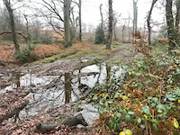
Photos of Ratingen Mountain Bike
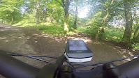
Videos of Ratingen Mountain Bike
trail: Lintorf Waldweg
0:17 |
2 |
Dec 26, 2024

trail: Heckerbergbach Waldweg
14:47 |
5 |
Jul 18, 2024

trail: Hinkesforstgraben Trail
4:23 |
8 |
Jun 4, 2024

trail: Papermill-Trail
0:09 |
5 |
Jun 4, 2024

trail: Eggerscheidt Waldpfad
3:37 |
1 |
Jun 4, 2024

trail: Ratingen Waldtrail
5:40 |
3 |
Jun 4, 2024

trail: Eggerscheidt Waldpfad
14:47 |
3 |
May 20, 2024
trail: Dickelsbach Trail
4:12 |
1 |
May 11, 2024
Recent Trail Reports
| status | trail | date | condition | info | user |
|---|---|---|---|---|---|
| Waldweg zum Ruhrhöhenweg | Apr 19, 2026 @ 2:05pm (Europe/Berlin) Apr 19, 2026 | Wet | Ioniansailor | ||
| Landsberg Trail zu Woodgarden | Apr 19, 2026 @ 2:05pm (Europe/Berlin) Apr 19, 2026 | Wet | Ioniansailor | ||
| Landsberger Graben Trail | Apr 19, 2026 @ 2:05pm (Europe/Berlin) Apr 19, 2026 | Wet | Ioniansailor | ||
| Sommersberg Waldweg | Apr 19, 2026 @ 2:05pm (Europe/Berlin) Apr 19, 2026 | Wet | Ioniansailor | ||
| Schönebeck | Oct 6, 2025 @ 3:48pm (Europe/Amsterdam) Oct 6, 2025 | Wet | Ioniansailor | ||
| Baulofsbruch Waldweg | Oct 6, 2025 @ 3:48pm (Europe/Amsterdam) Oct 6, 2025 | Wet | Ioniansailor | ||
| Steinkothen - Angerweg Waldweg | Oct 6, 2025 @ 3:48pm (Europe/Amsterdam) Oct 6, 2025 | Wet | Ioniansailor | ||
| Schwarzbach Feldweg | Oct 7, 2025 @ 8:48am (Europe/Amsterdam) Oct 6, 2025 | Variable | Ioniansailor | ||
| Schwarzbach Waldtrail | Oct 7, 2025 @ 8:48am (Europe/Amsterdam) Oct 6, 2025 | Variable | Ioniansailor | ||
| Homberg Gravelpfad | Oct 7, 2025 @ 8:48am (Europe/Amsterdam) Oct 6, 2025 | Variable | Ioniansailor |
Activity Feed
| username | action | type | title | date |
|---|---|---|---|---|
| martindin123 | wishlist | trail | activity #94831810 | May 16, 2026 @ 10:31am May 16, 2026 |
| f8aexj | wishlist | region | activity #94228570 | May 7, 2026 @ 10:55am May 7, 2026 |
| Ioniansailor | add | report | activity #92959917 and 3 more | Apr 19, 2026 @ 10:08am Apr 19, 2026 |
| Tobinouu | wishlist | trail | activity #91500617 and 1 more | Mar 29, 2026 @ 3:02am Mar 29, 2026 |
| Wolfsblut | ridden | trail | activity #88560054 | Feb 8, 2026 @ 5:52am Feb 8, 2026 |
Recent Comments
| username | type | title | comment | date |
|---|---|---|---|---|
| trail | This trail is Nature Reserve Area - Biking and... | Jul 18, 2024 @ 6:20am Jul 18, 2024 | ||
| trail | Sehr steiles Ende, sonst ein sehr geiler trail... | Sep 5, 2021 @ 6:10am Sep 5, 2021 | ||
| trail | Der Trail ist in beide Richtungen gut... | Apr 6, 2020 @ 7:33am Apr 6, 2020 |
Local Badges
-

Epic Mountain Bike Climb 2k2 awarded -

Climbing 10k Badge11 awarded -

Mountain Biking 100k Badge0 awarded -

Epic Ride Descent 2k2 awarded -

Descent 10k Badge12 awarded -

Descent 100k Badge0 awarded
Bike & Skill Parks
| name | type | city | rating |
|---|---|---|---|
| Dirtpark Ratingen Hösel | skill park | Ratingen |
Activity Type Stats
| activitytype | trails | distance | descent | descent distance | total vertical | rating | global rank | state rank | photos | reports | routes | ridelogs |
|---|---|---|---|---|---|---|---|---|---|---|---|---|
| Mountain Bike | 100 | 44 miles | 4,774 ft | 20 miles | 390 ft | #2,913 | #31 | 63 | 602 | 1,763 | ||
| E-Bike | 100 | 45 miles | 4,852 ft | 21 miles | 390 ft | #2,407 | #42 | 596 | 202 | |||
| Horse | 4 | 1 mile | 98 ft | 1,706 ft | 180 ft | #612 | #10 | 3 | ||||
| Hike | 98 | 45 miles | 4,836 ft | 21 miles | 390 ft | #3,945 | #32 | 5 | 602 | 62 | ||
| Trail Running | 97 | 45 miles | 4,747 ft | 21 miles | 390 ft | #3,481 | #30 | 8 | 602 | 103 |
Frequently Asked Questions About Ratingen
▼
What are the highest rated mountain biking trails in Ratingen?
The highest rated mountain biking trails in Ratingen are:
- Am Pöstchen Bachtrail (4.1/5)
- Hanten Trail (4.1/5)
- Klusenbach Wurzel-Downhill 1 (4/5)
- Sommersberg Waldtrail (4/5)
- Steinbergtrail (4/5)
▼
What is the best time of the year to ride in Ratingen?
Based on ride log data, the most popular months to ride in Ratingen are:
- July (22 activities)
- May (19 activities)
- June (16 activities)
▼
Where can I park to ride in Ratingen?
There are 18 parking locations listed in Ratingen. The most popular parking spots are:
- Wanderparkplatz
- Wanderparkplatz Steinkothen
- Wanderparkplatz Am Steinbrenner
- Parkplatz 6-Seen-Platte Duisburg
- Wanderparkplatz
▼
What is the longest trail in Ratingen?
The longest trail in Ratingen is Ratingen Wald- und Lichtungstrail at 4,324 ft. View all trails sorted by distance.
Activities
- By noelMTB
 & contributors
 - Admins: apply
- #40909 - 2,840 views
- ratingen activity log | embed map of Ratingen mountain bike trails | ratingen mountain biking points of interest
Downloading of trail gps tracks in kml & gpx formats is enabled for Ratingen.
You must login to download files.