close
-
Layers w
- Weather Layers
- Pro
- Pro
- Pro
- Pro
- Pro
- Pro
- More Layers
- Pro
- Pro
- Pro
- Pro
-
Upgrade to

3D
Trail Conditions
- Unknown
- Snow Groomed
- Snow Packed
- Snow Covered
- Snow Cover Partial
- Freeze/thaw Cycle
- Icy
- Prevalent Mud
- Wet
- Variable
- Ideal
- Dry
- Very Dry
Trail Flow (Ridden Direction)
Trailforks scans users ridelogs to determine the most popular direction each trail is ridden. A good flowing trail network will have most trails flowing in a single direction according to their intension.
The colour categories are based on what percentage of riders are riding a trail in its intended direction.
The colour categories are based on what percentage of riders are riding a trail in its intended direction.
- > 96%
- > 90%
- > 80%
- > 70%
- > 50%
- < 50%
- bi-directional trail
- no data
Trail Last Ridden
Trailforks scans ridelogs to determine the last time a trail was ridden.
- < 2 days
- < 1 week
- < 2 weeks
- < 1 month
- < 6 months
- > 6 months
Trail Ridden Direction
The intended direction a trail should be ridden.
- Downhill Only
- Downhill Primary
- Both Directions
- Uphill Primary
- Uphill Only
- One Direction
Contribute Details
Colors indicate trail is missing specified detail.
- Description
- Photos
- Description & Photos
- Videos
Trail Popularity ?
Trailforks scans ridelogs to determine which trails are ridden the most in the last 9 months.
Trails are compared with nearby trails in the same city region with a possible 25 colour shades.
Think of this as a heatmap, more rides = more kinetic energy = warmer colors.
- most popular
- popular
- less popular
- not popular
ATV/ORV/OHV Filter
Max Vehicle Width
inches
US Cell Coverage
Legend

Radar Time
Activity Recordings
Trailforks uses anonymized public activity data.
?
Activity Recordings
Trailforks uses anonymized public activity data.
?
Personal Heatmap
▶
Activity Types
all
/
none
▶
Options
2
Date range
month
–
Winter Trails
Warning
A routing network for winter maps does not exist. Selecting trails using the winter trails layer has been disabled.
Missing Trails
Most Popular
Least Popular
Trails are colored based on popularity. The more popular a trail is, the more red. Less popular trails trend towards green.
Jump Magnitude Heatmap
Heatmap of where riders jump on trails. Zoom in to see individual jumps, click circles to view jump details.
BC Backroad Status
![map legend]()
Service Road Atlas is a free to use, community-driven service for viewing and creating reports on the numerous back-country service roads around B.C. and Alberta.

Slope Aspect
Direction the slope faces
Trails Deemphasized
Trails are shown in grey.
Only show trails with no bike usage.
Suggested Layers
Based on selected activity type
Save the current map location and zoom level as your default home location whenever this page is loaded.
Save
No description for Rättvik has been added yet!
Login or register to submit one.
This region uses the Uk/Euro style trail grading system.
Activities Click to view
- Mountain Bike
61 trails
- Adaptive Bike
0 trails
- Hike
61 trails
- Trail Running
61 trails
- Nordic Ski
14 trails
Region Details
- 19
- 16
- 14
- 12
Region Status
Caution as of Jun 30, 2025Stats
- Avg Trail Rating
- Trails (view details)
- 61
- Trails Mountain Bike
- 61
- Trails E-Bike
- 2
- Trails Hike
- 61
- Trails Trail Running
- 61
- Trails Nordic Ski
- 14
- Total Distance
- 37 miles
- Total Descent
- 2,826 ft
- Total Vertical
- 998 ft
- Highest Trailhead
- 1,529 ft
- Reports
- 81
- Photos
- 3
- Ridden Counter
- 2,194
Sub Regions
-
Jarlstugan
- 10
- 9
- 7
Popular Rättvik Mountain Biking Trails
• 95 ★ 0.0 • 3,153 ft • 17 ft • 163 •
Popular blue difficulty singletrack. This multi-use trail can be used both directions and has a easy overall physical rating with a 17 ft blue climb. It features bridge. Trail visibility is sometimes hard to follow. On average it takes 11 minutes to complete this trail.
• 95 ★ 0.0 • 4,902 ft • 22 ft • 90 •
Popular red difficulty singletrack. This multi-use trail can be used both directions. On average it takes 4 minutes to complete this trail.
• 80 ★ 0.0 • 873 ft • 0 ft • 84 •
Popular blue difficulty singletrack. This multi-use trail can be used both directions. On average it takes 3 minutes to complete this trail.
• 100 ★ 0.0 • 1,444 ft • 0 ft • 83 •
Popular blue difficulty singletrack. This multi-use trail can be used both directions. On average it takes 1 minutes to complete this trail.
• 60 ★ 4.0 • 3,829 ft • 0 ft • 78 •
Moderately popular blue difficulty singletrack. This multi-use trail can be used both directions. On average it takes 29 minutes to complete this trail.
• 100 ★ 0.0 • 2,516 ft • 0 ft • 76 •
Popular blue difficulty singletrack. This multi-use trail can be used both directions. On average it takes 3 minutes to complete this trail.
• 100 ★ 0.0 • 2 miles • 9 ft • 75 •
Popular blue difficulty singletrack. This multi-use trail can be used both directions.
Rättvik Mountain Bike Routes
56 miles • 1,852 ft • 0 • Point to Point •
Starta i Rättvik, cykla längs Siljan till Leksand, fortsätt genom Insjön och Djurås så slutar du i...
Videos of Rättvik Mountain Bike
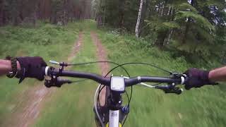
trail: Södra Vålberget
465 |
Aug 21, 2017 , Rättvik
Recent Trail Reports
| status | trail | date | condition | info | user |
|---|---|---|---|---|---|
| Farfarsleden Österängsån | Jun 30, 2024 @ 9:53am Jun 30, 2024 | Ideal | Koppjark | ||
| Svarta Slingan 2 | Aug 18, 2023 @ 5:17am Aug 18, 2023 | Ideal | MickeS | ||
| Farfarsleden 1 | Aug 18, 2023 @ 5:17am Aug 18, 2023 | Ideal | MickeS | ||
| Cykelvägen Längs Med Järnvägen | Aug 18, 2023 @ 5:17am Aug 18, 2023 | Ideal | MickeS | ||
| Rättviks Småbåtshamn Grusvägen | Aug 18, 2023 @ 5:17am Aug 18, 2023 | Ideal | MickeS | ||
| Rättviks Småbåtshamn | Aug 18, 2023 @ 5:17am Aug 18, 2023 | Wet | MickeS | ||
| Tina Ängsvägen | Aug 18, 2023 @ 5:17am Aug 18, 2023 | Ideal | MickeS | ||
| Tina Trötvägen | Aug 5, 2023 @ 3:37am Aug 5, 2023 | Ideal | MickeS | ||
| Farfarsleden 2 | Aug 5, 2023 @ 3:37am Aug 5, 2023 | Ideal | MickeS | ||
| Cykelväg Järnvägsbron Mot Stationen | Aug 5, 2023 @ 3:37am Aug 5, 2023 | Ideal | MickeS |
Activity Feed
| username | action | type | title | date |
|---|---|---|---|---|
| isakbaronen98 | wishlist | route | activity #79825897 | Sep 7, 2025 @ 5:08am Sep 7, 2025 |
| pernorrman | vote | trail | activity #74711821 | Jun 28, 2025 @ 2:22am Jun 28, 2025 |
| OrjanX | update | trail | activity #70395813 | Apr 26, 2025 @ 4:09am Apr 26, 2025 |
| OrjanX | add | trail | activity #59132021 | Sep 19, 2024 @ 7:37am Sep 19, 2024 |
| addeevil | wishlist | route | activity #56120426 | Jul 24, 2024 @ 12:11am Jul 24, 2024 |
Recent Comments
| username | type | title | comment | date |
|---|---|---|---|---|
| trail | Denna del är inte röd, mera grön kanske... | Aug 20, 2021 @ 2:54am Aug 20, 2021 | ||
| trail | Rättad. Hela stigen finns som en rutt under... | Jun 29, 2020 @ 2:05pm Jun 29, 2020 | ||
| trail | Tack för info, ska testa den i morgon! | Jun 29, 2020 @ 1:05pm Jun 29, 2020 | ||
| trail | Nope, är tyvärr inte riktigt i våra normala... | Apr 8, 2020 @ 9:13am Apr 8, 2020 | ||
| trail | Går väl en led hela vägen från dådran by... | Aug 28, 2019 @ 5:14am Aug 28, 2019 |
Local Badges
-

Epic Mountain Bike Climb 2k2 awarded -

Climbing 10k Badge4 awarded -

Mountain Biking 100k Badge0 awarded -

Epic Ride Descent 2k2 awarded -

Descent 10k Badge4 awarded -

Descent 100k Badge0 awarded
Activity Type Stats
| activitytype | trails | distance | descent | descent distance | total vertical | rating | global rank | state rank | photos | reports | routes | ridelogs |
|---|---|---|---|---|---|---|---|---|---|---|---|---|
| Mountain Bike | 61 | 37 miles | 2,825 ft | 14 miles | 997 ft | #8,261 | #191 | 3 | 81 | 3 | 1,839 | |
| E-Bike | 2 | 1 mile | 79 ft | 79 | 31 | |||||||
| Hike | 61 | 37 miles | 2,825 ft | 14 miles | 997 ft | #4,756 | #153 | 81 | 50 | |||
| Trail Running | 61 | 37 miles | 2,825 ft | 14 miles | 997 ft | #4,166 | #153 | 81 | 70 | |||
| Nordic Ski | 14 | 10 miles | 696 ft | 5 miles | 617 ft | #603 | #65 | 445 |
Frequently Asked Questions About Rättvik
▼
What are the best places to ride in Rättvik?
Rättvik has 1 areas to explore for mountain biking. The top rated areas are:
▼
What are the highest rated mountain biking trails in Rättvik?
The highest rated mountain biking trails in Rättvik are:
- Södra Vålberget (4/5)
- Farfarsleden 2 (4/5)
- Farfarsleden 1 (3.9/5)
- Janssons Frestelse (3.6/5)
- Farfarsleden Mellan (0/5)
▼
What is the best time of the year to ride in Rättvik?
Based on ride log data, the most popular months to ride in Rättvik are:
- July (41 activities)
- June (21 activities)
- August (19 activities)
▼
Where can I park to ride in Rättvik?
There are 1 parking locations listed in Rättvik. The most popular parking spots are:
- By ollesvenskonthetrail
 TRAILFORKS & contributors
 - Admins: ollesvenskonthetrail, JALLE, OrjanX, martinlindstr, OrjanX, svenakela, weldion
- #19738 - 3,747 views
- rättvik activity log | embed map of Rättvik mountain bike trails | rättvik mountain biking points of interest
Downloading of trail gps tracks in kml & gpx formats is enabled for Rättvik.
You must login to download files.