close
-
Layers w
- Weather Layers
- Pro
- Pro
- Pro
- Pro
- Pro
- Pro
- More Layers
- Pro
- Pro
- Pro
- Pro
-
Upgrade to

3D
Trail Conditions
- Unknown
- Snow Groomed
- Snow Packed
- Snow Covered
- Snow Cover Partial
- Freeze/thaw Cycle
- Icy
- Prevalent Mud
- Wet
- Variable
- Ideal
- Dry
- Very Dry
Trail Flow (Ridden Direction)
Trailforks scans users ridelogs to determine the most popular direction each trail is ridden. A good flowing trail network will have most trails flowing in a single direction according to their intension.
The colour categories are based on what percentage of riders are riding a trail in its intended direction.
The colour categories are based on what percentage of riders are riding a trail in its intended direction.
- > 96%
- > 90%
- > 80%
- > 70%
- > 50%
- < 50%
- bi-directional trail
- no data
Trail Last Ridden
Trailforks scans ridelogs to determine the last time a trail was ridden.
- < 2 days
- < 1 week
- < 2 weeks
- < 1 month
- < 6 months
- > 6 months
Trail Ridden Direction
The intended direction a trail should be ridden.
- Downhill Only
- Downhill Primary
- Both Directions
- Uphill Primary
- Uphill Only
- One Direction
Contribute Details
Colors indicate trail is missing specified detail.
- Description
- Photos
- Description & Photos
- Videos
Trail Popularity ?
Trailforks scans ridelogs to determine which trails are ridden the most in the last 9 months.
Trails are compared with nearby trails in the same city region with a possible 25 colour shades.
Think of this as a heatmap, more rides = more kinetic energy = warmer colors.
- most popular
- popular
- less popular
- not popular
ATV/ORV/OHV Filter
Max Vehicle Width
inches
US Cell Coverage
Legend

Radar Time
Activity Recordings
Trailforks uses anonymized public activity data.
?
Activity Recordings
Trailforks uses anonymized public activity data.
?
Personal Heatmap
▶
Activity Types
all
/
none
▶
Options
2
Date range
month
–
Winter Trails
Warning
A routing network for winter maps does not exist. Selecting trails using the winter trails layer has been disabled.
Missing Trails
Most Popular
Least Popular
Trails are colored based on popularity. The more popular a trail is, the more red. Less popular trails trend towards green.
Jump Magnitude Heatmap
Heatmap of where riders jump on trails. Zoom in to see individual jumps, click circles to view jump details.
BC Backroad Status
![map legend]()
Service Road Atlas is a free to use, community-driven service for viewing and creating reports on the numerous back-country service roads around B.C. and Alberta.

Slope Aspect
Direction the slope faces
Trails Deemphasized
Trails are shown in grey.
Only show trails with no bike usage.
Suggested Layers
Based on selected activity type
Save the current map location and zoom level as your default home location whenever this page is loaded.
Save
No description for Reșița has been added yet!
Login or register to submit one.
This region uses the Uk/Euro style trail grading system.
Activities Click to view
- Mountain Bike
62 trails
- E-Bike
39 trails
- Gravel Bike
0 trails
- Adaptive Bike
0 trails
- Winter Fat Bike
0 trails
- Horse
13 trails
- Hike
62 trails
- Trail Running
62 trails
Region Details
- 42
- 7
- 9
Region Status
Caution as of Mar 31, 2026Local Trail Association
Stats
- Avg Trail Rating
- Trails (view details)
- 61
- Trails Mountain Bike
- 63
- Trails E-Bike
- 39
- Trails Horse
- 13
- Trails Hike
- 62
- Trails Trail Running
- 62
- Trails Dirtbike/Moto
- 1
- Trails ATV/ORV/OHV
- 1
- Trails Snowshoe
- 1
- Total Distance
- 80 miles
- Total Descent
- 17,481 ft
- Total Vertical
- 4,065 ft
- Highest Trailhead
- 4,689 ft
- Reports
- 219
- Photos
- 107
- Ridden Counter
- 1,076
Sub Regions
-
Cioara Mountain
- 2
- 1
-
Dealu' Golului
- 3
Popular Reșița Mountain Biking Trails
• 100 ★ 4.9 • 1 mile • 0 ft • 69 •
Probably the most flowy trail from Reşiţa area, with a lot of big berms and fast sections. Big jumps are also present. The terrain it's not too loose, so the trail can be ridden by less experienced riders too.
• 100 ★ 4.8 • 4,970 ft • 11 ft • 55 •
Old trail rebuilded for Metal Enduro 2018. It's one of the easiest singletrail around Reşiţa, without any major obstacles. Has some long climbs on it.
• 90 ★ 4.4 • 1 mile • 0 ft • 46 •
starts with a fast section, full of wide and fast turns, that can prove to be treacherous due to the loose terrain. As the forest becomes more dense, the trail gets straighter and faster, with some pedal sections. The glade segment...
• 85 ★ 4.5 • 3,143 ft • 0 ft • 37 •
Nice trail with mixed stuff: some off-camber, some tight corners, a climb, even a nice drop. Fun is guaranteed on this one.
Reșița Mountain Bike Routes
18 miles • 3,653 ft • 0 • Point to Point •
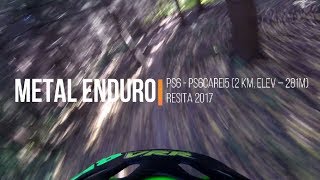
Second day of Metal Enduro 2019
16 miles • 3,902 ft • 0 • Point to Point • Race •
First day of Metal Enduro 2019
2 miles • 448 ft • 1 • Loop • Race •
Traseul concursului XCO Resita Mountai Bike Race 2023
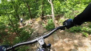
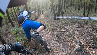
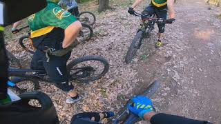
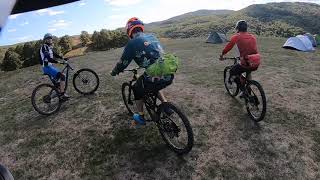
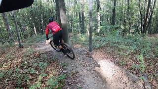
Photos of Reșița Mountain Bike
Videos of Reșița Mountain Bike
trail: Canada
10:42 |
200 |
May 1, 2024 , Reșița

5:53 |
198 |
Feb 28, 2020

trail: Canada
23:30 |
544 |
Oct 14, 2019 , Reșița
trail: Fluturelu
9:58 |
373 |
Oct 14, 2019 , Reșița
trail: Uzină
6:15 |
338 |
Oct 14, 2019 , Reșița
trail: Fluturelu
7:10 |
286 |
Oct 14, 2019 , Reșița
trail: drigloVĂȚ
5:36 |
335 |
Oct 14, 2019 , Reșița
trail: Moșu
7:23 |
554 |
Mar 7, 2018 , Reșița
Recent Trail Reports
| status | trail | date | condition | info | user |
|---|---|---|---|---|---|
| Vico-Canossa SM+SD | Mar 31, 2026 @ 6:12pm (Europe/Rome) Mar 31, 2026 | Very Dry | cy76bb | ||
| Ghica Connector | Mar 14, 2026 @ 11:45am (Europe/Belgrade) Mar 14, 2026 | Dry | beul | ||
| Fluturelu/Uzină Access | Feb 28, 2026 @ 12:21pm (Europe/Belgrade) Feb 28, 2026 | Variable | Mishconi | ||
| drigloVĂȚ | Feb 28, 2026 @ 12:21pm (Europe/Belgrade) Feb 28, 2026 | Ideal | Mishconi | ||
| Golului Connect-r | Feb 28, 2026 @ 12:21pm (Europe/Belgrade) Feb 28, 2026 | Variable | Mishconi | ||
| Poezie | Feb 28, 2026 @ 12:21pm (Europe/Belgrade) Feb 28, 2026 | Ideal | Mishconi | ||
| La Purcici | Feb 28, 2026 @ 12:21pm (Europe/Belgrade) Feb 28, 2026 | Variable | Mishconi | ||
| Cioara Climb | Feb 28, 2026 @ 12:21pm (Europe/Belgrade) Feb 28, 2026 | Variable | Mishconi | ||
| Urcare prin Moroasa | Feb 28, 2026 @ 12:21pm (Europe/Belgrade) Feb 28, 2026 | Variable | Mishconi | ||
| Moșu | Dec 28, 2025 @ 12:53pm (Europe/Belgrade) Dec 28, 2025 | Ideal | beul |
Activity Feed
| username | action | type | title | date |
|---|---|---|---|---|
| calindraghin | ridden | trail | activity #96484789 | Jun 7, 2026 @ 11:55am Jun 7, 2026 |
| CiprianDRbMPP | ridden | trail | activity #94427582 | May 10, 2026 @ 8:02am May 10, 2026 |
| GeorgePsyUp8 | difficultyvote | trail | activity #91761514 | Apr 2, 2026 @ 7:48am Apr 2, 2026 |
| cy76bb | add | report | activity #91651249 | Mar 31, 2026 @ 9:12am Mar 31, 2026 |
| beul | add | report | activity #90679353 | Mar 16, 2026 @ 12:29am Mar 16, 2026 |
Recent Comments
| username | type | title | comment | date |
|---|---|---|---|---|
| report | Someone should be hunting the dogs then :D | Apr 15, 2021 @ 1:24am Apr 15, 2021 | ||
| report | Not friendly, but they're easily scared.... | Apr 15, 2021 @ 1:04am Apr 15, 2021 | ||
| report | Friendly or not so much? | Apr 15, 2021 @ 12:51am Apr 15, 2021 | ||
| report | muie homeless | Mar 28, 2021 @ 9:23am Mar 28, 2021 | ||
| trail | Into sadomasochism? Then this short climbing... | Mar 7, 2021 @ 12:37am Mar 7, 2021 |
Local Badges
-

Epic Ride Climb 2k66 awarded -

Climbing 10k Badge11 awarded -

Climbing 100k Badge4 awarded -

Epic Ride Descent 2k72 awarded -

Descent 10k Badge11 awarded -

Descent 100k Badge4 awarded
Bike & Skill Parks
| name | type | city | rating |
|---|---|---|---|
| Pump Track Govândari | skill park | Reșița | |
| SkillPark Caraiman | skill park | Reșița |
Activity Type Stats
| activitytype | trails | distance | descent | descent distance | total vertical | rating | global rank | state rank | photos | reports | routes | ridelogs |
|---|---|---|---|---|---|---|---|---|---|---|---|---|
| Mountain Bike | 62 | 80 miles | 17,480 ft | 35 miles | 4,065 ft | #1,227 | #3 | 54 | 223 | 6 | 2,652 | |
| E-Bike | 39 | 53 miles | 7,733 ft | 20 miles | 4,035 ft | #929 | #23 | 165 | 66 | |||
| Horse | 13 | 22 miles | 1,877 ft | 8 miles | 3,914 ft | #292 | #7 | 51 | ||||
| Hike | 62 | 79 miles | 16,608 ft | 34 miles | 4,065 ft | #1,184 | #7 | 2 | 220 | 68 | ||
| Trail Running | 62 | 79 miles | 16,608 ft | 34 miles | 4,065 ft | #355 | #5 | 220 | 2 | 685 | ||
| Dirtbike/Moto | 1 | 1 mile | 52 ft | 2,103 ft | 246 ft | 51 | ||||||
| ATV/ORV/OHV | 1 | 1 mile | 52 ft | 2,103 ft | 246 ft | 51 | ||||||
| Snowshoe | 1 | 1 |
Frequently Asked Questions About Reșița
▼
What are the best places to ride in Reșița?
Reșița has 2 areas to explore for mountain biking. The top rated areas are:
▼
What are the highest rated mountain biking trails in Reșița?
▼
What is the best time of the year to ride in Reșița?
Based on ride log data, the most popular months to ride in Reșița are:
- October (47 activities)
- April (19 activities)
- September (11 activities)
▼
Where can I park to ride in Reșița?
There are 3 parking locations listed in Reșița. The most popular parking spots are: View all parking and trailhead locations on the map to plan your visit.
Activities
Trails
- By pufalot
 TRAILFORKS & contributors
 - Admins: pufalot, Meehi, beul, BAR
- #19371 - 9,849 views
- reșița activity log | embed map of Reșița mountain bike trails | reșița mountain biking points of interest
Downloading of trail gps tracks in kml & gpx formats is enabled for Reșița.
You must login to download files.