close
-
Layers w
- Weather Layers
- Pro
- Pro
- Pro
- Pro
- Pro
- Pro
- More Layers
- Pro
- Pro
- Pro
- Pro
-
Upgrade to

3D
Trail Conditions
- Unknown
- Snow Groomed
- Snow Packed
- Snow Covered
- Snow Cover Partial
- Freeze/thaw Cycle
- Icy
- Prevalent Mud
- Wet
- Variable
- Ideal
- Dry
- Very Dry
Trail Flow (Ridden Direction)
Trailforks scans users ridelogs to determine the most popular direction each trail is ridden. A good flowing trail network will have most trails flowing in a single direction according to their intension.
The colour categories are based on what percentage of riders are riding a trail in its intended direction.
The colour categories are based on what percentage of riders are riding a trail in its intended direction.
- > 96%
- > 90%
- > 80%
- > 70%
- > 50%
- < 50%
- bi-directional trail
- no data
Trail Last Ridden
Trailforks scans ridelogs to determine the last time a trail was ridden.
- < 2 days
- < 1 week
- < 2 weeks
- < 1 month
- < 6 months
- > 6 months
Trail Ridden Direction
The intended direction a trail should be ridden.
- Downhill Only
- Downhill Primary
- Both Directions
- Uphill Primary
- Uphill Only
- One Direction
Contribute Details
Colors indicate trail is missing specified detail.
- Description
- Photos
- Description & Photos
- Videos
Trail Popularity ?
Trailforks scans ridelogs to determine which trails are ridden the most in the last 9 months.
Trails are compared with nearby trails in the same city region with a possible 25 colour shades.
Think of this as a heatmap, more rides = more kinetic energy = warmer colors.
- most popular
- popular
- less popular
- not popular
ATV/ORV/OHV Filter
Max Vehicle Width
inches
US Cell Coverage
Legend

Radar Time
Activity Recordings
Trailforks uses anonymized public activity data.
?
Activity Recordings
Trailforks uses anonymized public activity data.
?
Personal Heatmap
▶
Activity Types
all
/
none
▶
Options
2
Date range
month
–
Winter Trails
Warning
A routing network for winter maps does not exist. Selecting trails using the winter trails layer has been disabled.
Missing Trails
Most Popular
Least Popular
Trails are colored based on popularity. The more popular a trail is, the more red. Less popular trails trend towards green.
Jump Magnitude Heatmap
Heatmap of where riders jump on trails. Zoom in to see individual jumps, click circles to view jump details.
BC Backroad Status
![map legend]()
Service Road Atlas is a free to use, community-driven service for viewing and creating reports on the numerous back-country service roads around B.C. and Alberta.

Slope Aspect
Direction the slope faces
Trails Deemphasized
Trails are shown in grey.
Only show trails with no bike usage.
Suggested Layers
Based on selected activity type
Save the current map location and zoom level as your default home location whenever this page is loaded.
Save
No description for Red Deer has been added yet!
Login or register to submit one.
Region Supporters & Maintainers
![]()
Red Deer Mountain Bike AssociationMaintainer
Activities Click to view
- Mountain Bike
104 trails
- E-Bike
83 trails
- Gravel Bike
0 trails
- Adaptive Bike
0 trails
- Winter Fat Bike
3 trails
- Horse
9 trails
- Hike
127 trails
- Trail Running
125 trails
- Snowshoe
10 trails
- Downhill Ski
4 trails
- Nordic Ski
5 trails
Region Details
- 32
- 8
- 21
- 40
- 2
- 1
Region Status
Open as of Jun 13, 2026Stats
- Avg Trail Rating
- Trails (view details)
- 109
- Trails Mountain Bike
- 107
- Trails E-Bike
- 83
- Trails Winter Fat Bike
- 3
- Trails Horse
- 9
- Trails Hike
- 127
- Trails Trail Running
- 125
- Trails Snowmobile
- 2
- Trails Snowshoe
- 10
- Trails Downhill Ski
- 4
- Trails Nordic Ski
- 5
- Total Distance
- 48 miles
- Total Descent
- 3,427 ft
- Total Vertical
- 442 ft
- Highest Trailhead
- 3,145 ft
- Reports
- 717
- Photos
- 209
- Ridden Counter
- 11,210
Sub Regions
-
Garden Heights
- 1
- 5
-
Heritage Ranch
- 1
- 1
- 13
-
Piper Creek Ravine
- 1
-
RDP Natural Area
-
Red Deer Mountain Bike Park
- 8
- 8
- 1
- 1
-
Red Deer Trail System
- 3
- 4
- 6
-
Riverbend
- 1
- 1
- 2
-
Springbrook
- 1
- 3
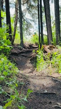
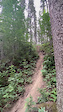
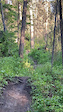
Popular Red Deer Mountain Biking Trails
• 95 ★ 4.3 • 1,053 ft • 2 ft • 466 •
Short Track with short turns, bridges, and elevated wooden north-shore features. A great progression trail for learning balance, turns and cornering!
• 100 ★ 4.2 • 646 ft • 0 ft • 413 •
This trail is a connector trail within the park to the skills areas.
• 100 ★ 5.0 • 869 ft • 0 ft • 412 •
Your welcome trail in the Mountain Bike Park - the perfect warm up lap and a great trail for progression, with optional tabletop jumps + bypoass rollers. This track has variable conditions based on weather. Always pre inspect trails...
• 95 ★ 4.3 • 492 ft • 3 ft • 383 •
North shore features, with hips and berms leading into 3 optional jumps, and then a berm (left line), or north shore mandatory wood drop (right line)
• 90 ★ 4.0 • 2,549 ft • 59 ft • 380 •
Common trail used by local clubs, challenging lines with many roots, and turns. Trail is used in both directions but primarily is ridden downhill from Wayne's - be sure to look ahead and watch for other riders!
• 70 ★ 3.7 • 3,891 ft • 89 ft • 257 •
. A CABC classic. starting at the bottom of the , the classi route starts with a punishing uptrack that skirts the north side of Small Talk - the Park's signature . if you want a more relaxed start, begin on the new UPper Entrance trail...
• 80 ★ 4.3 • 3,120 ft • 58 ft • 253 •
One of the original xc trails in the park, starting from 77 St this is a two-way trail that is fun and flowy, with some challenging short climbs to get you warmed up for a day in the park!
Red Deer Mountain Bike Routes
3 miles • 229 ft • 18 • Loop •
Known on Strava as the CABC XC Loop... This 5.1 km loop is best ridden clockwise
9 miles • 150 ft • 0 •
City of Red Deer paved path going through the Red Deer river valley
• 10 miles • 747 ft • 45 •
• 1 mile • 161 ft • 21 •
• 4 miles • 308 ft • 47 •
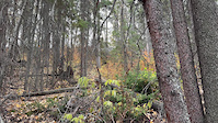
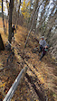
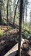
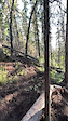
Photos of Red Deer Mountain Bike
Videos of Red Deer Mountain Bike
trail: McKenzie Trails Bench Trail
0:23 |
|
Jun 16, 2026
trail: Rampage
0:08 |
15 |
Apr 12, 2025
trail: Barbie Girl
0:10 |
20 |
Apr 12, 2025
trail: Moose Knuckle
0:10 |
54 |
Jun 29, 2024
trail: Fenceline
0:10 |
39 |
Jun 29, 2024

trail: Fenceline
0:08 |
30 |
Jun 29, 2024
trail: Barbie Girl
0:06 |
27 |
Jun 29, 2024
trail: Barbie Girl
0:07 |
18 |
Jun 29, 2024
Current Trail Warnings
| status | trail | date | condition | user | info |
|---|---|---|---|---|---|
| Fenceline | Jun 12, 2026 @ 10:36pm (America/Edmonton) Jun 12, 2026 | Unknown | mikejwise RDMBA | Massive tree down on the drop in just... |
Recent Trail Reports
| status | trail | date | condition | info | user |
|---|---|---|---|---|---|
| ALL TALK (Free Ride Line) | Jun 13, 2026 @ 11:17am (America/Edmonton) Jun 13, 2026 | Unknown | mikejwise RDMBA | ||
| Small Talk (Flow Trail) | Jun 12, 2026 @ 10:38pm (America/Edmonton) Jun 12, 2026 | Very Dry | mikejwise RDMBA | ||
| Moose Knuckle | Jun 12, 2026 @ 10:36pm (America/Edmonton) Jun 12, 2026 | Variable | mikejwise RDMBA | ||
| Pines | May 23, 2026 @ 10:12pm (America/Edmonton) May 23, 2026 | Ideal | Fraser5750 | ||
| Sweet 16 | Dec 25, 2025 @ 12:50pm (America/Edmonton) Dec 25, 2025 | Snow Packed | goldrush781 | ||
| Upper Heritage Ridge Trail | Aug 19, 2025 @ 10:02am Aug 19, 2025 | Dry | Bcharanduk | ||
| Heritage Ranch Inner Loop 2 | Aug 19, 2025 @ 10:02am Aug 19, 2025 | Dry | Bcharanduk | ||
| Heritage Ranch Outer Loop Climb | Apr 15, 2025 @ 7:27pm Apr 15, 2025 | Ideal | vladchimiuk | ||
| Heritage Outer / Inner Loop Connector | Apr 15, 2025 @ 7:27pm Apr 15, 2025 | Ideal | vladchimiuk | ||
| QE2 Sprint / The Chute | Apr 15, 2025 @ 7:27pm Apr 15, 2025 | Ideal | vladchimiuk |
Activity Feed
| username | action | type | title | date |
|---|---|---|---|---|
| manofsteel1973 | add | video | activity #97061624 | Jun 15, 2026 @ 1:10pm Jun 15, 2026 |
| manofsteel1973 | add | video | activity #97061460 | Jun 15, 2026 @ 1:07pm Jun 15, 2026 |
| manofsteel1973 | add | video | activity #97021471 | Jun 14, 2026 @ 8:45pm Jun 14, 2026 |
| mikejwise | add | report | activity #96892357 | Jun 13, 2026 @ 10:17am Jun 13, 2026 |
| mikejwise | add | photo | activity #96871236 and 3 more | Jun 13, 2026 @ 6:48am Jun 13, 2026 |
Recent Comments
| username | type | title | comment | date |
|---|---|---|---|---|
| trail | Tree down over the path around the switch back... | Jul 9, 2023 @ 1:54pm Jul 9, 2023 | ||
| trail | Watch out for moose. No joke. | May 13, 2023 @ 2:39pm May 13, 2023 | ||
| trail | Good trail, should definitely be a blue trail | Dec 22, 2022 @ 4:27pm Dec 22, 2022 | ||
| trail | This trail has always been an unsanctioned... | Sep 29, 2022 @ 8:59pm Sep 29, 2022 | ||
| trail | A large sign has been erected blocking the... | Sep 12, 2022 @ 12:38pm Sep 12, 2022 |
Local Badges
-

Epic Ride Climb 2k5 awarded -

Climbing 10k Badge35 awarded -

Climbing 100k Badge1 awarded -

Epic Ride Descent 2k5 awarded -

Descent 10k Badge36 awarded -

Descent 100k Badge1 awarded
Local Products
Activity Type Stats
| activitytype | trails | distance | descent | descent distance | total vertical | rating | global rank | state rank | photos | reports | routes | ridelogs |
|---|---|---|---|---|---|---|---|---|---|---|---|---|
| Mountain Bike | 104 | 45 miles | 2,270 ft | 14 miles | 194 ft | #1,019 | #11 | 456 | 796 | 3 | 22,413 | |
| E-Bike | 83 | 31 miles | 1,946 ft | 11 miles | 144 ft | #2,286 | #19 | 7 | 615 | 488 | ||
| Winter Fat Bike | 3 | #255 | #37 | 59 | ||||||||
| Horse | 9 | 4 miles | 167 ft | 1 mile | 79 ft | #2,238 | #23 | 137 | ||||
| Hike | 127 | 46 miles | 2,205 ft | 14 miles | 194 ft | #3,324 | #22 | 747 | 251 | |||
| Trail Running | 125 | 45 miles | 2,198 ft | 14 miles | 194 ft | #3,109 | #23 | 747 | 1,579 | |||
| Snowmobile | 2 | 1,191 ft | 3 ft | 125 ft | 10 ft | 1 | ||||||
| Snowshoe | 10 | 4 miles | 177 ft | 1 mile | 108 ft | #641 | #20 | 7 | 39 | |||
| Downhill Ski | 4 | 5,246 ft | 1,070 ft | 5,220 ft | 443 ft | #563 | #10 | 110 | ||||
| Nordic Ski | 5 | 2,680 ft | 59 ft | 1,749 ft | 62 ft | #687 | #16 | 490 |
Frequently Asked Questions About Red Deer
▼
What are the best places to ride in Red Deer?
Red Deer has 9 areas to explore for mountain biking. The top rated areas are:
▼
What are the highest rated mountain biking trails in Red Deer?
The highest rated mountain biking trails in Red Deer are:
- Small Talk (Flow Trail) (4.5/5)
- ALL TALK (Free Ride Line) (4.4/5)
- Skinny Line (4.3/5)
- Lower Heritage Ranch (4.2/5)
- Sweet 16 (4.1/5)
▼
What is the best time of the year to ride in Red Deer?
Based on ride log data, the most popular months to ride in Red Deer are:
- July (240 activities)
- May (180 activities)
- August (146 activities)
▼
Where can I park to ride in Red Deer?
There are 16 parking locations listed in Red Deer. The most popular parking spots are: View all parking and trailhead locations on the map to plan your visit.
Activities
Trails
- By GabeCastella & contributors
- Admins: RDMBA, CAAG
- #5635 - 18,427 views
- red deer activity log | embed map of Red Deer mountain bike trails | red deer mountain biking points of interest polygons
Downloading of trail gps tracks in kml & gpx formats is enabled for Red Deer.
You must login to download files.