close
-
Layers w
- Weather Layers
- Pro
- Pro
- Pro
- Pro
- Pro
- Pro
- More Layers
- Pro
- Pro
- Pro
- Pro
-
Upgrade to

3D
Trail Conditions
- Unknown
- Snow Groomed
- Snow Packed
- Snow Covered
- Snow Cover Partial
- Freeze/thaw Cycle
- Icy
- Prevalent Mud
- Wet
- Variable
- Ideal
- Dry
- Very Dry
Trail Flow (Ridden Direction)
Trailforks scans users ridelogs to determine the most popular direction each trail is ridden. A good flowing trail network will have most trails flowing in a single direction according to their intension.
The colour categories are based on what percentage of riders are riding a trail in its intended direction.
The colour categories are based on what percentage of riders are riding a trail in its intended direction.
- > 96%
- > 90%
- > 80%
- > 70%
- > 50%
- < 50%
- bi-directional trail
- no data
Trail Last Ridden
Trailforks scans ridelogs to determine the last time a trail was ridden.
- < 2 days
- < 1 week
- < 2 weeks
- < 1 month
- < 6 months
- > 6 months
Trail Ridden Direction
The intended direction a trail should be ridden.
- Downhill Only
- Downhill Primary
- Both Directions
- Uphill Primary
- Uphill Only
- One Direction
Contribute Details
Colors indicate trail is missing specified detail.
- Description
- Photos
- Description & Photos
- Videos
Trail Popularity ?
Trailforks scans ridelogs to determine which trails are ridden the most in the last 9 months.
Trails are compared with nearby trails in the same city region with a possible 25 colour shades.
Think of this as a heatmap, more rides = more kinetic energy = warmer colors.
- most popular
- popular
- less popular
- not popular
ATV/ORV/OHV Filter
Max Vehicle Width
inches
US Cell Coverage
Legend

Radar Time
Activity Recordings
Trailforks uses anonymized public activity data.
?
Activity Recordings
Trailforks uses anonymized public activity data.
?
Personal Heatmap
▶
Activity Types
all
/
none
▶
Options
2
Date range
month
–
Winter Trails
Warning
A routing network for winter maps does not exist. Selecting trails using the winter trails layer has been disabled.
Missing Trails
Most Popular
Least Popular
Trails are colored based on popularity. The more popular a trail is, the more red. Less popular trails trend towards green.
Jump Magnitude Heatmap
Heatmap of where riders jump on trails. Zoom in to see individual jumps, click circles to view jump details.
BC Backroad Status
![map legend]()
Service Road Atlas is a free to use, community-driven service for viewing and creating reports on the numerous back-country service roads around B.C. and Alberta.

Slope Aspect
Direction the slope faces
Trails Deemphasized
Trails are shown in grey.
Only show trails with no bike usage.
Suggested Layers
Based on selected activity type
Save the current map location and zoom level as your default home location whenever this page is loaded.
Save
No description for Red Lodge has been added yet!
Login or register to submit one.
Activities Click to view
- Mountain Bike
50 trails
- E-Bike
12 trails
- Gravel Bike
0 trails
- Adaptive Bike
3 trails
- Winter Fat Bike
0 trails
- Horse
91 trails
- Hike
128 trails
- Trail Running
127 trails
- Snowshoe
1 trails
- Downhill Ski
71 trails
- Backcountry Ski
1 trails
- Nordic Ski
0 trails
Region Details
- 3
- 1
- 8
- 28
- 8
- 2
Region Status
Caution as of 18 hoursStats
- Avg Trail Rating
- Trails (view details)
- 195
- Trails Mountain Bike
- 50
- Trails E-Bike
- 12
- Trails Adaptive Bike
- 3
- Trails Horse
- 91
- Trails Hike
- 128
- Trails Trail Running
- 127
- Trails ATV/ORV/OHV
- 1
- Trails Snowmobile
- 2
- Trails Snowshoe
- 1
- Trails Downhill Ski
- 73
- Trails Backcountry Ski
- 1
- Total Distance
- 522 miles
- Total Descent
- 87,652 ft
- Total Vertical
- 7,461 ft
- Highest Trailhead
- 12,684 ft
- Reports
- 264
- Photos
- 152
- Ridden Counter
- 3,140
Sub Regions
-
Absaroka-Beartooth Wilderness Area
-
Red Lodge City Trails
- 1
- 5
-
Red Lodge Mountain
- 2
- 8
- 1
- 2
-
Silver Run Trails
- 2
- 6
- 5
-
The Beartooths
- 13
- 2
Popular Red Lodge Mountain Biking Trails
• 90 ★ 4.0 • 4 miles • 235 ft • 161 •
Take a rip down this almost finished new trail that features a 1,800 ft descent over 4.3 miles of pole forest. Trail surface ranges from old two track, dirt single track, some packed rock switch backs, and a couple short, technical...
• 75 ★ 4.4 • 16 miles • 1,059 ft • 148 •
Classicly shuttled, but Maurice Mountain Trail (the majority of the vertical) can be done as an out and back for a lot less faffing, and way more bang for your buck. is the upper portion above treeline, pretty rocky with lots of ups and...
• 95 ★ 4.0 • 5 miles • 396 ft • 146 •
Silver Run National Recreation Trail (Forest Trail 102) is 5.0 miles long and is a popular cross country ski trail as well as a hiking and mountain biking area. The trail follows the West Fork of Rock Creek and has 4 possible loops. The...
• 95 ★ 4.4 • 2 miles • 0 ft • 123 •
If you like riding or walking through forest with the occasional creek crossings on a trail that is fast and flowy, then this is your trail. One of the more rocky trails in the region descends from just below the ski area parking lot...
• 85 ★ 4.3 • 4 miles • 481 ft • 113 •
Great forested single track. A couple punchy climbs but nothing too intense or long. Mostly in the trees. Can be ridden as an out and back going either direction (but starting on the north end is probably the best approach, or you could...
• 85 ★ 4.2 • 3 miles • 6 ft • 99 •
(Forest Trail 35) is 2.6 miles long. This trail makes a loop with the Silver Run Cross Country Ski Trails (Forest Trail 102) and the (Forest Trail 64).
• 80 ★ 3.5 • 1 mile • 1,076 ft • 73 •
Silver Run Plateau Trail (Forest Trail 64) is 3.1 miles long. Trail climbs to Silver Run Plateau at over 10,000 feet. Spectacular views abound of the West Fork drainage, drainage to Hellroaing Plateau, and Pyramid Mountain. Trail...
Red Lodge Mountain Bike Routes
24 miles • 4,500 ft • 9 • Race •
An endurance-style cross country mountain bike race with a 25 mile race which is a single lap of this...
• 11 miles • 2,570 ft • 4 •
• 4 miles • 510 ft • 1 •
• 8 miles • 1,287 ft • 1 •
• 11 miles • 1,751 ft • 2 •
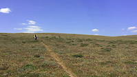
Photos of Red Lodge Mountain Bike
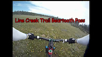
Videos of Red Lodge Mountain Bike
0:00 |
394 |
Sep 24, 2018
6:23 |
709 |
Jul 24, 2015
Current Trail Warnings
| status | trail | date | condition | user | info |
|---|---|---|---|---|---|
| Scrimps | Jun 5, 2026 @ 9:02am (America/Denver) Jun 5, 2026 | Ideal | Cyberploy Beartooth | Multiple large trees down across trail,... |
Recent Trail Reports
| status | trail | date | condition | info | user |
|---|---|---|---|---|---|
| Coal Miners Pumptrack | Jun 5, 2026 @ 9:05am (America/Denver) Jun 5, 2026 | Ideal | Cyberploy Beartooth | ||
| Palisades | Jun 5, 2026 @ 9:04am (America/Denver) Jun 5, 2026 | Ideal | Cyberploy Beartooth | ||
| Willow Creek | Jun 5, 2026 @ 9:03am (America/Denver) Jun 5, 2026 | Ideal | Cyberploy Beartooth | ||
| Prima Donna | Jun 5, 2026 @ 9:03am (America/Denver) Jun 5, 2026 | Ideal | Cyberploy Beartooth | ||
| Ingles Creek | Jun 5, 2026 @ 8:56am (America/Denver) Jun 5, 2026 | Ideal | Cyberploy Beartooth | ||
| Silver Run Plateau | Jun 5, 2026 @ 8:54am (America/Denver) Jun 5, 2026 | Ideal | Cyberploy Beartooth | ||
| Silver Run Plateau (64) Upper | Jun 5, 2026 @ 8:53am (America/Denver) Jun 5, 2026 | Snow Covered | Cyberploy Beartooth | ||
| Corral Creek | Jun 4, 2026 @ 6:48am (America/Boise) Jun 4, 2026 | Dry | Bikeram | ||
| Basin Lakes | May 31, 2026 @ 6:59am (America/Boise) May 31, 2026 | Dry | Bikeram | ||
| Bear Track | May 28, 2026 @ 6:44am (America/Boise) May 28, 2026 | Ideal | Bikeram |
Activity Feed
| username | action | type | title | date |
|---|---|---|---|---|
| reida500 | wishlist | route | activity #97067074 | Jun 15, 2026 @ 2:54pm Jun 15, 2026 |
| RobinDavid | comment | trail | activity #96848748 and 1 more | Jun 12, 2026 @ 10:09pm Jun 12, 2026 |
| Cyberploy | add | report | activity #96296672 | Jun 5, 2026 @ 8:05am Jun 5, 2026 |
| Cyberploy | add | report | activity #96296463 and 3 more | Jun 5, 2026 @ 8:02am Jun 5, 2026 |
| Cyberploy | comment | trail | activity #96296413 | Jun 5, 2026 @ 8:01am Jun 5, 2026 |
Recent Comments
| username | type | title | comment | date |
|---|---|---|---|---|
| trail | Good up and back from the lower end. Nice... | Jun 12, 2026 @ 10:12pm Jun 12, 2026 | ||
| trail | Sign at the bottom end says no bicycles but... | Jun 12, 2026 @ 10:09pm Jun 12, 2026 | ||
| trail | Do not ride or hike this when the trail is... | Jun 5, 2026 @ 8:01am Jun 5, 2026 | ||
| trail | Top half was meandering and fun for a trail... | Jul 27, 2025 @ 9:11pm Jul 27, 2025 | ||
| trail | It’s super dry here right now, and this... | Jul 27, 2025 @ 9:06pm Jul 27, 2025 |
Local Badges
-

Epic Ride Climb 2k53 awarded -

Climbing 10k Badge16 awarded -

Climbing 100k Badge2 awarded -

Epic Ride Descent 2k69 awarded -

Descent 10k Badge21 awarded -

Descent 100k Badge2 awarded
Local Products
Activity Type Stats
| activitytype | trails | distance | descent | descent distance | total vertical | rating | global rank | state rank | photos | reports | routes | ridelogs |
|---|---|---|---|---|---|---|---|---|---|---|---|---|
| Mountain Bike | 50 | 139 miles | 26,716 ft | 61 miles | 5,348 ft | #1,945 | #707 | 148 | 260 | 1 | 4,098 | |
| E-Bike | 12 | 7 miles | 1,880 ft | 4 miles | 2,605 ft | #6,141 | #1,872 | 201 | 182 | |||
| Adaptive Bike | 3 | #516 | #1,830 | 1 | ||||||||
| Horse | 91 | 382 miles | 45,180 ft | 114 miles | 7,454 ft | #47 | #335 | 53 | ||||
| Hike | 128 | 496 miles | 61,240 ft | 157 miles | 7,461 ft | #231 | #121 | 254 | 1,873 | |||
| Trail Running | 127 | 494 miles | 61,240 ft | 157 miles | 7,461 ft | #206 | #89 | 4 | 254 | 522 | ||
| ATV/ORV/OHV | 1 | 16 miles | 4,705 ft | 10 miles | 3,891 ft | 36 | 1 | |||||
| Snowmobile | 2 | 3 miles | 607 ft | 2 miles | 489 ft | 2 | 2 | |||||
| Snowshoe | 1 | 2 miles | 164 ft | 3,983 ft | 259 ft | #1,288 | #697 | 2 | 12 | |||
| Downhill Ski | 71 | 23 miles | 25,761 ft | 22 miles | 2,290 ft | #306 | #122 | 4 | 1,010 | |||
| Backcountry Ski | 1 | 2 miles | 144 ft | 1 mile | 141 ft | #469 | #117 | 2 | 1,294 |
Frequently Asked Questions About Red Lodge
▼
What are the best places to ride in Red Lodge?
Red Lodge has 7 areas to explore for mountain biking. The top rated areas are:
▼
What are the highest rated mountain biking trails in Red Lodge?
The highest rated mountain biking trails in Red Lodge are:
- Line Creek Plateau-Maurice Mountain (4.2/5)
- Willow Creek (4.2/5)
- Coal Miners Pumptrack (4.1/5)
- Balsam Route (4.1/5)
- Half Rabbit (4.1/5)
▼
What is the best time of the year to ride in Red Lodge?
Based on ride log data, the most popular months to ride in Red Lodge are:
- July (147 activities)
- June (68 activities)
- August (65 activities)
▼
Where can I park to ride in Red Lodge?
There are 55 parking locations listed in Red Lodge. The most popular parking spots are: View all parking and trailhead locations on the map to plan your visit.
Activities
Trails
Points of Interest
- Black Mountain Peak Summit
- Other [watercrossing]
- Other [watercrossing]
- Other [watercrossing]
- Other [watercrossing]
- Other [watercrossing]
- Mount Wallace Summit
- Pine Creek Campground Camping
- Livingston Peak Summit
- Other [watercrossing]
- Granite Peak (12,651 ft)
- Mount Wood (12,618 ft)
- Castle Mountain (12,605 ft)
- By Cyberploy
 Beartooth & contributors
 - Admins: Beartooth
- #5405 - 19,885 views
- red lodge activity log | embed map of Red Lodge mountain bike trails | red lodge mountain biking points of interest
Downloading of trail gps tracks in kml & gpx formats is enabled for Red Lodge.
You must login to download files.