close
-
Layers w
- Weather Layers
- Pro
- Pro
- Pro
- Pro
- Pro
- Pro
- More Layers
- Pro
- Pro
- Pro
- Pro
-
Upgrade to

3D
Trail Conditions
- Unknown
- Snow Groomed
- Snow Packed
- Snow Covered
- Snow Cover Partial
- Freeze/thaw Cycle
- Icy
- Prevalent Mud
- Wet
- Variable
- Ideal
- Dry
- Very Dry
Trail Flow (Ridden Direction)
Trailforks scans users ridelogs to determine the most popular direction each trail is ridden. A good flowing trail network will have most trails flowing in a single direction according to their intension.
The colour categories are based on what percentage of riders are riding a trail in its intended direction.
The colour categories are based on what percentage of riders are riding a trail in its intended direction.
- > 96%
- > 90%
- > 80%
- > 70%
- > 50%
- < 50%
- bi-directional trail
- no data
Trail Last Ridden
Trailforks scans ridelogs to determine the last time a trail was ridden.
- < 2 days
- < 1 week
- < 2 weeks
- < 1 month
- < 6 months
- > 6 months
Trail Ridden Direction
The intended direction a trail should be ridden.
- Downhill Only
- Downhill Primary
- Both Directions
- Uphill Primary
- Uphill Only
- One Direction
Contribute Details
Colors indicate trail is missing specified detail.
- Description
- Photos
- Description & Photos
- Videos
Trail Popularity ?
Trailforks scans ridelogs to determine which trails are ridden the most in the last 9 months.
Trails are compared with nearby trails in the same city region with a possible 25 colour shades.
Think of this as a heatmap, more rides = more kinetic energy = warmer colors.
- most popular
- popular
- less popular
- not popular
ATV/ORV/OHV Filter
Max Vehicle Width
inches
US Cell Coverage
Legend

Radar Time
Activity Recordings
Trailforks uses anonymized public activity data.
?
Activity Recordings
Trailforks uses anonymized public activity data.
?
Personal Heatmap
▶
Activity Types
all
/
none
▶
Options
2
Date range
month
–
Winter Trails
Warning
A routing network for winter maps does not exist. Selecting trails using the winter trails layer has been disabled.
Missing Trails
Most Popular
Least Popular
Trails are colored based on popularity. The more popular a trail is, the more red. Less popular trails trend towards green.
Jump Magnitude Heatmap
Heatmap of where riders jump on trails. Zoom in to see individual jumps, click circles to view jump details.
BC Backroad Status
![map legend]()
Service Road Atlas is a free to use, community-driven service for viewing and creating reports on the numerous back-country service roads around B.C. and Alberta.

Slope Aspect
Direction the slope faces
Trails Deemphasized
Trails are shown in grey.
Only show trails with no bike usage.
Suggested Layers
Based on selected activity type
Save the current map location and zoom level as your default home location whenever this page is loaded.
SaveMostly a cross-country riding area across the road from Bear Mountain. Natural trails, a lot of climbing. Motorized vehicles of any kind are not permitted. No motors on Red.
These are hand-built trails for light recreational use. Biking, hiking or equestrian uses (where permitted) only.
Horses permitted on Caswell Trail, Gun Club By-Pass, and Valley View.
Red Mountain and most of the forest in the City of Mission is a city managed tree farm. This unique designation allows the city to protect the forest from development, and allows the public access to the mountains for trails. The FVMBA has a strong working relationship with the City's Forestry department.
Clear cuts happen as they do everywhere, however the city considers the trails important, restoring trails affected by logging. We enjoy our forests and trails as an evolving environment through natural environmental impact, and controlled impact from logging.
View region descriptions for other activity types
These are hand-built trails for light recreational use. Biking, hiking or equestrian uses (where permitted) only.
Horses permitted on Caswell Trail, Gun Club By-Pass, and Valley View.
Red Mountain and most of the forest in the City of Mission is a city managed tree farm. This unique designation allows the city to protect the forest from development, and allows the public access to the mountains for trails. The FVMBA has a strong working relationship with the City's Forestry department.
Clear cuts happen as they do everywhere, however the city considers the trails important, restoring trails affected by logging. We enjoy our forests and trails as an evolving environment through natural environmental impact, and controlled impact from logging.
E-Bike
E-Bikes are discouraged on Red. Keep Red raw and sucking. Dirtbike/Moto
No dirtbike trails on Red Mtn. Check out Blue Mountain, or Vedder Mountain for alternatives in the Fraser Valley.Primary Trail Type: Cross-Country
eBikes Allowed:
No
Land Status: Community Forest
Land Manager: City of Mission
 google parking directions
 Access Info:
Mill Pond on Dewdney Trunk Road
Region Supporters & Maintainers
![]()
Fraser Valley Mountain Bikers Assoc
since 2003Sponsor- Mary Jane Duke
since 2024Maintainer
Activities Click to view
- Mountain Bike
40 trails
- E-Bike
0 trails
- Horse
4 trails
- Hike
47 trails
- Trail Running
47 trails
Region Details
- 17
- 2
- 9
- 11
- 1
Region Status
Open as of May 30, 2026Stats
- Avg Trail Rating
- Trails (view details)
- 43
- Trails Mountain Bike
- 42
- Trails Horse
- 4
- Trails Hike
- 47
- Trails Trail Running
- 47
- Trails Snowshoe
- 1
- Total Distance
- 28 miles
- Total Descent
- 6,995 ft
- Total Vertical
- 1,705 ft
- Highest Trailhead
- 1,843 ft
- Reports
- 1,799
- Photos
- 690
- Ridden Counter
- 7,189
Popular Red Mountain Mountain Biking Trails
• 95 ★ 4.5 • 2,349 ft • 129 ft • 472 •
Access to Red Mountain trails to avoid the ricocheting bullets from the gun club. NO ACCESS via the gun club! No motorized vehicles allowed! Horses can use this trail to access road network, and allowed horse trails.
• 90 ★ 3.6 • 3,376 ft • 73 ft • 413 •
Nicknamed "No-mentum". You certainly need to find your own flow on this trail. Challenging roots and rocks keep it interesting. The lower section below is faster and flowier, and ridden more often. Light trail use only. Soft surface. No...
• 75 ★ 4.0 • 4,749 ft • 164 ft • 333 •
Challenging trail. Lots of roots and technical features. Horses are allowed on the short section from trail junction straight up to the road. Please be courteous with other trail users.
• 65 ★ 4.0 • 3,169 ft • 0 ft • 278 •
Flat at the top then fast rocky natural descent. Trail follows a rocky chute, often funnelling water. It is more of a black-blue trail, especially with recent erosion. Not a recommended trail for someone looking to do an easy blue.
• 70 ★ 2.9 • 3,438 ft • 322 ft • 255 •
Primarily used as a hiking trail and in that kind of condition. Eroded, chunky and unsustainable. You can ride it to access if you choose, but you will walk sections. The trail is one of the few trails on Red Mountain maintained by the...
• 70 ★ 3.3 • 3,287 ft • 58 ft • 254 •
A tight narrow windy single track which meanders with some steep pitches up and down. Technically challenging, requiring above average skills (and narrow bars) to clear the entire trail. The last 200 meters plummets down steep exiting...
• 80 ★ 3.4 • 846 ft • 0 ft • 245 •
Popular blue difficulty singletrack. This mountain bike primary trail. On average it takes 3 minutes to complete this trail.
Red Mountain Mountain Bike Routes
★ 5.0 • 1 mile • 382 ft • 3 •
Trail closures & detours at Red Mountain, Mission. Construction of a new microwave tower by BC Hydro...
★ 4.0 • 15 miles • 3,260 ft • 28 • Loop •
Two Loops: one on Bear and one on Red. I rode Bear first, but you could do Red first as it is a little...
9 miles • 2,216 ft • 13 •
Fraser Valley Bear Classic Fraser Valley Relive Your Ride For other ride suggestions for this and other...
4 miles • 761 ft • 5 •
Fraser Valley Red Quickie Relive Your Ride For other ride suggestions for this and other areas. As well as...
7 miles • 1,281 ft • 10 •
Fraser Valley Red Classic Relive Your Ride For other ride suggestions for this and other areas. As well as...
2 miles • 455 ft • 2 •
Trail closures & detours at Red Mountain, Mission. Construction of a new microwave tower by BC Hydro...
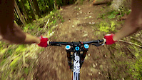
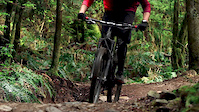
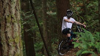
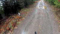
Photos of Red Mountain Mountain Bike
Videos of Red Mountain Mountain Bike
trail: Arduum Guns and Rotors
2:13 |
912 |
Mar 24, 2019
trail: Arduum Guns and Rotors
2:11 |
6772 |
Jul 31, 2017

trail: Arduum Guns and Rotors
21:06 |
1121 |
Apr 19, 2016
trail: Arduum Guns and Rotors
0:23 |
4617 |
Oct 25, 2015
trail: Hells Bells
0:19 |
678 |
Jan 25, 2015
trail: Hells Bells
4:41 |
393 |
Jan 5, 2015
trail: Upper Momentum
2:48 |
920 |
Aug 26, 2013

trail: rEDneck
5:12 |
20153 |
Dec 24, 2010
Current Trail Warnings
| status | trail | date | condition | user | info |
|---|---|---|---|---|---|
| Arduum Guns and Rotors | May 17, 2026 @ 2:17pm (America/Vancouver) May 17, 2026 | Variable | b-roc | Hike Trees down at the bottom. One right... |
Recent Trail Reports
| status | trail | date | condition | info | user |
|---|---|---|---|---|---|
| Momentum | May 30, 2026 @ 3:03pm (America/Vancouver) May 30, 2026 | Ideal | b-roc | ||
| Black Tie | May 30, 2026 @ 3:03pm (America/Vancouver) May 30, 2026 | Ideal | b-roc | ||
| Gun Club Bypass | May 30, 2026 @ 3:03pm (America/Vancouver) May 30, 2026 | Ideal | b-roc | ||
| Mastodon | May 17, 2026 @ 2:17pm (America/Vancouver) May 17, 2026 | Variable | b-roc | ||
| Big Red | Apr 26, 2026 @ 9:58pm (America/Vancouver) Apr 26, 2026 | Snow Covered | Earlson | ||
| Knacker Whacker | Apr 17, 2026 @ 2:44pm (America/Vancouver) Apr 17, 2026 | Variable | b-roc | ||
| Hells Bells | Apr 17, 2026 @ 2:44pm (America/Vancouver) Apr 17, 2026 | Variable | b-roc | ||
| Crazy 8 | Apr 17, 2026 @ 2:44pm (America/Vancouver) Apr 17, 2026 | Variable | b-roc | ||
| rEDneck | Apr 17, 2026 @ 2:44pm (America/Vancouver) Apr 17, 2026 | Variable | b-roc | ||
| Valley View | Apr 17, 2026 @ 2:44pm (America/Vancouver) Apr 17, 2026 | Variable | b-roc |
Activity Feed
| username | action | type | title | date |
|---|---|---|---|---|
| b-roc | add | report | activity #95908289 and 2 more | May 30, 2026 @ 8:50pm May 30, 2026 |
| Earlson | comment | report | activity #95377363 | May 23, 2026 @ 8:49pm May 23, 2026 |
| b-roc | add | report | activity #94958359 and 1 more | May 17, 2026 @ 8:57pm May 17, 2026 |
| RockyMntnDan | wishlist | trail | activity #94002042 | May 3, 2026 @ 6:55pm May 3, 2026 |
| emlyn | ridden | trail | activity #93885986 | May 2, 2026 @ 12:29pm May 2, 2026 |
Recent Comments
| username | type | title | comment | date |
|---|---|---|---|---|
| report | Thanks | May 23, 2026 @ 8:49pm May 23, 2026 | ||
| report | Large tree removed | Apr 11, 2026 @ 7:27pm Apr 11, 2026 | ||
| report | Fritz cleared these. | Jan 25, 2026 @ 12:41pm Jan 25, 2026 | ||
| report | Thanks for all the info. Pretty wild from the... | Dec 20, 2025 @ 7:19pm Dec 20, 2025 | ||
| report | Oh boy. That's wild. Yeah - I'm in Mission.... | Nov 1, 2025 @ 6:50pm Nov 1, 2025 |
Nearby Areas
| name | distance | ||||
|---|---|---|---|---|---|
| Steelhead | 2 | 1 | 0.6 km | ||
| Stave West - Rolley Lake | 4 | 2 | 2.7 km | ||
| Rolley Lake Provincal Park | 1 | 1 | 3.2 km | ||
| Bear Mountain | 6 | 25 | 8 | 3.2 km | |
| Woodlot | 8 | 10 | 3 | 4.8 km |
Local Badges
-

Completionist5 awarded
Local Mountain Biking Directory
-
Phoenix Velo Training Group
-
Wentings CycleBike Shop
![Wentings Cycle]()
-
No Hype BikesBike Shop
Local Products
Activity Type Stats
| activitytype | trails | distance | descent | descent distance | total vertical | rating | global rank | state rank | photos | reports | routes | ridelogs |
|---|---|---|---|---|---|---|---|---|---|---|---|---|
| Mountain Bike | 40 | 23 miles | 5,013 ft | 11 miles | 1,270 ft | #3,548 | #161 | 661 | 1,818 | 11 | 3,032 | |
| Horse | 4 | 3 miles | 912 ft | 1 mile | 925 ft | #1,081 | #34 | 746 | ||||
| Hike | 47 | 28 miles | 6,995 ft | 14 miles | 1,706 ft | #2,411 | #110 | 44 | 1,740 | 2 | 524 | |
| Trail Running | 47 | 28 miles | 6,995 ft | 14 miles | 1,706 ft | #4,453 | #149 | 1,739 | 3 | 177 | ||
| Snowshoe | 1 | 4 miles | 1,168 ft | 2 miles | 351 ft | #53 | 83 | 4 |
Frequently Asked Questions About Red Mountain
▼
What are the highest rated mountain biking trails in Red Mountain?
The highest rated mountain biking trails in Red Mountain are:
- Better Red than Dead (4.4/5)
- rEDneck (4.3/5)
- Gun Club Bypass (4.2/5)
- The Green Room (4.2/5)
- On Golden Pond (4.1/5)
▼
What is the best time of the year to ride in Red Mountain?
Based on ride log data, the most popular months to ride in Red Mountain are:
- June (41 activities)
- May (36 activities)
- October (31 activities)
▼
Where can I park to ride in Red Mountain?
There are 3 parking locations listed in Red Mountain. The most popular parking spots are: View all parking and trailhead locations on the map to plan your visit.
▼
What is the longest trail in Red Mountain?
The longest trail in Red Mountain is Mastodon at 1.9 miles. View all trails sorted by distance.
Activities
Trails
- By fogmann
 FVMBA-Mission & contributors
 - Admins: FVMBA-Mission, b-roc, FVMBA - ADMIN, lee5986, Hams, meghanjackson, Graham-Macaulay, FVMBA-Mission, b-roc
- #241 - 28,780 views
- red mountain activity log | embed map of Red Mountain mountain bike trails | red mountain mountain biking points of interest polygons
Downloading of trail gps tracks in kml & gpx formats is enabled for Red Mountain.
You must login to download files.