close
-
Layers w
- Weather Layers
- Pro
- Pro
- Pro
- Pro
- Pro
- Pro
- More Layers
- Pro
- Pro
- Pro
- Pro
-
Upgrade to

3D
Trail Conditions
- Unknown
- Snow Groomed
- Snow Packed
- Snow Covered
- Snow Cover Partial
- Freeze/thaw Cycle
- Icy
- Prevalent Mud
- Wet
- Variable
- Ideal
- Dry
- Very Dry
Trail Flow (Ridden Direction)
Trailforks scans users ridelogs to determine the most popular direction each trail is ridden. A good flowing trail network will have most trails flowing in a single direction according to their intension.
The colour categories are based on what percentage of riders are riding a trail in its intended direction.
The colour categories are based on what percentage of riders are riding a trail in its intended direction.
- > 96%
- > 90%
- > 80%
- > 70%
- > 50%
- < 50%
- bi-directional trail
- no data
Trail Last Ridden
Trailforks scans ridelogs to determine the last time a trail was ridden.
- < 2 days
- < 1 week
- < 2 weeks
- < 1 month
- < 6 months
- > 6 months
Trail Ridden Direction
The intended direction a trail should be ridden.
- Downhill Only
- Downhill Primary
- Both Directions
- Uphill Primary
- Uphill Only
- One Direction
Contribute Details
Colors indicate trail is missing specified detail.
- Description
- Photos
- Description & Photos
- Videos
Trail Popularity ?
Trailforks scans ridelogs to determine which trails are ridden the most in the last 9 months.
Trails are compared with nearby trails in the same city region with a possible 25 colour shades.
Think of this as a heatmap, more rides = more kinetic energy = warmer colors.
- most popular
- popular
- less popular
- not popular
ATV/ORV/OHV Filter
Max Vehicle Width
inches
US Cell Coverage
Legend

Radar Time
Activity Recordings
Trailforks uses anonymized public activity data.
?
Activity Recordings
Trailforks uses anonymized public activity data.
?
Personal Heatmap
▶
Activity Types
all
/
none
▶
Options
2
Date range
month
–
Winter Trails
Warning
A routing network for winter maps does not exist. Selecting trails using the winter trails layer has been disabled.
Missing Trails
Most Popular
Least Popular
Trails are colored based on popularity. The more popular a trail is, the more red. Less popular trails trend towards green.
Jump Magnitude Heatmap
Heatmap of where riders jump on trails. Zoom in to see individual jumps, click circles to view jump details.
BC Backroad Status
![map legend]()
Service Road Atlas is a free to use, community-driven service for viewing and creating reports on the numerous back-country service roads around B.C. and Alberta.

Slope Aspect
Direction the slope faces
Trails Deemphasized
Trails are shown in grey.
Only show trails with no bike usage.
Suggested Layers
Based on selected activity type
Save the current map location and zoom level as your default home location whenever this page is loaded.
Save
No description for Redding has been added yet!
Login or register to submit one.
Activities Click to view
- Mountain Bike
34 trails
- Gravel Bike
0 trails
- Adaptive Bike
0 trails
- Winter Fat Bike
0 trails
- Horse
7 trails
- Hike
66 trails
- Trail Running
66 trails
- Nordic Ski
4 trails
Region Details
- 3
- 1
- 7
- 19
- 4
Region Status
Open as of Jun 29, 2026Stats
- Avg Trail Rating
- Trails (view details)
- 40
- Trails Mountain Bike
- 34
- Trails Horse
- 7
- Trails Hike
- 66
- Trails Trail Running
- 66
- Trails Snowshoe
- 1
- Trails Nordic Ski
- 4
- Total Distance
- 34 miles
- Total Descent
- 4,387 ft
- Total Vertical
- 553 ft
- Highest Trailhead
- 840 ft
- Reports
- 740
- Photos
- 42
- Ridden Counter
- 7,090
Sub Regions
-
Collis P Huntington State Park
- 1
- 7
- 17
- 4
Popular Redding Mountain Biking Trails
• 100 ★ 3.6 • 568 ft • 6 ft • 462 •
Quick Up and over Trail with some technical sections at the top and a nice dbl roller if your hitting it from the South direction.
• 95 ★ 4.4 • 3,340 ft • 39 ft • 461 •
Highly rated popular blue difficulty singletrack. This multi-use trail can be used both directions and has a easy overall physical rating with a 39 ft green climb. It features log ride and other. On average it takes 8 minutes to complete this trail.
• 95 ★ 2.0 • 700 ft • 2 ft • 387 •
Popular green difficulty singletrack. This multi-use trail can be used both directions. On average it takes 2 minutes to complete this trail.
• 85 ★ 2.0 • 2,887 ft • 0 ft • 311 •
Popular green difficulty doubletrack. This mountain bike primary trail can be used both directions and has a easy overall physical rating with a 0 ft green climb. Trail visibility is always easy to follow. On average it takes 4 minutes to complete this trail.
• 65 ★ 4.3 • 2 miles • 130 ft • 289 •
Very Technical and rocky. Riding this trail with no stops or foot dabs is quite an accomplishment. No major climbs, but still very demanding. Recommended direction is NW to SE. (The loop is an optional out-n-back section, about 0.3 mile...
Redding Mountain Bike Routes
10 miles • 822 ft • 8 • Loop •
Includes all the "black" trails. Can be ridden in either direction.
★ 3.3 • 8 miles • 723 ft • 24 • Loop •
Hit all of the well-known hunty single track in a fashion that minimizes climbing
Photos of Redding Mountain Bike
Videos of Redding Mountain Bike
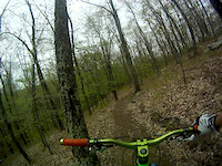
trail: Red Trail
2:15 |
274 |
May 22, 2016

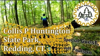
trail: Burn Loops
7:08 |
217 |
Oct 11, 2023 , Redding

trail: Lollipop
16:57 |
204 |
Oct 11, 2023 , Redding
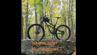
trail: Stratocaster
11:45 |
192 |
Oct 11, 2023 , Redding
18:44 |
377 |
Jul 29, 2023
Recent Trail Reports
| status | trail | date | condition | info | user |
|---|---|---|---|---|---|
| South Pond Trail | Mar 21, 2026 @ 1:46pm (America/New_York) Mar 21, 2026 | Ideal | cr3ynolds | ||
| Lily Pond | Jan 10, 2026 @ 12:00pm (America/New_York) Jan 10, 2026 | Prevalent Mud | Bushdds | ||
| Northern Connecter | Jan 10, 2026 @ 12:00pm (America/New_York) Jan 10, 2026 | Icy | Bushdds | ||
| "Up and Over N&S" | Jan 10, 2026 @ 12:00pm (America/New_York) Jan 10, 2026 | Variable | Bushdds | ||
| Field Crossing | Jan 10, 2026 @ 12:00pm (America/New_York) Jan 10, 2026 | Wet | Bushdds | ||
| Entry Trail | Jan 10, 2026 @ 12:00pm (America/New_York) Jan 10, 2026 | Icy | Bushdds | ||
| Burn Loops | Nov 27, 2025 @ 10:06am (America/New_York) Nov 27, 2025 | Dry | cr3ynolds | ||
| Stratocaster | Nov 27, 2025 @ 10:06am (America/New_York) Nov 27, 2025 | Dry | cr3ynolds | ||
| Ravenscrest | Nov 8, 2025 @ 10:05am (America/New_York) Nov 8, 2025 | Dry | cr3ynolds | ||
| White Trail | Jun 3, 2025 @ 1:05pm Jun 3, 2025 | Ideal | ralphvVnjyJ |
Activity Feed
| username | action | type | title | date |
|---|---|---|---|---|
| tdsutliff | wishlist | region | activity #97977976 | Jun 28, 2026 @ 4:53am Jun 28, 2026 |
| AlexAccetta | add | photo | activity #97470107 and 1 more | Jun 21, 2026 @ 4:05am Jun 21, 2026 |
| AlexAccetta | add | photo | activity #97470009 | Jun 21, 2026 @ 4:04am Jun 21, 2026 |
| JoannKt3002 | wishlist | trail | activity #97002429 and 1 more | Jun 14, 2026 @ 1:52pm Jun 14, 2026 |
| MikeOnHisB1ke | wishlist | region | activity #96645842 | Jun 9, 2026 @ 6:35pm Jun 9, 2026 |
Recent Comments
| username | type | title | comment | date |
|---|---|---|---|---|
| trail | If you need to use this shortcut, maybe you... | Feb 4, 2023 @ 5:54pm Feb 4, 2023 | ||
| trail | I’d say don’t try this in fall unless you... | Nov 28, 2021 @ 5:40am Nov 28, 2021 | ||
| report | See rbf I wbnne | Jun 26, 2021 @ 10:28am Jun 26, 2021 | ||
| trail | While most of this 5+ mile loop is wide enough... | Apr 10, 2021 @ 11:32am Apr 10, 2021 | ||
| trail | Trails blocked in multi location with large... | Aug 9, 2020 @ 6:30am Aug 9, 2020 |
Local Badges
-

Epic Ride Climb 2k3 awarded -

Climbing 10k Badge35 awarded -

Climbing 100k Badge1 awarded -

Epic Ride Descent 2k3 awarded -

Descent 10k Badge36 awarded -

Descent 100k Badge1 awarded
Activity Type Stats
| activitytype | trails | distance | descent | descent distance | total vertical | rating | global rank | state rank | photos | reports | routes | ridelogs |
|---|---|---|---|---|---|---|---|---|---|---|---|---|
| Mountain Bike | 34 | 21 miles | 2,461 ft | 10 miles | 328 ft | #2,996 | #1,053 | 39 | 739 | 2 | 9,265 | |
| Horse | 7 | 2 miles | 302 ft | 1 mile | 236 ft | #3,251 | #1,858 | 68 | 2 | |||
| Hike | 66 | 34 miles | 4,386 ft | 15 miles | 554 ft | #4,530 | #1,597 | 3 | 741 | 843 | ||
| Trail Running | 66 | 34 miles | 4,386 ft | 15 miles | 554 ft | #5,108 | #1,601 | 741 | 139 | |||
| Snowshoe | 1 | 974 ft | 10 ft | 495 ft | 10 ft | 7 | ||||||
| Nordic Ski | 4 | 3,655 ft | 141 ft | 2,231 ft | 125 ft | #1,887 | #1,008 | 32 |
Frequently Asked Questions About Redding
▼
What are the best places to ride in Redding?
Redding has 5 areas to explore for mountain biking. The top rated areas are:
▼
What are the highest rated mountain biking trails in Redding?
The highest rated mountain biking trails in Redding are:
- Burn Loops (4.2/5)
- South Pond Trail (4.2/5)
- Stratocaster (4.1/5)
- South Park (4.1/5)
- Blue connector (4.1/5)
▼
What is the best time of the year to ride in Redding?
Based on ride log data, the most popular months to ride in Redding are:
- July (187 activities)
- August (157 activities)
- May (155 activities)
▼
Where can I park to ride in Redding?
There are 18 parking locations listed in Redding. The most popular parking spots are: View all parking and trailhead locations on the map to plan your visit.
Activities
Trails
Points of Interest
- By Runerider
 FC NEMBA & contributors
 - Admins: HCH, NEMBAEXEC, FC NEMBA
- #7369 - 4,519 views
- redding activity log | embed map of Redding mountain bike trails | redding mountain biking points of interest
Downloading of trail gps tracks in kml & gpx formats is enabled for Redding.
You must login to download files.