close
-
Layers w
- Weather Layers
- Pro
- Pro
- Pro
- Pro
- Pro
- Pro
- More Layers
- Pro
- Pro
- Pro
- Pro
-
Upgrade to

3D
Trail Conditions
- Unknown
- Snow Groomed
- Snow Packed
- Snow Covered
- Snow Cover Partial
- Freeze/thaw Cycle
- Icy
- Prevalent Mud
- Wet
- Variable
- Ideal
- Dry
- Very Dry
Trail Flow (Ridden Direction)
Trailforks scans users ridelogs to determine the most popular direction each trail is ridden. A good flowing trail network will have most trails flowing in a single direction according to their intension.
The colour categories are based on what percentage of riders are riding a trail in its intended direction.
The colour categories are based on what percentage of riders are riding a trail in its intended direction.
- > 96%
- > 90%
- > 80%
- > 70%
- > 50%
- < 50%
- bi-directional trail
- no data
Trail Last Ridden
Trailforks scans ridelogs to determine the last time a trail was ridden.
- < 2 days
- < 1 week
- < 2 weeks
- < 1 month
- < 6 months
- > 6 months
Trail Ridden Direction
The intended direction a trail should be ridden.
- Downhill Only
- Downhill Primary
- Both Directions
- Uphill Primary
- Uphill Only
- One Direction
Contribute Details
Colors indicate trail is missing specified detail.
- Description
- Photos
- Description & Photos
- Videos
Trail Popularity ?
Trailforks scans ridelogs to determine which trails are ridden the most in the last 9 months.
Trails are compared with nearby trails in the same city region with a possible 25 colour shades.
Think of this as a heatmap, more rides = more kinetic energy = warmer colors.
- most popular
- popular
- less popular
- not popular
ATV/ORV/OHV Filter
Max Vehicle Width
inches
US Cell Coverage
Legend

Radar Time
Activity Recordings
Trailforks uses anonymized public activity data.
?
Activity Recordings
Trailforks uses anonymized public activity data.
?
Personal Heatmap
▶
Activity Types
all
/
none
▶
Options
2
Date range
month
–
Winter Trails
Warning
A routing network for winter maps does not exist. Selecting trails using the winter trails layer has been disabled.
Missing Trails
Most Popular
Least Popular
Trails are colored based on popularity. The more popular a trail is, the more red. Less popular trails trend towards green.
Jump Magnitude Heatmap
Heatmap of where riders jump on trails. Zoom in to see individual jumps, click circles to view jump details.
BC Backroad Status
![map legend]()
Service Road Atlas is a free to use, community-driven service for viewing and creating reports on the numerous back-country service roads around B.C. and Alberta.

Slope Aspect
Direction the slope faces
Trails Deemphasized
Trails are shown in grey.
Only show trails with no bike usage.
Suggested Layers
Based on selected activity type
Save the current map location and zoom level as your default home location whenever this page is loaded.
Save
No description for Redmond has been added yet!
Login or register to submit one.
Links
Activities Click to view
- Mountain Bike
88 trails
- E-Bike
8 trails
- Gravel Bike
0 trails
- Adaptive Bike
0 trails
- Winter Fat Bike
0 trails
- Horse
7 trails
- Hike
90 trails
- Trail Running
89 trails
- Dirtbike/Moto
70 trails
- ATV/ORV/OHV
43 trails
Region Details
- 11
- 1
- 35
- 31
- 6
- 2
Region Status
Open as of Jun 13, 2026Stats
- Avg Trail Rating
- Trails (view details)
- 144
- Trails Mountain Bike
- 90
- Trails E-Bike
- 8
- Trails Horse
- 7
- Trails Hike
- 90
- Trails Trail Running
- 89
- Trails Dirtbike/Moto
- 72
- Trails ATV/ORV/OHV
- 43
- Total Distance
- 196 miles
- Total Descent
- 18,637 ft
- Total Vertical
- 2,478 ft
- Highest Trailhead
- 5,103 ft
- Reports
- 1,299
- Photos
- 386
- Ridden Counter
- 31,634
Sub Regions
-
Cascade View
- 1
- 1
-
Cline Buttes
- 19
- 13
- 2
- 2
-
Maston
-
Radlands
- 4
- 2
- 3
-
Smith Rock
- 1
- 4
- 9
- 1
Popular Redmond Mountain Biking Trails
• 100 ★ 3.9 • 3 miles • 227 ft • 1,161 •
Popular green difficulty singletrack. This mountain bike primary trail can be used both directions. On average it takes 19 minutes to complete this trail.
• 100 ★ 3.4 • 1 mile • 83 ft • 1,051 •
Popular green difficulty singletrack. This mountain bike primary trail can be used both directions. On average it takes 7 minutes to complete this trail.
• 90 ★ 3.7 • 5,249 ft • 83 ft • 1,014 •
Most technical Trail in Maston area. Rocky sections along the Canyon rim. Great Views of the river below.
• 85 ★ 3.9 • 2 miles • 53 ft • 947 •
Popular green difficulty singletrack. This mountain bike primary trail can be used both directions. On average it takes 10 minutes to complete this trail.
• 85 ★ 3.7 • 3 miles • 90 ft • 884 •
Popular green difficulty singletrack. This mountain bike primary trail. On average it takes 10 minutes to complete this trail.
• 95 ★ 4.0 • 1 mile • 69 ft • 796 •
Popular green difficulty singletrack. This mountain bike primary trail can be used both directions. On average it takes 7 minutes to complete this trail.
• 70 ★ 4.0 • 2 miles • 95 ft • 658 •
Great Winter Riding Area. Mostly Flat, fast trails, mostly wet friendly.
Redmond Mountain Bike Routes
★ 3.5 • 11 miles • 556 ft • 4 •
A mix of open and sandy trail, tight single track, switch backs, off-camber side hill sections and techy...
★ 3.4 • 11 miles • 409 ft • 8 •
Big loop around Maston, approx. 11 miles. The Maston trail network is located about 20 minutes north of...
★ 3.0 • 5 miles • 187 ft • 3 •
Area Description: A fun trail system just east of Redmond that hosts green, blue, and black-rated trails....
8 miles • 242 ft • 6 • Loop •
Maston Tie - Headgate - Talon - Lost Dream - - Maston Tie. Great beginner loop.
12 miles • 622 ft • 5 • Loop •
Great winter loop with slightly more mileage than the standard Cascade Loop. Also includes a bit more...
43 miles • 3,086 ft • 19 • Loop •
Up and over Cline Butte, over to Cascade View and back, then a loop around most of Maston. Includes an...
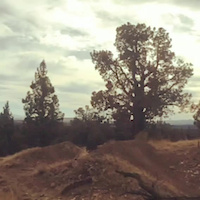
Photos of Redmond Mountain Bike
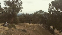
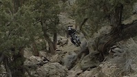
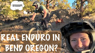
Videos of Redmond Mountain Bike
trail: Cline Access
0:10 |
188 |
Jan 29, 2018

trail: Cline Access
0:08 |
299 |
Jan 29, 2018
trail: Cline Access
0:10 |
189 |
Jan 29, 2018
trail: Cline Access
7:25 |
8638 |
Aug 7, 2017
trail: DH 3
21:32 |
61 |
Jan 21, 2026 , Redmond

trail: Summit Trail East
9:25 |
33 |
Nov 13, 2025 , Redmond
trail: Wolf Tree Trail
9:25 |
29 |
Nov 13, 2025 , Redmond

trail: River Trail
9:25 |
43 |
Nov 13, 2025 , Redmond
Recent Trail Reports
| status | trail | date | condition | info | user |
|---|---|---|---|---|---|
| Rockbar Trail | Jun 13, 2026 @ 5:32pm (America/Los_Angeles) Jun 13, 2026 | Dry | Gista | ||
| Fat Rabbit Loop | Jun 1, 2026 @ 12:09pm (America/Boise) Jun 1, 2026 | Dry | RadaKelly | ||
| Chainbreak | May 24, 2026 @ 11:26am (America/Los_Angeles) May 24, 2026 | Unknown | PxKyN7Xp | ||
| Rattler | May 2, 2026 @ 1:39pm (America/Boise) May 2, 2026 | Dry | lindsey9547 | ||
| Whiptail | May 2, 2026 @ 1:39pm (America/Boise) May 2, 2026 | Dry | lindsey9547 | ||
| Return Policy | Apr 26, 2026 @ 12:16pm (America/Boise) Apr 26, 2026 | Very Dry | Ferrymorse3 | ||
| XC Trail - Legal Eagle | Apr 26, 2026 @ 12:16pm (America/Boise) Apr 26, 2026 | Dry | Ferrymorse3 | ||
| DH 1 | Apr 12, 2026 @ 11:27am (America/Los_Angeles) Apr 12, 2026 | Wet | Jeffav51 | ||
| Dry Canyon Trail | Mar 25, 2026 @ 10:19am (America/Los_Angeles) Mar 25, 2026 | Very Dry | Skisumo | ||
| The Goat | Mar 17, 2026 @ 3:56pm (America/Boise) Mar 17, 2026 | Very Dry | schnjo |
Activity Feed
| username | action | type | title | date |
|---|---|---|---|---|
| jamieNUtUv1 | wishlist | trail | activity #97060852 | Jun 15, 2026 @ 12:56pm Jun 15, 2026 |
| rdr22aeg | wishlist | region | activity #97036670 | Jun 15, 2026 @ 6:23am Jun 15, 2026 |
| cbwatkins | wishlist | region | activity #96981054 | Jun 14, 2026 @ 10:00am Jun 14, 2026 |
| Gista | add | report | activity #96928853 | Jun 13, 2026 @ 5:32pm Jun 13, 2026 |
| DiannewAlH5W | vote | route | activity #96877121 | Jun 13, 2026 @ 7:55am Jun 13, 2026 |
Recent Comments
| username | type | title | comment | date |
|---|---|---|---|---|
| trail | This trail was a big disappointment. I agree... | Apr 13, 2026 @ 1:17pm Apr 13, 2026 | ||
| trail | It’s marked as uphill only but man does it... | Jan 9, 2026 @ 1:33pm Jan 9, 2026 | ||
| trail | I never rode here when it was taken over by... | Jan 3, 2026 @ 1:14pm Jan 3, 2026 | ||
| trail | Rode it a year later and it's still terrible.... | Nov 4, 2025 @ 1:27pm Nov 4, 2025 | ||
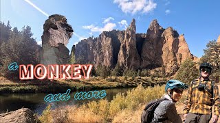
| trail | What a great way to see monkey face rock! The... | Oct 3, 2025 @ 4:46pm Oct 3, 2025 |
Local Badges
-

Doodle's Badge0 awarded -

10 Green Trails452 awarded -

10 Blue Trails281 awarded -

Epic Ride Climb 2k88 awarded -

Climbing 10k Badge69 awarded -

Climbing 100k Badge3 awarded
Bike & Skill Parks
| name | type | city | rating |
|---|---|---|---|
| Buckhorn OHV | skill park | Redmond | |
| Redmond Pump Track | skill park | Redmond |
Local Products
Activity Type Stats
| activitytype | trails | distance | descent | descent distance | total vertical | rating | global rank | state rank | photos | reports | routes | ridelogs |
|---|---|---|---|---|---|---|---|---|---|---|---|---|
| Mountain Bike | 88 | 111 miles | 13,035 ft | 41 miles | 2,477 ft | #938 | #368 | 369 | 1,298 | 15 | 21,762 | |
| E-Bike | 8 | 14 miles | 2,231 ft | 7 miles | 1,519 ft | #4,569 | #1,467 | 692 | 751 | |||
| Horse | 7 | 5 miles | 955 ft | 1 mile | 1,001 ft | #2,005 | #1,119 | 148 | 11 | |||
| Hike | 90 | 111 miles | 13,015 ft | 39 miles | 2,477 ft | #1,094 | #503 | 14 | 1,291 | 4,071 | ||
| Trail Running | 89 | 111 miles | 13,015 ft | 39 miles | 2,477 ft | #1,270 | #463 | 2 | 1,287 | 2,751 | ||
| Dirtbike/Moto | 70 | 84 miles | 4,416 ft | 30 miles | 571 ft | #93 | #58 | 3 | 147 | 71 | ||
| ATV/ORV/OHV | 43 | 43 miles | 1,965 ft | 16 miles | 564 ft | #372 | #109 | 141 | 16 |
Frequently Asked Questions About Redmond
▼
What are the best places to ride in Redmond?
Redmond has 7 areas to explore for mountain biking. The top rated areas are:
▼
What are the highest rated mountain biking trails in Redmond?
The highest rated mountain biking trails in Redmond are:
- Crossfire (4.2/5)
- Return Policy (4.1/5)
- DH 3 (4.1/5)
- Wolf Tree Trail (4.1/5)
- The Saddle (4.1/5)
▼
What is the best time of the year to ride in Redmond?
Based on ride log data, the most popular months to ride in Redmond are:
- March (307 activities)
- April (274 activities)
- November (241 activities)
▼
Where can I park to ride in Redmond?
There are 14 parking locations listed in Redmond. The most popular parking spots are: View all parking and trailhead locations on the map to plan your visit.
Activities
Trails
- By sjsokr
 & contributors
 - Admins: COTA, COTA
- #10181 - 12,649 views
- redmond activity log | embed map of Redmond mountain bike trails | redmond mountain biking points of interest polygons
Downloading of trail gps tracks in kml & gpx formats is enabled for Redmond.
You must login to download files.