close
-
Layers w
- Weather Layers
- Pro
- Pro
- Pro
- Pro
- Pro
- Pro
- More Layers
- Pro
- Pro
- Pro
- Pro
-
Upgrade to

3D
Trail Conditions
- Unknown
- Snow Groomed
- Snow Packed
- Snow Covered
- Snow Cover Partial
- Freeze/thaw Cycle
- Icy
- Prevalent Mud
- Wet
- Variable
- Ideal
- Dry
- Very Dry
Trail Flow (Ridden Direction)
Trailforks scans users ridelogs to determine the most popular direction each trail is ridden. A good flowing trail network will have most trails flowing in a single direction according to their intension.
The colour categories are based on what percentage of riders are riding a trail in its intended direction.
The colour categories are based on what percentage of riders are riding a trail in its intended direction.
- > 96%
- > 90%
- > 80%
- > 70%
- > 50%
- < 50%
- bi-directional trail
- no data
Trail Last Ridden
Trailforks scans ridelogs to determine the last time a trail was ridden.
- < 2 days
- < 1 week
- < 2 weeks
- < 1 month
- < 6 months
- > 6 months
Trail Ridden Direction
The intended direction a trail should be ridden.
- Downhill Only
- Downhill Primary
- Both Directions
- Uphill Primary
- Uphill Only
- One Direction
Contribute Details
Colors indicate trail is missing specified detail.
- Description
- Photos
- Description & Photos
- Videos
Trail Popularity ?
Trailforks scans ridelogs to determine which trails are ridden the most in the last 9 months.
Trails are compared with nearby trails in the same city region with a possible 25 colour shades.
Think of this as a heatmap, more rides = more kinetic energy = warmer colors.
- most popular
- popular
- less popular
- not popular
ATV/ORV/OHV Filter
Max Vehicle Width
inches
US Cell Coverage
Legend

Radar Time
Activity Recordings
Trailforks uses anonymized public activity data.
?
Activity Recordings
Trailforks uses anonymized public activity data.
?
Personal Heatmap
▶
Activity Types
all
/
none
▶
Options
2
Date range
month
–
Winter Trails
Warning
A routing network for winter maps does not exist. Selecting trails using the winter trails layer has been disabled.
Missing Trails
Most Popular
Least Popular
Trails are colored based on popularity. The more popular a trail is, the more red. Less popular trails trend towards green.
Jump Magnitude Heatmap
Heatmap of where riders jump on trails. Zoom in to see individual jumps, click circles to view jump details.
BC Backroad Status
![map legend]()
Service Road Atlas is a free to use, community-driven service for viewing and creating reports on the numerous back-country service roads around B.C. and Alberta.

Slope Aspect
Direction the slope faces
Trails Deemphasized
Trails are shown in grey.
Only show trails with no bike usage.
Suggested Layers
Based on selected activity type
Save the current map location and zoom level as your default home location whenever this page is loaded.
Save
No description for Redruth has been added yet!
Login or register to submit one.
This region uses the Uk/Euro style trail grading system.
Activities Click to view
- Mountain Bike
91 trails
- E-Bike
7 trails
- Gravel Bike
0 trails
- Adaptive Bike
0 trails
- Winter Fat Bike
0 trails
- Horse
4 trails
- Hike
87 trails
- Trail Running
87 trails
Region Details
- 8
- 3
- 40
- 30
- 3
- 1
- 1
Region Status
Caution as of 2 daysStats
- Avg Trail Rating
- Trails (view details)
- 90
- Trails Mountain Bike
- 92
- Trails E-Bike
- 7
- Trails Horse
- 4
- Trails Hike
- 87
- Trails Trail Running
- 87
- Total Distance
- 36 miles
- Total Descent
- 6,368 ft
- Total Vertical
- 719 ft
- Highest Trailhead
- 777 ft
- Reports
- 370
- Photos
- 517
- Ridden Counter
- 2,753
Sub Regions
-
Carn Brea
- 3
- 30
- 22
- 4
- 1
-
Poldice Valley
- 1
- 1
Popular Redruth Mountain Biking Trails
• 100 ★ 4.4 • 1,886 ft • 0 ft • 118 •
Fun flowing single track from the top of poldice to the bottom...
• 85 ★ 3.0 • 2,396 ft • 63 ft • 99 •
An alternate route in and out of the car park and cafe at Bissoe. This is a little more interesting (especially in the wet) and a little more of a challenge than the standard coast to coast trail route. It runs alongside the main trail,...
• 100 ★ 4.0 • 978 ft • 0 ft • 93 •
Flowing range of medium to large jumps with mandatory air.
• 95 ★ 3.0 • 1,739 ft • 0 ft • 90 •
A section of the Great Flat Lode. Popular and well known by local riders as it is quick with flow. No trail features to speak of, but the mine buildings near by are fun to mess about on!
• 85 ★ 3.0 • 902 ft • 0 ft • 73 •
Popular blue difficulty singletrack. This mountain bike primary trail can be used downhill primary. On average it takes 2 minutes to complete this trail.
• 95 ★ 3.0 • 846 ft • 0 ft • 72 •
A good entry level trail to some of the great stuff hiding in Unity Woods. The trail starts with a couple of drops which set you up for a step up. You then follow the trail over a couple of rollers (possible double) into the berms....
• 95 ★ 0.0 • 633 ft • 39 ft • 66 •
Some rock garden to pick through, a couple with rollable lines to the sides.
Redruth Mountain Bike Routes
★ 5.0 • 31 miles • 2,246 ft • 9 • Loop •
Local freeride over both Carns and out to the coast and back.
★ 4.0 • 7 miles • 634 ft • 0 •
This is a part of the mineral tramways network and links a number of areas such as Tehidy, Lanner, Poldice...
★ 3.0 • 7 miles • 634 ft • 0 •
This is a part of the mineral tramways network and links a number of areas such as Tehidy, Lanner, Poldice...
• 5 miles • 1,150 ft • 0 •
• 3 miles • 82 ft • 0 •
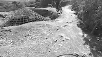
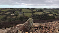
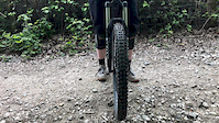
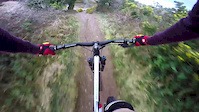
Photos of Redruth Mountain Bike
Videos of Redruth Mountain Bike
trail: Poldice
0:11 |
50 |
May 9, 2021
trail: Ridge Racer
0:05 |
86 |
Mar 8, 2021

trail: Poldice
0:12 |
15 |
Mar 1, 2021

trail: Poldice
3:50 |
3680 |
Jan 28, 2021

trail: Unity Main DH Line
0:04 |
136 |
May 21, 2020
trail: Unity Main DH Line
0:05 |
120 |
May 13, 2020
trail: Poldice
3:17 |
171 |
Jan 8, 2019
trail: Poldice
3:09 |
3029 |
Apr 27, 2018
Recent Trail Reports
| status | trail | date | condition | info | user |
|---|---|---|---|---|---|
| Ring Bash Rampage | Jun 19, 2026 @ 4:54pm (Europe/London) 2 days | Variable | ripsilver Cornwall | ||
| Monument to Tregajorran rock | Jun 19, 2026 @ 4:53pm (Europe/London) 2 days | Variable | ripsilver Cornwall | ||
| Turtle rock | Jun 19, 2026 @ 4:52pm (Europe/London) 2 days | Variable | ripsilver Cornwall | ||
| Cup and Saucer | Jun 19, 2026 @ 4:51pm (Europe/London) 2 days | Variable | ripsilver Cornwall | ||
| Harvey's Quarry | Jun 19, 2026 @ 4:49pm (Europe/London) 2 days | Ideal | ripsilver Cornwall | ||
| Monkey's solution | Jun 19, 2026 @ 4:47pm (Europe/London) 2 days | Variable | ripsilver Cornwall | ||
| Tolgus Mount Valley | May 25, 2026 @ 6:39pm (Europe/London) May 25, 2026 | Ideal | ripsilver Cornwall | ||
| Weeeeeeeeeeeee | Apr 25, 2026 @ 12:36pm (Europe/London) Apr 25, 2026 | Dry | ripsilver Cornwall | ||
| Access Road | Apr 24, 2026 @ 4:17pm (Europe/London) Apr 24, 2026 | Dry | ripsilver Cornwall | ||
| Yew Beauty | Apr 23, 2026 @ 9:18pm (Europe/London) Apr 23, 2026 | Ideal | ripsilver Cornwall |
Activity Feed
| username | action | type | title | date |
|---|---|---|---|---|
| ripsilver | update | trail | activity #97321882 | Jun 19, 2026 @ 8:59am 2 days |
| ripsilver | difficultyvote | trail | activity #97321436 | Jun 19, 2026 @ 8:53am 2 days |
| ripsilver | vote | trail | activity #97321056 and 1 more | Jun 19, 2026 @ 8:47am 2 days |
| ripsilver | add | report | activity #97321032 and 5 more | Jun 19, 2026 @ 8:47am 2 days |
| 1KP1Wh | ridden | route | activity #97234060 | Jun 17, 2026 @ 11:03pm Jun 17, 2026 |
Recent Comments
| username | type | title | comment | date |
|---|---|---|---|---|
| trail | Trail has been resurrected and rebuilt 👍 | Dec 20, 2025 @ 11:07am Dec 20, 2025 | ||
| trail | Lower half of trail doesn’t really get... | Sep 16, 2024 @ 2:41pm Sep 16, 2024 | ||
| trail | please anyone been a t the top camp? | May 22, 2023 @ 6:24pm May 22, 2023 | ||
| trail | Be wary of horse riders coming up this trail,... | Dec 22, 2019 @ 4:25am Dec 22, 2019 | ||
| trail | Epic jumping! Loved the top section. Still... | Jul 25, 2018 @ 4:35am Jul 25, 2018 |
Local Badges
-

10 Green Trails45 awarded -

10 Blue Trails30 awarded -

Epic Ride Climb 2k21 awarded -

Climbing 10k Badge16 awarded -

Climbing 100k Badge0 awarded -

Epic Ride Descent 2k20 awarded
Bike & Skill Parks
| name | type | city | rating |
|---|---|---|---|
| Cornwall BMX Track | skill park | Redruth |
Activity Type Stats
| activitytype | trails | distance | descent | descent distance | total vertical | rating | global rank | state rank | photos | reports | routes | ridelogs |
|---|---|---|---|---|---|---|---|---|---|---|---|---|
| Mountain Bike | 91 | 36 miles | 6,368 ft | 21 miles | 719 ft | #3,484 | #116 | 508 | 370 | 3 | 4,054 | |
| E-Bike | 7 | 2 miles | 666 ft | 2 miles | 568 ft | #4,976 | #211 | 286 | 775 | |||
| Horse | 4 | 2 miles | 515 ft | 1 mile | 299 ft | #1,453 | #76 | 128 | ||||
| Hike | 87 | 35 miles | 6,096 ft | 20 miles | 719 ft | #4,105 | #92 | 9 | 363 | 124 | ||
| Trail Running | 87 | 35 miles | 6,096 ft | 20 miles | 719 ft | #3,666 | #83 | 363 | 101 |
Frequently Asked Questions About Redruth
▼
What are the best places to ride in Redruth?
Redruth has 2 areas to explore for mountain biking. The top rated areas are:
▼
What are the highest rated mountain biking trails in Redruth?
The highest rated mountain biking trails in Redruth are:
- Ring Bash Rampage (4.1/5)
- Yew Beauty (4.1/5)
- Ridge Racer (4.1/5)
- DD Downhill (4/5)
- Fine Line (4/5)
▼
What is the best time of the year to ride in Redruth?
Based on ride log data, the most popular months to ride in Redruth are:
- July (26 activities)
- August (19 activities)
- September (16 activities)
▼
Where can I park to ride in Redruth?
Activities
Trails
Points of Interest
- By MadisonB99 & contributors
- Admins: wisey, MathieuC, cemoorelife, Cornwall
- #6459 - 7,042 views
- redruth activity log | embed map of Redruth mountain bike trails | redruth mountain biking points of interest
Downloading of trail gps tracks in kml & gpx formats is enabled for Redruth.
You must login to download files.