close
-
Layers w
- Weather Layers
- Pro
- Pro
- Pro
- Pro
- Pro
- Pro
- More Layers
- Pro
- Pro
- Pro
- Pro
-
Upgrade to

3D
Trail Conditions
- Unknown
- Snow Groomed
- Snow Packed
- Snow Covered
- Snow Cover Partial
- Freeze/thaw Cycle
- Icy
- Prevalent Mud
- Wet
- Variable
- Ideal
- Dry
- Very Dry
Trail Flow (Ridden Direction)
Trailforks scans users ridelogs to determine the most popular direction each trail is ridden. A good flowing trail network will have most trails flowing in a single direction according to their intension.
The colour categories are based on what percentage of riders are riding a trail in its intended direction.
The colour categories are based on what percentage of riders are riding a trail in its intended direction.
- > 96%
- > 90%
- > 80%
- > 70%
- > 50%
- < 50%
- bi-directional trail
- no data
Trail Last Ridden
Trailforks scans ridelogs to determine the last time a trail was ridden.
- < 2 days
- < 1 week
- < 2 weeks
- < 1 month
- < 6 months
- > 6 months
Trail Ridden Direction
The intended direction a trail should be ridden.
- Downhill Only
- Downhill Primary
- Both Directions
- Uphill Primary
- Uphill Only
- One Direction
Contribute Details
Colors indicate trail is missing specified detail.
- Description
- Photos
- Description & Photos
- Videos
Trail Popularity ?
Trailforks scans ridelogs to determine which trails are ridden the most in the last 9 months.
Trails are compared with nearby trails in the same city region with a possible 25 colour shades.
Think of this as a heatmap, more rides = more kinetic energy = warmer colors.
- most popular
- popular
- less popular
- not popular
ATV/ORV/OHV Filter
Max Vehicle Width
inches
US Cell Coverage
Legend

Radar Time
Activity Recordings
Trailforks uses anonymized public activity data.
?
Activity Recordings
Trailforks uses anonymized public activity data.
?
Personal Heatmap
▶
Activity Types
all
/
none
▶
Options
2
Date range
month
–
Winter Trails
Warning
A routing network for winter maps does not exist. Selecting trails using the winter trails layer has been disabled.
Missing Trails
Most Popular
Least Popular
Trails are colored based on popularity. The more popular a trail is, the more red. Less popular trails trend towards green.
Jump Magnitude Heatmap
Heatmap of where riders jump on trails. Zoom in to see individual jumps, click circles to view jump details.
BC Backroad Status
![map legend]()
Service Road Atlas is a free to use, community-driven service for viewing and creating reports on the numerous back-country service roads around B.C. and Alberta.

Slope Aspect
Direction the slope faces
Trails Deemphasized
Trails are shown in grey.
Only show trails with no bike usage.
Suggested Layers
Based on selected activity type
Save the current map location and zoom level as your default home location whenever this page is loaded.
Save
No description for Redstone has been added yet!
Login or register to submit one.
 google parking directions
Primary Trail Type: Cross-Country
Shuttleable: YES
google parking directions Activities Click to view
- Mountain Bike
17 trails
- E-Bike
17 trails
- Hike
17 trails
- Trail Running
17 trails
Region Details
- 4
- 1
- 6
- 4
- 2
Region Status
Caution as of Jun 16, 2026Stats
- Avg Trail Rating
- Trails (view details)
- 17
- Trails Mountain Bike
- 17
- Trails E-Bike
- 17
- Trails Hike
- 17
- Trails Trail Running
- 17
- Total Distance
- 15 miles
- Total Descent
- 1,596 ft
- Total Vertical
- 1,086 ft
- Highest Trailhead
- 3,187 ft
- Reports
- 317
- Photos
- 67
- Ridden Counter
- 3,018
Popular Redstone Mountain Biking Trails
• 85 ★ 3.8 • 2,271 ft • 261 ft • 351 •
Mixed single/doubletrack gravel trail used to climb up from Redstone to Lower Rossland.
• 65 ★ 3.8 • 3,846 ft • 137 ft • 347 •
One of the older trails in the area, offers a good connection between the Railgrade and Louie Joe.
• 65 ★ 2.4 • 2,076 ft • 16 ft • 316 •
Used to connect through to the if looping back to Malde Ck Rd or Rossland.
• 65 ★ 3.7 • 2,881 ft • 218 ft • 212 •
Doubletrack connector between Redstone Golf Resort and Lower Rossland. Good for climbing up after riding Cemetery, or if you ride after Whiskey.
• 60 ★ 3.0 • 2,155 ft • 28 ft • 189 •
Nice mellow singletrack connecting the to the , crossing Redstone Drive in the middle. Very easy for an intermediate .
• 55 ★ 3.8 • 2,595 ft • 0 ft • 184 •
A short single track trail which makes for a great early season flowy addition to a Cemetery lap. The trail is fast and flowy with a couple of rocky features to add spice to your life! Also and originally named B Merry.
• 45 ★ 3.0 • 3,250 ft • 287 ft • 159 •
Used to connect through to the if descending to Warfield.
Photos of Redstone Mountain Bike
Current Trail Warnings
| status | trail | date | condition | user | info |
|---|---|---|---|---|---|
| Louie Joe (upper) | Jun 2, 2026 @ 4:28pm (America/Vancouver) Jun 2, 2026 | Dry | johnpeachell | Large tree down near Redstone end |
Recent Trail Reports
| status | trail | date | condition | info | user |
|---|---|---|---|---|---|
| Cemetery (lower) | Jun 16, 2026 @ 4:40pm (America/Vancouver) Jun 16, 2026 | Ideal | stewspooner KCTS | ||
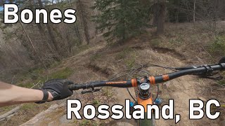
| Bones | Jun 1, 2026 @ 5:21pm (America/Vancouver) Jun 1, 2026 | Ideal | stewspooner KCTS | ||
| Upper Switchback | May 23, 2026 @ 3:27pm (America/Vancouver) May 23, 2026 | Ideal | LeeBaker-soxfan | ||
| Rubberhead | May 23, 2026 @ 10:17am (America/Vancouver) May 23, 2026 | Ideal | stewspooner KCTS | ||
| Lower Switchback | May 14, 2026 @ 2:21pm (America/Vancouver) May 14, 2026 | Ideal | stewspooner KCTS | ||
| Wagon Road (lower) | Mar 28, 2026 @ 4:48pm (America/Vancouver) Mar 28, 2026 | Ideal | darklord | ||
| Louie Joe (lower) | Sep 27, 2025 @ 6:34pm (America/Vancouver) Sep 27, 2025 | Ideal | johnpeachell | ||
| Railgrade | Aug 23, 2025 @ 12:13pm Aug 23, 2025 | Dry | cdnsolseeker | ||
| Wagon Road (upper) | Apr 15, 2024 @ 9:45am Apr 15, 2024 | Ideal | mmilan | ||
| Golf Course Loop w | Jan 22, 2018 @ 6:50pm Jan 22, 2018 | Snow Packed | barry-mclane |
Activity Feed
| username | action | type | title | date |
|---|---|---|---|---|
| Trevorsisbox | ridden | trail | activity #97526719 | Jun 21, 2026 @ 3:43pm 2 days |
| stewspooner | add | report | activity #97146332 | Jun 16, 2026 @ 4:41pm Jun 16, 2026 |
| johnpeachell | add | report | activity #96117582 | Jun 2, 2026 @ 4:28pm Jun 2, 2026 |
| stewspooner | add | report | activity #96051514 | Jun 1, 2026 @ 5:21pm Jun 1, 2026 |
| zacjob | add | report | activity #95984885 | May 31, 2026 @ 4:03pm May 31, 2026 |
Recent Comments
| username | type | title | comment | date |
|---|---|---|---|---|
| report | Make that 6 as 3 more at exit | May 7, 2026 @ 12:53pm May 7, 2026 | ||
| report | Sorry that’s lower louis joe trail. I... | Aug 14, 2025 @ 9:23am Aug 14, 2025 | ||
| report | Cleared | Sep 19, 2024 @ 9:04am Sep 19, 2024 | ||
| report | Numerous blowdowns between just above where... | Aug 14, 2024 @ 2:44pm Aug 14, 2024 | ||
| trail | Nice to see that we’ll get the original name... | May 12, 2024 @ 2:40pm May 12, 2024 |
Nearby Areas
| name | distance | ||||
|---|---|---|---|---|---|
| Downtown Rossland | 9 | 4 | 1 km | ||
| Monte Christo - KC | 7 | 25 | 11 | 4 | 1.3 km |
| Red Mountain Community Trails | 2 | 8 | 2 | 1.9 km | |
| Malde Creek | 1 | 11 | 4 | 4 | 2.1 km |
| Red Mountain Resort Bike Park | 3 | 7 | 4 | 1 | 3.2 km |
Activity Type Stats
| activitytype | trails | distance | descent | descent distance | total vertical | rating | global rank | state rank | photos | reports | routes | ridelogs |
|---|---|---|---|---|---|---|---|---|---|---|---|---|
| Mountain Bike | 17 | 15 miles | 1,598 ft | 4 miles | 1,086 ft | #6,674 | #284 | 58 | 317 | 1,649 | ||
| E-Bike | 17 | 15 miles | 1,598 ft | 4 miles | 1,086 ft | #5,643 | #218 | 250 | 224 | |||
| Hike | 17 | 15 miles | 1,598 ft | 4 miles | 1,086 ft | #10,098 | #394 | 9 | 317 | 74 | ||
| Trail Running | 17 | 15 miles | 1,598 ft | 4 miles | 1,086 ft | #8,801 | #331 | 317 | 323 |
Frequently Asked Questions About Redstone
▼
What are the highest rated mountain biking trails in Redstone?
The highest rated mountain biking trails in Redstone are:
- Railgrade (4.1/5)
- Louie Joe (upper) (3.9/5)
- Rubberhead (3.9/5)
- Bones (3.9/5)
- Louie Joe (lower) (3.9/5)
▼
What is the best time of the year to ride in Redstone?
Based on ride log data, the most popular months to ride in Redstone are:
- July (32 activities)
- August (23 activities)
- May (18 activities)
▼
Where can I park to ride in Redstone?
There are 1 parking locations listed in Redstone. The most popular parking spots are:
▼
What is the longest trail in Redstone?
The longest trail in Redstone is Railgrade at 5.6 miles. View all trails sorted by distance.
Activities
Trails
Points of Interest
- By barry-mclane & contributors
- Admins: KCTS, BJSC, KCTS
- #5711 - 4,907 views
- redstone activity log | embed map of Redstone mountain bike trails | redstone mountain biking points of interest polygons
Downloading of trail gps tracks in kml & gpx formats is enabled for Redstone.
You must login to download files.