close
-
Layers w
- Weather Layers
- Pro
- Pro
- Pro
- Pro
- Pro
- Pro
- More Layers
- Pro
- Pro
- Pro
- Pro
-
Upgrade to

3D
Trail Conditions
- Unknown
- Snow Groomed
- Snow Packed
- Snow Covered
- Snow Cover Partial
- Freeze/thaw Cycle
- Icy
- Prevalent Mud
- Wet
- Variable
- Ideal
- Dry
- Very Dry
Trail Flow (Ridden Direction)
Trailforks scans users ridelogs to determine the most popular direction each trail is ridden. A good flowing trail network will have most trails flowing in a single direction according to their intension.
The colour categories are based on what percentage of riders are riding a trail in its intended direction.
The colour categories are based on what percentage of riders are riding a trail in its intended direction.
- > 96%
- > 90%
- > 80%
- > 70%
- > 50%
- < 50%
- bi-directional trail
- no data
Trail Last Ridden
Trailforks scans ridelogs to determine the last time a trail was ridden.
- < 2 days
- < 1 week
- < 2 weeks
- < 1 month
- < 6 months
- > 6 months
Trail Ridden Direction
The intended direction a trail should be ridden.
- Downhill Only
- Downhill Primary
- Both Directions
- Uphill Primary
- Uphill Only
- One Direction
Contribute Details
Colors indicate trail is missing specified detail.
- Description
- Photos
- Description & Photos
- Videos
Trail Popularity ?
Trailforks scans ridelogs to determine which trails are ridden the most in the last 9 months.
Trails are compared with nearby trails in the same city region with a possible 25 colour shades.
Think of this as a heatmap, more rides = more kinetic energy = warmer colors.
- most popular
- popular
- less popular
- not popular
ATV/ORV/OHV Filter
Max Vehicle Width
inches
US Cell Coverage
Legend

Radar Time
Activity Recordings
Trailforks uses anonymized public activity data.
?
Activity Recordings
Trailforks uses anonymized public activity data.
?
Personal Heatmap
▶
Activity Types
all
/
none
▶
Options
2
Date range
month
–
Winter Trails
Warning
A routing network for winter maps does not exist. Selecting trails using the winter trails layer has been disabled.
Missing Trails
Most Popular
Least Popular
Trails are colored based on popularity. The more popular a trail is, the more red. Less popular trails trend towards green.
Jump Magnitude Heatmap
Heatmap of where riders jump on trails. Zoom in to see individual jumps, click circles to view jump details.
BC Backroad Status
![map legend]()
Service Road Atlas is a free to use, community-driven service for viewing and creating reports on the numerous back-country service roads around B.C. and Alberta.

Slope Aspect
Direction the slope faces
Trails Deemphasized
Trails are shown in grey.
Only show trails with no bike usage.
Suggested Layers
Based on selected activity type
Save the current map location and zoom level as your default home location whenever this page is loaded.
Save
No description for Regensburg has been added yet!
Login or register to submit one.
This region uses the Uk/Euro style trail grading system.
Activities Click to view
- Mountain Bike
359 trails
- E-Bike
359 trails
- Gravel Bike
0 trails
- Adaptive Bike
0 trails
- Winter Fat Bike
0 trails
- Hike
337 trails
- Trail Running
337 trails
Region Details
- 61
- 185
- 73
- 27
- 5
Region Status
Open as of 2 daysStats
- Avg Trail Rating
- Trails (view details)
- 356
- Trails Mountain Bike
- 359
- Trails E-Bike
- 359
- Trails Horse
- 1
- Trails Hike
- 337
- Trails Trail Running
- 337
- Total Distance
- 187 miles
- Total Descent
- 45,276 ft
- Total Vertical
- 802 ft
- Highest Trailhead
- 1,876 ft
- Reports
- 1,761
- Photos
- 787
- Ridden Counter
- 20,046
Sub Regions
-
Donau
- 36
- 15
- 2
- 1
-
Laber
- 11
- 5
- 4
-
Marienhöhe
- 1
-
Naabdelta
- 77
- 34
- 10
- 2
-
Regen
- 16
- 9
- 4
-
Tegernheim & Co.
- 19
- 10
- 6
Popular Regensburg Mountain Biking Trails
• 100 ★ 4.7 • 1,174 ft • 1 ft • 282 •
Highly rated popular blue difficulty singletrack. This mountain bike primary trail can be used downhill only and has a easy overall physical rating. It features drop and jump. On average it takes 1 minutes to complete this trail.
• 100 ★ 4.6 • 2,070 ft • 0 ft • 279 •
Highly rated popular red difficulty singletrack. This mountain bike primary trail and has a moderate overall physical rating. It features drop and jump. Exposure: High Risk of Serious Injury. Trail visibility is always easy to follow. On average it takes 2 minutes to complete this trail.
• 100 ★ 4.8 • 1,958 ft • 3 ft • 217 •
Highly rated popular blue difficulty singletrack. This mountain bike primary trail can be used one direction. It features berm and jump. Trail visibility is always easy to follow. On average it takes 2 minutes to complete this trail.
• 100 ★ 4.6 • 1,047 ft • 0 ft • 207 •
Rauf und runter im Hohlweg. Eher einfacher Blauer.
• 100 ★ 3.8 • 932 ft • 0 ft • 196 •
Popular green difficulty singletrack. This mountain bike primary trail can be used downhill only and has a easy overall physical rating. Adaptive MTB rating: amtb blue. Trail visibility is always easy to follow. On average it takes minutes to complete this trail.
• 100 ★ 3.9 • 1,345 ft • 0 ft • 179 •
Popular blue difficulty singletrack. This mountain bike primary trail can be used one direction and has a moderate overall physical rating. Trail visibility is always easy to follow. On average it takes 1 minutes to complete this trail.
• 85 ★ 4.7 • 2,090 ft • 0 ft • 178 •
Jumpline von Etterzhausen. Starts off the forest road with a few flat turns, then a steep roller into the first small jump into a left turn berm, then a few medium jumps with several variations possible including a few hip jumps on the...
• 95 ★ 4.4 • 2,100 ft • 0 ft • 174 •
Highly rated popular red difficulty singletrack. This mountain bike primary trail can be used one direction. It features jump and gap jump. Trail visibility is always easy to follow. On average it takes 3 minutes to complete this trail.
Regensburg Mountain Bike Routes
★ 4.7 • 147 miles • 15,944 ft • 5 • Loop •
Die Jura-Landschaft entstammt einem riesigen Meer, das die Region vor 200 Millionen Jahren bedeckte. Nach...
★ 5.0 • 9 miles • 1,652 ft • 16 • Point to Point •
Very demanding all-mountain route connecting some of the finest single track pieces of Marienhöhe,...
★ 5.0 • 15 miles • 1,870 ft • 8 • Loop •
Technical demanding but short route around the Naabdelta. There is no signage.
19 miles • 3,220 ft • 21 • Point to Point •
Very demanding all-mountain route connecting some of the finest single track pieces of Marienhöhe,...
Photos of Regensburg Mountain Bike
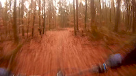
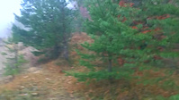
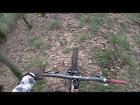
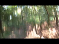
Videos of Regensburg Mountain Bike
trail: Rumpl
0:34 |
678 |
Nov 27, 2018
trail: Shin-Kakine
0:08 |
289 |
Nov 14, 2018

trail: Shin-Kakine
0:08 |
6 |
Nov 13, 2018
trail: Minigolf aka Ausbaubar
0:07 |
624 |
Dec 12, 2017
trail: Minigolf aka Ausbaubar
0:02 |
242 |
Dec 12, 2017
trail: Jumpline
0:44 |
888 |
Dec 7, 2017
trail: Jumpline
0:13 |
433 |
Dec 7, 2017
trail: Jumpline
0:13 |
194 |
Nov 14, 2017
Current Trail Warnings
| status | trail | date | condition | user | info |
|---|---|---|---|---|---|
| Jumpline | Jun 19, 2026 @ 11:21am (America/Vancouver) 2 days | Dry | RatisBonanza | In der zweiten Linksanlegerkurve Bäume... | |
| Pfarrersteig | Jun 15, 2026 @ 7:12pm (Europe/Berlin) Jun 15, 2026 | Ideal | joseggp90 | Small tree down across trail, can... | |
| Lucky! | Jun 7, 2026 @ 2:36pm (Europe/Berlin) Jun 7, 2026 | Dry | ghost-shifter | ein paar neue Bäume liegen quer |
Recent Trail Reports
| status | trail | date | condition | info | user |
|---|---|---|---|---|---|
| Transmitter | Jun 14, 2026 @ 10:38am (America/Vancouver) Jun 14, 2026 | Variable | RatisBonanza | ||
| KleinP im Wald | Jun 9, 2026 @ 5:12pm (Europe/Prague) Jun 9, 2026 | Variable | VodruamvomBergqnt1hT | ||
| Neu-Bobbahn | Jun 9, 2026 @ 5:12pm (Europe/Prague) Jun 9, 2026 | Variable | VodruamvomBergqnt1hT | ||
| Halber Hermann | Jun 9, 2026 @ 5:12pm (Europe/Prague) Jun 9, 2026 | Variable | VodruamvomBergqnt1hT | ||
| Lazzlo | Jun 9, 2026 @ 5:12pm (Europe/Prague) Jun 9, 2026 | Ideal | VodruamvomBergqnt1hT | ||
| Maudiwoady | Jun 5, 2026 @ 7:23pm (Europe/Berlin) Jun 5, 2026 | Ideal | FabianDeml | ||
| Rocket | Jun 1, 2026 @ 2:53pm (Europe/Berlin) Jun 1, 2026 | Variable | RatisBonanza | ||
| Kamelbuckel | May 31, 2026 @ 10:07am (America/Vancouver) May 31, 2026 | Wet | RatisBonanza | ||
| Nasenhaar hoch/runter | May 31, 2026 @ 10:04am (America/Vancouver) May 31, 2026 | Wet | RatisBonanza | ||
| Böses Bächli | May 30, 2026 @ 10:05pm (Europe/Berlin) May 30, 2026 | Unknown | Crumz |
Activity Feed
| username | action | type | title | date |
|---|---|---|---|---|
| RatisBonanza | add | report | activity #97332346 | Jun 19, 2026 @ 11:21am 2 days |
| RatisBonanza | checkin | trail | activity #97332267 and 2 more | Jun 19, 2026 @ 11:20am 2 days |
| FranzGT | wishlist | region | activity #97305519 | Jun 19, 2026 @ 3:22am 2 days |
| joseggp90 | add | report | activity #97049931 | Jun 15, 2026 @ 10:12am Jun 15, 2026 |
| RatisBonanza | add | report | activity #96984945 | Jun 14, 2026 @ 10:38am Jun 14, 2026 |
Recent Comments
| username | type | title | comment | date |
|---|---|---|---|---|
| trail | Das neue Stück am Ende ist echt super... | Jun 4, 2026 @ 1:39pm Jun 4, 2026 | ||
| trail | Das letzte Stück innerhalb des alten... | May 17, 2026 @ 10:54am May 17, 2026 | ||
| trail | Trail existiert nicht. | May 7, 2026 @ 6:39am May 7, 2026 | ||
| report | merci | May 3, 2026 @ 11:54pm May 3, 2026 | ||
| trail | Gemütliche Auffahrt um wieder Richtung Lucky... | May 1, 2026 @ 7:35am May 1, 2026 |
Local Badges
-

Completionist0 awarded -

Epic Ride 50k1,684 awarded -

Top 10 Trails11 awarded -
Completionist0 awarded -
Completionist0 awarded -
Completionist0 awarded
Bike & Skill Parks
| name | type | city | rating |
|---|---|---|---|
| Dirtpark Tegernheim | skill park | Regensburg | |
| Dirtpark JUZ Arena | skill park | Regensburg | |
| Dirtpark Sinzing | skill park | Regensburg |
Activity Type Stats
| activitytype | trails | distance | descent | descent distance | total vertical | rating | global rank | state rank | photos | reports | routes | ridelogs |
|---|---|---|---|---|---|---|---|---|---|---|---|---|
| Mountain Bike | 359 | 184 miles | 44,216 ft | 102 miles | 801 ft | #235 | #1 | 785 | 1,758 | 7 | 28,010 | |
| E-Bike | 359 | 184 miles | 44,216 ft | 102 miles | 801 ft | #198 | #7 | 2 | 1,387 | 3 | 3,535 | |
| Horse | 1 | 2 miles | 312 ft | 2 miles | 148 ft | 470 | ||||||
| Hike | 337 | 179 miles | 41,870 ft | 97 miles | 801 ft | #257 | #7 | 1,576 | 409 | |||
| Trail Running | 337 | 179 miles | 41,870 ft | 97 miles | 801 ft | #331 | #7 | 1,579 | 988 |
Frequently Asked Questions About Regensburg
▼
What are the best places to ride in Regensburg?
Regensburg has 6 areas to explore for mountain biking. The top rated areas are:
▼
What are the highest rated mountain biking trails in Regensburg?
The highest rated mountain biking trails in Regensburg are:
- Hinterholz (4.6/5)
- Halber Hermann (4.6/5)
- Snakeline (4.5/5)
- Neu-Bobbahn (4.5/5)
- Herr Vorragend (4.5/5)
▼
What is the best time of the year to ride in Regensburg?
Based on ride log data, the most popular months to ride in Regensburg are:
- July (288 activities)
- May (221 activities)
- April (206 activities)
▼
Where can I park to ride in Regensburg?
Activities
Trails
- By lightlives
 & contributors
 - Admins: larry81541
- #5540 - 38,375 views
- regensburg activity log | embed map of Regensburg mountain bike trails | regensburg mountain biking points of interest
Downloading of trail gps tracks in kml & gpx formats is enabled for Regensburg.
You must login to download files.