close
-
Layers w
- Weather Layers
- Pro
- Pro
- Pro
- Pro
- Pro
- Pro
- More Layers
- Pro
- Pro
- Pro
- Pro
-
Upgrade to

3D
Trail Conditions
- Unknown
- Snow Groomed
- Snow Packed
- Snow Covered
- Snow Cover Partial
- Freeze/thaw Cycle
- Icy
- Prevalent Mud
- Wet
- Variable
- Ideal
- Dry
- Very Dry
Trail Flow (Ridden Direction)
Trailforks scans users ridelogs to determine the most popular direction each trail is ridden. A good flowing trail network will have most trails flowing in a single direction according to their intension.
The colour categories are based on what percentage of riders are riding a trail in its intended direction.
The colour categories are based on what percentage of riders are riding a trail in its intended direction.
- > 96%
- > 90%
- > 80%
- > 70%
- > 50%
- < 50%
- bi-directional trail
- no data
Trail Last Ridden
Trailforks scans ridelogs to determine the last time a trail was ridden.
- < 2 days
- < 1 week
- < 2 weeks
- < 1 month
- < 6 months
- > 6 months
Trail Ridden Direction
The intended direction a trail should be ridden.
- Downhill Only
- Downhill Primary
- Both Directions
- Uphill Primary
- Uphill Only
- One Direction
Contribute Details
Colors indicate trail is missing specified detail.
- Description
- Photos
- Description & Photos
- Videos
Trail Popularity ?
Trailforks scans ridelogs to determine which trails are ridden the most in the last 9 months.
Trails are compared with nearby trails in the same city region with a possible 25 colour shades.
Think of this as a heatmap, more rides = more kinetic energy = warmer colors.
- most popular
- popular
- less popular
- not popular
ATV/ORV/OHV Filter
Max Vehicle Width
inches
US Cell Coverage
Legend

Radar Time
Activity Recordings
Trailforks uses anonymized public activity data.
?
Activity Recordings
Trailforks uses anonymized public activity data.
?
Personal Heatmap
▶
Activity Types
all
/
none
▶
Options
2
Date range
month
–
Winter Trails
Warning
A routing network for winter maps does not exist. Selecting trails using the winter trails layer has been disabled.
Missing Trails
Most Popular
Least Popular
Trails are colored based on popularity. The more popular a trail is, the more red. Less popular trails trend towards green.
Jump Magnitude Heatmap
Heatmap of where riders jump on trails. Zoom in to see individual jumps, click circles to view jump details.
BC Backroad Status
![map legend]()
Service Road Atlas is a free to use, community-driven service for viewing and creating reports on the numerous back-country service roads around B.C. and Alberta.

Slope Aspect
Direction the slope faces
Trails Deemphasized
Trails are shown in grey.
Only show trails with no bike usage.
Suggested Layers
Based on selected activity type
Save the current map location and zoom level as your default home location whenever this page is loaded.
SaveReinosa es un municipio y localidad española de la comunidad autónoma de Cantabria, centro de la comarca de Campoo-Los Valles y uno de los núcleos urbanos más importantes del sur de Cantabria. Está surcada por los ríos Ebro, Híjar, Izarilla y río de Las Fuentes. El término municipal, con una población de 8810 habitantes (INE 2021), está rodeado completamente por el municipio de Campoo de Enmedio, siendo el municipio de menor superficie de Cantabria. Reinosa es una de las cuatro localidades de la comunidad autónoma con el título de «ciudad», junto a Santander, Torrelavega y Castro Urdiales. Se encuentra en la ruta del Besaya del camino de Santiago del Norte.
This region uses the Uk/Euro style trail grading system.
Activities Click to view
- Mountain Bike
177 trails
- E-Bike
177 trails
- Adaptive Bike
2 trails
- Horse
15 trails
- Hike
179 trails
- Trail Running
179 trails
Region Details
- 120
- 6
- 35
- 15
Region Status
Open as of Jun 14, 2026Stats
- Avg Trail Rating
- Trails (view details)
- 178
- Trails Mountain Bike
- 177
- Trails E-Bike
- 177
- Trails Gravel Bike
- 3
- Trails Adaptive Bike
- 3
- Trails Horse
- 15
- Trails Hike
- 179
- Trails Trail Running
- 179
- Trails Dirtbike/Moto
- 2
- Trails Observed Trials
- 2
- Trails ATV/ORV/OHV
- 2
- Total Distance
- 138 miles
- Total Descent Distance
- 62 miles
- Total Descent
- 20,783 ft
- Total Vertical
- 3,102 ft
- Highest Trailhead
- 5,026 ft
- Reports
- 97
- Photos
- 150
- Ridden Counter
- 586
Sub Regions
-
San Miguel de Aguayo-Iguña
- 9
- 7
Popular Reinosa Mountain Biking Trails
• 85 ★ 5.0 • 1 mile • 6 ft • 14 •
Segunda parte del Sendero del monte Endino, super flow, con un par de pasos un poco más delicados, que no hacen subir el nivel de dificultad general
• 95 ★ 0.0 • 3,871 ft • 438 ft • 14 •
Track sacado de la pag oficial del PR-S 78 Sendero del Embalse del Ebro-Ramal Norte. Se desconoce si es ciclable...
• 5 ★ 5.0 • 5,144 ft • 0 ft • 10 •
La senda empieza navegando entre matorrales para luego entrar en un hayedo espectacular. So las condiciones del sendero lo permiten, el trazado es muy fluido en general, con algunas curvas cerradas, zonas de rockgarden y algunos...
• 95 ★ 4.0 • 1 mile • 34 ft • 8 •
La parte de arriba es una senda doble con zonas de gran inclinación y piedra suelta. En seguida llegamos a unos pastos donde hay que buscar un poco la continuidad. La tercera parte es un singletrack con mucha piedra suelta que luego se...
• 95 ★ 0.0 • 1,696 ft • 0 ft • 7 •
Popular green difficulty singletrack. This multi-use trail can be used both directions and has a easy overall physical rating with a 0 ft green climb. Trail visibility is always easy to follow.
• 80 ★ 4.0 • 2 miles • 69 ft • 6 •
La senda se puede dividir en dos partes bien diferenciadas: - La primera llega hasta el molino, tiene fuerte pendiente y algo de roca. No tiene pasos técnicos pero se puede ir muy rápido. - La segunda es un pedaleo junto al río....
• 5 ★ 4.0 • 2,238 ft • 264 ft • 5 •
Tramo en principio por antigua tiradera de madera, que al acabarse, hay que buscar la trazada entre rocas, porteando la bici para llegar a la pista de arriba. Se trata de un porteo muy duro con un paso algo delicado. Quedate con el...
Reinosa Mountain Bike Routes
43 miles • 6,139 ft • 3 • Loop •
Recorrido largo de la marcha que se celebrara el 30 de Junio en Reinosa
29 miles • 3,498 ft • 3 • Loop •
Ruta corta de la marcha que se celebra el 30 de junio
23 miles • 4,424 ft • 2 • Loop •
Ascensión a la cima del pico más elevado de la Sierra de Hijar (2143 m). límite entre Cantabria y...
18 miles • 3,327 ft • 0 • Loop •
El objetivo principal de esta marcha es mostrar el entorno natural de la zona, en el que se pueden...
34 miles • 6,120 ft • 0 • Loop •
Recorrido largo de la marcha cicloturista Las Rodadas de Aguayo Btt 2024 que se celebrará el domingo 28...
Photos of Reinosa Mountain Bike
Videos of Reinosa Mountain Bike

trail: Endino Inferior
15:35 |
121 |
Feb 3, 2022 , Reinosa
trail: De La Guerra
21:09 |
40 |
Sep 1, 2025 , Reinosa
trail: Fontibre-Argüeso
22:22 |
37 |
Aug 6, 2025 , Reinosa
Recent Trail Reports
| status | trail | date | condition | info | user |
|---|---|---|---|---|---|
| Ferrocarril | Jun 14, 2026 @ 9:04am (Europe/Madrid) Jun 14, 2026 | Ideal | kikosinplomo TFSPAIN | ||
| Diablo Negro | Jun 14, 2026 @ 9:04am (Europe/Madrid) Jun 14, 2026 | Ideal | kikosinplomo TFSPAIN | ||
| Dos Tontos Muy Tontos | Jun 14, 2026 @ 9:04am (Europe/Madrid) Jun 14, 2026 | Ideal | kikosinplomo TFSPAIN | ||
| Monte Canales | Jun 14, 2026 @ 9:04am (Europe/Madrid) Jun 14, 2026 | Prevalent Mud | kikosinplomo TFSPAIN | ||
| Acceso Monte Canales | Jun 14, 2026 @ 9:04am (Europe/Madrid) Jun 14, 2026 | Variable | kikosinplomo TFSPAIN | ||
| Los Llanos | Jun 14, 2026 @ 9:04am (Europe/Madrid) Jun 14, 2026 | Ideal | kikosinplomo TFSPAIN | ||
| Humartún | May 9, 2026 @ 11:00am (Europe/Madrid) May 9, 2026 | Ideal | kikosinplomo TFSPAIN | ||
| Collado de Rumaceo | May 9, 2026 @ 11:00am (Europe/Madrid) May 9, 2026 | Ideal | kikosinplomo TFSPAIN | ||
| La Costana | May 9, 2026 @ 11:00am (Europe/Madrid) May 9, 2026 | Variable | kikosinplomo TFSPAIN | ||
| Tibia | May 9, 2026 @ 11:00am (Europe/Madrid) May 9, 2026 | Prevalent Mud | kikosinplomo TFSPAIN |
National Scenic Trails & Official Routes
-
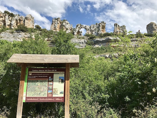
GR 99 Camino Natural del Ebro
- Mountain Bike
- E-Bike
- Horse
- Hike
- Trail Running
-
GR1 Sendero Histórico Cantabria
- Mountain Bike
Activity Feed
| username | action | type | title | date |
|---|---|---|---|---|
| kikosinplomo | add | photo | activity #96983681 and 4 more | Jun 14, 2026 @ 10:25am Jun 14, 2026 |
| kikosinplomo | add | report | activity #96983529 and 5 more | Jun 14, 2026 @ 10:24am Jun 14, 2026 |
| kikosinplomo | add | poi | activity #96982640 and 2 more | Jun 14, 2026 @ 10:14am Jun 14, 2026 |
| kikosinplomo | add | trail | activity #96980891 and 2 more | Jun 14, 2026 @ 9:59am Jun 14, 2026 |
| kikosinplomo | update | poi | activity #94493703 and 2 more | May 11, 2026 @ 7:33am May 11, 2026 |
Recent Comments
| username | type | title | comment | date |
|---|---|---|---|---|
| trail | Divertida, fluida y en un bosque espectacular.... | Aug 24, 2025 @ 1:20pm Aug 24, 2025 | ||
| trail | Impresionante sendero natural!! | Oct 12, 2022 @ 7:22am Oct 12, 2022 | ||
| trail | Un sendero precioso. Totalmente natural, con... | Oct 12, 2022 @ 7:21am Oct 12, 2022 |
Local Badges
-

Epic Mountain Bike Climb 2k39 awarded -

Climbing 10k Badge3 awarded -

Mountain Biking 100k Badge1 awarded -

Epic Ride Descent 2k39 awarded -

Descent 10k Badge3 awarded -

Descent 100k Badge1 awarded
Bike & Skill Parks
| name | type | city | rating |
|---|---|---|---|
| Bikepark Reinosa | skill park | Reinosa |
Activity Type Stats
| activitytype | trails | distance | descent | descent distance | total vertical | rating | global rank | state rank | photos | reports | routes | ridelogs |
|---|---|---|---|---|---|---|---|---|---|---|---|---|
| Mountain Bike | 177 | 136 miles | 20,233 ft | 61 miles | 3,100 ft | #2,176 | #184 | 129 | 97 | 5 | 1,208 | |
| E-Bike | 177 | 136 miles | 20,233 ft | 61 miles | 3,100 ft | #608 | #172 | 16 | 81 | 2 | 120 | |
| Gravel Bike | 3 | 2 | ||||||||||
| Adaptive Bike | 2 | #501 | #183 | |||||||||
| Horse | 15 | 12 miles | 3,297 ft | 6 miles | 2,976 ft | #1,727 | #144 | 8 | ||||
| Hike | 179 | 138 miles | 20,784 ft | 62 miles | 3,100 ft | #1,433 | #157 | 83 | 72 | |||
| Trail Running | 179 | 138 miles | 20,784 ft | 62 miles | 3,100 ft | #1,056 | #153 | 83 | 13 | |||
| Dirtbike/Moto | 2 | 4 miles | 52 ft | 2,448 ft | 1,896 ft | 8 | ||||||
| Observed Trials | 2 | 4 miles | 52 ft | 2,448 ft | 1,896 ft | |||||||
| ATV/ORV/OHV | 2 | 4 miles | 52 ft | 2,448 ft | 1,896 ft | 8 |
Frequently Asked Questions About Reinosa
▼
What are the best places to ride in Reinosa?
Reinosa has 1 areas to explore for mountain biking. The top rated areas are:
▼
What are the highest rated mountain biking trails in Reinosa?
The highest rated mountain biking trails in Reinosa are:
- Endino Inferior (4.2/5)
- Los Ojancanus (4.1/5)
- Endino Superior (4.1/5)
- Herradura (4.1/5)
- Robleda de Villacantid (4/5)
▼
What is the best time of the year to ride in Reinosa?
Based on ride log data, the most popular months to ride in Reinosa are:
- May (4 activities)
- October (2 activities)
- July (2 activities)
▼
Where can I park to ride in Reinosa?
Check the Reinosa trail map for trailhead and parking information. Community members regularly update access and parking details for trails in the area.
Activities
Trails
Points of Interest
- By Crisjaca
 & contributors
 - Admins: krasty1002, Angelreing, kikosinplomo
- #47141 - 1,453 views
- reinosa activity log | embed map of Reinosa mountain bike trails | reinosa mountain biking points of interest
Downloading of trail gps tracks in kml & gpx formats is enabled for Reinosa.
You must login to download files.