close
-
Layers w
- Weather Layers
- Pro
- Pro
- Pro
- Pro
- Pro
- Pro
- More Layers
- Pro
- Pro
- Pro
- Pro
-
Upgrade to

3D
Trail Conditions
- Unknown
- Snow Groomed
- Snow Packed
- Snow Covered
- Snow Cover Partial
- Freeze/thaw Cycle
- Icy
- Prevalent Mud
- Wet
- Variable
- Ideal
- Dry
- Very Dry
Trail Flow (Ridden Direction)
Trailforks scans users ridelogs to determine the most popular direction each trail is ridden. A good flowing trail network will have most trails flowing in a single direction according to their intension.
The colour categories are based on what percentage of riders are riding a trail in its intended direction.
The colour categories are based on what percentage of riders are riding a trail in its intended direction.
- > 96%
- > 90%
- > 80%
- > 70%
- > 50%
- < 50%
- bi-directional trail
- no data
Trail Last Ridden
Trailforks scans ridelogs to determine the last time a trail was ridden.
- < 2 days
- < 1 week
- < 2 weeks
- < 1 month
- < 6 months
- > 6 months
Trail Ridden Direction
The intended direction a trail should be ridden.
- Downhill Only
- Downhill Primary
- Both Directions
- Uphill Primary
- Uphill Only
- One Direction
Contribute Details
Colors indicate trail is missing specified detail.
- Description
- Photos
- Description & Photos
- Videos
Trail Popularity ?
Trailforks scans ridelogs to determine which trails are ridden the most in the last 9 months.
Trails are compared with nearby trails in the same city region with a possible 25 colour shades.
Think of this as a heatmap, more rides = more kinetic energy = warmer colors.
- most popular
- popular
- less popular
- not popular
ATV/ORV/OHV Filter
Max Vehicle Width
inches
US Cell Coverage
Legend

Radar Time
Activity Recordings
Trailforks uses anonymized public activity data.
?
Activity Recordings
Trailforks uses anonymized public activity data.
?
Personal Heatmap
▶
Activity Types
all
/
none
▶
Options
2
Date range
month
–
Winter Trails
Warning
A routing network for winter maps does not exist. Selecting trails using the winter trails layer has been disabled.
Missing Trails
Most Popular
Least Popular
Trails are colored based on popularity. The more popular a trail is, the more red. Less popular trails trend towards green.
Jump Magnitude Heatmap
Heatmap of where riders jump on trails. Zoom in to see individual jumps, click circles to view jump details.
BC Backroad Status
![map legend]()
Service Road Atlas is a free to use, community-driven service for viewing and creating reports on the numerous back-country service roads around B.C. and Alberta.

Slope Aspect
Direction the slope faces
Trails Deemphasized
Trails are shown in grey.
Only show trails with no bike usage.
Suggested Layers
Based on selected activity type
Save the current map location and zoom level as your default home location whenever this page is loaded.
SavePopular Trail Networks
view all areas »
No description for Renfrew County has been added yet!
Login or register to submit one.
Links
Activities Click to view
- Mountain Bike
259 trails
- E-Bike
111 trails
- Hike
308 trails
- Trail Running
304 trails
- ATV/ORV/OHV
21 trails
- Snowmobile
29 trails
- Snowshoe
155 trails
- Downhill Ski
19 trails
- Nordic Ski
71 trails
Stats
- Avg Trail Rating
- Trails (view details)
- 362
- Trails Mountain Bike
- 259
- Trails E-Bike
- 111
- Trails Horse
- 1
- Trails Hike
- 308
- Trails Trail Running
- 304
- Trails Dirtbike/Moto
- 3
- Trails ATV/ORV/OHV
- 21
- Trails Snowmobile
- 29
- Trails Snowshoe
- 155
- Trails Downhill Ski
- 19
- Trails Backcountry Ski
- 3
- Trails Nordic Ski
- 71
- Total Distance
- 345 miles
- Total Descent
- 25,765 ft
- Total Vertical
- 1,524 ft
- Highest Trailhead
- 1,579 ft
- Reports
- 1,789
- Photos
- 743
- Ridden Counter
- 10,872
Sub Regions
- Admaston/Bromley Township (1)
- Arnprior (2)
- Beachburg (107)
- Bonnechere Valley Township (11)
- Kahlua Trails (11)
- Kregurs Creek (5)
- Greater Madawaska Township (50)
- Horton Township (1)
- Killaloe, Hagarty And Richards Township (5)
- Laurentian Hills (2)
- Laurentian Valley Township (1)
- Forest Lea (49)
- Madawaska Valley Township (7)
- Madawaska Mountain (0)
- SLBM Trails (7)
- McNab/Braeside Township (1)
- North Algona Wilberforce Township (0)
- Pembroke (3)
- Petawawa (23)
- Renfrew (2)
- Whitewater Region Township (1)
- Driftwood Provincial Park (0)
Popular Renfrew County Mountain Biking Trails
• 100 ★ 0.0 • 768 ft • 0 ft • 186 •
is green connector that has some playful rock faces and small jumps.
• 90 ★ 5.0 • 1,926 ft • 20 ft • 181 •
A flow run, lots or berm turns and smooth track so the rider can focus on smooth transition between turns. The lower half of the run gives you fast berms and a little air to end the run. Big smiles while ripping this run! One-Way Only
• 100 ★ 4.4 • 837 ft • 0 ft • 174 •
Fun start to accessing some trails with an interesting rock spine ride to start things off. This trail gives you access to many different trails.
• 85 ★ 0.0 • 942 ft • 38 ft • 173 •
This is the entrance to the system. Keeps you out of the campgrounds and gives you direct access to the flow track sections.
• 85 ★ 0.0 • 640 ft • 5 ft • 165 •
The entrance of , is just that, some rocky sections but you are rewarded with some super fun berms.
• 95 ★ 3.5 • 3 miles • 53 ft • 159 •
is typically open year-round. We will groom occasionaly with snowmobile.
• 70 ★ 4.0 • 1 mile • 85 ft • 159 •
is a fun windy green run with a lot of features that with some speed can make even the most experience rider let out some whoots :-)
• 75 ★ 5.0 • 2,238 ft • 0 ft • 157 •
River Running is a fun flowy technical trail with lots of rock to roll and some hidden gems. Ends right at the banks of the Ottawa River for a spectacular view.
Renfrew County Mountain Bike Routes
★ 4.0 • 17 miles • 159 ft • 4 •
COURSE RUNS ON OPEN ROADS OBEY TRAFFIC LAWS RIDE WITHIN ABILITY COURSE RUNS ON PRIVATE LANDS, WITH...
★ 5.0 • 4 miles • 130 ft • 12 •
Start at big tree and ride down to 2. Start off with some nice flow and then a moderate climb. But then...
6 miles • 110 ft • 8 • Loop •
A short loop starting at and Finishing up at .
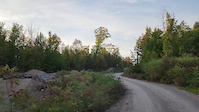
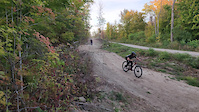
Photos of Renfrew County Mountain Bike
Videos of Renfrew County Mountain Bike
trail: Philharmonic Airwaves
0:26 |
36 |
Sep 17, 2025
trail: Philharmonic Airwaves
0:11 |
18 |
Sep 17, 2025

trail: Portage
2:11 |
63 |
Nov 20, 2024

trail: Kowalski's Cascades
0:33 |
73 |
Nov 20, 2024

trail: Gladiator
0:54 |
66 |
Nov 20, 2024

trail: Class V
0:09 |
100 |
Oct 31, 2024

trail: Gladiator
0:15 |
45 |
Oct 31, 2024

trail: Dinknuts Drop
0:07 |
|
Sep 27, 2024
Recent Trail Reports
Activity Feed
| username | action | type | title | date |
|---|---|---|---|---|
| Sharkyh2o | update | region | activity #97068154 | Jun 15, 2026 @ 3:12pm 3 days |
| Sharkyh2o | add | report | activity #97045306 | Jun 15, 2026 @ 9:03am 3 days |
| Sharkyh2o | update | trail | activity #97039110 and 4 more | Jun 15, 2026 @ 7:14am 3 days |
| Weichenm | add | report | activity #97034604 and 1 more | Jun 15, 2026 @ 5:33am 3 days |
| Benat08 | add | report | activity #97024234 and 3 more | Jun 14, 2026 @ 10:55pm Jun 14, 2026 |
Recent Comments
| username | type | title | comment | date |
|---|---|---|---|---|
| trail | This isn't a trail suitable for mountain... | May 13, 2026 @ 10:55am May 13, 2026 | ||
| trail | The only true mountain bike trail of all the... | May 13, 2026 @ 9:21am May 13, 2026 | ||
| trail | This isn't a trail for mountain bikes; there... | May 13, 2026 @ 9:06am May 13, 2026 | ||
| trail | This isn't a trail for mountain bikes; there... | May 13, 2026 @ 8:59am May 13, 2026 | ||
| trail | This isn't a trail for mountain bikes; there... | May 13, 2026 @ 8:48am May 13, 2026 |
Local Badges
-

Climbing 10k Badge0 awarded -

Epic Mountain Bike Climb 2k0 awarded -
Epic Mountain Bike Climb 2k0 awarded -
Climbing 10k Badge0 awarded -

Completionist0 awarded -

Mountain Biking 100k Badge0 awarded
Bike & Skill Parks
| name | type | city | rating |
|---|---|---|---|
| Wilderness Tours Bike Park | bike park | Beachburg | |
| Construction Yard | skill park | Petawawa | |
| Lavallee Bike Park, by BORCA | skill park | Beachburg | |
| Wilderness Tours Skills Park | skill park | Beachburg |
Local Products
Local Trail Supporters
![Wilderness Tours Rafting Resort]()
- www.wildernesstours.com
Local Trail Association
Activity Type Stats
| activitytype | trails | distance | descent | descent distance | total vertical | rating | global rank | state rank | photos | reports | routes | ridelogs |
|---|---|---|---|---|---|---|---|---|---|---|---|---|
| Mountain Bike | 259 | 279 miles | 13,960 ft | 96 miles | 1,437 ft | 737 | 1,785 | 14 | 7,856 | |||
| E-Bike | 111 | 156 miles | 5,522 ft | 59 miles | 696 ft | 1,545 | 1 | 102 | ||||
| Horse | 1 | 2,057 ft | 3 ft | 207 ft | 33 ft | 105 | 4 | |||||
| Hike | 308 | 308 miles | 17,933 ft | 108 miles | 1,526 ft | 7 | 1,567 | 1 | 1,200 | |||
| Trail Running | 304 | 304 miles | 17,644 ft | 107 miles | 1,526 ft | 1,528 | 4 | 258 | ||||
| Dirtbike/Moto | 3 | 7 miles | 262 ft | 2 miles | 679 ft | 104 | 21 | |||||
| ATV/ORV/OHV | 21 | 104 miles | 1,020 ft | 37 miles | 600 ft | 104 | 34 | |||||
| Snowmobile | 29 | 107 miles | 1,811 ft | 40 miles | 1,063 ft | 4 | ||||||
| Snowshoe | 155 | 175 miles | 11,168 ft | 67 miles | 1,332 ft | 270 | 150 | |||||
| Downhill Ski | 19 | 8 miles | 5,686 ft | 8 miles | 738 ft | 4 | 250 | |||||
| Backcountry Ski | 3 | 3 miles | 331 ft | 2 miles | 174 ft | 4 | 105 | |||||
| Nordic Ski | 71 | 127 miles | 3,169 ft | 50 miles | 1,247 ft | 8 | 274 |
Frequently Asked Questions About Renfrew County
▼
What are the best places to ride in Renfrew County?
Renfrew County has 24 areas to explore for mountain biking. The top rated areas are:
▼
What are the highest rated mountain biking trails in Renfrew County?
The highest rated mountain biking trails in Renfrew County are:
- Deer Run (4.2/5)
- River Runner (4.2/5)
- Kessel Run (4.2/5)
- Nyami Nyami (4.2/5)
- Algonquin Pass (4.2/5)
▼
What is the best time of the year to ride in Renfrew County?
Based on ride log data, the most popular months to ride in Renfrew County are:
- August (135 activities)
- July (127 activities)
- September (116 activities)
▼
What is the longest trail in Renfrew County?
The longest trail in Renfrew County is Alice to Achray at 9.3 miles. View all trails sorted by distance.
Activities
- Renfrew County Mountain Biking Trails
- Renfrew County E-Biking Trails
- Renfrew County Hiking Trails
- Renfrew County Trail Running Trails
- Renfrew County ATVing/Offroading Trails
- Renfrew County Snowmobiling Trails
- Renfrew County Snowshoeing Trails
- Renfrew County Skiing Trails
- Renfrew County Nordic Skiing Trails
Trails
Points of Interest
- Riverside Take Out Campsites Camping
- Ottawa River East Campground Camping
- Ottawa River West Campground Camping
- Brumm Campground Camping
- Oak Highland Trail Riverview Loop Lookout Viewpoint
- Oak Highland Trail Riverview Loop Lookout Viewpoint
- Oak Highland Trail Riverview Loop Lookout Viewpoint
- Sugar Mountain Viewpoint
- Blueberry Mountain Viewpoint
- Vacation Rentals Lodge
- By markholloway
 Trailforks Map Team & contributors
 - Admins: Canadmos
- #10138 - 10,470 views
- renfrew county activity log | embed map of Renfrew County mountain bike trails | renfrew county mountain biking points of interest
Downloading of trail gps tracks in kml & gpx formats is enabled for Renfrew County.
You must login to download files.