close
-
Layers w
- Weather Layers
- Pro
- Pro
- Pro
- Pro
- Pro
- Pro
- More Layers
- Pro
- Pro
- Pro
- Pro
-
Upgrade to

3D
Trail Conditions
- Unknown
- Snow Groomed
- Snow Packed
- Snow Covered
- Snow Cover Partial
- Freeze/thaw Cycle
- Icy
- Prevalent Mud
- Wet
- Variable
- Ideal
- Dry
- Very Dry
Trail Flow (Ridden Direction)
Trailforks scans users ridelogs to determine the most popular direction each trail is ridden. A good flowing trail network will have most trails flowing in a single direction according to their intension.
The colour categories are based on what percentage of riders are riding a trail in its intended direction.
The colour categories are based on what percentage of riders are riding a trail in its intended direction.
- > 96%
- > 90%
- > 80%
- > 70%
- > 50%
- < 50%
- bi-directional trail
- no data
Trail Last Ridden
Trailforks scans ridelogs to determine the last time a trail was ridden.
- < 2 days
- < 1 week
- < 2 weeks
- < 1 month
- < 6 months
- > 6 months
Trail Ridden Direction
The intended direction a trail should be ridden.
- Downhill Only
- Downhill Primary
- Both Directions
- Uphill Primary
- Uphill Only
- One Direction
Contribute Details
Colors indicate trail is missing specified detail.
- Description
- Photos
- Description & Photos
- Videos
Trail Popularity ?
Trailforks scans ridelogs to determine which trails are ridden the most in the last 9 months.
Trails are compared with nearby trails in the same city region with a possible 25 colour shades.
Think of this as a heatmap, more rides = more kinetic energy = warmer colors.
- most popular
- popular
- less popular
- not popular
ATV/ORV/OHV Filter
Max Vehicle Width
inches
US Cell Coverage
Legend

Radar Time
Activity Recordings
Trailforks uses anonymized public activity data.
?
Activity Recordings
Trailforks uses anonymized public activity data.
?
Personal Heatmap
▶
Activity Types
all
/
none
▶
Options
2
Date range
month
–
Winter Trails
Warning
A routing network for winter maps does not exist. Selecting trails using the winter trails layer has been disabled.
Missing Trails
Most Popular
Least Popular
Trails are colored based on popularity. The more popular a trail is, the more red. Less popular trails trend towards green.
Jump Magnitude Heatmap
Heatmap of where riders jump on trails. Zoom in to see individual jumps, click circles to view jump details.
BC Backroad Status
![map legend]()
Service Road Atlas is a free to use, community-driven service for viewing and creating reports on the numerous back-country service roads around B.C. and Alberta.

Slope Aspect
Direction the slope faces
Trails Deemphasized
Trails are shown in grey.
Only show trails with no bike usage.
Suggested Layers
Based on selected activity type
Save the current map location and zoom level as your default home location whenever this page is loaded.
Save
No description for Requena has been added yet!
Login or register to submit one.
This region uses the Uk/Euro style trail grading system.
Activities Click to view
- Mountain Bike
545 trails
- E-Bike
544 trails
- Adaptive Bike
0 trails
- Horse
13 trails
- Hike
545 trails
- Trail Running
544 trails
- Dirtbike/Moto
9 trails
- Observed Trials
7 trails
- ATV/ORV/OHV
7 trails
Region Details
- 379
- 27
- 121
- 5
Region Status
Open as of Apr 24, 2026Stats
- Avg Trail Rating
- Trails (view details)
- 532
- Trails Mountain Bike
- 545
- Trails E-Bike
- 544
- Trails Gravel Bike
- 1
- Trails Horse
- 13
- Trails Hike
- 545
- Trails Trail Running
- 544
- Trails Dirtbike/Moto
- 9
- Trails Observed Trials
- 7
- Trails ATV/ORV/OHV
- 7
- Total Distance
- 452 miles
- Total Descent
- 54,302 ft
- Total Vertical
- 2,245 ft
- Highest Trailhead
- 3,386 ft
- Reports
- 341
- Photos
- 9
- Ridden Counter
- 5,549
Sub Regions
-
El Rebollar
- 18
- 47
- 1
-
Hoces del Cabriel
- 5
- 33
- 4
-
La Serratilla
- 4
- 39
Popular Requena Mountain Biking Trails
• 95 ★ 4.0 • 4,482 ft • 0 ft • 105 •
Popular blue difficulty singletrack. This multi-use trail can be used downhill primary and has a moderate overall physical rating. It features berm, drop, jump and rock garden. On average it takes 4 minutes to complete this trail.
• 100 ★ 2.0 • 1,971 ft • 117 ft • 90 •
Popular green difficulty singletrack. This multi-use trail can be used both directions. On average it takes 5 minutes to complete this trail.
• 100 ★ 2.5 • 866 ft • 78 ft • 85 •
Corto enlace en subida que da acceso a 3 bajadas
• 100 ★ 3.4 • 2,802 ft • 0 ft • 77 •
Senda rápida y divertida con curvas cerradas y árboles a los lados con los que llevar cuidado. Parte final algo más empinada.
• 95 ★ 4.8 • 4,541 ft • 15 ft • 77 •
Senda muy rápida de descenso con curvas peraltadas y algún pequeño escalón.
• 100 ★ 2.5 • 1 mile • 83 ft • 75 •
Popular blue difficulty singletrack. This multi-use trail can be used downhill primary. It features berm, drop and rock garden. On average it takes 7 minutes to complete this trail.
• 95 ★ 2.0 • 2,457 ft • 67 ft • 73 •
Popular green difficulty singletrack. This multi-use trail can be used both directions. Trail visibility is always easy to follow. On average it takes 2 minutes to complete this trail.
• 100 ★ 2.0 • 887 ft • 4 ft • 70 •
Popular green difficulty singletrack. This multi-use trail can be used both directions. On average it takes minutes to complete this trail.
Requena Mountain Bike Routes
19 miles • 3,181 ft • 21 • Loop •
Ruta por la Serratilla pero saliendo del aeródromo del Rebollar
22 miles • 3,834 ft • 23 • Loop •
Ruta que coge la zona este de la falda norte de El Rebollar. Se disfruta más con doble que rígida, pero...
14 miles • 2,527 ft • 19 • Loop •
Combinación de sendas de la zona intentando coger las mejores. Versión más o menos rápida
22 miles • 3,539 ft • 34 • Loop •
Ruta que coge las sendas de la zona oeste, mucho flow. Esta ruta también aprovecha las sendas de y que...
38 miles • 3,112 ft • 10 • Loop • Race •
Etapa 1 de la Valencia Epic Race 2024
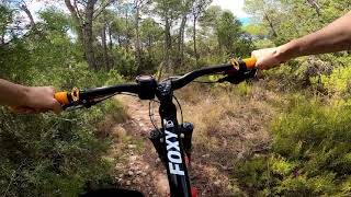
Videos of Requena Mountain Bike
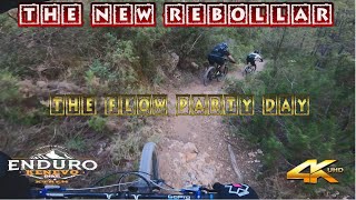
11:27 |
102 |
Jan 16, 2023

trail: La Cobra
18:30 |
228 |
Sep 18, 2020 , Requena

trail: Barranco del Pocillo
18:30 |
255 |
Sep 18, 2020 , Requena
trail: Antenas Montote
18:30 |
261 |
Sep 18, 2020 , Requena
Recent Trail Reports
Activity Feed
| username | action | type | title | date |
|---|---|---|---|---|
| juanx | update | route | activity #94174088 and 1 more | May 6, 2026 @ 1:07pm May 6, 2026 |
| AlbertoYYiAXQ | wishlist | route | activity #94047343 | May 4, 2026 @ 2:02pm May 4, 2026 |
| montonm | add | trail | activity #93880012 | May 2, 2026 @ 11:21am May 2, 2026 |
| falsorro | wishlist | route | activity #93802480 | May 1, 2026 @ 12:12pm May 1, 2026 |
| JuanEF | add | report | activity #93421025 | Apr 26, 2026 @ 2:36am Apr 26, 2026 |
Recent Comments
| username | type | title | comment | date |
|---|---|---|---|---|
| trail | Senda de tierra con toboganes. 100% recomendable | Feb 22, 2026 @ 1:05pm Feb 22, 2026 | ||
| trail | los primeros 40 metros mucha inclinacion con... | Sep 13, 2025 @ 6:17am Sep 13, 2025 | ||
| trail | AMBAS DIRRECIONES NADA , en sentido contraria... | Sep 13, 2025 @ 6:15am Sep 13, 2025 | ||
| trail | Senda 100% Flow con muchas curvas. | May 6, 2025 @ 4:47am May 6, 2025 | ||
| trail | Gracias por el comentario,se pondrá como... | Apr 13, 2025 @ 2:17am Apr 13, 2025 |
Local Badges
-

10 Blue Trails71 awarded -

Epic Ride Climb 2k10 awarded -

Climbing 10k Badge16 awarded -

Climbing 100k Badge2 awarded -

Completionist0 awarded -

Epic Ride Descent 2k10 awarded
Bike & Skill Parks
| name | type | city | rating |
|---|---|---|---|
| Pumptrack Requena | skill park | Requena |
Activity Type Stats
| activitytype | trails | distance | descent | descent distance | total vertical | rating | global rank | state rank | photos | reports | routes | ridelogs |
|---|---|---|---|---|---|---|---|---|---|---|---|---|
| Mountain Bike | 545 | 452 miles | 54,301 ft | 200 miles | 2,244 ft | #497 | #55 | 10 | 341 | 6 | 2,681 | |
| E-Bike | 544 | 452 miles | 54,301 ft | 200 miles | 2,244 ft | #75 | #46 | 339 | 6 | 188 | ||
| Gravel Bike | 1 | #4,051 | #162 | 12 | 11 | |||||||
| Horse | 13 | 20 miles | 1,670 ft | 8 miles | 1,243 ft | #1,617 | #134 | 12 | ||||
| Hike | 545 | 452 miles | 54,301 ft | 200 miles | 2,244 ft | #213 | #50 | 339 | 6 | 33 | ||
| Trail Running | 544 | 452 miles | 54,301 ft | 200 miles | 2,244 ft | #160 | #47 | 339 | 49 | |||
| Dirtbike/Moto | 9 | 15 miles | 1,509 ft | 7 miles | 1,243 ft | #845 | #50 | 12 | 1 | |||
| Observed Trials | 7 | 11 miles | 758 ft | 5 miles | 1,234 ft | #71 | #4 | |||||
| ATV/ORV/OHV | 7 | 11 miles | 758 ft | 5 miles | 1,234 ft | #594 | #21 | 12 | 1 |
Frequently Asked Questions About Requena
▼
What are the best places to ride in Requena?
Requena has 3 areas to explore for mountain biking. The top rated areas are:
▼
What are the highest rated mountain biking trails in Requena?
The highest rated mountain biking trails in Requena are:
- Twister (4.3/5)
- Navidad (4.2/5)
- Ciclogénisis (4.2/5)
- Pony (4.1/5)
- Papa Noel (4.1/5)
▼
What is the best time of the year to ride in Requena?
Based on ride log data, the most popular months to ride in Requena are:
- December (16 activities)
- May (11 activities)
- November (10 activities)
▼
Where can I park to ride in Requena?
There are 3 parking locations listed in Requena. The most popular parking spots are: View all parking and trailhead locations on the map to plan your visit.
Activities
Trails
- requena activity log | embed map of Requena mountain bike trails | requena mountain biking points of interest polygons
Downloading of trail gps tracks in kml & gpx formats is enabled for Requena.
You must login to download files.