close
-
Layers w
- Weather Layers
- Pro
- Pro
- Pro
- Pro
- Pro
- Pro
- More Layers
- Pro
- Pro
- Pro
- Pro
-
Upgrade to

3D
Trail Conditions
- Unknown
- Snow Groomed
- Snow Packed
- Snow Covered
- Snow Cover Partial
- Freeze/thaw Cycle
- Icy
- Prevalent Mud
- Wet
- Variable
- Ideal
- Dry
- Very Dry
Trail Flow (Ridden Direction)
Trailforks scans users ridelogs to determine the most popular direction each trail is ridden. A good flowing trail network will have most trails flowing in a single direction according to their intension.
The colour categories are based on what percentage of riders are riding a trail in its intended direction.
The colour categories are based on what percentage of riders are riding a trail in its intended direction.
- > 96%
- > 90%
- > 80%
- > 70%
- > 50%
- < 50%
- bi-directional trail
- no data
Trail Last Ridden
Trailforks scans ridelogs to determine the last time a trail was ridden.
- < 2 days
- < 1 week
- < 2 weeks
- < 1 month
- < 6 months
- > 6 months
Trail Ridden Direction
The intended direction a trail should be ridden.
- Downhill Only
- Downhill Primary
- Both Directions
- Uphill Primary
- Uphill Only
- One Direction
Contribute Details
Colors indicate trail is missing specified detail.
- Description
- Photos
- Description & Photos
- Videos
Trail Popularity ?
Trailforks scans ridelogs to determine which trails are ridden the most in the last 9 months.
Trails are compared with nearby trails in the same city region with a possible 25 colour shades.
Think of this as a heatmap, more rides = more kinetic energy = warmer colors.
- most popular
- popular
- less popular
- not popular
ATV/ORV/OHV Filter
Max Vehicle Width
inches
US Cell Coverage
Legend

Radar Time
Activity Recordings
Trailforks uses anonymized public activity data.
?
Activity Recordings
Trailforks uses anonymized public activity data.
?
Personal Heatmap
▶
Activity Types
all
/
none
▶
Options
2
Date range
month
–
Winter Trails
Warning
A routing network for winter maps does not exist. Selecting trails using the winter trails layer has been disabled.
Missing Trails
Most Popular
Least Popular
Trails are colored based on popularity. The more popular a trail is, the more red. Less popular trails trend towards green.
Jump Magnitude Heatmap
Heatmap of where riders jump on trails. Zoom in to see individual jumps, click circles to view jump details.
BC Backroad Status
![map legend]()
Service Road Atlas is a free to use, community-driven service for viewing and creating reports on the numerous back-country service roads around B.C. and Alberta.

Slope Aspect
Direction the slope faces
Trails Deemphasized
Trails are shown in grey.
Only show trails with no bike usage.
Suggested Layers
Based on selected activity type
Save the current map location and zoom level as your default home location whenever this page is loaded.
Save
No description for Rheden has been added yet!
Login or register to submit one.
Activities Click to view
- Mountain Bike
21 trails
- E-Bike
12 trails
- Gravel Bike
0 trails
- Adaptive Bike
0 trails
- Hike
14 trails
- Trail Running
14 trails
Region Details
- 1
- 2
- 4
- 9
- 1
Region Status
Open as of Apr 26, 2026Local Trail Association
Stats
- Avg Trail Rating
- Trails (view details)
- 21
- Trails Mountain Bike
- 21
- Trails E-Bike
- 12
- Trails Hike
- 14
- Trails Trail Running
- 14
- Total Distance
- 33 miles
- Total Descent Distance
- 16 miles
- Total Descent
- 2,092 ft
- Total Vertical
- 240 ft
- Highest Trailhead
- 352 ft
- Reports
- 746
- Photos
- 148
- Ridden Counter
- 15,133
Sub Regions
-
Veluwezoom
- 2
- 4
- 9
- 1
Popular Rheden Mountain Biking Trails
• 90 ★ 4.0 • 1 mile • 45 ft • 671 •
Monument; watch-out for it and dive into the history Starts as a dualtrack. At the halfway point it opens up to a gravel road. Once it crosses the Bloemersweg it turns to singletrack again.
• 90 ★ 5.0 • 4,518 ft • 43 ft • 661 •
Super fun, twisty, up-and-down singletrack that crosses a large shallow valley. The trail is mostly hardpack with a few features like berms, a drop, tables and a small rockgarden. It's named after the road that lies parallel to this...
• 65 ★ 4.0 • 1 mile • 8 ft • 621 •
Moderately popular green difficulty mixed. This mountain bike primary trail can be used one direction and has a easy overall physical rating with a 8 ft green climb. Trail visibility is always easy to follow. On average it takes 5 minutes to complete this trail.
• 85 ★ 4.0 • 2 miles • 59 ft • 611 •
Intense up-and down singletrack loop on the Dieren side of Veluwezoom National Park. South and Eastern quadrants are faster and flowy with more hardpack however there are a few lose sand segments. Gravel bikes wont work in very lose dry...
• 75 ★ 4.0 • 3,816 ft • 76 ft • 604 •
Highly rated popular red difficulty singletrack. This mountain bike primary trail can be used one direction and has a moderate overall physical rating with a 76 ft blue climb. It features berm, drop, jump, pump track and roller coaster. Trail visibility is always easy to follow. On average it takes 6 minutes to complete this trail.
• 70 ★ 4.0 • 2,913 ft • 8 ft • 592 •
This trail can be very dry and sandy. The name 'Teerose' comes from German radar antennas used in WWII, of which the remains can be found in the area of this trail.
• 95 ★ 2.0 • 1 mile • 56 ft • 582 •
Super fun, twisty, up-and-down singletrack that crosses a large shallow valley. The trail is mostly hardpack with a few small loose sand segments. South to North, you start with a flat trail that then descends gently overall over a fair...
• 55 ★ 3.0 • 4,252 ft • 34 ft • 559 •
This is a fast, hardpack, flowy trail - It weaves like a thin tunnel through the ferns for most of its length and has a small tabletop jump half way down. It offers great views over the heather-covered hillsides at the Paviljoen Posbank...
Rheden Mountain Bike Routes
30 miles • 1,540 ft • 8 • Point to Point •
Officiële blauwe MTB-route Rheden Natuurmonumenten vignet plichtig
★ 5.0 • 14 miles • 710 ft • 0 •
Informatie over route Schaarsbergen De Schaarsbergen route kent niet de grote hoogteverschillen van elders...
22 miles • 1,094 ft • 2 •
Officiële groene gravel route van Natuurmonumenten vignetplichtig
Photos of Rheden Mountain Bike
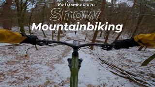
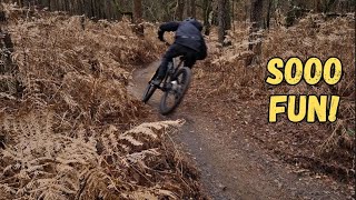
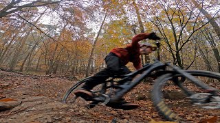
Videos of Rheden Mountain Bike
trail: MTB route Grannytrail
0:08 |
|
Nov 29, 2020
youtuber
![Snowy Fortune Cookie]()

2:34 |
140 |
Jan 21, 2024 , Rheden
youtuber
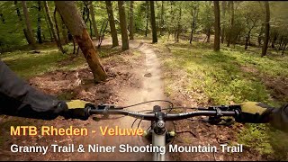
![Snowy Shooting Mountain in]()

2:34 |
138 |
Jan 21, 2024 , Rheden
youtuber
![Zijn de rode lussen van Rheden ook tof in de...]()
trail: MTB route Grannytrail
2:34 |
125 |
Jan 21, 2024 , Rheden
youtuber
![De uitdagende rode lussen van Rheden //...]()

13:00 |
188 |
Jan 2, 2024
youtuber
![Is this the BEST Legal Mountainbike Trail in...]()
trail: MTB route Grannytrail
3:07 |
197 |
Dec 22, 2023 , Rheden
2:31 |
339 |
Jun 5, 2022 , Rheden
trail: MTB route Grannytrail
6:23 |
417 |
Jan 7, 2022 , Rheden
Recent Trail Reports
Activity Feed
| username | action | type | title | date |
|---|---|---|---|---|
| SjeambecK | add | report | activity #93430372 and 7 more | Apr 26, 2026 @ 4:57am Apr 26, 2026 |
| RickbpcgIz | wishlist | trail | activity #91275873 and 22 more | Mar 25, 2026 @ 11:42am Mar 25, 2026 |
| ArnoV8ZKuY | vote | route | activity #90579254 | Mar 14, 2026 @ 1:29pm Mar 14, 2026 |
| ArnoV8ZKuY | wishlist | route | activity #90579245 | Mar 14, 2026 @ 1:29pm Mar 14, 2026 |
| ArnoV8ZKuY | wishlist | route | activity #90280905 | Mar 9, 2026 @ 12:25pm Mar 9, 2026 |
Recent Comments
| username | type | title | comment | date |
|---|---|---|---|---|
| trail | Closed for maintenance | Nov 3, 2024 @ 2:16am Nov 3, 2024 | ||
| report | @Rob: Klopt, trail is ook 3 februari weer... | Jul 8, 2024 @ 2:37pm Jul 8, 2024 | ||
| report | Dit probleem is al lang opgelosg | Jul 8, 2024 @ 9:44am Jul 8, 2024 | ||
| trail | Een van de vetste trails van van de route | Aug 6, 2023 @ 9:25am Aug 6, 2023 | ||
| trail | Dit is zeker niet zwart | Jan 28, 2023 @ 11:04pm Jan 28, 2023 |
Local Badges
-

Completionist22 awarded -

10 Blue Trails173 awarded -

Epic Mountain Bike Climb 2k3 awarded -

Climbing 10k Badge67 awarded -

Mountain Biking 100k Badge0 awarded -

Epic Ride Descent 2k3 awarded
Bike & Skill Parks
| name | type | city | rating |
|---|---|---|---|
| Arnhem MX | skill park | Rheden |
Activity Type Stats
| activitytype | trails | distance | descent | descent distance | total vertical | rating | global rank | state rank | photos | reports | routes | ridelogs |
|---|---|---|---|---|---|---|---|---|---|---|---|---|
| Mountain Bike | 21 | 33 miles | 2,093 ft | 16 miles | 240 ft | #1,042 | #4 | 148 | 746 | 3 | 14,283 | |
| E-Bike | 12 | 25 miles | 1,568 ft | 13 miles | 240 ft | #1,250 | #4 | 621 | 2 | 1,427 | ||
| Hike | 14 | 29 miles | 1,604 ft | 14 miles | 240 ft | #2,051 | #15 | 673 | 242 | |||
| Trail Running | 14 | 29 miles | 1,604 ft | 14 miles | 240 ft | #1,561 | #15 | 673 | 215 |
Frequently Asked Questions About Rheden
▼
What are the best places to ride in Rheden?
Rheden has 1 areas to explore for mountain biking. The top rated areas are:
▼
What are the highest rated mountain biking trails in Rheden?
The highest rated mountain biking trails in Rheden are:
- MTB route Shooting Mountain Trail (4.5/5)
- MTB route Grannytrail (4.5/5)
- Vernieuwd - Granny *Double* Drop line (4.2/5)
- MTB route Grannytrail bonus climb (4.2/5)
- MTB route Emmatrail (4.2/5)
▼
What is the best time of the year to ride in Rheden?
Based on ride log data, the most popular months to ride in Rheden are:
- February (58 activities)
- April (42 activities)
- July (41 activities)
▼
Where can I park to ride in Rheden?
There are 1 parking locations listed in Rheden. The most popular parking spots are:
Activities
Trails
- By trailforks
 Trailforks & contributors
 - Admins: MTB-NPV
- #30347 - 4,454 views
- rheden activity log | embed map of Rheden mountain bike trails | rheden mountain biking points of interest
Downloading of trail gps tracks in kml & gpx formats is enabled for Rheden.
You must login to download files.