close
-
Layers w
- Weather Layers
- Pro
- Pro
- Pro
- Pro
- Pro
- Pro
- More Layers
- Pro
- Pro
- Pro
- Pro
-
Upgrade to

3D
Trail Conditions
- Unknown
- Snow Groomed
- Snow Packed
- Snow Covered
- Snow Cover Partial
- Freeze/thaw Cycle
- Icy
- Prevalent Mud
- Wet
- Variable
- Ideal
- Dry
- Very Dry
Trail Flow (Ridden Direction)
Trailforks scans users ridelogs to determine the most popular direction each trail is ridden. A good flowing trail network will have most trails flowing in a single direction according to their intension.
The colour categories are based on what percentage of riders are riding a trail in its intended direction.
The colour categories are based on what percentage of riders are riding a trail in its intended direction.
- > 96%
- > 90%
- > 80%
- > 70%
- > 50%
- < 50%
- bi-directional trail
- no data
Trail Last Ridden
Trailforks scans ridelogs to determine the last time a trail was ridden.
- < 2 days
- < 1 week
- < 2 weeks
- < 1 month
- < 6 months
- > 6 months
Trail Ridden Direction
The intended direction a trail should be ridden.
- Downhill Only
- Downhill Primary
- Both Directions
- Uphill Primary
- Uphill Only
- One Direction
Contribute Details
Colors indicate trail is missing specified detail.
- Description
- Photos
- Description & Photos
- Videos
Trail Popularity ?
Trailforks scans ridelogs to determine which trails are ridden the most in the last 9 months.
Trails are compared with nearby trails in the same city region with a possible 25 colour shades.
Think of this as a heatmap, more rides = more kinetic energy = warmer colors.
- most popular
- popular
- less popular
- not popular
ATV/ORV/OHV Filter
Max Vehicle Width
inches
US Cell Coverage
Legend

Radar Time
Activity Recordings
Trailforks uses anonymized public activity data.
?
Activity Recordings
Trailforks uses anonymized public activity data.
?
Personal Heatmap
▶
Activity Types
all
/
none
▶
Options
2
Date range
month
–
Winter Trails
Warning
A routing network for winter maps does not exist. Selecting trails using the winter trails layer has been disabled.
Missing Trails
Most Popular
Least Popular
Trails are colored based on popularity. The more popular a trail is, the more red. Less popular trails trend towards green.
Jump Magnitude Heatmap
Heatmap of where riders jump on trails. Zoom in to see individual jumps, click circles to view jump details.
BC Backroad Status
![map legend]()
Service Road Atlas is a free to use, community-driven service for viewing and creating reports on the numerous back-country service roads around B.C. and Alberta.

Slope Aspect
Direction the slope faces
Trails Deemphasized
Trails are shown in grey.
Only show trails with no bike usage.
Suggested Layers
Based on selected activity type
Save the current map location and zoom level as your default home location whenever this page is loaded.
Save
No description for Rheola has been added yet!
Login or register to submit one.
This region uses the Uk/Euro style trail grading system.
Activities Click to view
- Mountain Bike
50 trails
- E-Bike
46 trails
- Adaptive Bike
0 trails
- Winter Fat Bike
0 trails
- Horse
28 trails
- Hike
43 trails
- Trail Running
43 trails
Region Details
- 36
- 7
- 4
Region Status
Open as of Jun 8, 2026Stats
- Avg Trail Rating
- Trails (view details)
- 51
- Trails Mountain Bike
- 50
- Trails E-Bike
- 46
- Trails Gravel Bike
- 2
- Trails Horse
- 28
- Trails Hike
- 43
- Trails Trail Running
- 43
- Total Distance
- 60 miles
- Total Descent
- 7,634 ft
- Total Vertical
- 1,844 ft
- Highest Trailhead
- 1,963 ft
- Reports
- 12
- Photos
- 95
- Ridden Counter
- 144
Articles

Final Results: British National Downhill - Round 1 Rheola
Apr 14, 2019 from pinkbike.com
Matt Walker takes the win in Rheola, but a podium for Gee and an impressive win for Rachel prove the new Atherton prototype is already at race pace.

Video: Raw Action from the British National Downhill - Round 1 Rheola
Apr 14, 2019 from pinkbike.com
The top British riders are all in Wales tackling the Rheola track in the first National race of the year.
Sub Regions
-
Crynant Forest
- 4
-
Rheola Forest
- 7
Popular Rheola Mountain Biking Trails
• 75 ★ 4.0 • 3,008 ft • 29 ft • 207 •
Highly rated popular red difficulty singletrack. This mountain bike primary trail can be used downhill primary and has a hard overall physical rating. On average it takes 8 minutes to complete this trail.
• ★ 5.0 • 2,825 ft • 0 ft • 8 •
rocky, rooty and natural feeling singletrack trail mixed with small rock steps and berms. (recently reopened 2025)
• 5 ★ 5.0 • 334 ft • 54 ft • 7 •
Rheola downhill mountain bike trail in South Wales is fast, rocky, rooty, steep natural downhill all the way. Tight twisty turns through the trees broke up the high speed chutes and bus stop sections. It is a technical track not for...
• 5 ★ 0.0 • 1 mile • 0 ft • 3 •
Rheola National DH track, This track is used for several races over the season but is open year round.
• ★ 4.0 • 2 miles • 227 ft • 2 •
Rocky singletrack trail linking two fire road sections together, Features berms and bridges over streams with a well made rocky climb in the mid section.
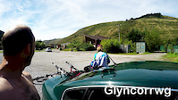
Photos of Rheola Mountain Bike
Videos of Rheola Mountain Bike

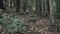
trail: Rheola DH
4:33 |
132 |
Apr 23, 2023

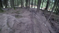
trail: Rheola DH
2:55 |
83 |
Jan 22, 2021
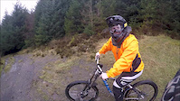
trail: Cranky Bruh
0:14 |
317 |
Oct 26, 2019
trail: Rheola DH
3:07 |
424 |
Apr 29, 2017
trail: Ghost Train
12:47 |
82 |
Aug 24, 2016

trail: Rheola DH
3:28 |
530 |
Apr 2, 2016
trail: Rheola DH
10:40 |
122 |
Mar 15, 2016
trail: Rheola DH
0:34 |
78 |
Nov 24, 2015
Recent Trail Reports
| status | trail | date | condition | info | user |
|---|---|---|---|---|---|
| Bow | Jun 8, 2026 @ 10:28am (Europe/London) Jun 8, 2026 | Variable | wonkle | ||
| Arrow And Archer | Jun 8, 2026 @ 10:27am (Europe/London) Jun 8, 2026 | Ideal | wonkle | ||
| Excalibur | Jun 8, 2026 @ 10:24am (Europe/London) Jun 8, 2026 | Variable | wonkle | ||
| J.E.R. | Mar 3, 2025 @ 6:40am Mar 3, 2025 | Dry | alexandraw | ||
| Freyr | Mar 3, 2025 @ 6:40am Mar 3, 2025 | Dry | alexandraw | ||
| Bob Moss | Mar 3, 2025 @ 6:39am Mar 3, 2025 | Dry | alexandraw | ||
| Riding High | Jun 23, 2018 @ 1:09am Jun 23, 2018 | Dry | m6dly | ||
| On The Edge | Jun 23, 2018 @ 1:09am Jun 23, 2018 | Very Dry | m6dly | ||
| Rheola DH | Dec 13, 2014 @ 1:34am Dec 13, 2014 | Wet | pukkasilvia |
Activity Feed
| username | action | type | title | date |
|---|---|---|---|---|
| wonkle | add | report | activity #96527205 and 2 more | Jun 8, 2026 @ 2:26am Jun 8, 2026 |
| wonkle | add | photo | activity #96526380 and 18 more | Jun 8, 2026 @ 1:37am Jun 8, 2026 |
| wonkle | vote | trail | activity #96525790 and 2 more | Jun 8, 2026 @ 1:04am Jun 8, 2026 |
| wonkle | add | trail | activity #95961481 and 3 more | May 31, 2026 @ 11:23am May 31, 2026 |
| Ljpower77 | wishlist | region | activity #91021856 | Mar 21, 2026 @ 1:40pm Mar 21, 2026 |
Recent Comments
| username | type | title | comment | date |
|---|---|---|---|---|
| trail | Trail is closed officially. It’s f@@ked up,... | Oct 7, 2025 @ 9:00am Oct 7, 2025 | ||
| trail | Trail has not been ridden in years. Dead as a... | Oct 7, 2025 @ 7:13am Oct 7, 2025 | ||
| trail | Trail is dead. Unridden for what seems like... | Oct 7, 2025 @ 7:10am Oct 7, 2025 |
Local Badges
-

Epic Mountain Bike Climb 2k0 awarded -

Climbing 10k Badge0 awarded -

Mountain Biking 100k Badge0 awarded -

Epic Ride Descent 2k0 awarded -

Descent 10k Badge0 awarded -

Descent 100k Badge0 awarded
Activity Type Stats
| activitytype | trails | distance | descent | descent distance | total vertical | rating | global rank | state rank | photos | reports | routes | ridelogs |
|---|---|---|---|---|---|---|---|---|---|---|---|---|
| Mountain Bike | 50 | 59 miles | 7,211 ft | 21 miles | 1,844 ft | #3,494 | #117 | 95 | 12 | 594 | ||
| E-Bike | 46 | 57 miles | 6,762 ft | 20 miles | 1,844 ft | #2,637 | #94 | 11 | 24 | |||
| Gravel Bike | 2 | 2,825 ft | 236 ft | 2,802 ft | 236 ft | #2,027 | #112 | 2 | ||||
| Horse | 28 | 46 miles | 4,026 ft | 15 miles | 1,844 ft | #980 | #41 | 4 | ||||
| Hike | 43 | 57 miles | 5,466 ft | 19 miles | 1,844 ft | #4,258 | #98 | 5 | 531 | |||
| Trail Running | 43 | 57 miles | 5,466 ft | 19 miles | 1,844 ft | #3,758 | #88 | 5 | 2 |
Frequently Asked Questions About Rheola
▼
What are the best places to ride in Rheola?
Rheola has 2 areas to explore for mountain biking. The top rated areas are:
▼
What are the highest rated mountain biking trails in Rheola?
The highest rated mountain biking trails in Rheola are:
- Excalibur (4.1/5)
- Bow (4.1/5)
- Rheola DH (4.1/5)
- Ghost Train (4/5)
- Arrow And Archer (4/5)
▼
What is the best time of the year to ride in Rheola?
Based on ride log data, the most popular months to ride in Rheola are:
- April (14 activities)
- June (5 activities)
- November (4 activities)
▼
Where can I park to ride in Rheola?
There are 1 parking locations listed in Rheola. The most popular parking spots are:
Activities
Trails
Points of Interest
- By pukkasilvia & contributors
- Admins: apply
- #6892 - 4,602 views
- rheola activity log | embed map of Rheola mountain bike trails | rheola mountain biking points of interest
Downloading of trail gps tracks in kml & gpx formats is enabled for Rheola.
You must login to download files.