close
-
Layers w
- Weather Layers
- Pro
- Pro
- Pro
- Pro
- Pro
- Pro
- More Layers
- Pro
- Pro
- Pro
- Pro
-
Upgrade to

3D
Trail Conditions
- Unknown
- Snow Groomed
- Snow Packed
- Snow Covered
- Snow Cover Partial
- Freeze/thaw Cycle
- Icy
- Prevalent Mud
- Wet
- Variable
- Ideal
- Dry
- Very Dry
Trail Flow (Ridden Direction)
Trailforks scans users ridelogs to determine the most popular direction each trail is ridden. A good flowing trail network will have most trails flowing in a single direction according to their intension.
The colour categories are based on what percentage of riders are riding a trail in its intended direction.
The colour categories are based on what percentage of riders are riding a trail in its intended direction.
- > 96%
- > 90%
- > 80%
- > 70%
- > 50%
- < 50%
- bi-directional trail
- no data
Trail Last Ridden
Trailforks scans ridelogs to determine the last time a trail was ridden.
- < 2 days
- < 1 week
- < 2 weeks
- < 1 month
- < 6 months
- > 6 months
Trail Ridden Direction
The intended direction a trail should be ridden.
- Downhill Only
- Downhill Primary
- Both Directions
- Uphill Primary
- Uphill Only
- One Direction
Contribute Details
Colors indicate trail is missing specified detail.
- Description
- Photos
- Description & Photos
- Videos
Trail Popularity ?
Trailforks scans ridelogs to determine which trails are ridden the most in the last 9 months.
Trails are compared with nearby trails in the same city region with a possible 25 colour shades.
Think of this as a heatmap, more rides = more kinetic energy = warmer colors.
- most popular
- popular
- less popular
- not popular
ATV/ORV/OHV Filter
Max Vehicle Width
inches
US Cell Coverage
Legend

Radar Time
Activity Recordings
Trailforks uses anonymized public activity data.
?
Activity Recordings
Trailforks uses anonymized public activity data.
?
Personal Heatmap
▶
Activity Types
all
/
none
▶
Options
2
Date range
month
–
Winter Trails
Warning
A routing network for winter maps does not exist. Selecting trails using the winter trails layer has been disabled.
Missing Trails
Most Popular
Least Popular
Trails are colored based on popularity. The more popular a trail is, the more red. Less popular trails trend towards green.
Jump Magnitude Heatmap
Heatmap of where riders jump on trails. Zoom in to see individual jumps, click circles to view jump details.
BC Backroad Status
![map legend]()
Service Road Atlas is a free to use, community-driven service for viewing and creating reports on the numerous back-country service roads around B.C. and Alberta.

Slope Aspect
Direction the slope faces
Trails Deemphasized
Trails are shown in grey.
Only show trails with no bike usage.
Suggested Layers
Based on selected activity type
Save the current map location and zoom level as your default home location whenever this page is loaded.
Save
No description for Ribeira has been added yet!
Login or register to submit one.
This region uses the Uk/Euro style trail grading system.
Activities Click to view
- Mountain Bike
122 trails
- E-Bike
120 trails
- Adaptive Bike
- Horse
7 trails
- Hike
124 trails
- Trail Running
123 trails
Region Details
- 74
- 2
- 36
- 5
- 3
Region Status
Open as of Dec 24, 2022Stats
- Avg Trail Rating
- Trails (view details)
- 122
- Trails Mountain Bike
- 122
- Trails E-Bike
- 120
- Trails Horse
- 7
- Trails Hike
- 124
- Trails Trail Running
- 123
- Trails Dirtbike/Moto
- 2
- Total Distance
- 112 miles
- Total Descent Distance
- 54 miles
- Total Descent
- 19,461 ft
- Total Vertical
- 2,101 ft
- Highest Trailhead
- 2,111 ft
- Reports
- 100
- Photos
- 57
- Ridden Counter
- 653
Sub Regions
-
Monte de San Alberto
- 1
- 10
- 2
- 1
-
Santa Uxía de Ribeira
-
Serra do Barbanza
- 18
- 2
Popular Ribeira Mountain Biking Trails
• 100 ★ 4.0 • 604 ft • 25 ft • 19 •
Pequeño sendero que se lleva hasta la bajada más alta.
• 80 ★ 3.0 • 1,250 ft • 9 ft • 15 •
Hay que tener precaución en los cruces de carretera.
• 95 ★ 3.0 • 623 ft • 0 ft • 15 •
Popular blue difficulty wilderness trail. This multi-use trail can be used both directions. Trail visibility is always easy to follow. On average it takes minutes to complete this trail.
• 70 ★ 3.0 • 3,589 ft • 0 ft • 13 •
Popular blue difficulty singletrack. This multi-use trail can be used downhill primary. Trail visibility is sometimes hard to follow. On average it takes 1 minutes to complete this trail.
• 55 ★ 0.0 • 2 miles • 38 ft • 13 •
Antiguo camino de acceso erosionado por el paso de los años que transcurre por un paisaje de brañas.
• 65 ★ 5.0 • 732 ft • 0 ft • 11 •
Bajada estrecha con saltos con variantes, sin mucho desnivel ni dificultades técnicas.
Ribeira Mountain Bike Routes
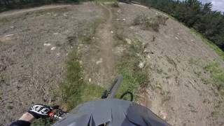
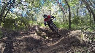
Photos of Ribeira Mountain Bike
Videos of Ribeira Mountain Bike
trail: El Tubo - Parte Alta
2:57 |
206 |
Jan 25, 2022 , Ribeira
trail: El Tubo - Parte Alta
0:55 |
161 |
Jan 25, 2022 , Ribeira
Recent Trail Reports
| status | trail | date | condition | info | user |
|---|---|---|---|---|---|
| Pedra da Ra a San Roque - Tramo Dos | Sep 2, 2022 @ 11:50am Sep 2, 2022 | Ideal | Greenlook700 | ||
| Pedra da Ra a San Roque - Tramo Uno | Sep 2, 2022 @ 11:50am Sep 2, 2022 | Ideal | Greenlook700 | ||
| Pedra da Ra aos Castros | Sep 2, 2022 @ 11:49am Sep 2, 2022 | Very Dry | Greenlook700 | ||
| A Curotiña | Apr 17, 2022 @ 1:01am Apr 17, 2022 | Variable | SAGOSoleto | ||
| Rego da Igrexa | Apr 10, 2022 @ 12:06am Apr 10, 2022 | Ideal | parajuanpf | ||
| A Teixoeira | Apr 10, 2022 @ 12:06am Apr 10, 2022 | Unknown | parajuanpf | ||
| Recovo Paralela | Apr 10, 2022 @ 12:06am Apr 10, 2022 | Unknown | parajuanpf | ||
| Frinsa - Hospital | Apr 10, 2022 @ 12:06am Apr 10, 2022 | Ideal | parajuanpf | ||
| La Curvas | Jan 20, 2022 @ 2:30pm Jan 20, 2022 | Ideal | marcossantamaria TFSPAIN | ||
| Hardline Hospi | Jan 20, 2022 @ 2:30pm Jan 20, 2022 | Ideal | marcossantamaria TFSPAIN |
Activity Feed
| username | action | type | title | date |
|---|---|---|---|---|
| juanx | update | trail | activity #83829847 and 1 more | Nov 8, 2025 @ 9:17pm Nov 8, 2025 |
| dontrideontheroads | vote | trail | activity #77581343 | Aug 7, 2025 @ 1:22am Aug 7, 2025 |
| dontrideontheroads | comment | trail | activity #77581337 | Aug 7, 2025 @ 1:22am Aug 7, 2025 |
| marcossantamaria | update | trail | activity #76207780 and 2 more | Jul 19, 2025 @ 12:32am Jul 19, 2025 |
| MuederJoe1972 | wishlist | region | activity #69196818 | Apr 7, 2025 @ 1:44pm Apr 7, 2025 |
Recent Comments
| username | type | title | comment | date |
|---|---|---|---|---|
| trail | Not for mountain bikes! No para bicicletas! | Aug 7, 2025 @ 1:22am Aug 7, 2025 | ||
| report | Just noticed that I posted this to RRTI... | May 5, 2023 @ 11:52am May 5, 2023 | ||
| report | "Definitely" chainsaw work, you say? ... | May 5, 2023 @ 11:16am May 5, 2023 | ||
| report | Ah yes, a "little" bridge hahahaha | May 5, 2022 @ 8:07pm May 5, 2022 | ||
| report | You rock Ben! | Apr 27, 2022 @ 10:21pm Apr 27, 2022 |
Local Badges
-

Epic Mountain Bike Climb 2k26 awarded -

Climbing 10k Badge6 awarded -

Mountain Biking 100k Badge1 awarded -

Epic Ride Descent 2k26 awarded -

Descent 10k Badge6 awarded -

Descent 100k Badge1 awarded
Bike & Skill Parks
| name | type | city | rating |
|---|---|---|---|
| Pumptrack Ribeira | skill park | Ribeira |
Activity Type Stats
| activitytype | trails | distance | descent | descent distance | total vertical | rating | global rank | state rank | photos | reports | routes | ridelogs |
|---|---|---|---|---|---|---|---|---|---|---|---|---|
| Mountain Bike | 122 | 111 miles | 19,396 ft | 54 miles | 2,100 ft | #2,264 | #189 | 57 | 98 | 2 | 1,639 | |
| E-Bike | 120 | 108 miles | 18,120 ft | 51 miles | 2,100 ft | #1,287 | #252 | 92 | 2 | 90 | ||
| Horse | 7 | 10 miles | 1,076 ft | 5 miles | 1,883 ft | #2,064 | #175 | 11 | ||||
| Hike | 124 | 112 miles | 19,462 ft | 54 miles | 2,100 ft | #1,997 | #196 | 89 | 1 | 45 | ||
| Trail Running | 123 | 111 miles | 19,439 ft | 54 miles | 2,100 ft | #1,547 | #191 | 89 | 1 | 7 | ||
| Dirtbike/Moto | 2 | 4,419 ft | 115 ft | 2,356 ft | 85 ft | 11 |
Frequently Asked Questions About Ribeira
▼
What are the best places to ride in Ribeira?
Ribeira has 3 areas to explore for mountain biking. The top rated areas are:
▼
What are the highest rated mountain biking trails in Ribeira?
The highest rated mountain biking trails in Ribeira are:
- La Curvas (4.1/5)
- Intro Hospital (4.1/5)
- La Roca (4.1/5)
- Hardline Hospi (4.1/5)
- Hospi ata Abaixo (4.1/5)
▼
Where can I park to ride in Ribeira?
▼
What is the longest trail in Ribeira?
The longest trail in Ribeira is Casota do Páramo 2 at 2.0 miles. View all trails sorted by distance.
Activities
Trails
Points of Interest
- Mirador da Curota Viewpoint
- Mirador Pedra da Ra Viewpoint
- Dolmen Arca do Barbanza Other
- Casota do Páramo Other
- Yacimiento Pedra da Xesta Other
- Fervenza de Cadarnoxo Other
- Monte Enxa Summit
- Iroite Summit
- Mirador do Iroite Viewpoint
- Alto da Torre (2,119 ft)
- Os Forcados (1,978 ft)
- Os Forcados (1,975 ft)
- ribeira activity log | embed map of Ribeira mountain bike trails | ribeira mountain biking points of interest polygons
Downloading of trail gps tracks in kml & gpx formats is enabled for Ribeira.
You must login to download files.