close
-
Layers w
- Weather Layers
- Pro
- Pro
- Pro
- Pro
- Pro
- Pro
- More Layers
- Pro
- Pro
- Pro
- Pro
-
Upgrade to

3D
Trail Conditions
- Unknown
- Snow Groomed
- Snow Packed
- Snow Covered
- Snow Cover Partial
- Freeze/thaw Cycle
- Icy
- Prevalent Mud
- Wet
- Variable
- Ideal
- Dry
- Very Dry
Trail Flow (Ridden Direction)
Trailforks scans users ridelogs to determine the most popular direction each trail is ridden. A good flowing trail network will have most trails flowing in a single direction according to their intension.
The colour categories are based on what percentage of riders are riding a trail in its intended direction.
The colour categories are based on what percentage of riders are riding a trail in its intended direction.
- > 96%
- > 90%
- > 80%
- > 70%
- > 50%
- < 50%
- bi-directional trail
- no data
Trail Last Ridden
Trailforks scans ridelogs to determine the last time a trail was ridden.
- < 2 days
- < 1 week
- < 2 weeks
- < 1 month
- < 6 months
- > 6 months
Trail Ridden Direction
The intended direction a trail should be ridden.
- Downhill Only
- Downhill Primary
- Both Directions
- Uphill Primary
- Uphill Only
- One Direction
Contribute Details
Colors indicate trail is missing specified detail.
- Description
- Photos
- Description & Photos
- Videos
Trail Popularity ?
Trailforks scans ridelogs to determine which trails are ridden the most in the last 9 months.
Trails are compared with nearby trails in the same city region with a possible 25 colour shades.
Think of this as a heatmap, more rides = more kinetic energy = warmer colors.
- most popular
- popular
- less popular
- not popular
ATV/ORV/OHV Filter
Max Vehicle Width
inches
US Cell Coverage
Legend

Radar Time
Activity Recordings
Trailforks uses anonymized public activity data.
?
Activity Recordings
Trailforks uses anonymized public activity data.
?
Personal Heatmap
▶
Activity Types
all
/
none
▶
Options
2
Date range
month
–
Winter Trails
Warning
A routing network for winter maps does not exist. Selecting trails using the winter trails layer has been disabled.
Missing Trails
Most Popular
Least Popular
Trails are colored based on popularity. The more popular a trail is, the more red. Less popular trails trend towards green.
Jump Magnitude Heatmap
Heatmap of where riders jump on trails. Zoom in to see individual jumps, click circles to view jump details.
BC Backroad Status
![map legend]()
Service Road Atlas is a free to use, community-driven service for viewing and creating reports on the numerous back-country service roads around B.C. and Alberta.

Slope Aspect
Direction the slope faces
Trails Deemphasized
Trails are shown in grey.
Only show trails with no bike usage.
Suggested Layers
Based on selected activity type
Save the current map location and zoom level as your default home location whenever this page is loaded.
Save
No description for Richmond has been added yet!
Login or register to submit one.
Activities Click to view
- Mountain Bike
35 trails
- E-Bike
23 trails
- Adaptive Bike
0 trails
- Winter Fat Bike
0 trails
- Hike
35 trails
- Trail Running
35 trails
Region Details
- 2
- 31
- 2
Region Status
Open as of Jan 4, 2026Local Trail Association
Stats
- Avg Trail Rating
- Trails (view details)
- 35
- Trails Mountain Bike
- 35
- Trails E-Bike
- 23
- Trails Hike
- 35
- Trails Trail Running
- 35
- Total Distance
- 34 miles
- Total Descent
- 280 ft
- Total Vertical
- 36 ft
- Highest Trailhead
- 37 ft
- Reports
- 127
- Photos
- 52
- Ridden Counter
- 11,424
Popular Richmond Mountain Biking Trails
• 100 ★ 0.0 • 3,173 ft • 15 ft • 1,378 •
Popular white difficulty paved path. This mountain bike primary trail can be used both directions. On average it takes 3 minutes to complete this trail.
• 100 ★ 5.0 • 4,587 ft • 8 ft • 901 •
Popular white difficulty mixed. This multi-use trail can be used both directions. On average it takes 4 minutes to complete this trail.
• 95 ★ 0.0 • 1,798 ft • 4 ft • 728 •
Popular white difficulty paved path. This multi-use trail can be used both directions. On average it takes 1 minutes to complete this trail.
• 95 ★ 0.0 • 2,487 ft • 11 ft • 591 •
Popular white difficulty family friendly paved path. This multi-use trail can be used both directions. On average it takes 1 minutes to complete this trail.
• 85 ★ 5.0 • 3 miles • 5 ft • 501 •
Popular white difficulty family friendly paved path. This mountain bike primary trail can be used both directions. On average it takes 11 minutes to complete this trail.
• 90 ★ 0.0 • 331 ft • 0 ft • 445 •
Popular white difficulty paved path. This mountain bike primary trail can be used both directions. On average it takes minutes to complete this trail.
• 70 ★ 0.0 • 1,365 ft • 0 ft • 381 •
Popular white difficulty gravel path. This mountain bike primary trail can be used both directions. On average it takes 3 minutes to complete this trail.
• 75 ★ 5.0 • 1 mile • 21 ft • 376 •
Popular white difficulty mixed. This multi-use trail can be used both directions. On average it takes 7 minutes to complete this trail.
Richmond Mountain Bike Routes
★ 3.0 • 45 miles • 810 ft • 2 • Point to Point •
1010101 1of12 BC - 01a Vancouver Intl Airport (YVR), BC to Mission, BC (Sun Valley Trout Park Inc) 74km
• 14 miles • 386 ft • 3 •
• 2 miles • 3 ft • 0 •
• 5 miles • 14 ft • 0 •
• 8 miles • 251 ft • 1 •
• 4 miles • 2 ft • 0 •
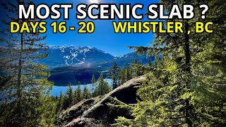
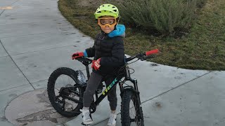
Videos of Richmond Mountain Bike
youtuber
![Bleeding Out Of What Hole ?!?]()
9:41 |
106 |
Apr 21, 2024

2:26 |
257 |
Jan 11, 2023
2:26 |
288 |
Jan 11, 2023

trail: Unknown Trail
0:27 |
114 |
Jul 4, 2022 , Richmond

trail: Russ Baker Trail
0:27 |
113 |
Jul 4, 2022 , Richmond

trail: South Dyke Trail
0:27 |
103 |
Jul 4, 2022 , Richmond

trail: South Dyke Trail
0:27 |
96 |
Jul 4, 2022 , Richmond

trail: Crestwood
0:27 |
106 |
Jul 4, 2022 , Richmond
Recent Trail Reports
| status | trail | date | condition | info | user |
|---|---|---|---|---|---|
| McConachie Connector | Aug 7, 2025 @ 2:28pm Aug 7, 2025 | Unknown | Dykmanchad101 | ||
| South Dyke Trail | Jul 1, 2025 @ 8:57am Jul 1, 2025 | Dry | Dawgprimo15 | ||
| South Dyke Trail | Jul 1, 2025 @ 8:57am Jul 1, 2025 | Dry | Dawgprimo15 | ||
| North Arm Bridge Bikeway | Apr 23, 2025 @ 11:01am Apr 23, 2025 | Dry | AndrewBW9bd7 | ||
| Annacis Channel West Bridge | Apr 12, 2025 @ 10:47am Apr 12, 2025 | Ideal | awhite76 | ||
| Middle Arm Trail | Jul 19, 2024 @ 1:43pm Jul 19, 2024 | Dry | Konstantin604 | ||
| South Dyke Trail | Jul 1, 2024 @ 9:23am Jul 1, 2024 | Dry | Dawgprimo15 | ||
| Corvette Path | Jul 1, 2024 @ 9:23am Jul 1, 2024 | Dry | Dawgprimo15 | ||
| Airport Gravel | Nov 4, 2023 @ 4:05am Nov 4, 2023 | Wet | Travis5578 NTB | ||
| Shell Road Trail | Aug 27, 2023 @ 1:55am Aug 27, 2023 | Dry | Konstantin604 |
Activity Feed
| username | action | type | title | date |
|---|---|---|---|---|
| angwagner | ridden | trail | activity #95220550 and 1 more | May 21, 2026 @ 8:28pm May 21, 2026 |
| comeonyebairns | ridden | trail | activity #91316584 | Mar 26, 2026 @ 6:10am Mar 26, 2026 |
| Mark6rdZbW | ridden | trail | activity #90309135 and 1 more | Mar 9, 2026 @ 11:04pm Mar 9, 2026 |
| Mark6rdZbW | wishlist | trail | activity #90066873 | Mar 6, 2026 @ 8:55am Mar 6, 2026 |
| mario9000 | ridden | skillpark | activity #79961485 | Sep 8, 2025 @ 9:55pm Sep 8, 2025 |
Recent Comments
| username | type | title | comment | date |
|---|---|---|---|---|
| trail | Nice | Feb 19, 2022 @ 9:57pm Feb 19, 2022 | ||
| report | Yup | Sep 26, 2021 @ 11:02am Sep 26, 2021 | ||
| skillpark | Skated this a dozen years ago, or so. Good... | Jul 18, 2020 @ 12:18pm Jul 18, 2020 | ||
| trail | Watch for cracks in the trail...2'across and... | Jul 6, 2019 @ 12:31pm Jul 6, 2019 | ||
| skillpark | They would only rebuild the park in May every... | Apr 4, 2018 @ 10:44pm Apr 4, 2018 |
Local Badges
-

Epic Mountain Bike Climb 2k0 awarded -

Climbing 10k Badge13 awarded -

Mountain Biking 100k Badge0 awarded -

Epic Ride Descent 2k0 awarded -

Descent 10k Badge13 awarded -

Descent 100k Badge0 awarded
Bike & Skill Parks
| name | type | city | rating |
|---|---|---|---|
| Richmond Bike Park | skill park | Richmond | |
| River Road Skatepark | skill park | Richmond | |
| Railway Granville Bike Park | skill park | Richmond |
Local Mountain Biking Directory
-
Krusty's Bicycles/ Cap's RichmondBike Shop
![Krusty's Bicycles/ Cap's Richmond]()
-
Village BikesBike Shop
Activity Type Stats
| activitytype | trails | distance | descent | descent distance | total vertical | rating | global rank | state rank | photos | reports | routes | ridelogs |
|---|---|---|---|---|---|---|---|---|---|---|---|---|
| Mountain Bike | 35 | 34 miles | 279 ft | 8 miles | 36 ft | #1,905 | #69 | 51 | 127 | 1 | 18,231 | |
| E-Bike | 23 | 28 miles | 230 ft | 7 miles | 30 ft | #3,507 | #84 | 126 | 3 | 784 | ||
| Hike | 35 | 34 miles | 279 ft | 8 miles | 36 ft | #5,101 | #122 | 127 | 155 | |||
| Trail Running | 35 | 34 miles | 279 ft | 8 miles | 36 ft | #4,151 | #102 | 127 | 1,741 |
Frequently Asked Questions About Richmond
▼
What are the highest rated mountain biking trails in Richmond?
The highest rated mountain biking trails in Richmond are:
- South Dyke Trail (4.1/5)
- South Dyke Trail (4.1/5)
- Railway Avenue Greenway (4.1/5)
- North Arm Bridge Bikeway (0/5)
- River Drive (0/5)
▼
What is the best time of the year to ride in Richmond?
Based on ride log data, the most popular months to ride in Richmond are:
- June (87 activities)
- April (73 activities)
- July (71 activities)
▼
Where can I park to ride in Richmond?
▼
What is the longest trail in Richmond?
The longest trail in Richmond is Westminster Highway at 3.3 miles. View all trails sorted by distance.
Activities
- By carolyn88 & contributors
- Admins: apply
- #5212 - 7,881 views
- richmond activity log | embed map of Richmond mountain bike trails | richmond mountain biking points of interest
Downloading of trail gps tracks in kml & gpx formats is enabled for Richmond.
You must login to download files.