close
-
Layers w
- Weather Layers
- Pro
- Pro
- Pro
- Pro
- Pro
- Pro
- More Layers
- Pro
- Pro
- Pro
- Pro
-
Upgrade to

3D
Trail Conditions
- Unknown
- Snow Groomed
- Snow Packed
- Snow Covered
- Snow Cover Partial
- Freeze/thaw Cycle
- Icy
- Prevalent Mud
- Wet
- Variable
- Ideal
- Dry
- Very Dry
Trail Flow (Ridden Direction)
Trailforks scans users ridelogs to determine the most popular direction each trail is ridden. A good flowing trail network will have most trails flowing in a single direction according to their intension.
The colour categories are based on what percentage of riders are riding a trail in its intended direction.
The colour categories are based on what percentage of riders are riding a trail in its intended direction.
- > 96%
- > 90%
- > 80%
- > 70%
- > 50%
- < 50%
- bi-directional trail
- no data
Trail Last Ridden
Trailforks scans ridelogs to determine the last time a trail was ridden.
- < 2 days
- < 1 week
- < 2 weeks
- < 1 month
- < 6 months
- > 6 months
Trail Ridden Direction
The intended direction a trail should be ridden.
- Downhill Only
- Downhill Primary
- Both Directions
- Uphill Primary
- Uphill Only
- One Direction
Contribute Details
Colors indicate trail is missing specified detail.
- Description
- Photos
- Description & Photos
- Videos
Trail Popularity ?
Trailforks scans ridelogs to determine which trails are ridden the most in the last 9 months.
Trails are compared with nearby trails in the same city region with a possible 25 colour shades.
Think of this as a heatmap, more rides = more kinetic energy = warmer colors.
- most popular
- popular
- less popular
- not popular
ATV/ORV/OHV Filter
Max Vehicle Width
inches
US Cell Coverage
Legend

Radar Time
Activity Recordings
Trailforks uses anonymized public activity data.
?
Activity Recordings
Trailforks uses anonymized public activity data.
?
Personal Heatmap
▶
Activity Types
all
/
none
▶
Options
2
Date range
month
–
Winter Trails
Warning
A routing network for winter maps does not exist. Selecting trails using the winter trails layer has been disabled.
Missing Trails
Most Popular
Least Popular
Trails are colored based on popularity. The more popular a trail is, the more red. Less popular trails trend towards green.
Jump Magnitude Heatmap
Heatmap of where riders jump on trails. Zoom in to see individual jumps, click circles to view jump details.
BC Backroad Status
![map legend]()
Service Road Atlas is a free to use, community-driven service for viewing and creating reports on the numerous back-country service roads around B.C. and Alberta.

Slope Aspect
Direction the slope faces
Trails Deemphasized
Trails are shown in grey.
Only show trails with no bike usage.
Suggested Layers
Based on selected activity type
Save the current map location and zoom level as your default home location whenever this page is loaded.
SaveThe area around Rico, Colorado features some of Colorado's best high elevation riding, including the famous Colorado Trail Blackhawk Pass section and the Calico trail. There are many long-distance epics that can be connected from the town of Rico.
Activities Click to view
- Mountain Bike
49 trails
- E-Bike
26 trails
- Gravel Bike
1 trails
- Adaptive Bike
0 trails
- Horse
26 trails
- Hike
53 trails
- Trail Running
52 trails
- Dirtbike/Moto
26 trails
- ATV/ORV/OHV
6 trails
Region Details
- 10
- 3
- 8
- 25
- 1
Region Status
Caution as of 1 dayStats
- Avg Trail Rating
- Trails (view details)
- 50
- Trails Mountain Bike
- 49
- Trails E-Bike
- 26
- Trails Gravel Bike
- 1
- Trails Horse
- 26
- Trails Hike
- 53
- Trails Trail Running
- 52
- Trails Dirtbike/Moto
- 26
- Trails ATV/ORV/OHV
- 6
- Trails Snowshoe
- 2
- Trails Backcountry Ski
- 2
- Total Distance
- 216 miles
- Total Descent
- 44,630 ft
- Total Vertical
- 5,036 ft
- Highest Trailhead
- 12,594 ft
- Reports
- 333
- Photos
- 136
- Ridden Counter
- 3,789
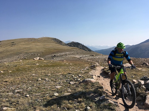
Popular Rico Mountain Biking Trails
• 100 ★ 4.6 • 9 miles • 1,013 ft • 503 •
Highly rated popular black diamond difficulty singletrack. This multi-use trail can be used both directions. On average it takes 2 hours minutes to complete this trail.
• 95 ★ 4.6 • 5 miles • 85 ft • 335 •
Sweet narrow single track that seemly goes on and on. Normally done as a loop. Rico trail alliance has pimped out this trail in the last few years making it a blast to ride and keeping it sustainable.
• 95 ★ 4.2 • 4 miles • 663 ft • 301 •
Popular black diamond difficulty singletrack. This multi-use trail can be used both directions. On average it takes 59 minutes to complete this trail.
• 85 ★ 2.8 • 6 miles • 1,051 ft • 225 •
Great singletrack between Cross Mountain (Lizard Head) and Dunton Meadows. Groundhog follows along the Lizardhead Wilderness boundary but is non-motorized multi-use. This is one of the few rolling and not very steep trails in the area....
• 70 ★ 4.4 • 6 miles • 2,185 ft • 83 •
High alpine ridgeline trail. Narrow multi-use singletrack with numerous punishing climbs and exposure. Beautiful views of the Sneffels range. Can be connected to the lower portion of the for the complete ride, or looped with East or...
• 50 ★ 3.0 • 11 miles • 2,822 ft • 65 •
Moderately popular black diamond difficulty singletrack. This mountain bike primary trail can be used downhill primary. On average it takes 43 minutes to complete this trail.
• 25 ★ 2.7 • 8 miles • 177 ft • 49 • • moto
Primarily used by dirt bikers. Very steep, slippery, and blown out in places.
Rico Mountain Bike Routes
15 miles • 2,835 ft • 2 • Loop •
A tough climb with a big downhill with CT in between
137 miles • 21,505 ft • 9 •
Rico - Ophir - Silverton - CT - Taylor Creek Rd - Burnett Creek
25 miles • 3,868 ft • 5 •
Lizard Head Pass to via Groundhog Stock Driveway, Upper Calico, and Lower Calico
8 miles • 2,525 ft • 0 • Point to Point •
Alternate Upper Section of Calico National Recreation Trail. This is the original "Highline Stock...
5 miles • 85 ft • 0 • Point to Point •
A must-ride of the Rico area, this trail offers five miles of steep, super- fast descending. While there...
★ 1.0 • 22 miles • 3,360 ft • 0 • Point to Point •
Ride up Rhyman, take CT, down Corral draw to Hermosa
Photos of Rico Mountain Bike
Videos of Rico Mountain Bike

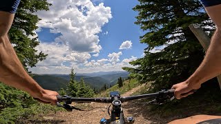
trail: CT - Blackhawk Pass
0:56 |
43 |
Jul 26, 2022
trail: Stoner Mesa
0:00 |
110 |
Dec 1, 2020
trail: CT - Blackhawk Pass
30:55 |
148 |
Jun 25, 2024 , Rico
youtuber
![Black Hawk Pass & Stagecoach (Durango, CO)...]()

trail: CT - Blackhawk Pass
35:28 |
557 |
Oct 14, 2022 , Rico
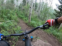
trail: Wildcat
25:14 |
304 |
Aug 13, 2022 , Rico
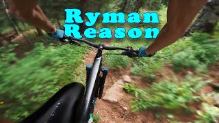
trail: Ryman Creek
17:26 |
353 |
Aug 4, 2022 , Rico
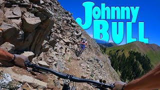
trail: Johnny Bull
2:10 |
317 |
Jul 5, 2022 , Rico
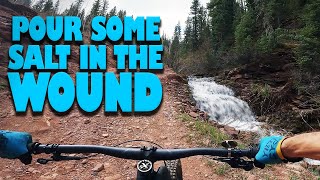
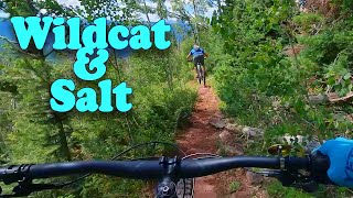
trail: Salt Creek
22:03 |
366 |
Jun 1, 2022 , Rico
Current Trail Warnings
| status | trail | date | condition | user | info |
|---|---|---|---|---|---|
| Salt Creek Trailhead Access | Jun 6, 2026 @ 8:21am (Pacific/Midway) Jun 6, 2026 | Dry | Shawnsrides | Few large potholes in the road up to... | |
| Winter creek trail | May 25, 2026 @ 7:01am (America/Denver) May 25, 2026 | Variable | TaylorRoberts | E-Bike 30 downed trees on the trail, needs major... |
Recent Trail Reports
| status | trail | date | condition | info | user |
|---|---|---|---|---|---|
| East Twin Spring | Jun 18, 2026 @ 4:28pm (America/Denver) 1 day | Dry | adrenalated | ||
| West Twin Spring | Jun 18, 2026 @ 4:26pm (America/Denver) 1 day | Very Dry | adrenalated | ||
| Stoner Creek (upper) | Jun 18, 2026 @ 4:25pm (America/Denver) 1 day | Dry | adrenalated | ||
| CT - Blackhawk Pass | Jun 17, 2026 @ 11:31pm (America/Denver) 2 days | Ideal | connormcdee93 | ||
| Johnny Bull | Jun 15, 2026 @ 10:50pm (America/Denver) Jun 15, 2026 | Dry | maleficmanatee | ||
| Eagle Peak | Jun 15, 2026 @ 10:45pm (America/Denver) Jun 15, 2026 | Dry | maleficmanatee | ||
| Salt Creek | Jun 13, 2026 @ 8:23am (America/Denver) Jun 13, 2026 | Dry | gregwenk | ||
| Scotch Creek | Jun 13, 2026 @ 8:23am (America/Denver) Jun 13, 2026 | Dry | gregwenk | ||
| Upper Calico Trail | Jun 11, 2026 @ 10:13pm (America/Denver) Jun 11, 2026 | Dry | adrenalated | ||
| Groundhog Stock Trail | Jun 9, 2026 @ 8:49pm (America/Denver) Jun 9, 2026 | Ideal | maleficmanatee |
National Scenic Trails & Official Routes
-
Colorado Trail (Bike)
- Mountain Bike
Activity Feed
| username | action | type | title | date |
|---|---|---|---|---|
| adrenalated | add | report | activity #97279148 and 2 more | Jun 18, 2026 @ 3:26pm 1 day |
| adrenalated | vote | trail | activity #97273965 and 4 more | Jun 18, 2026 @ 1:42pm 1 day |
| adrenalated | add | trail | activity #97273702 and 2 more | Jun 18, 2026 @ 1:37pm 1 day |
| adrenalated | vote | trail | activity #97250930 and 1 more | Jun 18, 2026 @ 7:32am 2 days |
| adrenalated | comment | trail | activity #97250911 | Jun 18, 2026 @ 7:32am 2 days |
Recent Comments
| username | type | title | comment | date |
|---|---|---|---|---|
| trail | There's no double black features on this... | Jun 18, 2026 @ 7:32am 2 days | ||
| report | Confirming that small snow drifts persist... | Jun 15, 2026 @ 9:31pm Jun 15, 2026 | ||
| trail | World class trail, but you'll have to earn it!... | Jun 12, 2026 @ 9:09am Jun 12, 2026 | ||
| trail | Chill little trail, most of the trail is built... | Jun 7, 2026 @ 5:26pm Jun 7, 2026 | ||
| report | Someone got to that tree quickly, thanks! All... | May 16, 2026 @ 3:57pm May 16, 2026 |
Local Badges
-

10 Black Trails11 awarded -

Epic Ride Climb 2k74 awarded -

Climbing 10k Badge22 awarded -

Climbing 100k Badge1 awarded -

Epic Ride Descent 2k121 awarded -

Descent 10k Badge29 awarded
Activity Type Stats
| activitytype | trails | distance | descent | descent distance | total vertical | rating | global rank | state rank | photos | reports | routes | ridelogs |
|---|---|---|---|---|---|---|---|---|---|---|---|---|
| Mountain Bike | 49 | 209 miles | 43,819 ft | 100 miles | 4,528 ft | #1,388 | #526 | 129 | 333 | 6 | 2,929 | |
| E-Bike | 26 | 111 miles | 21,001 ft | 52 miles | 4,528 ft | #1,736 | #893 | 210 | 159 | |||
| Gravel Bike | 1 | #2,294 | #672 | 3 | 3 | |||||||
| Horse | 26 | 86 miles | 15,735 ft | 42 miles | 4,948 ft | #748 | #568 | 99 | 2 | |||
| Hike | 53 | 210 miles | 41,549 ft | 97 miles | 5,036 ft | #1,122 | #517 | 4 | 324 | 4 | 820 | |
| Trail Running | 52 | 207 miles | 41,063 ft | 95 miles | 5,036 ft | #880 | #334 | 316 | 4 | 70 | ||
| Dirtbike/Moto | 26 | 110 miles | 22,454 ft | 54 miles | 4,528 ft | #332 | #147 | 3 | 116 | 33 | ||
| ATV/ORV/OHV | 6 | 39 miles | 3,599 ft | 14 miles | 2,900 ft | #547 | #200 | 46 | 3 | |||
| Snowshoe | 2 | 8 miles | 3,835 ft | 7 miles | 3,071 ft | 12 | 31 | |||||
| Backcountry Ski | 2 | 8 miles | 3,835 ft | 7 miles | 3,071 ft | 12 | 352 |
Frequently Asked Questions About Rico
▼
What are the highest rated mountain biking trails in Rico?
The highest rated mountain biking trails in Rico are:
- Salt Creek (4.4/5)
- Johnny Bull (4.3/5)
- CT - Blackhawk Pass (4.3/5)
- Circle Trail (4.1/5)
- Winter creek trail (4.1/5)
▼
What is the best time of the year to ride in Rico?
Based on ride log data, the most popular months to ride in Rico are:
- July (68 activities)
- August (51 activities)
- June (45 activities)
▼
Where can I park to ride in Rico?
There are 6 parking locations listed in Rico. The most popular parking spots are: View all parking and trailhead locations on the map to plan your visit.
▼
What is the longest trail in Rico?
The longest trail in Rico is Bear Creek (La Plata) at 13.7 miles. View all trails sorted by distance.
Activities
Trails
- By jasbushey
 Durango & contributors
 - Admins: RTA, SJMA
- #15511 - 12,040 views
- rico activity log | embed map of Rico mountain bike trails | rico mountain biking points of interest
Downloading of trail gps tracks in kml & gpx formats is enabled for Rico.
You must login to download files.