close
-
Layers w
- Weather Layers
- Pro
- Pro
- Pro
- Pro
- Pro
- Pro
- More Layers
- Pro
- Pro
- Pro
- Pro
-
Upgrade to

3D
Trail Conditions
- Unknown
- Snow Groomed
- Snow Packed
- Snow Covered
- Snow Cover Partial
- Freeze/thaw Cycle
- Icy
- Prevalent Mud
- Wet
- Variable
- Ideal
- Dry
- Very Dry
Trail Flow (Ridden Direction)
Trailforks scans users ridelogs to determine the most popular direction each trail is ridden. A good flowing trail network will have most trails flowing in a single direction according to their intension.
The colour categories are based on what percentage of riders are riding a trail in its intended direction.
The colour categories are based on what percentage of riders are riding a trail in its intended direction.
- > 96%
- > 90%
- > 80%
- > 70%
- > 50%
- < 50%
- bi-directional trail
- no data
Trail Last Ridden
Trailforks scans ridelogs to determine the last time a trail was ridden.
- < 2 days
- < 1 week
- < 2 weeks
- < 1 month
- < 6 months
- > 6 months
Trail Ridden Direction
The intended direction a trail should be ridden.
- Downhill Only
- Downhill Primary
- Both Directions
- Uphill Primary
- Uphill Only
- One Direction
Contribute Details
Colors indicate trail is missing specified detail.
- Description
- Photos
- Description & Photos
- Videos
Trail Popularity ?
Trailforks scans ridelogs to determine which trails are ridden the most in the last 9 months.
Trails are compared with nearby trails in the same city region with a possible 25 colour shades.
Think of this as a heatmap, more rides = more kinetic energy = warmer colors.
- most popular
- popular
- less popular
- not popular
ATV/ORV/OHV Filter
Max Vehicle Width
inches
US Cell Coverage
Legend

Radar Time
Activity Recordings
Trailforks uses anonymized public activity data.
?
Activity Recordings
Trailforks uses anonymized public activity data.
?
Personal Heatmap
▶
Activity Types
all
/
none
▶
Options
2
Date range
month
–
Winter Trails
Warning
A routing network for winter maps does not exist. Selecting trails using the winter trails layer has been disabled.
Missing Trails
Most Popular
Least Popular
Trails are colored based on popularity. The more popular a trail is, the more red. Less popular trails trend towards green.
Jump Magnitude Heatmap
Heatmap of where riders jump on trails. Zoom in to see individual jumps, click circles to view jump details.
BC Backroad Status
![map legend]()
Service Road Atlas is a free to use, community-driven service for viewing and creating reports on the numerous back-country service roads around B.C. and Alberta.

Slope Aspect
Direction the slope faces
Trails Deemphasized
Trails are shown in grey.
Only show trails with no bike usage.
Suggested Layers
Based on selected activity type
Save the current map location and zoom level as your default home location whenever this page is loaded.
SaveThis region is Unsanctioned, Ride at your own Risk!
No description for Ridge Runner has been added yet! Login or register to submit one.Primary Trail Type: Cross-Country
Land Status: Private Property
 google parking directions
 Activities Click to view
- Mountain Bike
113 trails
- E-Bike
68 trails
- Hike
111 trails
- Trail Running
108 trails
- Dirtbike/Moto
12 trails
- ATV/ORV/OHV
15 trails
Region Details
- 23
- 11
- 76
- 3
Region Status
Open as of Jun 14, 2026Stats
- Avg Trail Rating
- Trails (view details)
- 115
- Trails Mountain Bike
- 115
- Trails E-Bike
- 68
- Trails Hike
- 111
- Trails Trail Running
- 108
- Trails Dirtbike/Moto
- 12
- Trails ATV/ORV/OHV
- 15
- Total Distance
- 59 miles
- Total Descent
- 6,419 ft
- Total Vertical
- 1,023 ft
- Highest Trailhead
- 1,376 ft
- Reports
- 4,683
- Photos
- 557
- Ridden Counter
- 35,925
Popular Ridge Runner Mountain Biking Trails
• 95 ★ 4.6 • 2,280 ft • 34 ft • 964 •
A fun cross country trail with some potential muddy spots, travelling through slag piles and some bedrock with a few nice ridges views. A couple of technical alternatives along the way.
• 95 ★ 4.0 • 787 ft • 16 ft • 820 •
A short easy trail used as a road bypass to the upper ridges trails. Its short and sweet!
• 90 ★ 4.0 • 4,488 ft • 122 ft • 730 •
Highly rated popular blue difficulty singletrack. This mountain bike primary trail can be used both directions and has a moderate overall physical rating with a 122 ft blue climb. On average it takes 9 minutes to complete this trail.
• 85 ★ 3.8 • 1,476 ft • 6 ft • 687 •
Mostly a climbing option to the power line road. The trail winds through the edge of the power line with some gravel road. A mostly single track option to get from the lower parking area up into the main trails of "ridge runner" area....
• 90 ★ 4.2 • 2,198 ft • 90 ft • 645 •
An easy trail that gets you up to one of the higher ridges in the area and to a newer network of trails heading out in the direction of Whiskey lake.
• 85 ★ 4.0 • 912 ft • 0 ft • 617 •
Connects end of by the Beaver Pond to Riparian. All quite reasonable. Going S to N there is an "around" for a steep rock face.
• 70 ★ 4.2 • 1 mile • 50 ft • 609 •
Highly rated popular blue difficulty singletrack. This mountain bike primary trail and has a moderate overall physical rating with a 50 ft blue climb. On average it takes 11 minutes to complete this trail.
Ridge Runner Mountain Bike Routes
Ridge Runner Tour Featured
16 miles • 1,737 ft • 68 • Loop •
★ 5.0 • 10 miles • 1,197 ft • 22 • Loop •
A route that combines a good mix of climbing and downhill covering the Runner and lower South Benson trails.
★ 5.0 • 10 miles • 964 ft • 43 • Loop •
Best to do this loop in a clockwise direction - although it is a lot of UP. 16 kms. Probably take 2.5 - 3...
★ 5.0 • 8 miles • 855 ft • 49 • Loop •
Route can be done both directions but better to do it clockwise. About 14 kms. Takes about 2 hours. A...
6 miles • 537 ft • 11 • Loop •
A good, relatively easy X-C route. Little less than 10 km. Would take 1.5 hours with some stops. Many good...
16 miles • 1,618 ft • 4 • Point to Point •
This route hits many of the Ridge Runner and then Abyss Highlights covering most of the new trails in the...
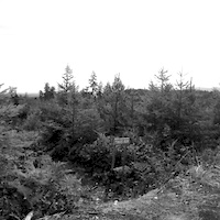
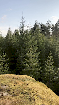
Photos of Ridge Runner Mountain Bike
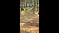
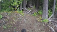
Videos of Ridge Runner Mountain Bike
trail: Tina's Run
3:55 |
40 |
Aug 29, 2020
trail: Cardiac Fail
0:05 |
368 |
May 8, 2020
trail: RimRunner
0:20 |
60 |
Apr 24, 2020

trail: Alternative Facts
0:10 |
71 |
Mar 23, 2020

trail: Rose
3:36 |
5030 |
Sep 20, 2018

trail: Oz
3:37 |
1255 |
Jan 3, 2017
trail: Black Jade
3:21 |
236 |
Nov 13, 2016
trail: The Great White
3:26 |
198 |
Nov 13, 2016
Recent Trail Reports
| status | trail | date | condition | info | user |
|---|---|---|---|---|---|
| NIghtmare | Jun 14, 2026 @ 9:44am (America/Vancouver) Jun 14, 2026 | Ideal | larrinski | ||
| Tangerine Dream | Jun 14, 2026 @ 9:44am (America/Vancouver) Jun 14, 2026 | Dry | larrinski | ||
| Black Hole | Jun 14, 2026 @ 9:44am (America/Vancouver) Jun 14, 2026 | Dry | larrinski | ||
| Rose Garden pt 1 | Jun 14, 2026 @ 9:44am (America/Vancouver) Jun 14, 2026 | Dry | larrinski | ||
| Rose Garden pt 2 | Jun 14, 2026 @ 9:44am (America/Vancouver) Jun 14, 2026 | Dry | larrinski | ||
| Off the Rails | Jun 14, 2026 @ 9:44am (America/Vancouver) Jun 14, 2026 | Dry | larrinski | ||
| Black Keys | Jun 14, 2026 @ 9:44am (America/Vancouver) Jun 14, 2026 | Dry | larrinski | ||
| The Slab | Jun 8, 2026 @ 11:29am (America/Vancouver) Jun 8, 2026 | Dry | agnostic NMBC | ||
| Fireball | Jun 1, 2026 @ 9:57am (America/Vancouver) Jun 1, 2026 | Dry | scottylitts6071 | ||
| No Bad Days | May 10, 2026 @ 3:55pm (America/Vancouver) May 10, 2026 | Dry | dmitrim |
Activity Feed
| username | action | type | title | date |
|---|---|---|---|---|
| T3j49fUK | wishlist | region | activity #97022199 | Jun 14, 2026 @ 9:20pm Jun 14, 2026 |
| larrinski | add | report | activity #97007691 and 6 more | Jun 14, 2026 @ 3:08pm Jun 14, 2026 |
| czandee | add | photo | activity #96769435 and 2 more | Jun 11, 2026 @ 4:49pm Jun 11, 2026 |
| PaulSeaD | wishlist | route | activity #96756496 | Jun 11, 2026 @ 12:48pm Jun 11, 2026 |
| SeaPaul | wishlist | route | activity #96752374 | Jun 11, 2026 @ 11:43am Jun 11, 2026 |
Recent Comments
| username | type | title | comment | date |
|---|---|---|---|---|
| report | Were you trying to spell Owl? | May 22, 2026 @ 10:56am May 22, 2026 | ||
| report | Ooo w | May 22, 2026 @ 10:29am May 22, 2026 | ||
| report | L | May 22, 2026 @ 10:25am May 22, 2026 | ||
| report | D Yeahx by red E Dxs Cut | May 11, 2026 @ 12:06pm May 11, 2026 | ||
| trail | March 26/26. Tree across trail post heavy winds. | Mar 26, 2026 @ 8:24pm Mar 26, 2026 |
Nearby Areas
| name | distance | ||||
|---|---|---|---|---|---|
| The Abyss / Extension Ridge | 6 | 59 | 3 | 1.6 km | |
| South Benson / Wolf Mountain | 2 | 8 | 30 | 8 | 2.3 km |
| Spruston Road Recreation Site | 1 | 3 | 2.7 km | ||
| Water District Lands | 4 | 13 | 2.8 km | ||
| South Wellington | 10 | 25 | 11 | 3.1 km |
Local Badges
-

Completionist18 awarded
Local Trail Supporters
- Jacques Brassard
![]()
- Bud
- AP Construction
Activity Type Stats
| activitytype | trails | distance | descent | descent distance | total vertical | rating | global rank | state rank | photos | reports | routes | ridelogs |
|---|---|---|---|---|---|---|---|---|---|---|---|---|
| Mountain Bike | 113 | 58 miles | 6,404 ft | 21 miles | 1,024 ft | #301 | #41 | 570 | 4,671 | 14 | 14,098 | |
| E-Bike | 68 | 33 miles | 3,366 ft | 12 miles | 1,024 ft | #2,405 | #81 | 2 | 4,327 | 10 | 903 | |
| Hike | 111 | 57 miles | 6,050 ft | 20 miles | 1,024 ft | #2,936 | #129 | 8 | 4,614 | 3 | 574 | |
| Trail Running | 108 | 56 miles | 6,004 ft | 20 miles | 1,024 ft | #2,257 | #67 | 5 | 4,614 | 3 | 471 | |
| Dirtbike/Moto | 12 | 9 miles | 860 ft | 4 miles | 525 ft | #461 | #47 | 1 | 888 | 68 | ||
| ATV/ORV/OHV | 15 | 12 miles | 1,115 ft | 4 miles | 525 ft | #289 | #22 | 6 | 889 | 15 |
Frequently Asked Questions About Ridge Runner
▼
What are the highest rated mountain biking trails in Ridge Runner?
The highest rated mountain biking trails in Ridge Runner are:
- Timberline (4.4/5)
- RimRunner (4.3/5)
- Wonderwall (4.3/5)
- Black Hole (4.3/5)
- Wonderwall Ridge (4.3/5)
▼
What is the best time of the year to ride in Ridge Runner?
Based on ride log data, the most popular months to ride in Ridge Runner are:
- May (317 activities)
- October (255 activities)
- April (251 activities)
▼
Where can I park to ride in Ridge Runner?
There are 2 parking locations listed in Ridge Runner. The most popular parking spots are:
▼
What is the longest trail in Ridge Runner?
The longest trail in Ridge Runner is Bushwacker at 1.1 miles. View all trails sorted by distance.
Activities
Trails
Points of Interest
- By trailcandy
 & contributors
 - Admins: NMBC, CPP, Jbrassard98
- #10731 - 26,902 views
- ridge runner activity log | embed map of Ridge Runner mountain bike trails | ridge runner mountain biking points of interest
Downloading of trail gps tracks in kml & gpx formats is enabled for Ridge Runner.
You must login to download files.