close
-
Layers w
- Weather Layers
- Pro
- Pro
- Pro
- Pro
- Pro
- Pro
- More Layers
- Pro
- Pro
- Pro
- Pro
-
Upgrade to

3D
Trail Conditions
- Unknown
- Snow Groomed
- Snow Packed
- Snow Covered
- Snow Cover Partial
- Freeze/thaw Cycle
- Icy
- Prevalent Mud
- Wet
- Variable
- Ideal
- Dry
- Very Dry
Trail Flow (Ridden Direction)
Trailforks scans users ridelogs to determine the most popular direction each trail is ridden. A good flowing trail network will have most trails flowing in a single direction according to their intension.
The colour categories are based on what percentage of riders are riding a trail in its intended direction.
The colour categories are based on what percentage of riders are riding a trail in its intended direction.
- > 96%
- > 90%
- > 80%
- > 70%
- > 50%
- < 50%
- bi-directional trail
- no data
Trail Last Ridden
Trailforks scans ridelogs to determine the last time a trail was ridden.
- < 2 days
- < 1 week
- < 2 weeks
- < 1 month
- < 6 months
- > 6 months
Trail Ridden Direction
The intended direction a trail should be ridden.
- Downhill Only
- Downhill Primary
- Both Directions
- Uphill Primary
- Uphill Only
- One Direction
Contribute Details
Colors indicate trail is missing specified detail.
- Description
- Photos
- Description & Photos
- Videos
Trail Popularity ?
Trailforks scans ridelogs to determine which trails are ridden the most in the last 9 months.
Trails are compared with nearby trails in the same city region with a possible 25 colour shades.
Think of this as a heatmap, more rides = more kinetic energy = warmer colors.
- most popular
- popular
- less popular
- not popular
ATV/ORV/OHV Filter
Max Vehicle Width
inches
US Cell Coverage
Legend

Radar Time
Activity Recordings
Trailforks uses anonymized public activity data.
?
Activity Recordings
Trailforks uses anonymized public activity data.
?
Personal Heatmap
▶
Activity Types
all
/
none
▶
Options
2
Date range
month
–
Winter Trails
Warning
A routing network for winter maps does not exist. Selecting trails using the winter trails layer has been disabled.
Missing Trails
Most Popular
Least Popular
Trails are colored based on popularity. The more popular a trail is, the more red. Less popular trails trend towards green.
Jump Magnitude Heatmap
Heatmap of where riders jump on trails. Zoom in to see individual jumps, click circles to view jump details.
BC Backroad Status
![map legend]()
Service Road Atlas is a free to use, community-driven service for viewing and creating reports on the numerous back-country service roads around B.C. and Alberta.

Slope Aspect
Direction the slope faces
Trails Deemphasized
Trails are shown in grey.
Only show trails with no bike usage.
Suggested Layers
Based on selected activity type
Save the current map location and zoom level as your default home location whenever this page is loaded.
Save
No description for Ridgefield has been added yet!
Login or register to submit one.
Activities Click to view
- Mountain Bike
91 trails
- Gravel Bike
0 trails
- Adaptive Bike
0 trails
- Hike
94 trails
- Trail Running
94 trails
Region Details
- 4
- 19
- 44
- 17
- 3
Region Status
Open as of Apr 18, 2026Stats
- Avg Trail Rating
- Trails (view details)
- 91
- Trails Mountain Bike
- 91
- Trails Horse
- 1
- Trails Hike
- 94
- Trails Trail Running
- 94
- Trails Snowshoe
- 1
- Total Distance
- 38 miles
- Total Descent
- 5,834 ft
- Total Vertical
- 487 ft
- Highest Trailhead
- 993 ft
- Reports
- 229
- Photos
- 40
- Ridden Counter
- 10,792
Sub Regions
-
Bennetts Pond / Hemlock Hills
- 16
- 33
- 12
-
Seth Low Pierrepont State Park and Lebowitz-Knapp Open Space
- 11
- 5
- 3
-
West Mountain Refuge
- 3
Popular Ridgefield Mountain Biking Trails
• 100 ★ 0.0 • 561 ft • 43 ft • 273 •
Popular blue difficulty singletrack. This multi-use trail can be used both directions. On average it takes 1 minutes to complete this trail.
• 95 ★ 0.0 • 545 ft • 47 ft • 231 •
Popular blue difficulty singletrack. This multi-use trail can be used both directions. On average it takes 1 minutes to complete this trail.
• 95 ★ 0.0 • 522 ft • 73 ft • 227 •
Popular black diamond difficulty singletrack. This multi-use trail can be used both directions. On average it takes 2 minutes to complete this trail.
• 95 ★ 0.0 • 1,614 ft • 27 ft • 224 •
Popular blue difficulty singletrack. This multi-use trail can be used both directions. On average it takes 4 minutes to complete this trail.
• 85 ★ 4.0 • 3,310 ft • 304 ft • 219 •
Primarily a mountain biking trail, designed & built as the MTB approach to Pine Mountain from the west side. Not recommended for hiking; The nearby is designated for hiking only and is a much more direct route for hikers.
• 80 ★ 5.0 • 3,642 ft • 89 ft • 216 •
RECOMMENDED ONE-WAY, SOUTH TO NORTH, starting at Blue/ intersection. This is a very challenging, masterfully-built technical singletrack trail that has some "B-line" (optional less challenging go-around sections) along the way, mostly...
• 80 ★ 0.0 • 3,209 ft • 37 ft • 210 •
Popular green difficulty singletrack. This multi-use trail can be used both directions. On average it takes 2 minutes to complete this trail.
• 100 ★ 0.0 • 781 ft • 0 ft • 207 •
Popular blue difficulty singletrack. This multi-use trail. On average it takes minutes to complete this trail.
Ridgefield Mountain Bike Routes
3 miles • 488 ft • 2 •
Action packed ride. Mostly up on the way in and down on the way back. Some exposure near . Careful on the...
5 miles • 597 ft • 9 • Loop •
Nice loop beneath the peak of Barlow Mountain. "Old Road" is the only true climbable trail in Seth Low...
7 miles • 1,315 ft • 14 •
Route connects Hemlock to Seth Low. Features some steep climbing, but gets to one of the more fun descents...
5 miles • 725 ft • 8 • Out & Back •
From Fitzgerald baseball field parking out to towards Mountain Rd. Finish and cross over Bennetts Farm...
5 miles • 725 ft • 8 • Out & Back •
Route from Hemlock ball fields parking lot to Seth Low's trail downhill and back. Good add-on to a Hemlock...
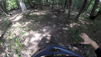
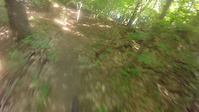
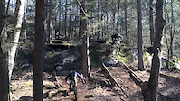
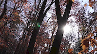
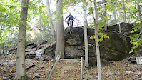
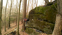
Photos of Ridgefield Mountain Bike
Videos of Ridgefield Mountain Bike

trail: White Trail - Bennetts Pond
0:46 |
39 |
Dec 23, 2025
0:00 |
435 |
Aug 19, 2016
trail: Orange Access Trail - West
0:32 |
317 |
Jul 20, 2016
trail: Connector
0:36 |
885 |
Dec 31, 2013

trail: Connector
0:19 |
725 |
Nov 24, 2013
trail: Connector
2:42 |
1078 |
Nov 10, 2013
trail: Connector
0:17 |
807 |
Oct 13, 2013
trail: Connector
0:13 |
317 |
Dec 3, 2012
Recent Trail Reports
| status | trail | date | condition | info | user |
|---|---|---|---|---|---|
| Gorge Trail | Apr 18, 2026 @ 1:44pm (America/New_York) Apr 18, 2026 | Ideal | Sh7eleven | ||
| Green Trail - Red Maple Swamp | Apr 18, 2026 @ 1:44pm (America/New_York) Apr 18, 2026 | Ideal | Sh7eleven | ||
| Nice Ascent from Parking Lot | Apr 18, 2026 @ 1:44pm (America/New_York) Apr 18, 2026 | Ideal | Sh7eleven | ||
| Narnia | Apr 18, 2026 @ 1:44pm (America/New_York) Apr 18, 2026 | Ideal | Sh7eleven | ||
| Bennett's Pond Spur - North | Oct 17, 2025 @ 4:01pm (America/New_York) Oct 17, 2025 | Ideal | Dampener | ||
| Bennetts Pond North ("Pebble Beach") | Aug 26, 2025 @ 5:39pm Aug 26, 2025 | Dry | Dampener | ||
| Blue Trail - Parking Lot Singletrack | Aug 26, 2025 @ 5:39pm Aug 26, 2025 | Dry | Dampener | ||
| Green Trail (East) - Bennett's Pond | Aug 25, 2025 @ 4:02pm Aug 25, 2025 | Very Dry | Dampener | ||
| Out of Nowhere (B line out) | Aug 8, 2025 @ 9:59am Aug 8, 2025 | Dry | brme4312 | ||
| Blue Connector | Aug 8, 2025 @ 9:59am Aug 8, 2025 | Dry | brme4312 |
Activity Feed
| username | action | type | title | date |
|---|---|---|---|---|
| DelawareULLZ | wishlist | trail | activity #97263910 | Jun 18, 2026 @ 11:05am Jun 18, 2026 |
| drjms | comment | report | activity #96381934 | Jun 6, 2026 @ 9:51am Jun 6, 2026 |
| trevorpeckham | vote | trail | activity #95701716 | May 28, 2026 @ 6:08am May 28, 2026 |
| MichaelGPMbUc | wishlist | route | activity #95170068 | May 21, 2026 @ 6:09am May 21, 2026 |
| MichaelGPMbUc | wishlist | route | activity #94982299 | May 18, 2026 @ 9:43am May 18, 2026 |
Recent Comments
| username | type | title | comment | date |
|---|---|---|---|---|
| report | 😈f | Jun 6, 2026 @ 9:51am Jun 6, 2026 | ||
| trail | This trail is not that hard. There are way... | Sep 13, 2025 @ 6:32pm Sep 13, 2025 | ||
| trail | Trail has recently been cleared back, but... | Oct 8, 2024 @ 5:28am Oct 8, 2024 | ||
| trail | Very rocky and technical with some low speed,... | Sep 25, 2024 @ 7:48am Sep 25, 2024 | ||
| trail | This is just a gravel fire road, at least to... | Sep 7, 2024 @ 4:36am Sep 7, 2024 |
Local Badges
-

10 Green Trails64 awarded -

Epic Ride 50k323 awarded -

Top 10 Trails5 awarded -

Completionist2 awarded -

Big Ride 30k829 awarded -
Completionist1 awarded
Activity Type Stats
| activitytype | trails | distance | descent | descent distance | total vertical | rating | global rank | state rank | photos | reports | routes | ridelogs |
|---|---|---|---|---|---|---|---|---|---|---|---|---|
| Mountain Bike | 91 | 37 miles | 5,702 ft | 15 miles | 486 ft | #2,489 | #892 | 38 | 234 | 9 | 7,317 | |
| Horse | 1 | 2 miles | 233 ft | 2,884 ft | 138 ft | 11 | ||||||
| Hike | 94 | 38 miles | 5,817 ft | 15 miles | 486 ft | #4,605 | #1,627 | 2 | 235 | 2 | 457 | |
| Trail Running | 94 | 38 miles | 5,817 ft | 15 miles | 486 ft | #4,230 | #1,291 | 235 | 2 | 311 | ||
| Snowshoe | 1 | 2 miles | 233 ft | 2,884 ft | 138 ft | 9 |
Frequently Asked Questions About Ridgefield
▼
What are the best places to ride in Ridgefield?
Ridgefield has 3 areas to explore for mountain biking. The top rated areas are:
▼
What are the highest rated mountain biking trails in Ridgefield?
The highest rated mountain biking trails in Ridgefield are:
- Blue Trail - Parking Lot Singletrack (4.1/5)
- Blue Trail South (4.1/5)
- Out of Nowhere (4.1/5)
- "Old Road" (Red) Trail (4.1/5)
- Orange Access Trail - North (4/5)
▼
What is the best time of the year to ride in Ridgefield?
Based on ride log data, the most popular months to ride in Ridgefield are:
- May (90 activities)
- September (82 activities)
- August (76 activities)
▼
Where can I park to ride in Ridgefield?
There are 7 parking locations listed in Ridgefield. The most popular parking spots are:
- Ned's Mountain Road Parking
- Seth Low Pierrepont State Park Parking
- Bennetts Pond State Park Parking
- Fitzgarld Field Parking
- Knollwood Drive Parking Lot
Activities
Trails
- By StephaneMarceau
 TRAILFORKS & contributors
 - Admins: HCH, NEMBAEXEC, FC NEMBA
- #8070 - 6,566 views
- ridgefield activity log | embed map of Ridgefield mountain bike trails | ridgefield mountain biking points of interest
Downloading of trail gps tracks in kml & gpx formats is enabled for Ridgefield.
You must login to download files.