close
-
Layers w
- Weather Layers
- Pro
- Pro
- Pro
- Pro
- Pro
- Pro
- More Layers
- Pro
- Pro
- Pro
- Pro
-
Upgrade to

3D
Trail Conditions
- Unknown
- Snow Groomed
- Snow Packed
- Snow Covered
- Snow Cover Partial
- Freeze/thaw Cycle
- Icy
- Prevalent Mud
- Wet
- Variable
- Ideal
- Dry
- Very Dry
Trail Flow (Ridden Direction)
Trailforks scans users ridelogs to determine the most popular direction each trail is ridden. A good flowing trail network will have most trails flowing in a single direction according to their intension.
The colour categories are based on what percentage of riders are riding a trail in its intended direction.
The colour categories are based on what percentage of riders are riding a trail in its intended direction.
- > 96%
- > 90%
- > 80%
- > 70%
- > 50%
- < 50%
- bi-directional trail
- no data
Trail Last Ridden
Trailforks scans ridelogs to determine the last time a trail was ridden.
- < 2 days
- < 1 week
- < 2 weeks
- < 1 month
- < 6 months
- > 6 months
Trail Ridden Direction
The intended direction a trail should be ridden.
- Downhill Only
- Downhill Primary
- Both Directions
- Uphill Primary
- Uphill Only
- One Direction
Contribute Details
Colors indicate trail is missing specified detail.
- Description
- Photos
- Description & Photos
- Videos
Trail Popularity ?
Trailforks scans ridelogs to determine which trails are ridden the most in the last 9 months.
Trails are compared with nearby trails in the same city region with a possible 25 colour shades.
Think of this as a heatmap, more rides = more kinetic energy = warmer colors.
- most popular
- popular
- less popular
- not popular
ATV/ORV/OHV Filter
Max Vehicle Width
inches
US Cell Coverage
Legend

Radar Time
Activity Recordings
Trailforks uses anonymized public activity data.
?
Activity Recordings
Trailforks uses anonymized public activity data.
?
Personal Heatmap
▶
Activity Types
all
/
none
▶
Options
2
Date range
month
–
Winter Trails
Warning
A routing network for winter maps does not exist. Selecting trails using the winter trails layer has been disabled.
Missing Trails
Most Popular
Least Popular
Trails are colored based on popularity. The more popular a trail is, the more red. Less popular trails trend towards green.
Jump Magnitude Heatmap
Heatmap of where riders jump on trails. Zoom in to see individual jumps, click circles to view jump details.
BC Backroad Status
![map legend]()
Service Road Atlas is a free to use, community-driven service for viewing and creating reports on the numerous back-country service roads around B.C. and Alberta.

Slope Aspect
Direction the slope faces
Trails Deemphasized
Trails are shown in grey.
Only show trails with no bike usage.
Suggested Layers
Based on selected activity type
Save the current map location and zoom level as your default home location whenever this page is loaded.
Save
No description for Rijeka has been added yet!
Login or register to submit one.
This region uses the Uk/Euro style trail grading system.
Activities Click to view
- Mountain Bike
624 trails
- E-Bike
235 trails
- Gravel Bike
0 trails
- Adaptive Bike
0 trails
- Winter Fat Bike
0 trails
- Horse
98 trails
- Hike
634 trails
- Trail Running
629 trails
- Dirtbike/Moto
59 trails
- Observed Trials
39 trails
- ATV/ORV/OHV
57 trails
- Snowmobile
2 trails
- Snowshoe
7 trails
- Downhill Ski
11 trails
- Backcountry Ski
13 trails
- Nordic Ski
0 trails
Region Details
- 320
- 161
- 84
- 40
- 15
- 1
Region Status
Open as of Jun 13, 2026Stats
- Avg Trail Rating
- Trails (view details)
- 663
- Trails Mountain Bike
- 625
- Trails E-Bike
- 235
- Trails Horse
- 98
- Trails Hike
- 635
- Trails Trail Running
- 629
- Trails Dirtbike/Moto
- 59
- Trails Observed Trials
- 39
- Trails ATV/ORV/OHV
- 57
- Trails Snowmobile
- 2
- Trails Snowshoe
- 7
- Trails Downhill Ski
- 11
- Trails Backcountry Ski
- 13
- Total Distance
- 637 miles
- Total Descent
- 126,578 ft
- Total Vertical
- 4,465 ft
- Highest Trailhead
- 4,467 ft
- Reports
- 1,885
- Photos
- 291
- Ridden Counter
- 11,847
Sub Regions
Popular Rijeka Mountain Biking Trails
• 85 ★ 4.4 • 5,030 ft • 16 ft • 90 •
A third trail done by Team Rodeo very recently (March 2017). The trail is easier than and , but some say more fun. The trail also ends up in the trail and then leads you to trail. It uses the same access trails as both of the...
• 100 ★ 4.8 • 1,266 ft • 3 ft • 87 •
Mostly hardpack soil and easy trail features. This is the part of the area where all the current trails ( , , , ) converge and exit to a road.
• 95 ★ 3.7 • 3,855 ft • 36 ft • 82 •
This is a trail leading you to the / ovo (with on the bottom) enduro trails. The trails starts on the top of highest point of the asphalt road connecting Sarsoni and ovica. The wide single track will take you through the forest to the...
• 90 ★ 4.6 • 3,530 ft • 17 ft • 75 •
Maintained by Team Rodeo, the trail is an enduro trail. The start is in the forest which quickly ends in a steep rocky trail on the face of the hill. As the hill flattens out a bit, rocks are changed for hard packed or loose dirt...
• 90 ★ 5.0 • 4,800 ft • 42 ft • 69 •
Highly rated popular red difficulty singletrack. This mountain bike primary trail can be used downhill only. It features berm, bridge, drop and rock garden. Trail visibility is sometimes hard to follow. On average it takes 8 minutes to complete this trail.
• 95 ★ 4.8 • 2,595 ft • 19 ft • 60 •
Fourth trail created by Team Rodeo. Starts on the same place as , but weers right and has more dirt sections. Steeper than other trails on ovica. There is a steep 20m long wall on the lower section for which this trail is (in)famous for.
• 95 ★ 2.0 • 1,635 ft • 13 ft • 47 •
Popular green difficulty singletrack. This mountain bike primary trail can be used downhill primary. On average it takes 1 minutes to complete this trail.
Rijeka Mountain Bike Routes
11 miles • 1,106 ft • 4 • Loop •
A nice and comfy Marcelji -> Breza and then mostly downhill to . Fun, easy and scenic.
19 miles • 2,281 ft • 1 • Point to Point •
Usually done by Team Rodeo, the starting point is in Vertigo bar or Drenova graveyard. The easy trails...
30 miles • 4,508 ft • 64 •
This is a trail for cyclists willing to push themselves to the limit: on this route, you will first have...
9 miles • 970 ft • 8 • Loop •
Length: 15.3 km Category: easy Surface: 100% gravel Duration: up to 2 hours Location: eastern slopes of...
19 miles • 2,902 ft • 0 • Point to Point •
Starting from Vertigo caffe bar or Drenova graveyard the trails will take you to Ronjgi/Sarsoni, then a...
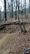
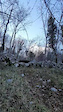
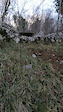
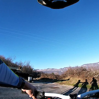
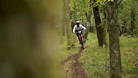
Photos of Rijeka Mountain Bike
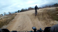
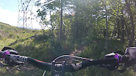
Videos of Rijeka Mountain Bike

trail: Flow
0:05 |
92 |
Jan 12, 2021
trail: Flow
0:08 |
80 |
Jan 12, 2021
trail: DH Grobnik(line 2)
0:12 |
42 |
Jan 11, 2021
trail: DH Grobnik(line 2)
0:16 |
35 |
Jan 11, 2021
trail: DH Grobnik(wallride line)
0:00 |
154 |
Jan 7, 2021
trail: Trnduro forest transfer
2:56 |
366 |
Sep 11, 2019
trail: Groblje Drenova
0:21 |
60 |
Feb 1, 2019
trail: Krletov singlic
3:25 |
141 |
Sep 22, 2017
Recent Trail Reports
Activity Feed
| username | action | type | title | date |
|---|---|---|---|---|
| msk111 | add | trail | activity #96880933 | Jun 13, 2026 @ 8:31am Jun 13, 2026 |
| msk111 | add | report | activity #96856803 and 2 more | Jun 13, 2026 @ 2:44am Jun 13, 2026 |
| msk111 | comment | trail | activity #96788666 | Jun 12, 2026 @ 12:42am Jun 12, 2026 |
| msk111 | add | photo | activity #96788621 and 4 more | Jun 12, 2026 @ 12:40am Jun 12, 2026 |
| msk111 | add | report | activity #96745580 | Jun 11, 2026 @ 10:04am Jun 11, 2026 |
Recent Comments
| username | type | title | comment | date |
|---|---|---|---|---|
| trail | Seems uphill not possible, and quite... | Jun 12, 2026 @ 12:42am Jun 12, 2026 | ||
| trail | A climb or two is too brutal (for beginners at... | Apr 26, 2026 @ 5:46am Apr 26, 2026 | ||
| trail | Not really suitable for uphill | Oct 20, 2025 @ 1:21pm Oct 20, 2025 | ||
| trail | after a few steep and narrow turns that I... | Oct 20, 2025 @ 9:39am Oct 20, 2025 | ||
| trail | I had good fun here, some technical parts but... | Jun 14, 2025 @ 4:19am Jun 14, 2025 |
Local Badges
-

Completionist0 awarded -
Completionist0 awarded -
Completionist0 awarded -
Completionist0 awarded -
Completionist0 awarded -
Completionist0 awarded
Activity Type Stats
| activitytype | trails | distance | descent | descent distance | total vertical | rating | global rank | state rank | photos | reports | routes | ridelogs |
|---|---|---|---|---|---|---|---|---|---|---|---|---|
| Mountain Bike | 624 | 619 miles | 120,522 ft | 300 miles | 4,429 ft | #143 | #1 | 372 | 1,882 | 10 | 9,104 | |
| E-Bike | 235 | 212 miles | 51,765 ft | 113 miles | 4,429 ft | #264 | #1 | 2 | 1,735 | 3 | 651 | |
| Horse | 98 | 65 miles | 16,785 ft | 33 miles | 4,416 ft | #159 | #2 | 403 | ||||
| Hike | 634 | 621 miles | 117,503 ft | 294 miles | 4,465 ft | #56 | #2 | 1 | 1,833 | 786 | ||
| Trail Running | 629 | 609 miles | 116,634 ft | 292 miles | 4,465 ft | #74 | #2 | 1,833 | 240 | |||
| Dirtbike/Moto | 59 | 68 miles | 12,507 ft | 34 miles | 4,416 ft | #147 | #2 | 405 | 3 | |||
| Observed Trials | 39 | 29 miles | 5,889 ft | 13 miles | 2,808 ft | #43 | #1 | 11 | ||||
| ATV/ORV/OHV | 57 | 66 miles | 12,313 ft | 33 miles | 4,416 ft | #75 | #2 | 397 | ||||
| Snowmobile | 2 | 2 miles | 774 ft | 2 miles | 758 ft | #135 | #1 | 1 | ||||
| Snowshoe | 7 | 4 miles | 2,037 ft | 4 miles | 853 ft | #239 | #1 | 1 | 1 | |||
| Downhill Ski | 11 | 5 miles | 3,524 ft | 5 miles | 856 ft | #168 | #1 | 2 | 1 | 8 | ||
| Backcountry Ski | 13 | 6 miles | 4,350 ft | 6 miles | 856 ft | #211 | #1 | 1 | 3 |
Frequently Asked Questions About Rijeka
▼
What are the best places to ride in Rijeka?
▼
What are the highest rated mountain biking trails in Rijeka?
The highest rated mountain biking trails in Rijeka are:
- Brlog (4.5/5)
- Flow (4.4/5)
- Mudna dol trail (4.4/5)
- Carevo (4.4/5)
- Krletov singlic (4.3/5)
▼
What is the best time of the year to ride in Rijeka?
Based on ride log data, the most popular months to ride in Rijeka are:
- April (34 activities)
- March (30 activities)
- May (28 activities)
▼
Where can I park to ride in Rijeka?
There are 15 parking locations listed in Rijeka. The most popular parking spots are: View all parking and trailhead locations on the map to plan your visit.
Activities
Trails
Points of Interest
- By VjekoslavKrsanac
 TRAILFORKS & contributors
 - Admins: VjekoslavKrsanac, TeamRodeo
- #13062 - 18,797 views
- rijeka activity log | embed map of Rijeka mountain bike trails | rijeka mountain biking points of interest
Downloading of trail gps tracks in kml & gpx formats is enabled for Rijeka.
You must login to download files.