close
-
Layers w
- Weather Layers
- Pro
- Pro
- Pro
- Pro
- Pro
- Pro
- More Layers
- Pro
- Pro
- Pro
- Pro
-
Upgrade to

3D
Trail Conditions
- Unknown
- Snow Groomed
- Snow Packed
- Snow Covered
- Snow Cover Partial
- Freeze/thaw Cycle
- Icy
- Prevalent Mud
- Wet
- Variable
- Ideal
- Dry
- Very Dry
Trail Flow (Ridden Direction)
Trailforks scans users ridelogs to determine the most popular direction each trail is ridden. A good flowing trail network will have most trails flowing in a single direction according to their intension.
The colour categories are based on what percentage of riders are riding a trail in its intended direction.
The colour categories are based on what percentage of riders are riding a trail in its intended direction.
- > 96%
- > 90%
- > 80%
- > 70%
- > 50%
- < 50%
- bi-directional trail
- no data
Trail Last Ridden
Trailforks scans ridelogs to determine the last time a trail was ridden.
- < 2 days
- < 1 week
- < 2 weeks
- < 1 month
- < 6 months
- > 6 months
Trail Ridden Direction
The intended direction a trail should be ridden.
- Downhill Only
- Downhill Primary
- Both Directions
- Uphill Primary
- Uphill Only
- One Direction
Contribute Details
Colors indicate trail is missing specified detail.
- Description
- Photos
- Description & Photos
- Videos
Trail Popularity ?
Trailforks scans ridelogs to determine which trails are ridden the most in the last 9 months.
Trails are compared with nearby trails in the same city region with a possible 25 colour shades.
Think of this as a heatmap, more rides = more kinetic energy = warmer colors.
- most popular
- popular
- less popular
- not popular
ATV/ORV/OHV Filter
Max Vehicle Width
inches
US Cell Coverage
Legend

Radar Time
Activity Recordings
Trailforks uses anonymized public activity data.
?
Activity Recordings
Trailforks uses anonymized public activity data.
?
Personal Heatmap
▶
Activity Types
all
/
none
▶
Options
2
Date range
month
–
Winter Trails
Warning
A routing network for winter maps does not exist. Selecting trails using the winter trails layer has been disabled.
Missing Trails
Most Popular
Least Popular
Trails are colored based on popularity. The more popular a trail is, the more red. Less popular trails trend towards green.
Jump Magnitude Heatmap
Heatmap of where riders jump on trails. Zoom in to see individual jumps, click circles to view jump details.
BC Backroad Status
![map legend]()
Service Road Atlas is a free to use, community-driven service for viewing and creating reports on the numerous back-country service roads around B.C. and Alberta.

Slope Aspect
Direction the slope faces
Trails Deemphasized
Trails are shown in grey.
Only show trails with no bike usage.
Suggested Layers
Based on selected activity type
Save the current map location and zoom level as your default home location whenever this page is loaded.
Save
No description for Rimini has been added yet!
Login or register to submit one.
This region uses the Uk/Euro style trail grading system.
Activities Click to view
- Mountain Bike
122 trails
- E-Bike
108 trails
- Horse
30 trails
- Hike
97 trails
- Trail Running
96 trails
- Dirtbike/Moto
7 trails
Region Details
- 9
- 4
- 46
- 46
Stats
- Avg Trail Rating
- Trails (view details)
- 116
- Trails Mountain Bike
- 123
- Trails E-Bike
- 108
- Trails Horse
- 30
- Trails Hike
- 97
- Trails Trail Running
- 96
- Trails Dirtbike/Moto
- 7
- Trails Snowshoe
- 3
- Trails Downhill Ski
- 3
- Trails Backcountry Ski
- 3
- Trails Nordic Ski
- 3
- Total Distance
- 87 miles
- Total Descent Distance
- 52 miles
- Total Descent
- 29,203 ft
- Total Vertical
- 4,417 ft
- Highest Trailhead
- 4,543 ft
- Reports
- 661
- Photos
- 30
- Ridden Counter
- 3,909
Sub Regions
- Gemmano (2)
- Montecopiolo (41)
- Montefiore Conca (3)
- Montescudo-Monte Colombo (30)
- Novafeltria (18)
- Uffogliano (2)
- Rimini (1)
- San Clemente (3)
- Santarcangelo di Romagna (1)
- Talamello (24)
Popular Rimini Mountain Biking Trails
• 95 ★ 4.3 • 1 mile • 0 ft • 101 •
for a smoother ride, with jumps and berms - not as rough as the main DH line
• 100 ★ 4.5 • 4,678 ft • 0 ft • 100 •
Downhill track with rockgardens and some steep lines. Good with DH and enduro/allmountain bikes.
• 70 ★ 4.0 • 5,276 ft • 60 ft • 96 •
Fun trail, part of the Talamello riding area. It starts with some rocky gardens and tight switchbacks (Antenne), it becomes larger for few hundreds meters.
• 100 ★ 5.0 • 1,086 ft • 0 ft • 85 •
Popular blue difficulty singletrack. This mountain bike primary trail can be used downhill only. It features jump and gap jump. On average it takes 1 minutes to complete this trail.
• 45 ★ 3.8 • 2 miles • 64 ft • 79 •
The full , with the new central part. A must ride when here, long, steep, technical and fun!
• 65 ★ 3.8 • 1 mile • 11 ft • 70 •
Moderately popular blue difficulty singletrack. This mountain bike primary trail can be used downhill primary and has a moderate overall physical rating. Trail visibility is sometimes hard to follow. On average it takes 10 minutes to complete this trail.
Rimini Mountain Bike Routes
6 miles • 1,676 ft • 3 •
Attenzione a Cinghialine, a mio avviso double black diamond, percorso ben mantenuto con ostacoli...
★ 5.0 • 29 miles • 2,715 ft • 0 • Loop •
Giro misto asfalto fuoristrada da 2 ore.
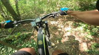
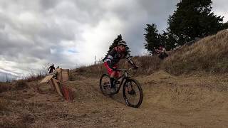
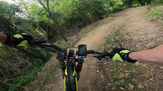
Photos of Rimini Mountain Bike
Videos of Rimini Mountain Bike
trail: Ghost House
0:04 |
20 |
Feb 19, 2024
trail: Take-Off Trail
0:32 |
21 |
Jan 8, 2024
trail: Marugone
2:43 |
331 |
Aug 2, 2021 , Montescudo-Monte Colombo
trail: Cinghialine 1
0:11 |
356 |
Aug 1, 2021 , Montescudo-Monte Colombo
trail: 1944
8:52 |
641 |
Aug 1, 2021 , Montescudo-Monte Colombo
trail: Cinghialine 1
2:42 |
406 |
Aug 1, 2021 , Montescudo-Monte Colombo

trail: Fly Flips
0:48 |
317 |
Aug 1, 2021 , Montescudo-Monte Colombo
trail: Ghost House
0:58 |
359 |
Aug 1, 2021 , Montescudo-Monte Colombo
Recent Trail Reports
Activity Feed
| username | action | type | title | date |
|---|---|---|---|---|
| renniz | add | report | activity #95840870 and 4 more | May 30, 2026 @ 5:19am May 30, 2026 |
| MarcorKskuF | wishlist | region | activity #94622194 | May 13, 2026 @ 6:11am May 13, 2026 |
| Syncra | ridden | trail | activity #93778393 | May 1, 2026 @ 6:43am May 1, 2026 |
| Syncra | add | report | activity #93778232 and 5 more | May 1, 2026 @ 6:41am May 1, 2026 |
| Syncra | vote | trail | activity #93778142 and 4 more | May 1, 2026 @ 6:40am May 1, 2026 |
Recent Comments
| username | type | title | comment | date |
|---|---|---|---|---|
| report | Pp poi p.o lo1p5s 9kpx il0dhdddi | Jun 2, 2025 @ 2:41am Jun 2, 2025 | ||
| trail | This is not a singletrail, wide gravel... | Apr 19, 2025 @ 1:11pm Apr 19, 2025 | ||
| trail | Follow the signposts "Joker", marked red | Apr 17, 2025 @ 10:41am Apr 17, 2025 | ||
| trail | Nice Trail some of the wood parts are a bit... | Sep 9, 2024 @ 6:02am Sep 9, 2024 | ||
| trail | Percorso oggi attenzione manca il ponticello... | Mar 25, 2023 @ 5:22am Mar 25, 2023 |
Local Badges
-

Big Ride 30k169 awarded -

Top 10 Trails0 awarded -

Epic Ride 50k431 awarded -
Epic Ride 50k95 awarded -
Big Ride 30k903 awarded -

Descent 100k Badge0 awarded
Bike & Skill Parks
| name | type | city | rating |
|---|---|---|---|
| Fratte | skill park | Talamello |
Activity Type Stats
| activitytype | trails | distance | descent | descent distance | total vertical | rating | global rank | state rank | photos | reports | routes | ridelogs |
|---|---|---|---|---|---|---|---|---|---|---|---|---|
| Mountain Bike | 122 | 87 miles | 29,203 ft | 52 miles | 4,416 ft | 30 | 663 | 2 | 11,237 | |||
| E-Bike | 108 | 79 miles | 26,214 ft | 48 miles | 4,416 ft | 633 | 1 | 2,364 | ||||
| Horse | 30 | 29 miles | 6,900 ft | 15 miles | 3,819 ft | 20 | ||||||
| Hike | 97 | 75 miles | 23,051 ft | 42 miles | 4,344 ft | 623 | 195 | |||||
| Trail Running | 96 | 80 miles | 23,907 ft | 46 miles | 4,344 ft | 623 | 44 | |||||
| Dirtbike/Moto | 7 | 6 miles | 1,335 ft | 3 miles | 2,254 ft | 17 | ||||||
| Snowshoe | 3 | 2 miles | 699 ft | 1 mile | 646 ft | 3 | ||||||
| Downhill Ski | 3 | 2 miles | 699 ft | 1 mile | 646 ft | 3 | ||||||
| Backcountry Ski | 3 | 2 miles | 699 ft | 1 mile | 646 ft | |||||||
| Nordic Ski | 3 | 2 miles | 699 ft | 1 mile | 646 ft |
Frequently Asked Questions About Rimini
▼
What are the best places to ride in Rimini?
Rimini has 1 areas to explore for mountain biking. The top rated areas are:
▼
What are the highest rated mountain biking trails in Rimini?
The highest rated mountain biking trails in Rimini are:
- Flipitero (4.3/5)
- Ghost House (4.2/5)
- Tom Tom Trail (4.1/5)
- Montone, macchia dei faggi (4.1/5)
- Vecchia Roccaccia (4.1/5)
▼
What is the best time of the year to ride in Rimini?
Based on ride log data, the most popular months to ride in Rimini are:
- July (63 activities)
- August (52 activities)
- November (48 activities)
▼
What is the longest trail in Rimini?
The longest trail in Rimini is Ciclabile del Conca - Lato Misano at 11.9 km. View all trails sorted by distance.
Activities
Trails
Points of Interest
- By denitopia
 TRAILFORKS VTA & contributors
 - Admins: denitopia, marcoangeletti, cemoorelife
- #11679 - 8,230 views
- rimini activity log | embed map of Rimini mountain bike trails | rimini mountain biking points of interest
Downloading of trail gps tracks in kml & gpx formats is enabled for Rimini.
You must login to download files.