
close
-
Layers w
- Weather Layers
- Pro
- Pro
- Pro
- Pro
- Pro
- Pro
- More Layers
- Pro
- Pro
- Pro
- Pro
-
Upgrade to

3D
Trail Conditions
- Unknown
- Snow Groomed
- Snow Packed
- Snow Covered
- Snow Cover Partial
- Freeze/thaw Cycle
- Icy
- Prevalent Mud
- Wet
- Variable
- Ideal
- Dry
- Very Dry
Trail Flow (Ridden Direction)
Trailforks scans users ridelogs to determine the most popular direction each trail is ridden. A good flowing trail network will have most trails flowing in a single direction according to their intension.
The colour categories are based on what percentage of riders are riding a trail in its intended direction.
The colour categories are based on what percentage of riders are riding a trail in its intended direction.
- > 96%
- > 90%
- > 80%
- > 70%
- > 50%
- < 50%
- bi-directional trail
- no data
Trail Last Ridden
Trailforks scans ridelogs to determine the last time a trail was ridden.
- < 2 days
- < 1 week
- < 2 weeks
- < 1 month
- < 6 months
- > 6 months
Trail Ridden Direction
The intended direction a trail should be ridden.
- Downhill Only
- Downhill Primary
- Both Directions
- Uphill Primary
- Uphill Only
- One Direction
Contribute Details
Colors indicate trail is missing specified detail.
- Description
- Photos
- Description & Photos
- Videos
Trail Popularity ?
Trailforks scans ridelogs to determine which trails are ridden the most in the last 9 months.
Trails are compared with nearby trails in the same city region with a possible 25 colour shades.
Think of this as a heatmap, more rides = more kinetic energy = warmer colors.
- most popular
- popular
- less popular
- not popular
ATV/ORV/OHV Filter
Max Vehicle Width
inches
US Cell Coverage
Legend

Radar Time
Activity Recordings
Trailforks uses anonymized public activity data.
?
Activity Recordings
Trailforks uses anonymized public activity data.
?
Personal Heatmap
▶
Activity Types
all
/
none
▶
Options
2
Date range
month
–
Winter Trails
Warning
A routing network for winter maps does not exist. Selecting trails using the winter trails layer has been disabled.
Missing Trails
Most Popular
Least Popular
Trails are colored based on popularity. The more popular a trail is, the more red. Less popular trails trend towards green.
Jump Magnitude Heatmap
Heatmap of where riders jump on trails. Zoom in to see individual jumps, click circles to view jump details.
BC Backroad Status
![map legend]()
Service Road Atlas is a free to use, community-driven service for viewing and creating reports on the numerous back-country service roads around B.C. and Alberta.

Slope Aspect
Direction the slope faces
Trails Deemphasized
Trails are shown in grey.
Only show trails with no bike usage.
Suggested Layers
Based on selected activity type
Save the current map location and zoom level as your default home location whenever this page is loaded.
SaveLe Rive Rosse sono un comprensorio di mountain bike situato tra le province di Biella e Vercelli, celebre per il suo terreno vulcanico dal colore rossastro che ricorda un paesaggio marziano. Quest'area, formatasi su un antico supervulcano, offre un mix unico di single track tecnici, salite ripide e discese molto belle e impegnative che la rendono una meta di culto per gli amanti dell'Enduro, dell'XC e del Freeride.
Molti suoi trail sono caratterizzati da fondo sabbioso, ideale dopo le piogge ma difficile da guidare per i meno esperti e nei periodi secchi.
Molti suoi trail sono caratterizzati da fondo sabbioso, ideale dopo le piogge ma difficile da guidare per i meno esperti e nei periodi secchi.
Primary Trail Type: All-Mountain & Downhill
eBikes Allowed:
Yes
Shuttleable: YES
Land Status: Community Forest
This region uses the Uk/Euro style trail grading system.
Activities Click to view
- Mountain Bike
62 trails
- E-Bike
58 trails
- Hike
38 trails
- Trail Running
34 trails
Region Details
- 21
- 12
- 26
- 3
Region Status
Open as of Jul 6, 2026Stats
- Avg Trail Rating
- Trails (view details)
- 63
- Trails Mountain Bike
- 62
- Trails E-Bike
- 58
- Trails Gravel Bike
- 2
- Trails Adaptive Bike
- 13
- Trails Winter Fat Bike
- 1
- Trails Hike
- 38
- Trails Trail Running
- 34
- Total Distance
- 53 miles
- Total Descent
- 16,482 ft
- Total Vertical
- 1,473 ft
- Highest Trailhead
- 2,412 ft
- Reports
- 2,119
- Photos
- 92
- Ridden Counter
- 2,825
Popular Rive Rosse Mountain Biking Trails
• 100 ★ 4.5 • 2 miles • 51 ft • 534 •
Highly rated popular blue difficulty singletrack. This mountain bike primary trail can be used downhill primary and has a moderate overall physical rating. It features gap jump, rock face and rock garden. Trail visibility is always easy to follow. On average it takes 22 minutes to complete this trail.
• 100 ★ 4.4 • 3,852 ft • 2 ft • 522 •
Highly rated popular blue difficulty singletrack. This mountain bike primary trail can be used downhill primary and has a moderate overall physical rating. On average it takes 5 minutes to complete this trail.
• 100 ★ 4.3 • 4,698 ft • 35 ft • 505 •
Bel sentiero, facile e veloce ma con un ultimo passaggio decisamente più difficile del resto.
• 100 ★ 4.4 • 4,413 ft • 0 ft • 421 •
Highly rated popular blue difficulty singletrack. This mountain bike primary trail can be used both directions and has a moderate overall physical rating. It features bridge and roller coaster. Trail visibility is always easy to follow. On average it takes 6 minutes to complete this trail.
• 95 ★ 4.6 • 4,749 ft • 7 ft • 369 •
Rocky and sandy trail with some uphill section, but generally fast and flow.
• 100 ★ 3.8 • 843 ft • 0 ft • 307 •
Popular blue difficulty singletrack. This multi-use trail can be used downhill only and has a moderate overall physical rating. Exposure: Normal Injury Risk. Trail visibility is always easy to follow. On average it takes 1 minutes to complete this trail.
• 95 ★ 4.5 • 804 ft • 5 ft • 289 •
Highly rated popular blue difficulty singletrack. This mountain bike primary trail can be used downhill only and has a moderate overall physical rating. Trail visibility is always easy to follow. On average it takes 2 minutes to complete this trail.
Rive Rosse Mountain Bike Routes
★ 5.0 • 15 miles • 2,356 ft • 3 •
Giro solito delle rive per avere una idea di dove andare sui migliori trail
Photos of Rive Rosse Mountain Bike
Videos of Rive Rosse Mountain Bike

trail: Speedypenny
2:06 |
36 |
Feb 10, 2021
trail: Factory
2:11 |
1578 |
Jul 17, 2019
trail: Factory
2:20 |
10874 |
Sep 6, 2017

trail: Factory
4:11 |
163 |
Jul 27, 2017

trail: Factory
5:48 |
5412 |
Jul 9, 2017
trail: Factory
10:16 |
113 |
Jun 21, 2017
trail: Factory
4:48 |
447 |
Jun 8, 2017
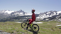
trail: Factory
5:25 |
3793 |
Jul 19, 2016
Recent Trail Reports
| status | trail | date | condition | info | user |
|---|---|---|---|---|---|
| Collegamento Madonna del Sabbione-M41 | Jul 5, 2026 @ 8:57am (Europe/Vaduz) Jul 4, 2026 | Dry | juccio ISDG | ||
| Jungle climb | Jul 5, 2026 @ 8:57am (Europe/Vaduz) Jul 4, 2026 | Dry | juccio ISDG | ||
| Rientro Sentieri La Pignola | Jul 5, 2026 @ 8:57am (Europe/Vaduz) Jul 4, 2026 | Dry | juccio ISDG | ||
| variante del sassone | Jul 5, 2026 @ 8:57am (Europe/Vaduz) Jul 4, 2026 | Dry | juccio ISDG | ||
| M41 | Jul 5, 2026 @ 8:57am (Europe/Vaduz) Jul 4, 2026 | Very Dry | juccio ISDG | ||
| M33 | Jul 5, 2026 @ 8:57am (Europe/Vaduz) Jul 4, 2026 | Dry | juccio ISDG | ||
| Vergnago | Jul 5, 2026 @ 8:57am (Europe/Vaduz) Jul 4, 2026 | Very Dry | juccio ISDG | ||
| Collegamento Pignola-Vergnago | Jul 5, 2026 @ 8:57am (Europe/Vaduz) Jul 4, 2026 | Dry | juccio ISDG | ||
| M41 Bis | Jun 6, 2026 @ 9:59am (Europe/Rome) Jun 6, 2026 | Ideal | Massimiliano64 | ||
| Collegamento Vergnago-Galletto | Jun 6, 2026 @ 9:59am (Europe/Rome) Jun 6, 2026 | Ideal | Massimiliano64 |
Activity Feed
| username | action | type | title | date |
|---|---|---|---|---|
| juccio | add | report | activity #98601128 and 8 more | Jul 6, 2026 @ 3:11pm Jul 6, 2026 |
| NicolaCeuqeC | ridden | trail | activity #96665047 | Jun 10, 2026 @ 5:05am Jun 10, 2026 |
| Massimiliano64 | add | report | activity #96523611 and 8 more | Jun 7, 2026 @ 11:44pm Jun 7, 2026 |
| BikersBoss | ridden | trail | activity #95594246 | May 26, 2026 @ 3:36pm May 26, 2026 |
| markg74 | add | report | activity #95549786 | May 26, 2026 @ 1:26am May 26, 2026 |
Recent Comments
| username | type | title | comment | date |
|---|---|---|---|---|
| trail | divertente e panoramico, ma breve | May 14, 2026 @ 9:03am May 14, 2026 | ||
| trail | finale ripido | May 14, 2026 @ 9:03am May 14, 2026 | ||
| trail | risalita dopo Factory | May 14, 2026 @ 9:02am May 14, 2026 | ||
| trail | carino | May 14, 2026 @ 9:01am May 14, 2026 | ||
| trail | non tra i migliori della zona | May 14, 2026 @ 9:01am May 14, 2026 |
Nearby Areas
| name | distance | ||||
|---|---|---|---|---|---|
| Monte Rovella | 2 | 2 | 1 | 4.3 km | |
| Trails E-Gravity Team - Serravalle Sesia | 2 | 2 | 4.9 km | ||
| Oasi Zegna | 3 | 5.4 km | |||
| I Sentieri Dei Gatti | 6 | 14 | 4 | 5.9 km | |
| I sentieri dei Tuli Bikers | 1 | 13 | 1 | 6.7 km |


Activity Type Stats
| activitytype | trails | distance | descent | descent distance | total vertical | rating | global rank | state rank | photos | reports | routes | ridelogs |
|---|---|---|---|---|---|---|---|---|---|---|---|---|
| Mountain Bike | 62 | 53 miles | 16,266 ft | 29 miles | 1,473 ft | #1,244 | #36 | 89 | 2,114 | 3 | 1,139 | |
| E-Bike | 58 | 50 miles | 15,223 ft | 28 miles | 1,473 ft | #258 | #31 | 3 | 2,008 | 467 | ||
| Gravel Bike | 2 | 4 miles | 62 ft | 2,280 ft | 1,040 ft | #3,653 | #128 | 124 | 4 | |||
| Adaptive Bike | 13 | 13 miles | 1,063 ft | 3 miles | 1,378 ft | #3,647 | #126 | 263 | ||||
| Winter Fat Bike | 1 | 3,133 ft | 102 ft | 2,490 ft | 102 ft | #3,653 | #128 | 6 | ||||
| Hike | 38 | 34 miles | 10,108 ft | 19 miles | 1,473 ft | #4,050 | #108 | 1,889 | 2 | 26 | ||
| Trail Running | 34 | 31 miles | 8,707 ft | 17 miles | 1,473 ft | #3,401 | #101 | 1,866 | 2 |
Frequently Asked Questions About Rive Rosse
▼
What are the highest rated mountain biking trails in Rive Rosse?
The highest rated mountain biking trails in Rive Rosse are:
- Factory (4.5/5)
- M41 Bis (4.4/5)
- Coolma DH (4.4/5)
- M41 (4.4/5)
- Speedypenny (4.3/5)
▼
What is the best time of the year to ride in Rive Rosse?
Based on ride log data, the most popular months to ride in Rive Rosse are:
- May (7 activities)
- February (7 activities)
- November (5 activities)
▼
Where can I park to ride in Rive Rosse?
Check the Rive Rosse trail map for trailhead and parking information. Community members regularly update access and parking details for trails in the area.
▼
What is the longest trail in Rive Rosse?
The longest trail in Rive Rosse is Jungle climb at 2.1 miles. View all trails sorted by distance.
Activities
Trails
Points of Interest
- By pelonegativo & contributors
- Admins: silviu86, adessoomaipiu, Matt93BI
- #22869 - 13,564 views
- rive rosse activity log | embed map of Rive Rosse mountain bike trails | rive rosse mountain biking points of interest
Downloading of trail gps tracks in kml & gpx formats is enabled for Rive Rosse.
You must login to download files.