close
-
Layers w
- Weather Layers
- Pro
- Pro
- Pro
- Pro
- Pro
- Pro
- More Layers
- Pro
- Pro
- Pro
- Pro
-
Upgrade to

3D
Trail Conditions
- Unknown
- Snow Groomed
- Snow Packed
- Snow Covered
- Snow Cover Partial
- Freeze/thaw Cycle
- Icy
- Prevalent Mud
- Wet
- Variable
- Ideal
- Dry
- Very Dry
Trail Flow (Ridden Direction)
Trailforks scans users ridelogs to determine the most popular direction each trail is ridden. A good flowing trail network will have most trails flowing in a single direction according to their intension.
The colour categories are based on what percentage of riders are riding a trail in its intended direction.
The colour categories are based on what percentage of riders are riding a trail in its intended direction.
- > 96%
- > 90%
- > 80%
- > 70%
- > 50%
- < 50%
- bi-directional trail
- no data
Trail Last Ridden
Trailforks scans ridelogs to determine the last time a trail was ridden.
- < 2 days
- < 1 week
- < 2 weeks
- < 1 month
- < 6 months
- > 6 months
Trail Ridden Direction
The intended direction a trail should be ridden.
- Downhill Only
- Downhill Primary
- Both Directions
- Uphill Primary
- Uphill Only
- One Direction
Contribute Details
Colors indicate trail is missing specified detail.
- Description
- Photos
- Description & Photos
- Videos
Trail Popularity ?
Trailforks scans ridelogs to determine which trails are ridden the most in the last 9 months.
Trails are compared with nearby trails in the same city region with a possible 25 colour shades.
Think of this as a heatmap, more rides = more kinetic energy = warmer colors.
- most popular
- popular
- less popular
- not popular
ATV/ORV/OHV Filter
Max Vehicle Width
inches
US Cell Coverage
Legend

Radar Time
Activity Recordings
Trailforks uses anonymized public activity data.
?
Activity Recordings
Trailforks uses anonymized public activity data.
?
Personal Heatmap
▶
Activity Types
all
/
none
▶
Options
2
Date range
month
–
Winter Trails
Warning
A routing network for winter maps does not exist. Selecting trails using the winter trails layer has been disabled.
Missing Trails
Most Popular
Least Popular
Trails are colored based on popularity. The more popular a trail is, the more red. Less popular trails trend towards green.
Jump Magnitude Heatmap
Heatmap of where riders jump on trails. Zoom in to see individual jumps, click circles to view jump details.
BC Backroad Status
![map legend]()
Service Road Atlas is a free to use, community-driven service for viewing and creating reports on the numerous back-country service roads around B.C. and Alberta.

Slope Aspect
Direction the slope faces
Trails Deemphasized
Trails are shown in grey.
Only show trails with no bike usage.
Suggested Layers
Based on selected activity type
Save the current map location and zoom level as your default home location whenever this page is loaded.
SaveCross country and all-mountain trails shared with motocross, equestrian and other users.
Primary Trail Type: Cross-Country
Land Status: Community Forest
 google parking directions
Links
Activities Click to view
- Mountain Bike
373 trails
- E-Bike
371 trails
- Horse
178 trails
- Hike
335 trails
- Trail Running
335 trails
- Dirtbike/Moto
355 trails
- Observed Trials
360 trails
Region Details
- 97
- 1
- 42
- 165
- 37
- 11
- 1
Region Status
Open as of Jun 15, 2026Local Trail Association
Stats
- Avg Trail Rating
- Trails (view details)
- 373
- Trails Mountain Bike
- 373
- Trails E-Bike
- 371
- Trails Horse
- 178
- Trails Hike
- 335
- Trails Trail Running
- 335
- Trails Dirtbike/Moto
- 355
- Trails Observed Trials
- 360
- Trails Snowshoe
- 1
- Trails Nordic Ski
- 2
- Total Distance
- 150 miles
- Total Descent Distance
- 83 miles
- Total Descent
- 32,599 ft
- Total Vertical
- 506 ft
- Highest Trailhead
- 584 ft
- Reports
- 3,342
- Photos
- 450
- Ridden Counter
- 68,004
Popular Riverhead Forest Multi Use Trail Network Trails
• 100 ★ 3.6 • 2,100 ft • 171 ft • 697 •
Motorbikes can only ride in Riverhead Forest at a sanctioned Waitemata Motorcycle ride. No riding at any other time. Steep single/double track climb. Much more interesting than riding the road with the bonus of being under the cover of...
• 100 ★ 4.2 • 1,240 ft • 140 ft • 683 •
Motorbikes can only ride in Riverhead Forest at a sanctioned Waitemata Motorcycle ride. No riding at any other time. Challenging but not technical climb up and fast down
• 90 ★ 4.3 • 1,696 ft • 0 ft • 577 •
Motorbikes can only ride in Riverhead Forest at a sanctioned Waitemata Motorcycle ride. No riding at any other time. Technical trail, twisty, tight in paces, roots, slippery.
• 100 ★ 3.0 • 889 ft • 25 ft • 549 •
Motorbikes can only ride in Riverhead Forest at a sanctioned Waitemata Motorcycle ride. No riding at any other time. Short easy grade access road/trail starting at , passing through the main compound/yard with many trails leading off it.
• 80 ★ 4.0 • 3,235 ft • 21 ft • 496 •
Motorbikes can only ride in Riverhead Forest at a sanctioned Waitemata Motorcycle ride. No riding at any other time. Very steep and off camber sections with several large and difficult features, some very fast flowy sections here too,...
• 95 ★ 4.0 • 948 ft • 0 ft • 450 •
Motorbikes can only ride in Riverhead Forest at a sanctioned Waitemata Motorcycle ride. No riding at any other time.
• 100 ★ 4.0 • 709 ft • 6 ft • 449 •
Motorbikes can only ride in Riverhead Forest at a sanctioned Waitemata Motorcycle ride. No riding at any other time. Clay track.
• 80 ★ 3.7 • 1,572 ft • 164 ft • 445 •
Motorbikes can only ride in Riverhead Forest at a sanctioned Waitemata Motorcycle ride. No riding at any other time. Brutal start to the climb with a rutted section after the metal mesh reinforced trail at the start. It then smooths out...
Mountain Bike Routes
★ 5.0 • 11 miles • 2,266 ft • 21 •
2019 Riverhead Enduro Course Some of the best trails to ride for Intermediate and advanced riders in this...
★ 4.0 • 12 miles • 1,813 ft • 16 • Loop •
Technical XC . Steep pinches & descents Some 2 way trails included
18 miles • 1,877 ft • 8 • Loop •
DOne in this direction, the climbs are more bearable and the downhills are more fun.
12 miles • 1,927 ft • 24 • Loop •
A great blue loop for intermediate riders. Nothing to scary, but still a few little challenges with a...
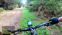
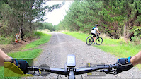
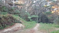
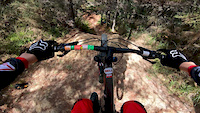
Photos of Riverhead Forest Multi Use Trail Network Mountain Bike
Videos of Riverhead Forest Multi Use Trail Network Mountain Bike
trail: Clay Hill
7:16 |
170 |
Dec 12, 2020
trail: Upper Blackwood
3:51 |
144 |
Nov 5, 2020
0:28 |
1022 |
May 16, 2020

0:10 |
548 |
Apr 27, 2020

0:10 |
365 |
Apr 27, 2020
0:30 |
587 |
Mar 21, 2020

0:40 |
556 |
Mar 21, 2020

0:00 |
807 |
Mar 21, 2020
Recent Trail Reports
| status | trail | date | condition | info | user |
|---|---|---|---|---|---|
| Downstroke | May 16, 2026 @ 1:30pm (Pacific/Auckland) May 15, 2026 | Ideal | gyro-nz | ||
| Spinlay Road | Apr 25, 2026 @ 9:25am (Pacific/Auckland) Apr 24, 2026 | Ideal | credible | ||
| Campbell Road | Apr 25, 2026 @ 9:25am (Pacific/Auckland) Apr 24, 2026 | Ideal | credible | ||
| Geeeez | Apr 15, 2026 @ 3:05pm (Pacific/Auckland) Apr 14, 2026 | Variable | CalebssV7lz | ||
| Levi | Apr 15, 2026 @ 3:05pm (Pacific/Auckland) Apr 14, 2026 | Wet | CalebssV7lz | ||
| Barlow Road Bypass | Apr 3, 2026 @ 9:41am (Pacific/Auckland) Apr 2, 2026 | Wet | credible | ||
| Janis Joplin | Apr 3, 2026 @ 9:41am (Pacific/Auckland) Apr 2, 2026 | Dry | credible | ||
| Tosser's track | Apr 3, 2026 @ 9:41am (Pacific/Auckland) Apr 2, 2026 | Ideal | credible | ||
| Thick Cut | Apr 3, 2026 @ 9:41am (Pacific/Auckland) Apr 2, 2026 | Ideal | credible | ||
| Long Bush SE Skid 2 | Mar 23, 2026 @ 12:13pm (Pacific/Auckland) Mar 22, 2026 | Ideal | Ewaj |
Activity Feed
| username | action | type | title | date |
|---|---|---|---|---|
| idrive110 | wishlist | trail | activity #97286448 | Jun 18, 2026 @ 5:45pm 2 days |
| Murray-Atkinson | comment | report | activity #97084406 | Jun 15, 2026 @ 8:05pm Jun 15, 2026 |
| byronhuntley | comment | report | activity #97076947 and 3 more | Jun 15, 2026 @ 5:30pm Jun 15, 2026 |
| byronhuntley | add | report | activity #97029643 and 4 more | Jun 15, 2026 @ 2:53am Jun 15, 2026 |
| BradXm8euw | wishlist | trail | activity #96274697 | Jun 4, 2026 @ 8:42pm Jun 4, 2026 |
Recent Comments
| username | type | title | comment | date |
|---|---|---|---|---|
| report | Hi Byron, Members of the public aren't... | Jun 15, 2026 @ 8:05pm Jun 15, 2026 | ||
| report | Prevalent Mud | Jun 15, 2026 @ 5:39pm Jun 15, 2026 | ||
| report | Prevalent Mud. | Jun 15, 2026 @ 5:38pm Jun 15, 2026 | ||
| report | Not advisable to ride Drury Lane. It is very... | Jun 15, 2026 @ 5:35pm Jun 15, 2026 | ||
| report | Not sure why my trail report was rejected. But... | Jun 15, 2026 @ 5:30pm Jun 15, 2026 |
Nearby Areas
| name | distance | ||||
|---|---|---|---|---|---|
| West Coast Riders Club | 6 | 10 | 3 | 2 | 3.2 km |
| Sanders Reserve | 3 | 4.7 km | |||
| AJHS Urban | 1 | 6.7 km | |||
| Royal Albany Trail | 1 | 22 | 1 | 6.8 km | |
| Unsworth Reserve | 3 | 6 | 3 | 8.2 km |
Local Badges
-

Completionist0 awarded
Activity Type Stats
| activitytype | trails | distance | descent | descent distance | total vertical | rating | global rank | state rank | photos | reports | routes | ridelogs |
|---|---|---|---|---|---|---|---|---|---|---|---|---|
| Mountain Bike | 373 | 149 miles | 32,566 ft | 83 miles | 505 ft | #97 | #5 | 430 | 3,338 | 14 | 20,810 | |
| E-Bike | 371 | 149 miles | 32,402 ft | 83 miles | 505 ft | #74 | #18 | 8 | 2,815 | 7 | 2,525 | |
| Horse | 178 | 92 miles | 12,162 ft | 43 miles | 499 ft | #26 | #2 | 1 | 465 | 33 | ||
| Hike | 335 | 135 miles | 25,591 ft | 72 miles | 505 ft | #189 | #7 | 5 | 3,142 | 757 | ||
| Trail Running | 335 | 135 miles | 25,495 ft | 71 miles | 505 ft | #85 | #6 | 6 | 3,170 | 2 | 2,517 | |
| Dirtbike/Moto | 355 | 145 miles | 31,381 ft | 80 miles | 505 ft | #35 | #1 | 618 | 15 | |||
| Observed Trials | 360 | 146 miles | 31,677 ft | 81 miles | 505 ft | #4 | #1 | 315 | 22 | |||
| Snowshoe | 1 | 1,263 ft | 30 ft | 787 ft | 33 ft | 1 | ||||||
| Nordic Ski | 2 | 3,196 ft | 180 ft | 2,280 ft | 157 ft |
Frequently Asked Questions About Riverhead Forest Multi Use Trail Network
▼
What are the highest rated mountain biking trails in Riverhead Forest Multi Use Trail Network?
The highest rated mountain biking trails in Riverhead Forest Multi Use Trail Network are:
- Geeeez (4.4/5)
- Geezetts (4.4/5)
- Blue Steel (4.4/5)
- Nek Minnit (4.3/5)
- Greasy Log (4.2/5)
▼
What is the best time of the year to ride in Riverhead Forest Multi Use Trail Network?
Based on ride log data, the most popular months to ride in Riverhead Forest Multi Use Trail Network are:
- February (560 activities)
- January (472 activities)
- March (434 activities)
▼
Where can I park to ride in Riverhead Forest Multi Use Trail Network?
There are 6 parking locations listed in Riverhead Forest Multi Use Trail Network. The most popular parking spots are: View all parking and trailhead locations on the map to plan your visit.
▼
What is the longest trail in Riverhead Forest Multi Use Trail Network?
The longest trail in Riverhead Forest Multi Use Trail Network is Maul at 2.3 km. View all trails sorted by distance.
Activities
- Riverhead Forest Multi Use Trail Network Mountain Biking Trails
- Riverhead Forest Multi Use Trail Network E-Biking Trails
- Riverhead Forest Multi Use Trail Network Horseback Trails
- Riverhead Forest Multi Use Trail Network Hiking Trails
- Riverhead Forest Multi Use Trail Network Trail Running Trails
- Riverhead Forest Multi Use Trail Network Dirtbiking Trails
- Riverhead Forest Multi Use Trail Network Observed Trials Trails
Trails
- Hard trails in Riverhead Forest Multi Use Trail Network
- Easy trails in Riverhead Forest Multi Use Trail Network
- Favorite trails in Riverhead Forest Multi Use Trail Network
- Most ridden trails in Riverhead Forest Multi Use Trail Network
- Singletrack in Riverhead Forest Multi Use Trail Network
- Viewpoint trails in Riverhead Forest Multi Use Trail Network
- Trails with technical features in Riverhead Forest Multi Use Trail Network
- Race routes in Riverhead Forest Multi Use Trail Network
- By ralley
 & contributors
 - Admins: WCRC, WMCC
- #7550 - 94,438 views
- riverhead forest multi use trail network activity log | embed map of Riverhead Forest Multi Use Trail Network mountain bike trails | riverhead forest multi use trail network mountain biking points of interest polygons
Downloading of trail gps tracks in kml & gpx formats is enabled for Riverhead Forest Multi Use Trail Network.
You must login to download files.