close
-
Layers w
- Weather Layers
- Pro
- Pro
- Pro
- Pro
- Pro
- Pro
- More Layers
- Pro
- Pro
- Pro
- Pro
-
Upgrade to

3D
Trail Conditions
- Unknown
- Snow Groomed
- Snow Packed
- Snow Covered
- Snow Cover Partial
- Freeze/thaw Cycle
- Icy
- Prevalent Mud
- Wet
- Variable
- Ideal
- Dry
- Very Dry
Trail Flow (Ridden Direction)
Trailforks scans users ridelogs to determine the most popular direction each trail is ridden. A good flowing trail network will have most trails flowing in a single direction according to their intension.
The colour categories are based on what percentage of riders are riding a trail in its intended direction.
The colour categories are based on what percentage of riders are riding a trail in its intended direction.
- > 96%
- > 90%
- > 80%
- > 70%
- > 50%
- < 50%
- bi-directional trail
- no data
Trail Last Ridden
Trailforks scans ridelogs to determine the last time a trail was ridden.
- < 2 days
- < 1 week
- < 2 weeks
- < 1 month
- < 6 months
- > 6 months
Trail Ridden Direction
The intended direction a trail should be ridden.
- Downhill Only
- Downhill Primary
- Both Directions
- Uphill Primary
- Uphill Only
- One Direction
Contribute Details
Colors indicate trail is missing specified detail.
- Description
- Photos
- Description & Photos
- Videos
Trail Popularity ?
Trailforks scans ridelogs to determine which trails are ridden the most in the last 9 months.
Trails are compared with nearby trails in the same city region with a possible 25 colour shades.
Think of this as a heatmap, more rides = more kinetic energy = warmer colors.
- most popular
- popular
- less popular
- not popular
ATV/ORV/OHV Filter
Max Vehicle Width
inches
US Cell Coverage
Legend

Radar Time
Activity Recordings
Trailforks uses anonymized public activity data.
?
Activity Recordings
Trailforks uses anonymized public activity data.
?
Personal Heatmap
▶
Activity Types
all
/
none
▶
Options
2
Date range
month
–
Winter Trails
Warning
A routing network for winter maps does not exist. Selecting trails using the winter trails layer has been disabled.
Missing Trails
Most Popular
Least Popular
Trails are colored based on popularity. The more popular a trail is, the more red. Less popular trails trend towards green.
Jump Magnitude Heatmap
Heatmap of where riders jump on trails. Zoom in to see individual jumps, click circles to view jump details.
BC Backroad Status
![map legend]()
Service Road Atlas is a free to use, community-driven service for viewing and creating reports on the numerous back-country service roads around B.C. and Alberta.

Slope Aspect
Direction the slope faces
Trails Deemphasized
Trails are shown in grey.
Only show trails with no bike usage.
Suggested Layers
Based on selected activity type
Save the current map location and zoom level as your default home location whenever this page is loaded.
Save
No description for Roanoke has been added yet!
Login or register to submit one.

IMBA Ride Center
Virginia's Blue Ridge
Activities Click to view
- Mountain Bike
107 trails
- E-Bike
83 trails
- Gravel Bike
13 trails
- Adaptive Bike
6 trails
- Winter Fat Bike
1 trails
- Horse
1 trails
- Hike
160 trails
- Trail Running
153 trails
- Dirtbike/Moto
0 trails
- ATV/ORV/OHV
0 trails
- Nordic Ski
0 trails
Region Details
- 8
- 5
- 38
- 43
- 11
Region Status
Caution as of 5 hoursStats
- Avg Trail Rating
- Trails (view details)
- 166
- Trails Mountain Bike
- 108
- Trails E-Bike
- 83
- Trails Gravel Bike
- 13
- Trails Adaptive Bike
- 6
- Trails Winter Fat Bike
- 1
- Trails Horse
- 1
- Trails Hike
- 160
- Trails Trail Running
- 153
- Total Distance
- 213 miles
- Total Descent
- 39,563 ft
- Total Vertical
- 3,825 ft
- Highest Trailhead
- 4,637 ft
- Reports
- 1,630
- Photos
- 400
- Ridden Counter
- 26,918
Articles

Local Flavors: The Complete Guide to Riding in Virginia's Blue Ridge
Jan 3, 2019 from pinkbike.com
Everything you need to know about mountain biking in Virginia.
Sub Regions
-
Carvin's Cove
- 9
- 17
- 7
-
Explore Park Trail System
- 7
- 10
- 1
-
Mill Mountain
- 5
- 8
- 14
- 1
-
Morningside Park
- 1
- 1
-
Murray Run
- 7
-
Read Mountain
- 3
- 1
-
Wasena Park
Popular Roanoke Mountain Biking Trails
• 100 ★ 4.2 • 2 miles • 220 ft • 1,092 •
Flatter XC style trail with gradual ups and downs. As the name suggests it goes through a few drainages, descending towards each one and climbing back out.
• 85 ★ 4.7 • 2 miles • 7 ft • 979 •
Near the top, ebs and flows with some moderate corners traversing the mountain. Then the trail heads down the mountain, with the surface becoming rougher. Rocks and roots poke out for some healthy chunder. Fast straightaways and...
• 85 ★ 4.5 • 1 mile • 560 ft • 975 •
The easy way to the top from the East side of the ridge and the East parking area. Also a good time going down with many option jumps but it is a quick down.
• 85 ★ 4.7 • 3,802 ft • 97 ft • 897 •
Similar to , the trail follows the contours of Brushy Mountain and descends/climbs out of a small mountain drain. Provides an important connection to the northern trails
• 90 ★ 4.2 • 2 miles • 441 ft • 738 •
Highly rated popular blue difficulty singletrack. This mountain bike primary trail can be used downhill primary. On average it takes 17 minutes to complete this trail.
• 95 ★ 4.0 • 2,007 ft • 98 ft • 711 •
Popular green difficulty singletrack. This mountain bike primary trail can be used downhill primary. On average it takes 3 minutes to complete this trail.
• 95 ★ 3.8 • 3,857 ft • 27 ft • 679 •
Popular blue difficulty singletrack. This mountain bike primary trail. On average it takes 7 minutes to complete this trail.
• 80 ★ 4.4 • 4 miles • 509 ft • 676 •
Lakeside offers some of the best views of Carvins Cove. The terrain offers a good mix of everything with a few shorter leg burning climbs. It offers possibly the best views of the water you will find and is a great option of an out and...
Roanoke Mountain Bike Routes
Intro to Carvin's Cove Featured
★ 5.0 • 16 miles • 1,288 ft • 8 • Loop •
An intermediate-friendly introduction to Carvin's Cove. This route samples the "mids" and "lowers" at the...
Carvin's Cove Over and Back Featured
★ 3.0 • 12 miles • 2,092 ft • 5 • Loop •
This is an over-and-back at Carvins Cove starting from the Bennett Springs parking lot. and can be swapped...
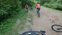
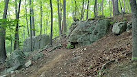
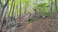
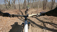
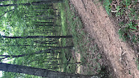
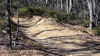
Photos of Roanoke Mountain Bike
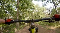
Videos of Roanoke Mountain Bike

trail: Wasena Pump Track
0:14 |
6 |
Feb 15, 2026
trail: Wood Thrush
0:21 |
180 |
Jul 29, 2022
trail: Carvin's Cove Road
0:31 |
141 |
Feb 18, 2022
trail: Carvin's Cove Road
0:27 |
172 |
Feb 18, 2022
trail: The Gauntlet
0:09 |
205 |
Apr 7, 2021
trail: Royalty
0:11 |
|
Jul 27, 2020
trail: OG Jump Line
0:13 |
391 |
Jul 12, 2019
trail: OG Jump Line
0:44 |
625 |
Jun 1, 2017
Current Trail Warnings
| status | trail | date | condition | user | info |
|---|---|---|---|---|---|
| Wood Thrush | Jun 14, 2026 @ 12:36pm (America/New_York) Jun 14, 2026 | Ideal | NGinipro | Large tree down across trail, blocking... |
Recent Trail Reports
| status | trail | date | condition | info | user |
|---|---|---|---|---|---|
| Arrowhead | Jun 18, 2026 @ 8:44am (America/New_York) 5 hours | Unknown | WesleyvulFgU | ||
| Enchanted Forest | Jun 7, 2026 @ 9:11am (America/Kentucky/Monticello) Jun 7, 2026 | Very Dry | Mtneertim | ||
| Little Bell | Jun 7, 2026 @ 9:11am (America/Kentucky/Monticello) Jun 7, 2026 | Very Dry | Mtneertim | ||
| Rock n' Roll | Jun 7, 2026 @ 9:11am (America/Kentucky/Monticello) Jun 7, 2026 | Very Dry | Mtneertim | ||
| Schoolhouse | Jun 7, 2026 @ 9:11am (America/Kentucky/Monticello) Jun 7, 2026 | Very Dry | Mtneertim | ||
| Songbird | Jun 7, 2026 @ 9:11am (America/Kentucky/Monticello) Jun 7, 2026 | Very Dry | Mtneertim | ||
| Laurel Canyon | Jun 7, 2026 @ 6:53pm (America/New_York) Jun 7, 2026 | Very Dry | WesleyvulFgU | ||
| Star/ Woods Thrush Connector | Jun 4, 2026 @ 10:53am (America/New_York) Jun 4, 2026 | Variable | abi-ridefierce RMBA | ||
| Ridgeline | May 27, 2026 @ 8:18am (America/New_York) May 27, 2026 | Wet | mtennant78 | ||
| Revercomb Way | May 25, 2026 @ 9:50am (America/New_York) May 25, 2026 | Wet | abi-ridefierce RMBA |
Activity Feed
| username | action | type | title | date |
|---|---|---|---|---|
| WesleyvulFgU | add | report | activity #97245748 | Jun 18, 2026 @ 5:44am 5 hours |
| rfades | ridden | trail | activity #97242610 | Jun 18, 2026 @ 4:22am 6 hours |
| Pkovo1 | ridden | route | activity #97173189 | Jun 17, 2026 @ 4:17am 1 day |
| juanpablosdiegos | wishlist | route | activity #97013984 | Jun 14, 2026 @ 5:01pm Jun 14, 2026 |
| NGinipro | add | report | activity #96979017 | Jun 14, 2026 @ 9:39am Jun 14, 2026 |
Recent Comments
| username | type | title | comment | date |
|---|---|---|---|---|
| report | Tree cleared | Jun 3, 2026 @ 9:14am Jun 3, 2026 | ||
| trail | Really fun trail, but not a green level trail... | May 9, 2026 @ 1:53pm May 9, 2026 | ||
| trail | I’m a novice mountain biker (but used to hit... | Apr 25, 2026 @ 10:29am Apr 25, 2026 | ||
| trail | Not for beginners who do blue trails.!! Some... | Apr 6, 2026 @ 9:34am Apr 6, 2026 | ||
| trail | Great trail and lots of fun. Rode 2 hours... | Apr 5, 2026 @ 5:28pm Apr 5, 2026 |
Local Badges
-

Completionist0 awarded -

Big Ride 30k2,984 awarded -

Epic Ride 50k847 awarded -

Top 10 Trails90 awarded -

Descent 100k Badge18 awarded -

10 Green Trails111 awarded
Bike & Skill Parks
| name | type | city | rating |
|---|---|---|---|
| Wasena Park Pump Track | skill park | Roanoke |
Upcoming Local Events
Activity Type Stats
| activitytype | trails | distance | descent | descent distance | total vertical | rating | global rank | state rank | photos | reports | routes | ridelogs |
|---|---|---|---|---|---|---|---|---|---|---|---|---|
| Mountain Bike | 107 | 116 miles | 19,964 ft | 55 miles | 3,757 ft | #695 | #266 | 353 | 1,628 | 15 | 32,086 | |
| E-Bike | 83 | 93 miles | 15,755 ft | 44 miles | 1,575 ft | #1,425 | #863 | 1,537 | 10 | 1,869 | ||
| Gravel Bike | 13 | 32 miles | 3,619 ft | 13 miles | 1,493 ft | #323 | #934 | 81 | 150 | |||
| Adaptive Bike | 6 | 25 miles | 3,202 ft | 11 miles | 1,490 ft | #335 | #1,662 | 63 | ||||
| Winter Fat Bike | 1 | 1 mile | 197 ft | 4,380 ft | 197 ft | #275 | #1,060 | 34 | 1 | |||
| Horse | 1 | 4 miles | 682 ft | 2 miles | 407 ft | #2,264 | #1,253 | 223 | 1 | |||
| Hike | 160 | 208 miles | 37,589 ft | 98 miles | 3,825 ft | #530 | #241 | 39 | 1,616 | 2 | 1,877 | |
| Trail Running | 153 | 204 miles | 37,067 ft | 96 miles | 3,825 ft | #655 | #243 | 1,603 | 2 | 1,418 |
Frequently Asked Questions About Roanoke
▼
What are the best places to ride in Roanoke?
Roanoke has 10 areas to explore for mountain biking. The top rated areas are:
▼
What are the highest rated mountain biking trails in Roanoke?
The highest rated mountain biking trails in Roanoke are:
- The Gauntlet (4.5/5)
- Royalty (4.5/5)
- 4 Gorge Extension (4.5/5)
- Buck (4.4/5)
- Upper Comet (4.4/5)
▼
What is the best time of the year to ride in Roanoke?
Based on ride log data, the most popular months to ride in Roanoke are:
- July (280 activities)
- August (246 activities)
- October (235 activities)
▼
Where can I park to ride in Roanoke?
There are 24 parking locations listed in Roanoke. The most popular parking spots are: View all parking and trailhead locations on the map to plan your visit.
Activities
Trails
Points of Interest
- A.T. Shelters: Lamberts Meadow Shelter Cabin
- Read Mountain Lookout Viewpoint
- Roanoke Mountain Summit
- Tinker Mtn Vista 5 Viewpoint
- Tinker Mtn Vista 6 Viewpoint
- Tinker Mtn Powerline Vista 3 Viewpoint
- Angels Gap Vista Viewpoint
- Great Valley Overlook Vista 1 Viewpoint
- Great Valley Overlook Vista 2 Viewpoint
- Tinker Mtn Vista 7 Viewpoint
- Little Pinnacle (5,072 ft)
- Haw Orchard Mountain (5,010 ft)
- Stone Mountain (4,931 ft)
- By brenthillier
 NSMBA TRAILFORKS & contributors
 - Admins: RMBA
- #3567 - 22,680 views
- roanoke activity log | embed map of Roanoke mountain bike trails | roanoke mountain biking points of interest
Downloading of trail gps tracks in kml & gpx formats is enabled for Roanoke.
You must login to download files.