close
-
Layers w
- Weather Layers
- Pro
- Pro
- Pro
- Pro
- Pro
- Pro
- More Layers
- Pro
- Pro
- Pro
- Pro
-
Upgrade to

3D
Trail Conditions
- Unknown
- Snow Groomed
- Snow Packed
- Snow Covered
- Snow Cover Partial
- Freeze/thaw Cycle
- Icy
- Prevalent Mud
- Wet
- Variable
- Ideal
- Dry
- Very Dry
Trail Flow (Ridden Direction)
Trailforks scans users ridelogs to determine the most popular direction each trail is ridden. A good flowing trail network will have most trails flowing in a single direction according to their intension.
The colour categories are based on what percentage of riders are riding a trail in its intended direction.
The colour categories are based on what percentage of riders are riding a trail in its intended direction.
- > 96%
- > 90%
- > 80%
- > 70%
- > 50%
- < 50%
- bi-directional trail
- no data
Trail Last Ridden
Trailforks scans ridelogs to determine the last time a trail was ridden.
- < 2 days
- < 1 week
- < 2 weeks
- < 1 month
- < 6 months
- > 6 months
Trail Ridden Direction
The intended direction a trail should be ridden.
- Downhill Only
- Downhill Primary
- Both Directions
- Uphill Primary
- Uphill Only
- One Direction
Contribute Details
Colors indicate trail is missing specified detail.
- Description
- Photos
- Description & Photos
- Videos
Trail Popularity ?
Trailforks scans ridelogs to determine which trails are ridden the most in the last 9 months.
Trails are compared with nearby trails in the same city region with a possible 25 colour shades.
Think of this as a heatmap, more rides = more kinetic energy = warmer colors.
- most popular
- popular
- less popular
- not popular
ATV/ORV/OHV Filter
Max Vehicle Width
inches
US Cell Coverage
Legend

Radar Time
Activity Recordings
Trailforks uses anonymized public activity data.
?
Activity Recordings
Trailforks uses anonymized public activity data.
?
Personal Heatmap
▶
Activity Types
all
/
none
▶
Options
2
Date range
month
–
Winter Trails
Warning
A routing network for winter maps does not exist. Selecting trails using the winter trails layer has been disabled.
Missing Trails
Most Popular
Least Popular
Trails are colored based on popularity. The more popular a trail is, the more red. Less popular trails trend towards green.
Jump Magnitude Heatmap
Heatmap of where riders jump on trails. Zoom in to see individual jumps, click circles to view jump details.
BC Backroad Status
![map legend]()
Service Road Atlas is a free to use, community-driven service for viewing and creating reports on the numerous back-country service roads around B.C. and Alberta.

Slope Aspect
Direction the slope faces
Trails Deemphasized
Trails are shown in grey.
Only show trails with no bike usage.
Suggested Layers
Based on selected activity type
Save the current map location and zoom level as your default home location whenever this page is loaded.
Save
No description for Rocca has been added yet!
Login or register to submit one.
 google parking directions
google parking directionsThis region uses the Uk/Euro style trail grading system.
Activities Click to view
- Mountain Bike
34 trails
- E-Bike
12 trails
- Hike
20 trails
- Trail Running
20 trails
Region Details
- 1
- 2
- 4
- 16
- 1
Region Status
Open as of May 22, 2026Stats
- Avg Trail Rating
- Trails (view details)
- 24
- Trails Mountain Bike
- 36
- Trails E-Bike
- 12
- Trails Hike
- 20
- Trails Trail Running
- 20
- Total Distance
- 17 miles
- Total Descent
- 2,431 ft
- Total Vertical
- 344 ft
- Highest Trailhead
- 382 ft
- Reports
- 392
- Photos
- 42
- Ridden Counter
- 416
Popular Rocca Mountain Biking Trails
• 85 ★ 5.0 • 566 ft • 0 ft • 42 •
Very nice & easy natural single track can be ridden also in reverse
• 75 ★ 5.0 • 1,558 ft • 39 ft • 35 •
Easy single track, almost flat but with tight turns between trees. Funny to ride in both directions
• 60 ★ 5.0 • 1,117 ft • 0 ft • 34 •
Moderately popular blue difficulty singletrack. This mountain bike primary trail can be used downhill only and has a moderate overall physical rating. It features drop and rock garden. On average it takes 1 minutes to complete this trail.
• 100 ★ 5.0 • 1,929 ft • 6 ft • 31 •
Starts pretty flat and twisty getting steeper in the central part, where you will find some berms and jumps of different sizes (not mandatory), followed by a narrow rocky section. Slow down at the road crossing after the first jump....
• 100 ★ 5.0 • 512 ft • 0 ft • 22 •
Popular blue difficulty singletrack. This mountain bike primary trail can be used downhill primary with a 0 ft black diamond climb. It features drop. On average it takes minutes to complete this trail.
Rocca Mountain Bike Routes
14 miles • 1,452 ft • 0 • Loop •
Località attraversate: Jamiano - Lago Pietrarossa - Cima Sablici - Quota E. Toti - Cima di Pietrarossa -...
Photos of Rocca Mountain Bike
Videos of Rocca Mountain Bike
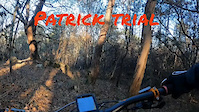
trail: Patrick's trail
2:19 |
14 |
Dec 30, 2024

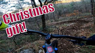
trail: Patrick's climb road
2:50 |
2017 |
Sep 29, 2017
![Prasez 1 e 2 + Pungitopo [MTB Monfalcone - GO]](https://ev1.pinkbike.org/tf/vt/1/yvt-229191-4.jpg)
trail: Pungitopo
3:23 |
84 |
Feb 16, 2025 , Monfalcone
![Prasez 1 e 2 + Pungitopo [MTB Monfalcone - GO]](https://ev1.pinkbike.org/tf/vt/1/yvt-229190-4.jpg)
trail: Prasez 2
3:23 |
32 |
Feb 16, 2025 , Monfalcone
![Prasez 1 e 2 + Pungitopo [MTB Monfalcone - GO]](https://ev1.pinkbike.org/tf/vt/1/yvt-229189-4.jpg)
trail: Prasez 1
3:23 |
55 |
Feb 16, 2025 , Monfalcone
![Bingobongo trail [MTBMonfalcone - GO]](https://ev1.pinkbike.org/tf/vt/1/yvt-229184-4.jpg)
trail: Bingo Bongo
2:50 |
67 |
Feb 16, 2025 , Monfalcone
trail: Simon 3
2:34 |
44 |
Jan 1, 2025 , Monfalcone

trail: Simon 2
2:34 |
49 |
Jan 1, 2025 , Monfalcone
Recent Trail Reports
| status | trail | date | condition | info | user |
|---|---|---|---|---|---|
| Patrick's trail | May 22, 2026 @ 3:01pm (Europe/Rome) May 22, 2026 | Ideal | ElMomos | ||
| Cinghialino | May 21, 2026 @ 5:10pm (Europe/Rome) May 21, 2026 | Ideal | ElMomos | ||
| Cinghiale | May 21, 2026 @ 5:10pm (Europe/Rome) May 21, 2026 | Ideal | ElMomos | ||
| Pungitopo | May 17, 2026 @ 3:35pm (Europe/Rome) May 17, 2026 | Variable | ElMomos | ||
| Redstone 121 jump line | May 17, 2026 @ 3:35pm (Europe/Rome) May 17, 2026 | Variable | ElMomos | ||
| Tasso | Apr 2, 2026 @ 5:47pm (Europe/Rome) Apr 2, 2026 | Ideal | ElMomos | ||
| Gatti | Mar 26, 2026 @ 5:44am (Europe/Rome) Mar 25, 2026 | Ideal | ElMomos | ||
| Simon 2 | Mar 4, 2026 @ 6:15am (Europe/Rome) Mar 3, 2026 | Variable | ElMomos | ||
| Simon 1 | Mar 4, 2026 @ 6:14am (Europe/Rome) Mar 3, 2026 | Ideal | ElMomos | ||
| Prasez 2 | Feb 28, 2026 @ 9:46am (Europe/Rome) Feb 28, 2026 | Ideal | ElMomos |
Activity Feed
| username | action | type | title | date |
|---|---|---|---|---|
| ElMomos | add | report | activity #95236273 and 2 more | May 22, 2026 @ 6:00am May 22, 2026 |
| ElMomos | add | report | activity #94970424 and 1 more | May 18, 2026 @ 5:46am May 18, 2026 |
| pierpaolo4tnxHQ | ridden | route | activity #94589815 | May 12, 2026 @ 3:57pm May 12, 2026 |
| ElMomos | add | trail | activity #91920078 and 1 more | Apr 4, 2026 @ 12:00pm Apr 4, 2026 |
| ElMomos | add | report | activity #91819913 and 1 more | Apr 3, 2026 @ 7:03am Apr 3, 2026 |
Recent Comments
| username | type | title | comment | date |
|---|---|---|---|---|
| trail | Please post as a “trail report”. This area... | Jul 31, 2024 @ 9:52am Jul 31, 2024 | ||
| trail | Attentions branches and foliage | Jul 31, 2024 @ 2:22am Jul 31, 2024 | ||
| trail | There's the best trail actually in the area. | Jun 2, 2024 @ 3:40am Jun 2, 2024 | ||
| trail | This is not Patrick trail, I post the right... | Apr 19, 2019 @ 1:52pm Apr 19, 2019 | ||
| trail | Isn't it the forestal road that heads to the... | Apr 16, 2019 @ 1:14am Apr 16, 2019 |
Nearby Areas
| name | distance | ||||
|---|---|---|---|---|---|
| Monte S. Michele | 4 | 12 | 5.3 km | ||
| Aurisina - Nabrežina | 24 | 7 | 7.1 km | ||
| Medea | 3 | 1 | 9.7 km | ||
| Calvario | 4 | 7 | 9.7 km | ||
| TCS trail network / Mark MTB | 9.9 km |
Activity Type Stats
| activitytype | trails | distance | descent | descent distance | total vertical | rating | global rank | state rank | photos | reports | routes | ridelogs |
|---|---|---|---|---|---|---|---|---|---|---|---|---|
| Mountain Bike | 34 | 17 miles | 2,431 ft | 5 miles | 344 ft | #3,520 | #147 | 42 | 407 | 1 | 1,498 | |
| E-Bike | 12 | 9 miles | 449 ft | 3,228 ft | 305 ft | #6,956 | #480 | 370 | 1 | 176 | ||
| Hike | 20 | 16 miles | 2,221 ft | 5 miles | 344 ft | #9,520 | #366 | 390 | 29 | |||
| Trail Running | 20 | 16 miles | 2,221 ft | 5 miles | 344 ft | #8,832 | #360 | 390 | 5 |
Frequently Asked Questions About Rocca
▼
What are the highest rated mountain biking trails in Rocca?
The highest rated mountain biking trails in Rocca are:
- 4 ALEX (4.4/5)
- Patrick's trail (4.3/5)
- Cinghiale (4.2/5)
- Vallone degli Aceri (4.2/5)
- Gatti (4.2/5)
▼
What is the best time of the year to ride in Rocca?
Based on ride log data, the most popular months to ride in Rocca are:
- May (3 activities)
- April (2 activities)
- December (1 activities)
▼
Where can I park to ride in Rocca?
There are 1 parking locations listed in Rocca. The most popular parking spots are:
▼
What is the longest trail in Rocca?
The longest trail in Rocca is Debudown at 8.4 miles. View all trails sorted by distance.
- By maxmisdaris
 MGNR & contributors
 - Admins: apply
- #43328 - 1,250 views
- rocca activity log | embed map of Rocca mountain bike trails | rocca mountain biking points of interest
Downloading of trail gps tracks in kml & gpx formats is enabled for Rocca.
You must login to download files.