close
-
Layers w
- Weather Layers
- Pro
- Pro
- Pro
- Pro
- Pro
- Pro
- More Layers
- Pro
- Pro
- Pro
- Pro
-
Upgrade to

3D
Trail Conditions
- Unknown
- Snow Groomed
- Snow Packed
- Snow Covered
- Snow Cover Partial
- Freeze/thaw Cycle
- Icy
- Prevalent Mud
- Wet
- Variable
- Ideal
- Dry
- Very Dry
Trail Flow (Ridden Direction)
Trailforks scans users ridelogs to determine the most popular direction each trail is ridden. A good flowing trail network will have most trails flowing in a single direction according to their intension.
The colour categories are based on what percentage of riders are riding a trail in its intended direction.
The colour categories are based on what percentage of riders are riding a trail in its intended direction.
- > 96%
- > 90%
- > 80%
- > 70%
- > 50%
- < 50%
- bi-directional trail
- no data
Trail Last Ridden
Trailforks scans ridelogs to determine the last time a trail was ridden.
- < 2 days
- < 1 week
- < 2 weeks
- < 1 month
- < 6 months
- > 6 months
Trail Ridden Direction
The intended direction a trail should be ridden.
- Downhill Only
- Downhill Primary
- Both Directions
- Uphill Primary
- Uphill Only
- One Direction
Contribute Details
Colors indicate trail is missing specified detail.
- Description
- Photos
- Description & Photos
- Videos
Trail Popularity ?
Trailforks scans ridelogs to determine which trails are ridden the most in the last 9 months.
Trails are compared with nearby trails in the same city region with a possible 25 colour shades.
Think of this as a heatmap, more rides = more kinetic energy = warmer colors.
- most popular
- popular
- less popular
- not popular
ATV/ORV/OHV Filter
Max Vehicle Width
inches
US Cell Coverage
Legend

Radar Time
Activity Recordings
Trailforks uses anonymized public activity data.
?
Activity Recordings
Trailforks uses anonymized public activity data.
?
Personal Heatmap
▶
Activity Types
all
/
none
▶
Options
2
Date range
month
–
Winter Trails
Warning
A routing network for winter maps does not exist. Selecting trails using the winter trails layer has been disabled.
Missing Trails
Most Popular
Least Popular
Trails are colored based on popularity. The more popular a trail is, the more red. Less popular trails trend towards green.
Jump Magnitude Heatmap
Heatmap of where riders jump on trails. Zoom in to see individual jumps, click circles to view jump details.
BC Backroad Status
![map legend]()
Service Road Atlas is a free to use, community-driven service for viewing and creating reports on the numerous back-country service roads around B.C. and Alberta.

Slope Aspect
Direction the slope faces
Trails Deemphasized
Trails are shown in grey.
Only show trails with no bike usage.
Suggested Layers
Based on selected activity type
Save the current map location and zoom level as your default home location whenever this page is loaded.
Save
No description for Rochester has been added yet!
Login or register to submit one.
Activities Click to view
- Mountain Bike
53 trails
- E-Bike
15 trails
- Gravel Bike
2 trails
- Adaptive Bike
0 trails
- Winter Fat Bike
0 trails
- Horse
12 trails
- Hike
79 trails
- Trail Running
79 trails
- Snowmobile
44 trails
- Snowshoe
18 trails
- Nordic Ski
16 trails
Region Details
- 16
- 5
- 19
- 13
Region Status
Open as of May 23, 2026Stats
- Avg Trail Rating
- Trails (view details)
- 124
- Trails Mountain Bike
- 53
- Trails E-Bike
- 15
- Trails Gravel Bike
- 2
- Trails Horse
- 12
- Trails Hike
- 79
- Trails Trail Running
- 79
- Trails Snowmobile
- 44
- Trails Snowshoe
- 18
- Trails Nordic Ski
- 16
- Total Distance
- 239 miles
- Total Descent
- 9,689 ft
- Total Vertical
- 549 ft
- Highest Trailhead
- 793 ft
- Reports
- 590
- Photos
- 33
- Ridden Counter
- 11,922
Sub Regions
-
Irondequoit Bay Park West
- 4
- 2
-
Northhampton Park
-
Seneca Park
-
Tryon Park
- 2
- 10
- 10
Popular Rochester Mountain Biking Trails
• 100 ★ 5.0 • 3,402 ft • 112 ft • 373 •
This flowy intermediate trail has everything from mild rollers to gap jumps and creek crossings. It connects to many of the trails in the park.
• 100 ★ 4.0 • 1,266 ft • 51 ft • 343 •
A fun and fast loop through a lower area of the park. Black can be found on the east side of the park, accessible from the . Climbing is rewarded with fast riding, a couple of berms, and some of the few man-made jumps in Bay Park....
• 90 ★ 3.7 • 3,104 ft • 111 ft • 322 •
Popular blue difficulty singletrack. This mountain bike primary trail can be used both directions. It features berm, roller coaster and skinny. On average it takes 5 minutes to complete this trail.
• 90 ★ 3.4 • 3,255 ft • 92 ft • 320 •
The only black diamond at Bay Park, but can be done by most intermediate riders. Can be ridden both ways. Head in from the parking lot to enjoy some fun descents after an initial steep climb. Take it from for some challenging technical...
• 85 ★ 4.0 • 1 mile • 153 ft • 304 •
Popular blue difficulty singletrack. This mountain bike primary trail can be used both directions. It features berm, jump and roller coaster. On average it takes 8 minutes to complete this trail.
• 85 ★ 0.0 • 2,687 ft • 54 ft • 288 •
Popular black diamond difficulty singletrack. This mountain bike primary trail can be used both directions. On average it takes 5 minutes to complete this trail.
• 85 ★ 0.0 • 1,417 ft • 30 ft • 265 •
Popular blue difficulty singletrack. This mountain bike primary trail can be used both directions. On average it takes 1 minutes to complete this trail.
Rochester Mountain Bike Routes
10 miles • 373 ft • 2 • Loop •
Genesee River loop starting at the bottom of Petten St. on a mixture of paved multiuse path and single...
• 12 miles • 2,087 ft • 22 •
• 6 miles • 869 ft • 20 •
• 5 miles • 915 ft • 11 •
• 8 miles • 1,275 ft • 31 •
• 4 miles • 668 ft • 8 •
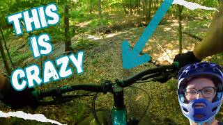
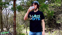
Photos of Rochester Mountain Bike
Videos of Rochester Mountain Bike
trail: Seneca Park Trail
0:12 |
22 |
Sep 20, 2022

trail: North Access
0:06 |
225 |
May 16, 2020
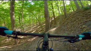
trail: RED Trail
6:56 |
294 |
Mar 11, 2014
trail: Blue
16:47 |
51 |
Sep 26, 2025 , Rochester

trail: Purple Trail
16:47 |
65 |
Sep 26, 2025 , Rochester
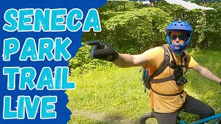
trail: Seneca Park Trail
54:32 |
135 |
Jul 26, 2024 , Rochester
trail: K16
151 |
Jun 26, 2024 , Rochester
trail: RED Trail
0:00 |
782 |
Jun 25, 2011
Recent Trail Reports
| status | trail | date | condition | info | user |
|---|---|---|---|---|---|
| K15 | May 23, 2026 @ 6:02am (America/New_York) May 23, 2026 | Variable | Arepiscopo | ||
| K17 | May 23, 2026 @ 6:02am (America/New_York) May 23, 2026 | Ideal | Arepiscopo | ||
| K16 | May 23, 2026 @ 6:02am (America/New_York) May 23, 2026 | Freeze/thaw Cycle | Arepiscopo | ||
| U8 | May 23, 2026 @ 6:02am (America/New_York) May 23, 2026 | Ideal | Arepiscopo | ||
| U6 | May 23, 2026 @ 6:02am (America/New_York) May 23, 2026 | Prevalent Mud | Arepiscopo | ||
| U07 | May 23, 2026 @ 6:02am (America/New_York) May 23, 2026 | Prevalent Mud | Arepiscopo | ||
| U10 | May 23, 2026 @ 6:02am (America/New_York) May 23, 2026 | Ideal | Arepiscopo | ||
| U10 | May 23, 2026 @ 6:02am (America/New_York) May 23, 2026 | Variable | Arepiscopo | ||
| G3 | May 23, 2026 @ 6:02am (America/New_York) May 23, 2026 | Ideal | Arepiscopo | ||
| U9 | May 23, 2026 @ 6:02am (America/New_York) May 23, 2026 | Variable | Arepiscopo |
Activity Feed
| username | action | type | title | date |
|---|---|---|---|---|
| thebooms | wishlist | region | activity #96850971 | Jun 12, 2026 @ 11:49pm Jun 12, 2026 |
| thebooms | wishlist | region | activity #96850956 | Jun 12, 2026 @ 11:48pm Jun 12, 2026 |
| SilkeRyder | wishlist | region | activity #95622582 | May 27, 2026 @ 3:25am May 27, 2026 |
| Arepiscopo | add | report | activity #95321459 and 16 more | May 23, 2026 @ 8:30am May 23, 2026 |
| jquartley | add | report | activity #93280807 | Apr 24, 2026 @ 7:52am Apr 24, 2026 |
Recent Comments
| username | type | title | comment | date |
|---|---|---|---|---|
| trail | i agree, but GROC has rated it black, as it's... | Nov 13, 2015 @ 11:07am Nov 13, 2015 | ||
| trail | I'd say the Green trail realistically has a... | Sep 3, 2015 @ 6:41am Sep 3, 2015 |
Local Badges
-

10 Green Trails70 awarded -

10 Blue Trails217 awarded -

Epic Ride Climb 2k4 awarded -

Climbing 10k Badge65 awarded -

Climbing 100k Badge3 awarded -

Epic Ride Descent 2k4 awarded
Activity Type Stats
| activitytype | trails | distance | descent | descent distance | total vertical | rating | global rank | state rank | photos | reports | routes | ridelogs |
|---|---|---|---|---|---|---|---|---|---|---|---|---|
| Mountain Bike | 53 | 53 miles | 3,770 ft | 19 miles | 390 ft | #1,340 | #509 | 33 | 590 | 1 | 19,691 | |
| E-Bike | 15 | 35 miles | 1,309 ft | 13 miles | 374 ft | #4,246 | #1,391 | 546 | 197 | |||
| Gravel Bike | 2 | 745 ft | 23 ft | 338 ft | 49 ft | #604 | #1,150 | 27 | 40 | |||
| Horse | 12 | 7 miles | 249 ft | 2 miles | 108 ft | #2,629 | #1,459 | 45 | ||||
| Hike | 79 | 71 miles | 4,741 ft | 24 miles | 407 ft | #3,721 | #1,315 | 588 | 1 | 537 | ||
| Trail Running | 79 | 71 miles | 4,741 ft | 24 miles | 407 ft | #3,144 | #917 | 588 | 1 | 540 | ||
| Snowmobile | 44 | 168 miles | 4,928 ft | 47 miles | 509 ft | #33 | #25 | 1 | 1 | |||
| Snowshoe | 18 | 11 miles | 482 ft | 3 miles | 108 ft | #988 | #486 | 19 | ||||
| Nordic Ski | 16 | 10 miles | 420 ft | 3 miles | 108 ft | #1,189 | #527 | 78 |
Frequently Asked Questions About Rochester
▼
What are the best places to ride in Rochester?
Rochester has 5 areas to explore for mountain biking. The top rated areas are:
▼
What are the highest rated mountain biking trails in Rochester?
The highest rated mountain biking trails in Rochester are:
- Roller Coaster (4.2/5)
- Orange Trail (4.2/5)
- Hubbell Hustle (4.1/5)
- Blue (4.1/5)
- G3 (4.1/5)
▼
What is the best time of the year to ride in Rochester?
Based on ride log data, the most popular months to ride in Rochester are:
- July (175 activities)
- August (151 activities)
- May (122 activities)
▼
Where can I park to ride in Rochester?
There are 9 parking locations listed in Rochester. The most popular parking spots are: View all parking and trailhead locations on the map to plan your visit.
Activities
- By DJBONEZ & contributors
- Admins: GROC
- #5904 - 12,148 views
- rochester activity log | embed map of Rochester mountain bike trails | rochester mountain biking points of interest
Downloading of trail gps tracks in kml & gpx formats is enabled for Rochester.
You must login to download files.