close
-
Layers w
- Weather Layers
- Pro
- Pro
- Pro
- Pro
- Pro
- Pro
- More Layers
- Pro
- Pro
- Pro
- Pro
-
Upgrade to

3D
Trail Conditions
- Unknown
- Snow Groomed
- Snow Packed
- Snow Covered
- Snow Cover Partial
- Freeze/thaw Cycle
- Icy
- Prevalent Mud
- Wet
- Variable
- Ideal
- Dry
- Very Dry
Trail Flow (Ridden Direction)
Trailforks scans users ridelogs to determine the most popular direction each trail is ridden. A good flowing trail network will have most trails flowing in a single direction according to their intension.
The colour categories are based on what percentage of riders are riding a trail in its intended direction.
The colour categories are based on what percentage of riders are riding a trail in its intended direction.
- > 96%
- > 90%
- > 80%
- > 70%
- > 50%
- < 50%
- bi-directional trail
- no data
Trail Last Ridden
Trailforks scans ridelogs to determine the last time a trail was ridden.
- < 2 days
- < 1 week
- < 2 weeks
- < 1 month
- < 6 months
- > 6 months
Trail Ridden Direction
The intended direction a trail should be ridden.
- Downhill Only
- Downhill Primary
- Both Directions
- Uphill Primary
- Uphill Only
- One Direction
Contribute Details
Colors indicate trail is missing specified detail.
- Description
- Photos
- Description & Photos
- Videos
Trail Popularity ?
Trailforks scans ridelogs to determine which trails are ridden the most in the last 9 months.
Trails are compared with nearby trails in the same city region with a possible 25 colour shades.
Think of this as a heatmap, more rides = more kinetic energy = warmer colors.
- most popular
- popular
- less popular
- not popular
ATV/ORV/OHV Filter
Max Vehicle Width
inches
US Cell Coverage
Legend

Radar Time
Activity Recordings
Trailforks uses anonymized public activity data.
?
Activity Recordings
Trailforks uses anonymized public activity data.
?
Personal Heatmap
▶
Activity Types
all
/
none
▶
Options
2
Date range
month
–
Winter Trails
Warning
A routing network for winter maps does not exist. Selecting trails using the winter trails layer has been disabled.
Missing Trails
Most Popular
Least Popular
Trails are colored based on popularity. The more popular a trail is, the more red. Less popular trails trend towards green.
Jump Magnitude Heatmap
Heatmap of where riders jump on trails. Zoom in to see individual jumps, click circles to view jump details.
BC Backroad Status
![map legend]()
Service Road Atlas is a free to use, community-driven service for viewing and creating reports on the numerous back-country service roads around B.C. and Alberta.

Slope Aspect
Direction the slope faces
Trails Deemphasized
Trails are shown in grey.
Only show trails with no bike usage.
Suggested Layers
Based on selected activity type
Save the current map location and zoom level as your default home location whenever this page is loaded.
Save
No description for Rockford has been added yet!
Login or register to submit one.
Activities Click to view
- Mountain Bike
65 trails
- E-Bike
19 trails
- Gravel Bike
1 trails
- Adaptive Bike
0 trails
- Winter Fat Bike
0 trails
- Hike
72 trails
- Trail Running
72 trails
- Snowshoe
11 trails
- Downhill Ski
16 trails
- Nordic Ski
11 trails
Region Details
- 12
- 1
- 18
- 32
- 2
Region Status
Open as of Jun 11, 2026Stats
- Avg Trail Rating
- Trails (view details)
- 90
- Trails Mountain Bike
- 65
- Trails E-Bike
- 19
- Trails Gravel Bike
- 1
- Trails Hike
- 72
- Trails Trail Running
- 72
- Trails Snowshoe
- 11
- Trails Downhill Ski
- 16
- Trails Nordic Ski
- 11
- Total Distance
- 72 miles
- Total Descent
- 5,376 ft
- Total Vertical
- 340 ft
- Highest Trailhead
- 1,028 ft
- Reports
- 7,920
- Photos
- 178
- Ridden Counter
- 33,698
Sub Regions
-
Cannon Township
-
Cannonsburg Ski Area
- 6
- 9
-
Cannonsburg State Game Area
- 6
-
Luton Park
- 9
- 7
-
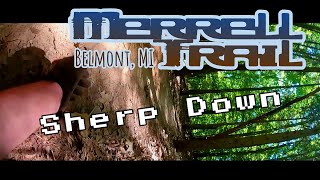
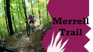
Merrell Trails
- 3
- 9
- 2
-
Pando Sports Park
- 1
Popular Rockford Mountain Biking Trails
• 100 ★ 4.6 • 2 miles • 161 ft • 2,011 •
Features a roller coaster stretch with some of the most fun singletrack in the state. Fun to ride in either direction--up or down. Take advantage of the subtle jumps and drops buried into the topography for a fun ride.
• 65 ★ 5.0 • 3,140 ft • 86 ft • 1,737 •
Highly rated moderately popular blue difficulty singletrack. This multi-use trail can be used both directions and has a easy overall physical rating with a 86 ft green climb. On average it takes 16 minutes to complete this trail.
• 65 ★ 5.0 • 2,726 ft • 101 ft • 893 •
A technically challenging trail which is a different beast depending on which direction you ride it. In the yellow direction you maneuver a narrow elevated curvy bridge into a rutty section, crank up tight switchbacks and then fly off a...
• 80 ★ 3.8 • 4,528 ft • 40 ft • 881 •
Easiest, sweetest, and shortest of all the Luton loops.
• 95 ★ 3.0 • 1,037 ft • 16 ft • 868 •
A short stretch of singletrack alternative to the runs through a burn-managed native prairie. This is a shorter and more entertaining stretch than the .
• 75 ★ 5.0 • 3,586 ft • 129 ft • 865 •
Highly rated popular blue difficulty singletrack. This multi-use trail can be used both directions and has a easy overall physical rating with a 129 ft green climb. On average it takes 3 minutes to complete this trail.
• 60 ★ 4.4 • 5,036 ft • 82 ft • 864 •
Also includes a "youth striders" trail near the trailhead. This loop is easy enough to take the whole family mountain biking.
Rockford Mountain Bike Routes
★ 5.0 • 8 miles • 493 ft • 15 • Loop •
Hand built stacked loop system with a short beginner kids loop.
★ 5.0 • 77 miles • 4,803 ft • 53 •
Park at the cannon townshop building on the corner of myerslake rd and belding rd. Hits all the trails in...
8 miles • 788 ft • 5 • Loop •
This is the Cannonsburg Ski Area mountain bike trail's clockwise direction loop used on Sundays Mondays...
8 miles • 789 ft • 5 • Loop •
This is the Cannonsburg Ski Area mountain bike trail's counter-clockwise direction loop used on Tuesdays,...
Recent Trail Reports
| status | trail | date | condition | info | user |
|---|---|---|---|---|---|
| Wynalda Flow Trail 3 | Jun 11, 2026 @ 7:02am (America/Detroit) Jun 11, 2026 | Ideal | MTB-Cowgirl | ||
| Wynalda Flow Trail 2 | Jun 11, 2026 @ 7:02am (America/Detroit) Jun 11, 2026 | Ideal | MTB-Cowgirl | ||
| Wynalda Flow Trail 1 | Jun 11, 2026 @ 7:02am (America/Detroit) Jun 11, 2026 | Ideal | MTB-Cowgirl | ||
| Carin Tech | Jun 4, 2026 @ 10:33am (America/Detroit) Jun 4, 2026 | Dry | rickplite | ||
| Nova | Jun 4, 2026 @ 10:33am (America/Detroit) Jun 4, 2026 | Dry | rickplite | ||
| Mix Master | Jun 4, 2026 @ 10:33am (America/Detroit) Jun 4, 2026 | Dry | rickplite | ||
| Wilderness Connector | Jun 4, 2026 @ 10:33am (America/Detroit) Jun 4, 2026 | Dry | rickplite | ||
| Siren | Jun 4, 2026 @ 10:33am (America/Detroit) Jun 4, 2026 | Dry | rickplite | ||
| Wynalda Return Trail | Jun 4, 2026 @ 10:33am (America/Detroit) Jun 4, 2026 | Dry | rickplite | ||
| Wilderness | Jun 4, 2026 @ 10:33am (America/Detroit) Jun 4, 2026 | Dry | rickplite |
Activity Feed
| username | action | type | title | date |
|---|---|---|---|---|
| EthanYwvHde | ridden | trail | activity #97071185 | Jun 15, 2026 @ 4:03pm Jun 15, 2026 |
| MTB-Cowgirl | add | report | activity #96727431 and 2 more | Jun 11, 2026 @ 4:02am Jun 11, 2026 |
| campkarl | ridden | region | activity #96559716 | Jun 8, 2026 @ 1:04pm Jun 8, 2026 |
| campkarl | wishlist | trail | activity #96559651 | Jun 8, 2026 @ 1:03pm Jun 8, 2026 |
| rickplite | add | report | activity #96240113 and 9 more | Jun 4, 2026 @ 11:00am Jun 4, 2026 |
Recent Comments
| username | type | title | comment | date |
|---|---|---|---|---|
| report | Really fun big jumps | Oct 27, 2025 @ 3:32pm Oct 27, 2025 | ||
| trail | It's 60% loose over hard and 40% beach sand.... | Sep 16, 2025 @ 1:35pm Sep 16, 2025 | ||
| trail | Living close to Merrell Trail, it ride it... | May 16, 2024 @ 6:14pm May 16, 2024 | ||
| trail | The black diamond rating on this trail is not... | May 16, 2024 @ 3:46pm May 16, 2024 | ||
| trail | The jumps are very small, beginner, and easy.... | Oct 26, 2022 @ 6:40am Oct 26, 2022 |
Local Badges
-

10 Green Trails439 awarded -

10 Blue Trails607 awarded -

Epic Ride Climb 2k26 awarded -

Climbing 10k Badge189 awarded -

Climbing 100k Badge17 awarded -

Epic Ride Descent 2k26 awarded
Bike & Skill Parks
| name | type | city | rating |
|---|---|---|---|
| Cannonsburg Skills Park | skill park | Rockford | |
| Rock City BMX | skill park | Rockford |
Activity Type Stats
| activitytype | trails | distance | descent | descent distance | total vertical | rating | global rank | state rank | photos | reports | routes | ridelogs |
|---|---|---|---|---|---|---|---|---|---|---|---|---|
| Mountain Bike | 65 | 57 miles | 4,770 ft | 16 miles | 338 ft | #331 | #123 | 176 | 7,920 | 9 | 51,905 | |
| E-Bike | 19 | 23 miles | 1,476 ft | 4 miles | 177 ft | #4,197 | #1,378 | 4,681 | 185 | |||
| Gravel Bike | 1 | 7 miles | 7 ft | 1,040 ft | 164 ft | #469 | #1,044 | 83 | 91 | |||
| Hike | 72 | 64 miles | 4,104 ft | 18 miles | 253 ft | #3,459 | #1,219 | 2 | 7,909 | 1,086 | ||
| Trail Running | 72 | 64 miles | 4,104 ft | 18 miles | 253 ft | #2,991 | #869 | 7,909 | 1 | 880 | ||
| Snowshoe | 11 | 14 miles | 367 ft | 5 miles | 190 ft | #867 | #405 | 1 | 63 | |||
| Downhill Ski | 16 | 3 miles | 338 ft | 1 mile | 131 ft | #489 | #203 | 121 | ||||
| Nordic Ski | 11 | 14 miles | 367 ft | 5 miles | 190 ft | #954 | #391 | 70 | 1 | 76 |
Frequently Asked Questions About Rockford
▼
What are the best places to ride in Rockford?
Rockford has 6 areas to explore for mountain biking. The top rated areas are:
▼
What are the highest rated mountain biking trails in Rockford?
The highest rated mountain biking trails in Rockford are:
- Phaser (4.6/5)
- Siren (4.6/5)
- Sawtooth (4.6/5)
- Wilderness (4.4/5)
- Luton Black Loop (4.4/5)
▼
What is the best time of the year to ride in Rockford?
Based on ride log data, the most popular months to ride in Rockford are:
- July (256 activities)
- August (173 activities)
- June (164 activities)
▼
Where can I park to ride in Rockford?
There are 13 parking locations listed in Rockford. The most popular parking spots are: View all parking and trailhead locations on the map to plan your visit.
Activities
Trails
- By brenthillier
 NSMBA TRAILFORKS & contributors
 - Admins: apply
- #8664 - 7,046 views
- rockford activity log | embed map of Rockford mountain bike trails | rockford mountain biking points of interest
Downloading of trail gps tracks in kml & gpx formats is enabled for Rockford.
You must login to download files.