close
-
Layers w
- Weather Layers
- Pro
- Pro
- Pro
- Pro
- Pro
- Pro
- More Layers
- Pro
- Pro
- Pro
- Pro
-
Upgrade to

3D
Trail Conditions
- Unknown
- Snow Groomed
- Snow Packed
- Snow Covered
- Snow Cover Partial
- Freeze/thaw Cycle
- Icy
- Prevalent Mud
- Wet
- Variable
- Ideal
- Dry
- Very Dry
Trail Flow (Ridden Direction)
Trailforks scans users ridelogs to determine the most popular direction each trail is ridden. A good flowing trail network will have most trails flowing in a single direction according to their intension.
The colour categories are based on what percentage of riders are riding a trail in its intended direction.
The colour categories are based on what percentage of riders are riding a trail in its intended direction.
- > 96%
- > 90%
- > 80%
- > 70%
- > 50%
- < 50%
- bi-directional trail
- no data
Trail Last Ridden
Trailforks scans ridelogs to determine the last time a trail was ridden.
- < 2 days
- < 1 week
- < 2 weeks
- < 1 month
- < 6 months
- > 6 months
Trail Ridden Direction
The intended direction a trail should be ridden.
- Downhill Only
- Downhill Primary
- Both Directions
- Uphill Primary
- Uphill Only
- One Direction
Contribute Details
Colors indicate trail is missing specified detail.
- Description
- Photos
- Description & Photos
- Videos
Trail Popularity ?
Trailforks scans ridelogs to determine which trails are ridden the most in the last 9 months.
Trails are compared with nearby trails in the same city region with a possible 25 colour shades.
Think of this as a heatmap, more rides = more kinetic energy = warmer colors.
- most popular
- popular
- less popular
- not popular
ATV/ORV/OHV Filter
Max Vehicle Width
inches
US Cell Coverage
Legend

Radar Time
Activity Recordings
Trailforks uses anonymized public activity data.
?
Activity Recordings
Trailforks uses anonymized public activity data.
?
Personal Heatmap
▶
Activity Types
all
/
none
▶
Options
2
Date range
month
–
Winter Trails
Warning
A routing network for winter maps does not exist. Selecting trails using the winter trails layer has been disabled.
Missing Trails
Most Popular
Least Popular
Trails are colored based on popularity. The more popular a trail is, the more red. Less popular trails trend towards green.
Jump Magnitude Heatmap
Heatmap of where riders jump on trails. Zoom in to see individual jumps, click circles to view jump details.
BC Backroad Status
![map legend]()
Service Road Atlas is a free to use, community-driven service for viewing and creating reports on the numerous back-country service roads around B.C. and Alberta.

Slope Aspect
Direction the slope faces
Trails Deemphasized
Trails are shown in grey.
Only show trails with no bike usage.
Suggested Layers
Based on selected activity type
Save the current map location and zoom level as your default home location whenever this page is loaded.
Save
No description for Roero has been added yet!
Login or register to submit one.
Primary Trail Type: Cross-Country
eBikes Allowed:
Yes
This region uses the Uk/Euro style trail grading system.
Activities Click to view
- Mountain Bike
70 trails
- E-Bike
65 trails
- Horse
10 trails
- Hike
59 trails
- Trail Running
60 trails
- Dirtbike/Moto
4 trails
Region Details
- 15
- 1
- 30
- 19
- 1
Region Status
Open as of Jun 13, 2026Stats
- Avg Trail Rating
- Trails (view details)
- 68
- Trails Mountain Bike
- 70
- Trails E-Bike
- 65
- Trails Horse
- 10
- Trails Hike
- 59
- Trails Trail Running
- 60
- Trails Dirtbike/Moto
- 4
- Trails Observed Trials
- 1
- Trails ATV/ORV/OHV
- 1
- Total Distance
- 46 miles
- Total Descent Distance
- 28 miles
- Total Descent
- 10,502 ft
- Total Vertical
- 699 ft
- Highest Trailhead
- 1,414 ft
- Reports
- 262
- Photos
- 35
- Ridden Counter
- 1,994
Popular Roero Mountain Biking Trails
• 95 ★ 5.0 • 2,861 ft • 0 ft • 65 •
Popular green difficulty singletrack. This mountain bike primary trail can be used both directions. On average it takes 2 minutes to complete this trail.
• 95 ★ 4.4 • 2,336 ft • 0 ft • 62 •
Popular blue difficulty singletrack. This mountain bike primary trail can be used downhill only and has a easy overall physical rating. It features berm. On average it takes 1 minutes to complete this trail.
• 85 ★ 5.0 • 5,171 ft • 137 ft • 54 •
Popular blue difficulty singletrack. This mountain bike primary trail can be used downhill primary and has a moderate overall physical rating with a 137 ft blue climb. Trail visibility is always easy to follow. On average it takes 9 minutes to complete this trail.
• 95 ★ 4.5 • 2,503 ft • 0 ft • 48 •
Popular green difficulty singletrack. This mountain bike primary trail can be used both directions and has a moderate overall physical rating with a 0 ft blue climb. On average it takes 3 minutes to complete this trail.
• 45 ★ 3.7 • 2,382 ft • 0 ft • 44 •
Moderately popular blue difficulty singletrack. This mountain bike primary trail can be used downhill primary and has a easy overall physical rating with a 0 ft blue climb. Trail visibility is always easy to follow. On average it takes 1 minutes to complete this trail.
• 80 ★ 0.0 • 1,850 ft • 0 ft • 43 •
Popular green difficulty singletrack. This mountain bike primary trail can be used both directions. On average it takes 2 minutes to complete this trail.
Photos of Roero Mountain Bike
Videos of Roero Mountain Bike
trail: Progressive
2:16 |
535 |
Jul 7, 2018

trail: Progressive
3:32 |
6861 |
Sep 11, 2016
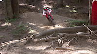
![Roero Park MTB - 5 Must Trails | Cuneo, Italy [4K]](https://ev1.pinkbike.org/tf/vt/1/yvt-260053-4.jpg)
trail: La Rete
16:08 |
20 |
Jan 6, 2026 , Caramagna Piemonte
![Roero Park MTB - 5 Must Trails | Cuneo, Italy [4K]](https://ev1.pinkbike.org/tf/vt/1/yvt-260052-4.jpg)
trail: Sentiero degli Aironi
16:08 |
21 |
Jan 6, 2026 , Caramagna Piemonte
![Roero Park MTB - 5 Must Trails | Cuneo, Italy [4K]](https://ev1.pinkbike.org/tf/vt/1/yvt-260051-4.jpg)
trail: Ajatta
16:08 |
26 |
Jan 6, 2026 , Caramagna Piemonte
![Roero Park MTB - 5 Must Trails | Cuneo, Italy [4K]](https://ev1.pinkbike.org/tf/vt/1/yvt-259585-4.jpg)
trail: Ummagumma dh
16:08 |
26 |
Dec 30, 2025 , Caramagna Piemonte
![Roero Park MTB - 5 Must Trails | Cuneo, Italy [4K]](https://ev1.pinkbike.org/tf/vt/1/yvt-259584-4.jpg)
trail: Pink Floyd
16:08 |
23 |
Dec 30, 2025 , Caramagna Piemonte
trail: PDC
0:35 |
130 |
Mar 7, 2022 , Caramagna Piemonte
Recent Trail Reports
| status | trail | date | condition | info | user |
|---|---|---|---|---|---|
| Rosa Trail | Apr 16, 2026 @ 9:46am (Europe/Rome) Apr 16, 2026 | Ideal | SimoneCornero | ||
| Casper | Apr 4, 2026 @ 2:19pm (Europe/Rome) Apr 4, 2026 | Ideal | Steulanghetto | ||
| Dh Monticello | Mar 8, 2026 @ 11:33am (Europe/Rome) Mar 8, 2026 | Ideal | flyingchicken1 | ||
| PDC | Mar 8, 2026 @ 11:33am (Europe/Rome) Mar 8, 2026 | Ideal | flyingchicken1 | ||
| Katrina | Mar 8, 2026 @ 11:33am (Europe/Rome) Mar 8, 2026 | Ideal | flyingchicken1 | ||
| Ajatta | Nov 1, 2025 @ 12:04pm (Europe/Monaco) Nov 1, 2025 | Dry | wilb96 | ||
| Sentiero Botanico della Verna 1 | Nov 1, 2025 @ 12:04pm (Europe/Monaco) Nov 1, 2025 | Dry | wilb96 | ||
| La Rete | Nov 1, 2025 @ 12:04pm (Europe/Monaco) Nov 1, 2025 | Dry | wilb96 | ||
| Sentiero Botanico Connector | Nov 1, 2025 @ 12:04pm (Europe/Monaco) Nov 1, 2025 | Dry | wilb96 | ||
| Sentiero Botanico Della Verna Connector | Nov 1, 2025 @ 12:04pm (Europe/Monaco) Nov 1, 2025 | Dry | wilb96 |
Activity Feed
| username | action | type | title | date |
|---|---|---|---|---|
| Corrado4A9Wr0 | ridden | trail | activity #95545198 | May 25, 2026 @ 11:09pm May 25, 2026 |
| mollatutto | wishlist | region | activity #94670434 | May 13, 2026 @ 10:38pm May 13, 2026 |
| Claudios7 | ridden | trail | activity #93537967 | Apr 27, 2026 @ 1:39pm Apr 27, 2026 |
| SimoneCornero | add | report | activity #92714313 | Apr 16, 2026 @ 4:15am Apr 16, 2026 |
| doctorpablo | ridden | trail | activity #92374003 | Apr 11, 2026 @ 3:18am Apr 11, 2026 |
Recent Comments
| username | type | title | comment | date |
|---|---|---|---|---|
| trail | Ciao, inserisci il commento come “trail... | Aug 21, 2024 @ 8:22am Aug 21, 2024 | ||
| trail | Sentiero non percorribile al momento per la... | Aug 21, 2024 @ 7:05am Aug 21, 2024 | ||
| trail | Che spettacolo un sacco di varianti dentro il... | Mar 20, 2023 @ 8:10am Mar 20, 2023 | ||
| trail | Da parcheggio pizzeria fior di fragola a... | Nov 27, 2022 @ 12:05pm Nov 27, 2022 | ||
| report | No problem! | Sep 5, 2022 @ 7:36am Sep 5, 2022 |
Nearby Areas
| name | distance | ||||
|---|---|---|---|---|---|
| America dei Boschi | 1.1 km | ||||
| Bike Park Alta Langa | 1 | 10 | 7 | 1 | 18 km |
| Santo Stefano Belbo | 1 | 1 | 3 | 18.9 km | |
| Canelli e le Terre d'Oro | 8 | 5 | 2 | 20 km | |
| Osservatorio | 7 | 2 | 20.1 km |
Local Badges
-

Completionist0 awarded
Activity Type Stats
| activitytype | trails | distance | descent | descent distance | total vertical | rating | global rank | state rank | photos | reports | routes | ridelogs |
|---|---|---|---|---|---|---|---|---|---|---|---|---|
| Mountain Bike | 70 | 46 miles | 10,502 ft | 28 miles | 699 ft | #2,614 | #95 | 35 | 262 | 2,287 | ||
| E-Bike | 65 | 44 miles | 9,606 ft | 27 miles | 699 ft | #2,694 | #187 | 250 | 376 | |||
| Horse | 10 | 9 miles | 988 ft | 4 miles | 364 ft | #1,874 | #100 | 3 | ||||
| Hike | 59 | 40 miles | 8,642 ft | 24 miles | 699 ft | #4,968 | #141 | 243 | 23 | |||
| Trail Running | 60 | 41 miles | 8,707 ft | 24 miles | 699 ft | #3,927 | #127 | 244 | 121 | |||
| Dirtbike/Moto | 4 | 5 miles | 699 ft | 2 miles | 348 ft | #645 | #21 | 1 | ||||
| Observed Trials | 1 | 2 miles | 236 ft | 3,120 ft | 184 ft | |||||||
| ATV/ORV/OHV | 1 | 2 miles | 236 ft | 3,120 ft | 184 ft |
Frequently Asked Questions About Roero
▼
What are the highest rated mountain biking trails in Roero?
The highest rated mountain biking trails in Roero are:
- Pink Floyd (4.3/5)
- La Rete (4.3/5)
- San Matteo (4.2/5)
- Sentiero degli Aironi (4.2/5)
- K2 (4.2/5)
▼
What is the best time of the year to ride in Roero?
Based on ride log data, the most popular months to ride in Roero are:
- September (3 activities)
- October (2 activities)
- May (1 activities)
▼
Where can I park to ride in Roero?
Check the Roero trail map for trailhead and parking information. Community members regularly update access and parking details for trails in the area.
▼
What is the longest trail in Roero?
The longest trail in Roero is Casper at 1.6 miles. View all trails sorted by distance.
- By nicho1993 & contributors
- Admins: silviu86, adessoomaipiu
- #44805 - 2,021 views
- roero activity log | embed map of Roero mountain bike trails |
Downloading of trail gps tracks in kml & gpx formats is enabled for Roero.
You must login to download files.