close
-
Layers w
- Weather Layers
- Pro
- Pro
- Pro
- Pro
- Pro
- Pro
- More Layers
- Pro
- Pro
- Pro
- Pro
-
Upgrade to

3D
Trail Conditions
- Unknown
- Snow Groomed
- Snow Packed
- Snow Covered
- Snow Cover Partial
- Freeze/thaw Cycle
- Icy
- Prevalent Mud
- Wet
- Variable
- Ideal
- Dry
- Very Dry
Trail Flow (Ridden Direction)
Trailforks scans users ridelogs to determine the most popular direction each trail is ridden. A good flowing trail network will have most trails flowing in a single direction according to their intension.
The colour categories are based on what percentage of riders are riding a trail in its intended direction.
The colour categories are based on what percentage of riders are riding a trail in its intended direction.
- > 96%
- > 90%
- > 80%
- > 70%
- > 50%
- < 50%
- bi-directional trail
- no data
Trail Last Ridden
Trailforks scans ridelogs to determine the last time a trail was ridden.
- < 2 days
- < 1 week
- < 2 weeks
- < 1 month
- < 6 months
- > 6 months
Trail Ridden Direction
The intended direction a trail should be ridden.
- Downhill Only
- Downhill Primary
- Both Directions
- Uphill Primary
- Uphill Only
- One Direction
Contribute Details
Colors indicate trail is missing specified detail.
- Description
- Photos
- Description & Photos
- Videos
Trail Popularity ?
Trailforks scans ridelogs to determine which trails are ridden the most in the last 9 months.
Trails are compared with nearby trails in the same city region with a possible 25 colour shades.
Think of this as a heatmap, more rides = more kinetic energy = warmer colors.
- most popular
- popular
- less popular
- not popular
ATV/ORV/OHV Filter
Max Vehicle Width
inches
US Cell Coverage
Legend

Radar Time
Activity Recordings
Trailforks uses anonymized public activity data.
?
Activity Recordings
Trailforks uses anonymized public activity data.
?
Personal Heatmap
▶
Activity Types
all
/
none
▶
Options
2
Date range
month
–
Winter Trails
Warning
A routing network for winter maps does not exist. Selecting trails using the winter trails layer has been disabled.
Missing Trails
Most Popular
Least Popular
Trails are colored based on popularity. The more popular a trail is, the more red. Less popular trails trend towards green.
Jump Magnitude Heatmap
Heatmap of where riders jump on trails. Zoom in to see individual jumps, click circles to view jump details.
BC Backroad Status
![map legend]()
Service Road Atlas is a free to use, community-driven service for viewing and creating reports on the numerous back-country service roads around B.C. and Alberta.

Slope Aspect
Direction the slope faces
Trails Deemphasized
Trails are shown in grey.
Only show trails with no bike usage.
Suggested Layers
Based on selected activity type
Save the current map location and zoom level as your default home location whenever this page is loaded.
Save
No description for Roma has been added yet!
Login or register to submit one.
This region uses the Uk/Euro style trail grading system.
Activities Click to view
- Mountain Bike
190 trails
- E-Bike
132 trails
- Horse
9 trails
- Hike
166 trails
- Trail Running
155 trails
Region Details
- 29
- 4
- 47
- 73
- 4
- 1
Stats
- Avg Trail Rating
- Trails (view details)
- 171
- Trails Mountain Bike
- 191
- Trails E-Bike
- 132
- Trails Gravel Bike
- 15
- Trails Adaptive Bike
- 3
- Trails Horse
- 9
- Trails Hike
- 166
- Trails Trail Running
- 155
- Total Distance
- 150 miles
- Total Descent
- 50,990 ft
- Total Vertical
- 5,198 ft
- Highest Trailhead
- 5,207 ft
- Reports
- 1,982
- Photos
- 301
- Ridden Counter
- 9,518
Sub Regions
- Capranica Prenestina (2)
- Monte Guadagnolo (2)
- Carpineto Romano (5)
- Cerveteri (10)
- Civitavecchia (15)
- Formello (30)
- Gorga (1)
- Palombara Sabina (9)
- Rocca di Papa (28)
- Rocca Priora (15)
- Roma (38)
- Sacrofano (2)
- VeioTrails (9)
- Subiaco (5)
- Tivoli (16)
- Monte Catillo (5)
- Tibur Trail Center (8)
- Trevignano Romano (17)
- Vicovaro (1)
Popular Roma Mountain Biking Trails
• 80 ★ 4.4 • 4,434 ft • 24 ft • 174 •
Popular blue difficulty singletrack. This mountain bike primary trail can be used downhill primary. On average it takes 8 minutes to complete this trail.
• 100 ★ 4.0 • 1 mile • 266 ft • 171 •
Beautiful dirt road in the Macchia di Sacrofano to the top of Monte Musino (380m) connecting all the best trails of the area (Volpe, Pungitopo, Scoiattolo, Cinghiale, Capra, Pecora in order from bottom to top). The road is well kept,...
• 60 ★ 3.7 • 2 miles • 181 ft • 169 •
Moderately popular blue difficulty singletrack. This mountain bike primary trail can be used downhill primary and has a moderate overall physical rating. It features drop and jump. On average it takes 15 minutes to complete this trail.
• 100 ★ 4.0 • 1 mile • 26 ft • 160 •
The sister trail of , it is much longer and comes down in the second part parallel to .
• 70 ★ 3.5 • 2,406 ft • 38 ft • 141 •
Panoramic, wonderful trail that runs on a panoramic crest and features some nice jumps and technical spots.
• 95 ★ 5.0 • 4,265 ft • 108 ft • 130 •
Popular green difficulty singletrack. This multi-use trail can be used both directions. On average it takes 7 minutes to complete this trail.
• 50 ★ 2.5 • 1,497 ft • 23 ft • 128 •
Short trail with many jumps. What does a squirrel ( ) all day? Jumps!
• 70 ★ 3.5 • 1,880 ft • 29 ft • 114 •
Final part of Volpe trail that connects to Cinghiale and Volpe uphill. It's single track with a few moderate drops.
Roma Mountain Bike Routes
★ 4.0 • 11 miles • 1,755 ft • 2 • Loop •
Partenza dalle catacombe, trails: Dark Deer; Snake; Boschetto. *per soft intendiamo la difficoltà dei trails
17 miles • 1,411 ft • 1 • Loop •
Passegiata cicloturistica che parte e termina al museo archeologico di Cerveteri, passando tra le...
13 miles • 2,293 ft • 3 • Loop •
From Via delle Barozze, La Foresta climb up to Campi di Annibale, then take Via Sacra until you reach the...
★ 5.0 • 14 miles • 1,495 ft • 0 •
A large ring around M.Ripoli, M.S.Angelo in Arcese and Gericomio. Starting from a parking near Agriturismo...
23 miles • 2,713 ft • 1 •
XXIII Point to Point Colli Albani - "La Via Sacra"
11 miles • 1,831 ft • 3 • Loop •
Giro che parte e termina al nuovo cimitero di Cerveteri. Passando nella necropoli dietro il cimitero si...
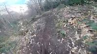
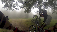
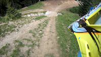
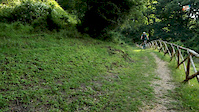
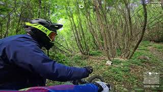
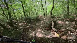
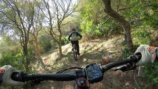
Photos of Roma Mountain Bike
Videos of Roma Mountain Bike
trail: B-Line
0:09 |
133 |
Mar 31, 2020
trail: Pettirosso Basso
7:23 |
259 |
Sep 24, 2014
trail: Snake
5:30 |
348 |
Jul 24, 2013
trail: Superintegrale
0:02 |
326 |
Jul 2, 2013
trail: Rocca Romana
4:19 |
49 |
May 20, 2025 , Trevignano Romano
trail: Pettirosso Basso
3:37 |
39 |
May 20, 2025 , Trevignano Romano

trail: Pettirosso "parte alta"
3:37 |
34 |
May 20, 2025 , Trevignano Romano
trail: Ripetitori
5:38 |
162 |
Nov 21, 2023 , Civitavecchia
Recent Trail Reports
| status | trail | date | condition | info | user |
|---|---|---|---|---|---|
| 3 Basso Monte Cavo | Jun 20, 2026 @ 8:22am (Europe/Rome) Jun 19, 2026 | Dry | JLGiallu1977 | ||
| 3 Alto Monte Cavo | Jun 20, 2026 @ 8:22am (Europe/Rome) Jun 19, 2026 | Dry | JLGiallu1977 | ||
| Giuliana Monte Cavo | Jun 20, 2026 @ 8:22am (Europe/Rome) Jun 19, 2026 | Dry | JLGiallu1977 | ||
| 4 Alto Monte Cavo | Jun 9, 2026 @ 3:23pm (Europe/Rome) Jun 9, 2026 | Very Dry | scittati | ||
| CAI 512 Le Piagge Di Genzano - Monte Cavo Rocca di Papa | Jun 1, 2026 @ 4:58pm (Europe/Rome) Jun 1, 2026 | Dry | JLGiallu1977 | ||
| Rocky Drop Roma | May 27, 2026 @ 5:10pm (Europe/Rome) May 27, 2026 | Dry | Pezzottocicloteam | ||
| Snake Cerveteri | May 21, 2026 @ 3:06pm (Europe/Vatican) May 21, 2026 | Dry | elgringo69mamma | ||
| Volpe-to-Cinghiale connector Formello | May 17, 2026 @ 9:52am (Europe/Rome) May 17, 2026 | Ideal | Carlosdelafuente | ||
| Volpe VeioTrails | May 17, 2026 @ 9:52am (Europe/Rome) May 17, 2026 | Ideal | Carlosdelafuente | ||
| Cinghiale to Volpe Formello | May 17, 2026 @ 9:52am (Europe/Rome) May 17, 2026 | Ideal | Carlosdelafuente |
Activity Feed
| username | action | type | title | date |
|---|---|---|---|---|
| tiburtrailcenter | update | region | activity #97618908 | Jun 23, 2026 @ 5:13am Jun 23, 2026 |
| tiburtrailcenter | wishlist | region | activity #97563218 | Jun 22, 2026 @ 8:22am Jun 22, 2026 |
| JLGiallu1977 | add | report | activity #97401021 and 2 more | Jun 20, 2026 @ 8:55am Jun 20, 2026 |
| EdrsJcT1 | ridden | trail | activity #97341691 | Jun 19, 2026 @ 1:36pm Jun 19, 2026 |
| DiegozyIpzP | comment | trail | activity #97070110 | Jun 15, 2026 @ 3:46pm Jun 15, 2026 |
Recent Comments
| username | type | title | comment | date |
|---|---|---|---|---|
| trail | Molto polveroso e scivoloso ma pulito 👍🏼 | Jun 15, 2026 @ 3:46pm Jun 15, 2026 | ||
| trail | Questo, ossia il sentiero principale è... | May 21, 2026 @ 3:00pm May 21, 2026 | ||
| trail | Percorso in salita con mtb il 7 aprile 2026.... | Apr 7, 2026 @ 10:37pm Apr 7, 2026 | ||
| trail | Percorso in data 7 aprile con mtb. Non sembra... | Apr 7, 2026 @ 10:33pm Apr 7, 2026 | ||
| trail | Nice green trail, but please delete old... | Nov 13, 2025 @ 1:08am Nov 13, 2025 |
Local Badges
-

Epic Ride Descent 2k15 awarded -

Epic Mountain Bike Climb 2k15 awarded -

Climbing 10k Badge7 awarded -

Mountain Biking 100k Badge2 awarded -

Descent 100k Badge2 awarded -

Big Ride 30k2,691 awarded
Bike & Skill Parks
| name | type | city | rating |
|---|---|---|---|
| All Park Roma | skill park | Roma | |
| Crossdromo Malagrotta (Rom) | skill park | Roma |
Activity Type Stats
| activitytype | trails | distance | descent | descent distance | total vertical | rating | global rank | state rank | photos | reports | routes | ridelogs |
|---|---|---|---|---|---|---|---|---|---|---|---|---|
| Mountain Bike | 190 | 150 miles | 50,991 ft | 86 miles | 5,197 ft | 293 | 1,976 | 22 | 50,330 | |||
| E-Bike | 132 | 79 miles | 25,210 ft | 45 miles | 5,197 ft | 6 | 1,865 | 10 | 8,675 | |||
| Gravel Bike | 15 | 36 | 705 | |||||||||
| Adaptive Bike | 2 | |||||||||||
| Horse | 9 | 8 miles | 2,444 ft | 4 miles | 2,556 ft | 2 | 203 | 41 | ||||
| Hike | 166 | 134 miles | 42,995 ft | 76 miles | 4,921 ft | 1,914 | 1,338 | |||||
| Trail Running | 155 | 130 miles | 40,525 ft | 72 miles | 4,911 ft | 1,914 | 1 | 465 |
Frequently Asked Questions About Roma
▼
What are the best places to ride in Roma?
Roma has 9 areas to explore for mountain biking. The top rated areas are:
▼
What are the highest rated mountain biking trails in Roma?
The highest rated mountain biking trails in Roma are:
- Giuliana (4.2/5)
- Roccette (4.2/5)
- Dark Deer (4.2/5)
- Discesa da Cabina elettrica a Ponte di ferro (4.1/5)
- Il Saraceno (4.1/5)
▼
What is the best time of the year to ride in Roma?
Based on ride log data, the most popular months to ride in Roma are:
- October (272 activities)
- July (258 activities)
- May (235 activities)
▼
What is the longest trail in Roma?
The longest trail in Roma is CAI 509 Circuito Delle Faete Di Rocca Di Papa at 5.5 miles. View all trails sorted by distance.
Activities
Trails
Points of Interest
- Rock steps TTF
- Ripetitori Nord di Monte Paradiso Viewpoint
- Ripetitori Sud di Monte Paradiso Viewpoint
- Viewpoint on Civitavecchia
- Monte Musino Viewpoint
- Torretta Cruciani Viewpoint
- Belvedere due laghi Viewpoint
- Lago di Nemi Viewpoint
- Monte Cavo Calle Iano-panorama su Roma Viewpoint
- Monte Autore (6,040 ft)
- Cima di Vallevona (5,922 ft)
- la Monella (5,719 ft)
- By denitopia
 TRAILFORKS VTA & contributors
 - Admins: denitopia, marcoangeletti, cemoorelife
- #11734 - 8,122 views
- roma activity log | embed map of Roma mountain bike trails | roma mountain biking points of interest
Downloading of trail gps tracks in kml & gpx formats is enabled for Roma.
You must login to download files.