close
-
Layers w
- Weather Layers
- Pro
- Pro
- Pro
- Pro
- Pro
- Pro
- More Layers
- Pro
- Pro
- Pro
- Pro
-
Upgrade to

3D
Trail Conditions
- Unknown
- Snow Groomed
- Snow Packed
- Snow Covered
- Snow Cover Partial
- Freeze/thaw Cycle
- Icy
- Prevalent Mud
- Wet
- Variable
- Ideal
- Dry
- Very Dry
Trail Flow (Ridden Direction)
Trailforks scans users ridelogs to determine the most popular direction each trail is ridden. A good flowing trail network will have most trails flowing in a single direction according to their intension.
The colour categories are based on what percentage of riders are riding a trail in its intended direction.
The colour categories are based on what percentage of riders are riding a trail in its intended direction.
- > 96%
- > 90%
- > 80%
- > 70%
- > 50%
- < 50%
- bi-directional trail
- no data
Trail Last Ridden
Trailforks scans ridelogs to determine the last time a trail was ridden.
- < 2 days
- < 1 week
- < 2 weeks
- < 1 month
- < 6 months
- > 6 months
Trail Ridden Direction
The intended direction a trail should be ridden.
- Downhill Only
- Downhill Primary
- Both Directions
- Uphill Primary
- Uphill Only
- One Direction
Contribute Details
Colors indicate trail is missing specified detail.
- Description
- Photos
- Description & Photos
- Videos
Trail Popularity ?
Trailforks scans ridelogs to determine which trails are ridden the most in the last 9 months.
Trails are compared with nearby trails in the same city region with a possible 25 colour shades.
Think of this as a heatmap, more rides = more kinetic energy = warmer colors.
- most popular
- popular
- less popular
- not popular
ATV/ORV/OHV Filter
Max Vehicle Width
inches
US Cell Coverage
Legend

Radar Time
Activity Recordings
Trailforks uses anonymized public activity data.
?
Activity Recordings
Trailforks uses anonymized public activity data.
?
Personal Heatmap
▶
Activity Types
all
/
none
▶
Options
2
Date range
month
–
Winter Trails
Warning
A routing network for winter maps does not exist. Selecting trails using the winter trails layer has been disabled.
Missing Trails
Most Popular
Least Popular
Trails are colored based on popularity. The more popular a trail is, the more red. Less popular trails trend towards green.
Jump Magnitude Heatmap
Heatmap of where riders jump on trails. Zoom in to see individual jumps, click circles to view jump details.
BC Backroad Status
![map legend]()
Service Road Atlas is a free to use, community-driven service for viewing and creating reports on the numerous back-country service roads around B.C. and Alberta.

Slope Aspect
Direction the slope faces
Trails Deemphasized
Trails are shown in grey.
Only show trails with no bike usage.
Suggested Layers
Based on selected activity type
Save the current map location and zoom level as your default home location whenever this page is loaded.
Save
No description for Round Mountain has been added yet!
Login or register to submit one.
 google parking directions
google parking directions Activities Click to view
- Mountain Bike
16 trails
- Hike
16 trails
- Trail Running
16 trails
Region Details
- 7
- 8
- 1
Region Status
Caution as of May 20, 2026Stats
- Avg Trail Rating
- Trails (view details)
- 16
- Trails Mountain Bike
- 16
- Trails Hike
- 16
- Trails Trail Running
- 16
- Total Distance
- 17 miles
- Total Descent
- 3,401 ft
- Total Vertical
- 1,613 ft
- Highest Trailhead
- 3,367 ft
- Reports
- 127
- Photos
- 62
- Ridden Counter
- 2,704
Popular Round Mountain Mountain Biking Trails
• 85 ★ 2.0 • 2,710 ft • 20 ft • 253 •
Popular blue difficulty singletrack. This mountain bike primary trail. On average it takes 2 minutes to complete this trail.
• 90 ★ 0.0 • 1 mile • 399 ft • 250 •
Popular blue difficulty singletrack. This mountain bike primary trail can be used both directions and has a moderate overall physical rating with a 399 ft blue climb. On average it takes 17 minutes to complete this trail.
• 75 ★ 4.0 • 2,465 ft • 187 ft • 212 •
Popular blue difficulty singletrack. This mountain bike primary trail. On average it takes 5 minutes to complete this trail.
• 80 ★ 4.5 • 2 miles • 8 ft • 206 •
Popular blue difficulty singletrack. This mountain bike primary trail can be used both directions and has a moderate overall physical rating with a 8 ft blue climb. On average it takes 11 minutes to complete this trail.
• 80 ★ 0.0 • 2,135 ft • 135 ft • 194 •
Popular blue difficulty singletrack. This mountain bike primary trail can be used both directions. On average it takes 4 minutes to complete this trail.
• 80 ★ 0.0 • 2,303 ft • 44 ft • 157 •
Popular blue difficulty singletrack. This mountain bike primary trail. On average it takes 6 minutes to complete this trail.
• 70 ★ 0.0 • 1 mile • 124 ft • 124 •
Popular blue difficulty singletrack. This mountain bike primary trail. On average it takes 10 minutes to complete this trail.
• 65 ★ 0.0 • 1 mile • 97 ft • 122 •
Moderately popular blue difficulty singletrack. This mountain bike primary trail. On average it takes 8 minutes to complete this trail.
Round Mountain Mountain Bike Routes
16 miles • 2,002 ft • 9 • Loop •
Nice ride on two popular trails close to town. Most of the climbing is on pavement utilizing Willow Valley...
9 miles • 1,428 ft • 8 • Loop •
Most of upper Round Mountain.
6 miles • 923 ft • 6 • Loop •
Great after work route or when you just need a quickie.
11 miles • 1,975 ft • 5 • Loop •
This gets you all of the Purdon-Edwards South Yuba Trail section. There is some extreme exposure towards...
11 miles • 1,054 ft • 1 •
Simple road/canal route for class rides focused on pedal time. Getting the kids spinning!
16 miles • 3,040 ft • 12 • Loop •
Might be on the harder side of moderate but doing it this way you get to end on a downhill. The drop to...
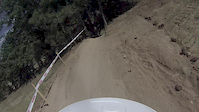
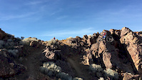
Photos of Round Mountain Mountain Bike
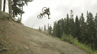
Videos of Round Mountain Mountain Bike
trail: Fork
0:34 |
45 |
Aug 5, 2017
trail: Fork
2:27 |
357 |
Apr 30, 2016
trail: Fork
2:26 |
47 |
Mar 10, 2015
trail: Fork
4:02 |
11015 |
Aug 25, 2013

trail: Fork
3:43 |
19792 |
Apr 29, 2013
trail: Fork
5:35 |
182 |
Mar 11, 2013

trail: Fork
2:13 |
637 |
Jan 31, 2013
trail: Fork
0:18 |
3853 |
Oct 5, 2012
Recent Trail Reports
Activity Feed
| username | action | type | title | date |
|---|---|---|---|---|
| illTonic | wishlist | route | activity #96462503 | Jun 7, 2026 @ 8:10am Jun 7, 2026 |
| Neversummer12 | add | report | activity #92977050 | Apr 19, 2026 @ 1:34pm Apr 19, 2026 |
| deeppow98 | comment | trail | activity #92418412 | Apr 11, 2026 @ 12:29pm Apr 11, 2026 |
| deeppow98 | add | report | activity #92417965 and 3 more | Apr 11, 2026 @ 12:25pm Apr 11, 2026 |
| rcfields | wishlist | trail | activity #92225606 | Apr 8, 2026 @ 6:05pm Apr 8, 2026 |
Recent Comments
| username | type | title | comment | date |
|---|---|---|---|---|
| trail | Trail is riding fine. One giant oak tree... | Apr 11, 2026 @ 12:29pm Apr 11, 2026 | ||
| trail | Trail clear of any downed wood | Mar 10, 2024 @ 2:26pm Mar 10, 2024 | ||
| trail | Trees are clear, still a bit of snow. Careful... | Feb 20, 2019 @ 11:54am Feb 20, 2019 | ||
| trail | Trail is clear of downed trees, lots of dead... | Feb 20, 2019 @ 11:52am Feb 20, 2019 | ||
| report | All clear of blowdowns, still lots of dead... | Feb 20, 2019 @ 11:50am Feb 20, 2019 |
Nearby Areas
| name | distance | ||||
|---|---|---|---|---|---|
| Harmony/Washington Ridge | 12 | 12 | 1 | 4 km | |
| Parliament Trails | 4 | 2 | 2 | 4.6 km | |
| South Yuba River State Park | 1 | 1 | 5.7 km | ||
| Loma Rica Ranch | 1 | 6.1 km | |||
| Malakoff Diggins State park | 2 | 6.3 km |
Activity Type Stats
| activitytype | trails | distance | descent | descent distance | total vertical | rating | global rank | state rank | photos | reports | routes | ridelogs |
|---|---|---|---|---|---|---|---|---|---|---|---|---|
| Mountain Bike | 16 | 17 miles | 3,402 ft | 8 miles | 1,614 ft | #5,970 | #2,227 | 62 | 127 | 9 | 2,418 | |
| Hike | 16 | 17 miles | 3,402 ft | 8 miles | 1,614 ft | #9,497 | #3,656 | 127 | 129 | |||
| Trail Running | 16 | 17 miles | 3,402 ft | 8 miles | 1,614 ft | #8,649 | #3,058 | 127 | 74 |
Frequently Asked Questions About Round Mountain
▼
What are the highest rated mountain biking trails in Round Mountain?
The highest rated mountain biking trails in Round Mountain are:
- Round Mountain Switchbacks (4.1/5)
- South Yuba Trail--Purdon to Edwards (4/5)
- Up And Over Trail (4/5)
- Rock Creek Road Trail (3.7/5)
- Rock Creek Flume Trail (0/5)
▼
What is the best time of the year to ride in Round Mountain?
Based on ride log data, the most popular months to ride in Round Mountain are:
- April (29 activities)
- May (18 activities)
- November (17 activities)
▼
Where can I park to ride in Round Mountain?
There are 5 parking locations listed in Round Mountain. The most popular parking spots are: View all parking and trailhead locations on the map to plan your visit.
▼
What is the longest trail in Round Mountain?
The longest trail in Round Mountain is South Yuba Trail--Purdon to Edwards at 4.4 miles. View all trails sorted by distance.
Activities
- By brenthillier
 NSMBA TRAILFORKS & contributors
 - Admins: BONC, TTF, LC, elikat715, Redhawk, dgoldsmith, Karlisle, Kellwob, limbolizard, Fgrgi000
- #8938 - 6,083 views
- round mountain activity log | embed map of Round Mountain mountain bike trails | round mountain mountain biking points of interest
Downloading of trail gps tracks in kml & gpx formats is enabled for Round Mountain.
You must login to download files.