close
-
Layers w
- Weather Layers
- Pro
- Pro
- Pro
- Pro
- Pro
- Pro
- More Layers
- Pro
- Pro
- Pro
- Pro
-
Upgrade to

3D
Trail Conditions
- Unknown
- Snow Groomed
- Snow Packed
- Snow Covered
- Snow Cover Partial
- Freeze/thaw Cycle
- Icy
- Prevalent Mud
- Wet
- Variable
- Ideal
- Dry
- Very Dry
Trail Flow (Ridden Direction)
Trailforks scans users ridelogs to determine the most popular direction each trail is ridden. A good flowing trail network will have most trails flowing in a single direction according to their intension.
The colour categories are based on what percentage of riders are riding a trail in its intended direction.
The colour categories are based on what percentage of riders are riding a trail in its intended direction.
- > 96%
- > 90%
- > 80%
- > 70%
- > 50%
- < 50%
- bi-directional trail
- no data
Trail Last Ridden
Trailforks scans ridelogs to determine the last time a trail was ridden.
- < 2 days
- < 1 week
- < 2 weeks
- < 1 month
- < 6 months
- > 6 months
Trail Ridden Direction
The intended direction a trail should be ridden.
- Downhill Only
- Downhill Primary
- Both Directions
- Uphill Primary
- Uphill Only
- One Direction
Contribute Details
Colors indicate trail is missing specified detail.
- Description
- Photos
- Description & Photos
- Videos
Trail Popularity ?
Trailforks scans ridelogs to determine which trails are ridden the most in the last 9 months.
Trails are compared with nearby trails in the same city region with a possible 25 colour shades.
Think of this as a heatmap, more rides = more kinetic energy = warmer colors.
- most popular
- popular
- less popular
- not popular
ATV/ORV/OHV Filter
Max Vehicle Width
inches
US Cell Coverage
Legend

Radar Time
Activity Recordings
Trailforks uses anonymized public activity data.
?
Activity Recordings
Trailforks uses anonymized public activity data.
?
Personal Heatmap
▶
Activity Types
all
/
none
▶
Options
2
Date range
month
–
Winter Trails
Warning
A routing network for winter maps does not exist. Selecting trails using the winter trails layer has been disabled.
Missing Trails
Most Popular
Least Popular
Trails are colored based on popularity. The more popular a trail is, the more red. Less popular trails trend towards green.
Jump Magnitude Heatmap
Heatmap of where riders jump on trails. Zoom in to see individual jumps, click circles to view jump details.
BC Backroad Status
![map legend]()
Service Road Atlas is a free to use, community-driven service for viewing and creating reports on the numerous back-country service roads around B.C. and Alberta.

Slope Aspect
Direction the slope faces
Trails Deemphasized
Trails are shown in grey.
Only show trails with no bike usage.
Suggested Layers
Based on selected activity type
Save the current map location and zoom level as your default home location whenever this page is loaded.
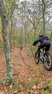
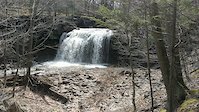
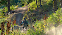
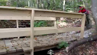
SaveThe Round Top trail system evolved from the local riding scene of the 90's. All of the trails are on private land and operate on a "handshake" agreement between the landowners and the Round Top Mountain Bike Association, which is a 501c3 non-profit organization. The majority of the trail system is on the property of the local resorts and inns, creating a unique opportunity for trailside accommodations, including two outdoor beer gardens. and many "Tentr" sites. There are 5 waterfalls throughout the system with well-built bridges spanning the various stream crossings. The trails are a bit on the techy side being in the Catskill Mountains, but have plenty of flow. The trail system also hosts the NYSMTB series, the RTMBA Enduro FUNdraiser, and the RTMBA FatFest (weather permitting). The trails are also groomed for fat bikes in the winter.
source: https://www.rtmba.org/
Primary Trail Type: Cross-Country
eBikes Allowed:
Yes
Land Status: Private Property
Land Manager: Round Top Mountain Bike Association
 google parking directions
 Access Info:
Riedlbauer's Resort driving range
Mountain Brauhaus
Winter Clove Inn bowling alley
Mountain Brauhaus
Winter Clove Inn bowling alley
Activities Click to view
- Mountain Bike
51 trails
- E-Bike
48 trails
- Hike
44 trails
- Trail Running
44 trails
- Snowshoe
2 trails
- Backcountry Ski
2 trails
Region Details
- 6
- 16
- 24
- 5
Region Status
Open as of 1 dayStats
- Avg Trail Rating
- Trails (view details)
- 51
- Trails Mountain Bike
- 52
- Trails E-Bike
- 48
- Trails Hike
- 44
- Trails Trail Running
- 44
- Trails Snowshoe
- 2
- Trails Backcountry Ski
- 2
- Total Distance
- 18 miles
- Total Descent
- 3,017 ft
- Total Vertical
- 590 ft
- Highest Trailhead
- 1,195 ft
- Reports
- 2,248
- Photos
- 234
- Ridden Counter
- 13,061
Popular Roundtopia Mountain Biking Trails
• 100 ★ 3.0 • 808 ft • 26 ft • 392 •
Popular blue difficulty singletrack. This mountain bike primary trail can be used both directions. It features drop. On average it takes 1 minutes to complete this trail.
• 90 ★ 0.0 • 824 ft • 22 ft • 364 •
Popular blue difficulty singletrack. This mountain bike primary trail can be used both directions with a 22 ft black diamond climb. It features bridge and drop. On average it takes 1 minutes to complete this trail.
• 75 ★ 5.0 • 1,148 ft • 40 ft • 347 •
Popular black diamond difficulty singletrack. This mountain bike primary trail can be used both directions. On average it takes 3 minutes to complete this trail.
• 95 ★ 4.0 • 1,751 ft • 30 ft • 346 •
Popular blue difficulty singletrack. This mountain bike primary trail can be used both directions. On average it takes 2 minutes to complete this trail.
• 70 ★ 3.8 • 1,005 ft • 72 ft • 344 •
Popular black diamond difficulty singletrack. This mountain bike primary trail can be used downhill primary. On average it takes 3 minutes to complete this trail.
• 100 ★ 4.0 • 3,109 ft • 199 ft • 338 •
Popular blue difficulty singletrack. This mountain bike primary trail can be used both directions with a 199 ft green climb. It features bridge. On average it takes 5 minutes to complete this trail.
• 75 ★ 4.0 • 2,820 ft • 240 ft • 319 •
Popular green difficulty doubletrack. This mountain bike primary trail can be used both directions with a 240 ft blue climb. On average it takes 5 minutes to complete this trail.
• 65 ★ 5.0 • 2,132 ft • 20 ft • 298 •
Moderately popular black diamond difficulty singletrack. This mountain bike primary trail can be used both directions and has a moderate overall physical rating with a 20 ft black diamond climb. It features rock face. On average it takes 6 minutes to complete this trail.
Roundtopia Mountain Bike Routes
5 miles • 592 ft • 11 •
This route encompasses the majority of the greatest features and trails at Riedlbauer's resort. This is a...
★ 1.0 • 7 miles • 691 ft • 10 •
2021 Round Top Rally XC race course loop
7 miles • 752 ft • 11 • Out & Back •
This is a fairly easy course for a beginner to learn on. There are a few tough hills(the Quarry) (Hematoma...
5 miles • 470 ft • 11 • Loop • Race •
2017 Round Top rally XC race course. Pro Cat 1 and Cat 2 lap.
• 5 miles • 519 ft • 8 •
• 10 miles • 1,157 ft • 16 •
Photos of Roundtopia Mountain Bike
Videos of Roundtopia Mountain Bike
trail: GnarCol Loop
0:27 |
139 |
Oct 14, 2025
trail: Hematoma
0:04 |
209 |
Apr 21, 2020
trail: Ale Trail
0:04 |
178 |
Apr 21, 2020
trail: Indian Lookout
0:06 |
404 |
Apr 21, 2020
trail: Offset
0:00 |
262 |
Sep 6, 2019
0:02 |
207 |
Sep 24, 2017
trail: GnarCol Loop
0:05 |
71 |
Oct 9, 2025 , Round Top
26:09 |
225 |
Jul 6, 2021
Recent Trail Reports
| status | trail | date | condition | info | user |
|---|---|---|---|---|---|
| Jimmy's Bluff | Sep 9, 2025 @ 3:49pm Sep 9, 2025 | Ideal | gorczync | ||
| The South Rim | Sep 9, 2025 @ 3:49pm Sep 9, 2025 | Ideal | gorczync | ||
| Aorta | Sep 9, 2025 @ 3:49pm Sep 9, 2025 | Ideal | gorczync | ||
| Pine Needley Hill | Sep 4, 2025 @ 10:44am Sep 4, 2025 | Very Dry | rslonakernu4u | ||
| Dry Lake bypass | Sep 4, 2025 @ 10:44am Sep 4, 2025 | Very Dry | rslonakernu4u | ||
| Peter's Driveway | Aug 23, 2025 @ 10:35am Aug 23, 2025 | Ideal | Tcraiglinz FCTPT | ||
| Winter Clove Rd | Aug 23, 2025 @ 10:35am Aug 23, 2025 | Ideal | Tcraiglinz FCTPT | ||
| Lower Turnicut | Aug 23, 2025 @ 10:35am Aug 23, 2025 | Ideal | Tcraiglinz FCTPT | ||
| Elevator-Drop, no drop | Aug 23, 2025 @ 10:35am Aug 23, 2025 | Ideal | Tcraiglinz FCTPT | ||
| Lower Moonshine | Aug 23, 2025 @ 10:35am Aug 23, 2025 | Ideal | Tcraiglinz FCTPT |
Activity Feed
| username | action | type | title | date |
|---|---|---|---|---|
| greeek32 | wishlist | route | activity #96948284 | Jun 14, 2026 @ 2:51am Jun 14, 2026 |
| drjms | wishlist | trail | activity #95939006 | May 31, 2026 @ 7:42am May 31, 2026 |
| GerritSinclairlK | wishlist | region | activity #93831826 | May 1, 2026 @ 9:19pm May 1, 2026 |
| CpsMPjJ3 | wishlist | region | activity #92379361 | Apr 11, 2026 @ 4:56am Apr 11, 2026 |
| CpsMPjJ3 | wishlist | region | activity #92360385 | Apr 10, 2026 @ 7:06pm Apr 10, 2026 |
Recent Comments
| username | type | title | comment | date |
|---|---|---|---|---|
| trail | Closed sign halfway down | Jul 30, 2023 @ 7:10am Jul 30, 2023 | ||
| trail | This zone of trails are all marked as closed... | Aug 22, 2022 @ 12:39pm Aug 22, 2022 | ||
| trail | This entire zone marked no trespassing pretty... | Aug 22, 2022 @ 12:38pm Aug 22, 2022 | ||
| report | Thanks. I saw that post today too. That... | May 3, 2022 @ 11:47am May 3, 2022 | ||
| report | The land owner has decided to no longer allow... | May 3, 2022 @ 6:57am May 3, 2022 |
Nearby Areas
| name | distance | ||||
|---|---|---|---|---|---|
| Tannersville-Hathaway Trail System | 1 | 4 | 1 | 5.5 km | |
| Kaaterskill Wild Forest | 10 | 13 | 6.3 km | ||
| Huckleberry Trail Network | 4 | 6 | 7.9 km | ||
| Elm Ridge Wild Forest | 8 | 20 | 1 | 9.2 km | |
| The Windham Path | 1 | 10.7 km |
Local Badges
-

Completionist2 awarded
Activity Type Stats
| activitytype | trails | distance | descent | descent distance | total vertical | rating | global rank | state rank | photos | reports | routes | ridelogs |
|---|---|---|---|---|---|---|---|---|---|---|---|---|
| Mountain Bike | 51 | 18 miles | 3,018 ft | 8 miles | 591 ft | #1,805 | #608 | 231 | 2,255 | 10 | 4,469 | |
| E-Bike | 48 | 16 miles | 2,913 ft | 8 miles | 591 ft | #4,387 | #1,224 | 3 | 2,236 | 4 | 146 | |
| Hike | 44 | 15 miles | 2,365 ft | 7 miles | 591 ft | #8,423 | #3,160 | 2,247 | 1 | 81 | ||
| Trail Running | 44 | 15 miles | 2,365 ft | 7 miles | 591 ft | #7,643 | #2,580 | 2,247 | 1 | 12 | ||
| Snowshoe | 2 | #1,571 | #833 | 7 | ||||||||
| Backcountry Ski | 2 | #407 | #120 | 58 | 50 |
Frequently Asked Questions About Roundtopia
▼
What are the highest rated mountain biking trails in Roundtopia?
The highest rated mountain biking trails in Roundtopia are:
- Indian Lookout (4.3/5)
- Lower Moonshine (4.2/5)
- Psychopath (4.1/5)
- Pinky Hill (4.1/5)
- Rodeo Field to Rick's Rock (4.1/5)
▼
What is the best time of the year to ride in Roundtopia?
Based on ride log data, the most popular months to ride in Roundtopia are:
- August (99 activities)
- September (94 activities)
- July (69 activities)
▼
Where can I park to ride in Roundtopia?
There are 4 parking locations listed in Roundtopia. The most popular parking spots are: View all parking and trailhead locations on the map to plan your visit.
▼
What is the longest trail in Roundtopia?
The longest trail in Roundtopia is GnarCol Loop at 1.3 miles. View all trails sorted by distance.
Activities
Trails
- By brenthillier
 NSMBA TRAILFORKS & contributors
 - Admins: RTMBA
- #4648 - 18,314 views
- roundtopia activity log | embed map of Roundtopia mountain bike trails | roundtopia mountain biking points of interest polygons
Downloading of trail gps tracks in kml & gpx formats is enabled for Roundtopia.
You must login to download files.