close
-
Layers w
- Weather Layers
- Pro
- Pro
- Pro
- Pro
- Pro
- Pro
- More Layers
- Pro
- Pro
- Pro
- Pro
-
Upgrade to

3D
Trail Conditions
- Unknown
- Snow Groomed
- Snow Packed
- Snow Covered
- Snow Cover Partial
- Freeze/thaw Cycle
- Icy
- Prevalent Mud
- Wet
- Variable
- Ideal
- Dry
- Very Dry
Trail Flow (Ridden Direction)
Trailforks scans users ridelogs to determine the most popular direction each trail is ridden. A good flowing trail network will have most trails flowing in a single direction according to their intension.
The colour categories are based on what percentage of riders are riding a trail in its intended direction.
The colour categories are based on what percentage of riders are riding a trail in its intended direction.
- > 96%
- > 90%
- > 80%
- > 70%
- > 50%
- < 50%
- bi-directional trail
- no data
Trail Last Ridden
Trailforks scans ridelogs to determine the last time a trail was ridden.
- < 2 days
- < 1 week
- < 2 weeks
- < 1 month
- < 6 months
- > 6 months
Trail Ridden Direction
The intended direction a trail should be ridden.
- Downhill Only
- Downhill Primary
- Both Directions
- Uphill Primary
- Uphill Only
- One Direction
Contribute Details
Colors indicate trail is missing specified detail.
- Description
- Photos
- Description & Photos
- Videos
Trail Popularity ?
Trailforks scans ridelogs to determine which trails are ridden the most in the last 9 months.
Trails are compared with nearby trails in the same city region with a possible 25 colour shades.
Think of this as a heatmap, more rides = more kinetic energy = warmer colors.
- most popular
- popular
- less popular
- not popular
ATV/ORV/OHV Filter
Max Vehicle Width
inches
US Cell Coverage
Legend

Radar Time
Activity Recordings
Trailforks uses anonymized public activity data.
?
Activity Recordings
Trailforks uses anonymized public activity data.
?
Personal Heatmap
▶
Activity Types
all
/
none
▶
Options
2
Date range
month
–
Winter Trails
Warning
A routing network for winter maps does not exist. Selecting trails using the winter trails layer has been disabled.
Missing Trails
Most Popular
Least Popular
Trails are colored based on popularity. The more popular a trail is, the more red. Less popular trails trend towards green.
Jump Magnitude Heatmap
Heatmap of where riders jump on trails. Zoom in to see individual jumps, click circles to view jump details.
BC Backroad Status
![map legend]()
Service Road Atlas is a free to use, community-driven service for viewing and creating reports on the numerous back-country service roads around B.C. and Alberta.

Slope Aspect
Direction the slope faces
Trails Deemphasized
Trails are shown in grey.
Only show trails with no bike usage.
Suggested Layers
Based on selected activity type
Save the current map location and zoom level as your default home location whenever this page is loaded.
SavePopular Trail Networks
view all areas »
No description for Routt County has been added yet!
Login or register to submit one.
Activities Click to view
- Mountain Bike
311 trails
- E-Bike
56 trails
- Horse
67 trails
- Hike
306 trails
- Trail Running
304 trails
- Dirtbike/Moto
29 trails
- ATV/ORV/OHV
12 trails
- Snowshoe
5 trails
- Downhill Ski
220 trails
- Nordic Ski
42 trails
Stats
- Avg Trail Rating
- Trails (view details)
- 612
- Trails Mountain Bike
- 312
- Trails E-Bike
- 56
- Trails Gravel Bike
- 106
- Trails Horse
- 67
- Trails Hike
- 306
- Trails Trail Running
- 304
- Trails Dirtbike/Moto
- 29
- Trails ATV/ORV/OHV
- 12
- Trails Snowmobile
- 1
- Trails Snowshoe
- 5
- Trails Downhill Ski
- 220
- Trails Backcountry Ski
- 22
- Trails Nordic Ski
- 42
- Total Distance
- 759 miles
- Total Descent
- 192,958 ft
- Total Vertical
- 5,800 ft
- Highest Trailhead
- 11,900 ft
- Reports
- 2,523
- Photos
- 830
- Ridden Counter
- 107,642
Articles
Video: Riding One of Steamboat's Fastest Trails in Prime Fall Conditions
Mar 24, 2022 from pinkbike.com
Steamboat Colorado's newest trail, Sprangus, is one of its fastest trails.
Colorado's 5 Most Popular Trail Networks According to Trailforks Data
Oct 20, 2021 from pinkbike.com
Colorado is the eighth most expansive of the 50 states by area and is home to 53 different mountain peaks in excess of 14,000 feet above sea level.
Race Report: Revolution Enduro Round 2 in Steamboat Springs, Colorado
Aug 12, 2020 from pinkbike.com
Round two brought athletes to Steamboat Springs.
Race Report: The Revolution Enduro Round Two at Steamboat Springs was a 2 Day, Back Country Epic
Jul 24, 2019 from pinkbike.com
Steamboat Lake State Park, Hahns Peak and Buffalo Pass offered a wealth of varied and challenging trails.
Sub Regions
- Clark (38)
- Seedhouse (34)
- Oak Creek (48)
- Lynx Pass (9)
- Oak Creek In Town Trails (7)
- Oak Creek Mountain Park (14)
- Stagecoach (16)
- Steamboat Springs (229)
- Backside Of Emerald Mountain (7)
- Bear River Bike Park (6)
- Buffalo Pass (37)
- Emerald Mountain (54)
- In Town Trails (35)
- Mad Creek (16)
- Mount Werner (31)
- Rabbit Ears Pass (7)
- Steamboat Bike Park (27)
Popular Routt County Mountain Biking Trails
• 100 ★ 4.9 • 4,564 ft • 0 ft • 2,134 •
Basically the exact same as upper but stepped up slightly in size. The jumps seem to be a bit larger but are still rollable for beginner riders.
• 100 ★ 4.0 • 3,023 ft • 16 ft • 2,126 •
Popular green difficulty singletrack. This mountain bike primary trail can be used downhill only. On average it takes 2 minutes to complete this trail.
• 100 ★ 3.3 • 2,284 ft • 5 ft • 1,990 •
Nice flowing single track, may be intermediate on account of the climbing, but another buff and smooth trail. It even has some nice berms, that you have to lean into pretty good going up hill or down. It used to be a bit punchy at the...
• 100 ★ 4.8 • 2 miles • 3 ft • 1,940 •
Fun flowy downhill trail. Lots of berms and table top jumps. All the jumps are beginner friendly and are easy to ride over if you don't want to jump them. Very smooth trail, rocks are almost not existent, until the very bottom section.
• 100 ★ 4.0 • 2 miles • 403 ft • 1,591 •
Popular white difficulty gravel path. This mountain bike primary trail can be used both directions. On average it takes 13 minutes to complete this trail.
• 100 ★ 4.6 • 4 miles • 852 ft • 1,567 •
Long winding trail that can be ridden up or down through beautiful aspens, ferns, and rock gardens. It connects to the top of Trail and .
• 95 ★ 4.3 • 1 mile • 0 ft • 1,484 •
This trail is a good but hard climb, and a rippin descent. It hugs the hillside a bit tight and can be a bit narrow, and there are some embedded rocks. Nothing too difficult.
• 100 ★ 3.6 • 531 ft • 0 ft • 1,433 •
Basically rock slab after rock slab with little drops in between. You climb this, and it can be a fun challenge. I prefer to spin the road, and then just rip down it. Let your bike just float on top of the rocks and you can get down...
Routt County Mountain Bike Routes
★ 4.3 • 22 miles • 2,466 ft • 10 • Loop •
This loop highlights two of Routt counties top trails with the headliner being the newly perfected Trail....
★ 5.0 • 23 miles • 3,658 ft • 3 •
Revolution Enduro Steamboat 2019 Day 1. Drop off at the top of stage 1 and pick up at end of stage 5
6 miles • 887 ft • 3 • Loop •
The Emerald Mountain Epic, formerly known as the Steamboat Stinger, provides a challenging backcountry...
★ 5.0 • 3 miles • 28 ft • 3 • Point to Point •
Beautiful, adventurous trail. Rocky, with natural features. Optional double black diamond lines.
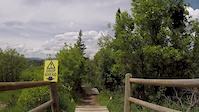
Photos of Routt County Mountain Bike
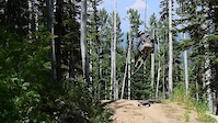
Videos of Routt County Mountain Bike
trail: Bear Tree Ridge (BTR)
0:11 |
146 |
Nov 28, 2020

trail: Buckin Bronc
4:22 |
2590 |
Nov 23, 2019
trail: Grouse
0:16 |
185 |
Sep 27, 2019
trail: Buckin Bronc
0:54 |
264 |
Sep 11, 2019
trail: Rustler's Ridge
0:37 |
1862 |
Jun 23, 2019
trail: Buckin Bronc
0:07 |
222 |
Jun 21, 2019
trail: Flying Diamond
5:38 |
1977 |
Mar 21, 2019

trail: Fish Creek
0:06 |
33 |
Oct 20, 2018
Current Trail Warnings
| status | trail | date | condition | user | info |
|---|---|---|---|---|---|
| CDT - Wyoming Trail (Muddy Creek) Rabbit Ears Pass | Jun 18, 2026 @ 3:51pm (America/Denver) 1 day | Variable | 22Lrek | The upper northwest half currently has 7... |
Recent Trail Reports
National Scenic Trails & Official Routes
-
Continental Divide Trail
- Mountain Bike
- Hike
- Trail Running

Activity Feed
| username | action | type | title | date |
|---|---|---|---|---|
| Ellenonsnow | add | report | activity #97311074 | Jun 19, 2026 @ 5:58am 16 hours |
| 22Lrek | add | report | activity #97277398 | Jun 18, 2026 @ 2:51pm 1 day |
| 22Lrek | ridden | trail | activity #97277092 and 1 more | Jun 18, 2026 @ 2:45pm 1 day |
| 22Lrek | ridden | trail | activity #97276866 and 16 more | Jun 18, 2026 @ 2:41pm 1 day |
| C34 | ridden | trail | activity #97231587 | Jun 17, 2026 @ 9:34pm 2 days |
Recent Comments
| username | type | title | comment | date |
|---|---|---|---|---|
| report | The first thing that popped out when we | Jun 13, 2026 @ 11:03am Jun 13, 2026 | ||
| trail | Closed May 15 - June 15 for elk calving season. | Jun 2, 2026 @ 11:54am Jun 2, 2026 | ||
| trail | If you’re expecting a downhill ripper, this... | Oct 8, 2025 @ 6:54pm Oct 8, 2025 | ||
| trail | One of the most over rated trails I’ve... | Sep 8, 2025 @ 2:58pm Sep 8, 2025 | ||
| report | I | Sep 1, 2025 @ 9:37am Sep 1, 2025 |
Local Badges
-

Big Ride 30k441 awarded -

Top 10 Trails6 awarded -

Epic Ride 50k87 awarded -
Epic Ride 50k426 awarded -
Epic Ride 50k2,710 awarded -
Big Ride 30k7,925 awarded
Bike & Skill Parks
| name | type | city | rating |
|---|---|---|---|
| Steamboat Bike Park | bike park | Steamboat Springs | |
| Steamboat Ski Resort | bike park | Steamboat Springs | |
| Steamboat Springs BMX Track | skill park | Steamboat Springs | |
| Bear River Bike Park | skill park | ||
| Pump Track | skill park | Oak Creek |
Upcoming Local Events
Local Products
Local Products
Activity Type Stats
| activitytype | trails | distance | descent | descent distance | total vertical | rating | global rank | state rank | photos | reports | routes | ridelogs |
|---|---|---|---|---|---|---|---|---|---|---|---|---|
| Mountain Bike | 311 | 495 miles | 90,361 ft | 239 miles | 4,255 ft | 823 | 2,500 | 135 | 53,410 | |||
| E-Bike | 56 | 161 miles | 27,277 ft | 80 miles | 4,199 ft | 3 | 1,986 | 4 | 456 | |||
| Gravel Bike | 106 | 134 miles | 15,728 ft | 52 miles | 3,993 ft | 644 | 4 | 426 | ||||
| Horse | 67 | 242 miles | 34,616 ft | 96 miles | 4,833 ft | 1,191 | 3 | |||||
| Hike | 306 | 602 miles | 102,795 ft | 269 miles | 5,801 ft | 3 | 2,439 | 19 | 4,692 | |||
| Trail Running | 304 | 602 miles | 102,657 ft | 269 miles | 5,801 ft | 2,438 | 23 | 2,936 | ||||
| Dirtbike/Moto | 29 | 108 miles | 18,596 ft | 55 miles | 3,465 ft | 1 | 1,034 | 1 | 15 | |||
| ATV/ORV/OHV | 12 | 69 miles | 12,133 ft | 38 miles | 3,202 ft | 1,028 | 2 | 1 | ||||
| Snowmobile | 1 | 4 miles | 236 ft | 1 mile | 331 ft | 17 | 11 | |||||
| Snowshoe | 5 | 13 miles | 2,930 ft | 8 miles | 2,467 ft | 18 | 1 | 226 | ||||
| Downhill Ski | 220 | 86 miles | 75,190 ft | 78 miles | 3,825 ft | 17 | 10,438 | |||||
| Backcountry Ski | 22 | 15 miles | 7,848 ft | 11 miles | 3,281 ft | 17 | 3,089 | |||||
| Nordic Ski | 42 | 35 miles | 2,149 ft | 12 miles | 2,684 ft | 17 | 1,951 |
Frequently Asked Questions About Routt County
▼
What are the best places to ride in Routt County?
Routt County has 21 areas to explore for mountain biking. The top rated areas are:
▼
What are the highest rated mountain biking trails in Routt County?
The highest rated mountain biking trails in Routt County are:
- Grouse (4.7/5)
- NPR (4.6/5)
- Agate (4.5/5)
- Lower NPR - Blue (4.5/5)
- Flash of Gold (4.5/5)
▼
What is the best time of the year to ride in Routt County?
Based on ride log data, the most popular months to ride in Routt County are:
- July (1,325 activities)
- August (667 activities)
- September (467 activities)
▼
What is the longest trail in Routt County?
The longest trail in Routt County is CDT - Wyoming Trail at 15.5 miles. View all trails sorted by distance.
Activities
- Routt County Mountain Biking Trails
- Routt County E-Biking Trails
- Routt County Horseback Trails
- Routt County Hiking Trails
- Routt County Trail Running Trails
- Routt County Dirtbiking Trails
- Routt County ATVing/Offroading Trails
- Routt County Snowshoeing Trails
- Routt County Skiing Trails
- Routt County Nordic Skiing Trails
Trails
Points of Interest
- Thunderhead Lodge
- Four Points Lodge
- Sender to Gap Jump TTF
- Kiosk Map Information
- Summit Lake Campground Camping
- Wood Sender TTF
- Huckleberry Bridge TTF
- Hip Booter TTF
- Big Sender TTF
- Strawberry Park Natural Hot Springs Information
- Lost Ranger Peak (11,946 ft)
- Mount Ethel (11,893 ft)
- Flattop Mountain (11,749 ft)
- By brenthillier
 NSMBA TRAILFORKS & contributors
 - Admins: jpmcghee, msmcfate, cmcquade, RCR
- #7963 - 6,853 views
- routt county activity log | embed map of Routt County mountain bike trails | routt county mountain biking points of interest polygons
Downloading of trail gps tracks in kml & gpx formats is disabled for Routt County.