close
-
Layers w
- Weather Layers
- Pro
- Pro
- Pro
- Pro
- Pro
- Pro
- More Layers
- Pro
- Pro
- Pro
- Pro
-
Upgrade to

3D
Trail Conditions
- Unknown
- Snow Groomed
- Snow Packed
- Snow Covered
- Snow Cover Partial
- Freeze/thaw Cycle
- Icy
- Prevalent Mud
- Wet
- Variable
- Ideal
- Dry
- Very Dry
Trail Flow (Ridden Direction)
Trailforks scans users ridelogs to determine the most popular direction each trail is ridden. A good flowing trail network will have most trails flowing in a single direction according to their intension.
The colour categories are based on what percentage of riders are riding a trail in its intended direction.
The colour categories are based on what percentage of riders are riding a trail in its intended direction.
- > 96%
- > 90%
- > 80%
- > 70%
- > 50%
- < 50%
- bi-directional trail
- no data
Trail Last Ridden
Trailforks scans ridelogs to determine the last time a trail was ridden.
- < 2 days
- < 1 week
- < 2 weeks
- < 1 month
- < 6 months
- > 6 months
Trail Ridden Direction
The intended direction a trail should be ridden.
- Downhill Only
- Downhill Primary
- Both Directions
- Uphill Primary
- Uphill Only
- One Direction
Contribute Details
Colors indicate trail is missing specified detail.
- Description
- Photos
- Description & Photos
- Videos
Trail Popularity ?
Trailforks scans ridelogs to determine which trails are ridden the most in the last 9 months.
Trails are compared with nearby trails in the same city region with a possible 25 colour shades.
Think of this as a heatmap, more rides = more kinetic energy = warmer colors.
- most popular
- popular
- less popular
- not popular
ATV/ORV/OHV Filter
Max Vehicle Width
inches
US Cell Coverage
Legend

Radar Time
Activity Recordings
Trailforks uses anonymized public activity data.
?
Activity Recordings
Trailforks uses anonymized public activity data.
?
Personal Heatmap
▶
Activity Types
all
/
none
▶
Options
2
Date range
month
–
Winter Trails
Warning
A routing network for winter maps does not exist. Selecting trails using the winter trails layer has been disabled.
Missing Trails
Most Popular
Least Popular
Trails are colored based on popularity. The more popular a trail is, the more red. Less popular trails trend towards green.
Jump Magnitude Heatmap
Heatmap of where riders jump on trails. Zoom in to see individual jumps, click circles to view jump details.
BC Backroad Status
![map legend]()
Service Road Atlas is a free to use, community-driven service for viewing and creating reports on the numerous back-country service roads around B.C. and Alberta.

Slope Aspect
Direction the slope faces
Trails Deemphasized
Trails are shown in grey.
Only show trails with no bike usage.
Suggested Layers
Based on selected activity type
Save the current map location and zoom level as your default home location whenever this page is loaded.
Save
No description for Roznava has been added yet!
Login or register to submit one.
Activities Click to view
- Mountain Bike
72 trails
- E-Bike
27 trails
- Gravel Bike
0 trails
- Adaptive Bike
0 trails
- Winter Fat Bike
0 trails
- Hike
55 trails
- Trail Running
56 trails
Region Details
- 14
- 1
- 10
- 21
- 9
- 2
- 2
Region Status
Open as of Jun 11, 2026Stats
- Avg Trail Rating
- Trails (view details)
- 65
- Trails Mountain Bike
- 72
- Trails E-Bike
- 27
- Trails Hike
- 55
- Trails Trail Running
- 56
- Total Distance
- 69 miles
- Total Descent
- 18,552 ft
- Total Vertical
- 3,164 ft
- Highest Trailhead
- 4,186 ft
- Reports
- 889
- Photos
- 82
- Ridden Counter
- 1,614
Sub Regions
-
DC-Trails
- 1
- 1
- 3
- 1
-
Flos Trails
- 1
- 2
- 3
- 2
-
Mine Trails
- 5
- 11
- 4
- 2
Popular Roznava Mountain Biking Trails
• 90 ★ 4.8 • 1,919 ft • 13 ft • 49 •
Popular proline difficulty singletrack. This mountain bike primary trail can be used downhill only and has a hard overall physical rating. It features rock face, rock garden and skinny. On average it takes 9 minutes to complete this trail.
• 75 ★ 4.0 • 4,566 ft • 219 ft • 46 •
Popular green difficulty mixed. This mountain bike primary trail can be used uphill primary and has a easy overall physical rating with a 219 ft green climb. On average it takes 8 minutes to complete this trail.
• 35 ★ 5.0 • 1,365 ft • 0 ft • 38 •
Less popular blue difficulty singletrack. This mountain bike primary trail can be used downhill only and has a moderate overall physical rating. It features berm and jump. On average it takes 4 minutes to complete this trail.
• 85 ★ 5.0 • 2,802 ft • 128 ft • 35 •
Popular black difficulty singletrack. This mountain bike primary trail can be used both directions and has a hard overall physical rating with a 128 ft black diamond climb. It features bridge, jump, rock garden and skinny. On average it takes 7 minutes to complete this trail.
• 70 ★ 5.0 • 2,054 ft • 0 ft • 35 •
Popular red difficulty singletrack. This mountain bike primary trail can be used downhill only and has a moderate overall physical rating. It features berm and jump. On average it takes 1 minutes to complete this trail.
• 65 ★ 4.8 • 2,897 ft • 6 ft • 34 •
Moderately popular blue difficulty alpine singletrack. This mountain bike primary trail can be used downhill only and has a moderate overall physical rating with a 6 ft blue climb. Trail visibility is always easy to follow. On average it takes 6 minutes to complete this trail.
• 55 ★ 5.0 • 1 mile • 64 ft • 33 •
Moderately popular blue difficulty alpine singletrack. This mountain bike primary trail can be used downhill primary and has a moderate overall physical rating with a 64 ft blue climb. It features rock garden and skinny. Trail visibility is always easy to follow. On average it takes 12 minutes to complete this trail.
• 55 ★ 5.0 • 2,920 ft • 8 ft • 33 •
Highly rated moderately popular blue difficulty singletrack. This mountain bike primary trail can be used downhill primary and has a moderate overall physical rating with a 8 ft blue climb. It features jump. On average it takes 20 minutes to complete this trail.
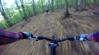
Photos of Roznava Mountain Bike
Recent Trail Reports
| status | trail | date | condition | info | user |
|---|---|---|---|---|---|
| Canada | Jun 6, 2026 @ 12:30pm (Europe/Bratislava) Jun 6, 2026 | Ideal | Spaff | ||
| Šľappka | Jun 6, 2026 @ 12:30pm (Europe/Bratislava) Jun 6, 2026 | Ideal | Spaff | ||
| Chodnik NEW 2025 | May 31, 2026 @ 1:06pm (Europe/Bratislava) May 31, 2026 | Ideal | grapperr | ||
| Vyslap 2 | May 31, 2026 @ 1:06pm (Europe/Bratislava) May 31, 2026 | Ideal | grapperr | ||
| Čierna ovca | May 31, 2026 @ 1:06pm (Europe/Bratislava) May 31, 2026 | Ideal | grapperr | ||
| Čierna Ovca FULL | May 31, 2026 @ 1:06pm (Europe/Bratislava) May 31, 2026 | Ideal | grapperr | ||
| Výšlap na čiernu ovcu | May 31, 2026 @ 1:06pm (Europe/Bratislava) May 31, 2026 | Ideal | grapperr | ||
| Divna Koza NEW | May 31, 2026 @ 1:06pm (Europe/Bratislava) May 31, 2026 | Ideal | grapperr | ||
| Baby Flow | May 21, 2026 @ 5:27pm (Europe/Bratislava) May 21, 2026 | Ideal | grapperr | ||
| Horrár | May 21, 2026 @ 5:27pm (Europe/Bratislava) May 21, 2026 | Dry | grapperr |
Activity Feed
| username | action | type | title | date |
|---|---|---|---|---|
| Spaff | add | report | activity #96475427 and 1 more | Jun 7, 2026 @ 10:21am Jun 7, 2026 |
| grapperr | add | report | activity #96032747 and 5 more | Jun 1, 2026 @ 11:59am Jun 1, 2026 |
| grapperr | add | report | activity #94749646 and 6 more | May 15, 2026 @ 7:30am May 15, 2026 |
| MiShreds | ridden | trail | activity #93764681 and 5 more | May 1, 2026 @ 2:50am May 1, 2026 |
| RandoTron | wishlist | region | activity #93529026 | Apr 27, 2026 @ 11:03am Apr 27, 2026 |
Recent Comments
| username | type | title | comment | date |
|---|---|---|---|---|
| trail | Trail is reshaped. Ready to ride. Enjoy!🤟👍 | Sep 12, 2025 @ 10:42pm Sep 12, 2025 | ||
| trail | Trails is clear but lower part after the road... | Jun 3, 2025 @ 12:26pm Jun 3, 2025 | ||
| trail | Trail is clean and reshaped. | Jun 3, 2025 @ 12:25pm Jun 3, 2025 | ||
| trail | Trail is closed due to forest work!!! | Jun 3, 2025 @ 12:24pm Jun 3, 2025 | ||
| trail | Trails is closed. Due to forest work!!! | Jun 3, 2025 @ 12:23pm Jun 3, 2025 |
Local Badges
-

10 Blue Trails17 awarded -

Epic Ride Climb 2k48 awarded -

Climbing 10k Badge17 awarded -

Climbing 100k Badge3 awarded -

Epic Ride Descent 2k50 awarded -

Descent 10k Badge17 awarded
Activity Type Stats
| activitytype | trails | distance | descent | descent distance | total vertical | rating | global rank | state rank | photos | reports | routes | ridelogs |
|---|---|---|---|---|---|---|---|---|---|---|---|---|
| Mountain Bike | 72 | 69 miles | 18,553 ft | 30 miles | 3,166 ft | #1,243 | #13 | 82 | 889 | 2,352 | ||
| E-Bike | 27 | 20 miles | 4,308 ft | 7 miles | 2,503 ft | #1,885 | #24 | 833 | 541 | |||
| Hike | 55 | 65 miles | 15,016 ft | 27 miles | 3,166 ft | #1,841 | #19 | 869 | 476 | |||
| Trail Running | 56 | 66 miles | 15,016 ft | 27 miles | 3,166 ft | #1,361 | #16 | 869 | 190 |
Frequently Asked Questions About Roznava
▼
What are the best places to ride in Roznava?
Roznava has 3 areas to explore for mountain biking. The top rated areas are:
▼
What are the highest rated mountain biking trails in Roznava?
The highest rated mountain biking trails in Roznava are:
- Femmúr (4.5/5)
- Borovnicáš e-uphill (4.4/5)
- SH Delelo (4.4/5)
- Schloser (4.4/5)
- Canada (4.3/5)
▼
What is the best time of the year to ride in Roznava?
Based on ride log data, the most popular months to ride in Roznava are:
- August (8 activities)
- November (7 activities)
- June (7 activities)
▼
Where can I park to ride in Roznava?
There are 3 parking locations listed in Roznava. The most popular parking spots are: View all parking and trailhead locations on the map to plan your visit.
Activities
Trails
Points of Interest
- By grapperr
 & contributors
 - Admins: jxxw
- #19511 - 4,475 views
- roznava activity log | embed map of Roznava mountain bike trails | roznava mountain biking points of interest
Downloading of trail gps tracks in kml & gpx formats is enabled for Roznava.
You must login to download files.