close
-
Layers w
- Weather Layers
- Pro
- Pro
- Pro
- Pro
- Pro
- Pro
- More Layers
- Pro
- Pro
- Pro
- Pro
-
Upgrade to

3D
Trail Conditions
- Unknown
- Snow Groomed
- Snow Packed
- Snow Covered
- Snow Cover Partial
- Freeze/thaw Cycle
- Icy
- Prevalent Mud
- Wet
- Variable
- Ideal
- Dry
- Very Dry
Trail Flow (Ridden Direction)
Trailforks scans users ridelogs to determine the most popular direction each trail is ridden. A good flowing trail network will have most trails flowing in a single direction according to their intension.
The colour categories are based on what percentage of riders are riding a trail in its intended direction.
The colour categories are based on what percentage of riders are riding a trail in its intended direction.
- > 96%
- > 90%
- > 80%
- > 70%
- > 50%
- < 50%
- bi-directional trail
- no data
Trail Last Ridden
Trailforks scans ridelogs to determine the last time a trail was ridden.
- < 2 days
- < 1 week
- < 2 weeks
- < 1 month
- < 6 months
- > 6 months
Trail Ridden Direction
The intended direction a trail should be ridden.
- Downhill Only
- Downhill Primary
- Both Directions
- Uphill Primary
- Uphill Only
- One Direction
Contribute Details
Colors indicate trail is missing specified detail.
- Description
- Photos
- Description & Photos
- Videos
Trail Popularity ?
Trailforks scans ridelogs to determine which trails are ridden the most in the last 9 months.
Trails are compared with nearby trails in the same city region with a possible 25 colour shades.
Think of this as a heatmap, more rides = more kinetic energy = warmer colors.
- most popular
- popular
- less popular
- not popular
ATV/ORV/OHV Filter
Max Vehicle Width
inches
US Cell Coverage
Legend

Radar Time
Activity Recordings
Trailforks uses anonymized public activity data.
?
Activity Recordings
Trailforks uses anonymized public activity data.
?
Personal Heatmap
▶
Activity Types
all
/
none
▶
Options
2
Date range
month
–
Winter Trails
Warning
A routing network for winter maps does not exist. Selecting trails using the winter trails layer has been disabled.
Missing Trails
Most Popular
Least Popular
Trails are colored based on popularity. The more popular a trail is, the more red. Less popular trails trend towards green.
Jump Magnitude Heatmap
Heatmap of where riders jump on trails. Zoom in to see individual jumps, click circles to view jump details.
BC Backroad Status
![map legend]()
Service Road Atlas is a free to use, community-driven service for viewing and creating reports on the numerous back-country service roads around B.C. and Alberta.

Slope Aspect
Direction the slope faces
Trails Deemphasized
Trails are shown in grey.
Only show trails with no bike usage.
Suggested Layers
Based on selected activity type
Save the current map location and zoom level as your default home location whenever this page is loaded.
Save
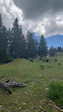
No description for Ruidoso has been added yet!
Login or register to submit one.
Activities Click to view
- Mountain Bike
44 trails
- E-Bike
7 trails
- Gravel Bike
6 trails
- Adaptive Bike
0 trails
- Hike
39 trails
- Trail Running
39 trails
- Downhill Ski
50 trails
Region Details
- 9
- 8
- 20
- 10
Region Status
Caution as of May 24, 2026Local Trail Association
Stats
- Avg Trail Rating
- Trails (view details)
- 92
- Trails Mountain Bike
- 44
- Trails E-Bike
- 7
- Trails Gravel Bike
- 6
- Trails Hike
- 39
- Trails Trail Running
- 39
- Trails Downhill Ski
- 50
- Total Distance
- 156 miles
- Total Descent
- 35,404 ft
- Total Vertical
- 6,030 ft
- Highest Trailhead
- 11,404 ft
- Reports
- 129
- Photos
- 72
- Ridden Counter
- 3,847
Sub Regions
-
Apache Ski Resort
- 1
- 3
- 1
-
Cedar Creek Recreation Area
- 4
- 7
- 8
-
Grindstone
- 2
- 9
Popular Ruidoso Mountain Biking Trails
• 90 ★ 4.7 • 1 mile • 73 ft • 283 •
Popular blue difficulty singletrack. This mountain bike primary trail can be used uphill primary and has a moderate overall physical rating. On average it takes 10 minutes to complete this trail.
• 100 ★ 5.0 • 4,487 ft • 295 ft • 281 •
Popular blue difficulty singletrack. This mountain bike primary trail can be used downhill primary. On average it takes 15 minutes to complete this trail.
• 100 ★ 4.5 • 3 miles • 194 ft • 261 •
Challenging climb, Techy fast downhill.
• 85 ★ 4.7 • 1 mile • 30 ft • 257 •
World class Downhill flow trail. Non stop Expert level features. With rollable lines choices for intermediate riders the entire length of trail. Free of charge on National Forest land.
• 70 ★ 4.4 • 2 miles • 183 ft • 210 •
One of the highlights of this trail system. Fast descent, wide open turns, rock gardens and small ledges reward the rider after the long climb to the top.
• 75 ★ 4.3 • 3,913 ft • 153 ft • 201 •
Ridge top trail with excellent views of Capitan Range & Sierra Blanca. Connector route to "DownHill Trail" from Shuttle Parking area.
• 95 ★ 5.0 • 1 mile • 219 ft • 163 •
Popular blue difficulty singletrack. This mountain bike primary trail can be used both directions. On average it takes 11 minutes to complete this trail.
• 75 ★ 4.0 • 1 mile • 374 ft • 153 •
Most direct trail to top of Cedar Creek Rec Area East.
Ruidoso Mountain Bike Routes
15 miles • 1,869 ft • 8 • Loop •
With trails winding through pine forests and the clear waters of Grindstone Lake, Ruidoso, often described...
• 11 miles • 1,870 ft • 4 •
• 6 miles • 1,210 ft • 4 •
• 11 miles • 1,968 ft • 4 •
• 14 miles • 2,654 ft • 7 •
• 15 miles • 2,890 ft • 8 •
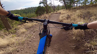
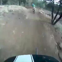
Photos of Ruidoso Mountain Bike
Videos of Ruidoso Mountain Bike
trail: Watermelon Sugar High
0:18 |
14 |
Jul 31, 2025

trail: Cedar Creek DownHill Trail
0:09 |
90 |
Aug 2, 2023
trail: Cedar Creek Loop
0:35 |
102 |
May 28, 2021
trail: Cedar Creek DownHill Trail
0:32 |
529 |
Jun 13, 2017
trail: Water Tower Trail
2:37 |
99 |
Apr 28, 2013
trail: Water Tower Trail
2:16 |
341 |
Apr 3, 2013

trail: Grindstone Ridge
11:52 |
45 |
Aug 25, 2025 , Ruidoso
trail: Watermelon Sugar High
23:33 |
25 |
Aug 25, 2025 , Ruidoso
Recent Trail Reports
| status | trail | date | condition | info | user |
|---|---|---|---|---|---|
| Lake Loop | May 24, 2026 @ 8:20am (America/Denver) May 24, 2026 | Variable | Dr-AlexHarrison | ||
| Upper Geriatrics | May 23, 2026 @ 1:31pm (America/Denver) May 23, 2026 | Dry | Jtyldesley | ||
| Lake Trail C | Apr 4, 2026 @ 2:35pm (America/Denver) Apr 4, 2026 | Ideal | nickyspitz | ||
| Alfred Hale Connector | Apr 4, 2026 @ 2:35pm (America/Denver) Apr 4, 2026 | Ideal | nickyspitz | ||
| Lake Trail A | Apr 4, 2026 @ 2:35pm (America/Denver) Apr 4, 2026 | Ideal | nickyspitz | ||
| Cedar Creek DownHill Trail | Mar 21, 2026 @ 2:07pm (America/Denver) Mar 21, 2026 | Very Dry | MattPZe1O4 | ||
| Lower Geriatics | Dec 16, 2025 @ 8:51am (America/Denver) Dec 16, 2025 | Very Dry | chainslapAZ | ||
| Spring Canyon Loop | Dec 15, 2025 @ 4:07pm (America/Denver) Dec 15, 2025 | Unknown | chainslapAZ | ||
| T 93 B | Dec 15, 2025 @ 8:38am (America/Denver) Dec 15, 2025 | Unknown | chainslapAZ | ||
| Ravens Ridge | Dec 15, 2025 @ 8:36am (America/Denver) Dec 15, 2025 | Unknown | chainslapAZ |
Activity Feed
| username | action | type | title | date |
|---|---|---|---|---|
| KellyaFoRL4 | ridden | trail | activity #96600853 and 1 more | Jun 9, 2026 @ 6:15am Jun 9, 2026 |
| m0fHC3 | wishlist | trail | activity #96344152 | Jun 5, 2026 @ 11:13pm Jun 5, 2026 |
| arthurzoksO5 | wishlist | trail | activity #96266435 and 2 more | Jun 4, 2026 @ 6:01pm Jun 4, 2026 |
| Dr-AlexHarrison | add | report | activity #95407338 | May 24, 2026 @ 7:25am May 24, 2026 |
| Dr-AlexHarrison | ridden | trail | activity #95406912 | May 24, 2026 @ 7:19am May 24, 2026 |
Recent Comments
| username | type | title | comment | date |
|---|---|---|---|---|
| trail | Overall not bad. Tree down at mile 2.5, and... | Jul 19, 2025 @ 11:09am Jul 19, 2025 | ||
| trail | UPDATE: great downhill ;) | Jun 12, 2024 @ 4:19pm Jun 12, 2024 | ||
| trail | Just got to top… no hike a bike sections at... | Jun 12, 2024 @ 2:51pm Jun 12, 2024 | ||
| trail | Did this trail north to south... | Oct 18, 2023 @ 8:20am Oct 18, 2023 | ||
| trail | We did Cedar Creek Travers to Water Tower... | Oct 18, 2023 @ 8:17am Oct 18, 2023 |
Local Badges
-

10 Blue Trails55 awarded -

Epic Ride Climb 2k9 awarded -

Climbing 10k Badge6 awarded -

Climbing 100k Badge1 awarded -

Epic Ride Descent 2k14 awarded -

Descent 10k Badge7 awarded
Bike & Skill Parks
| name | type | city | rating |
|---|---|---|---|
| Apache Ski Resort | bike park | Ruidoso |
Local Trail Supporters
- Pinnacle Trail System Design LLC
Activity Type Stats
| activitytype | trails | distance | descent | descent distance | total vertical | rating | global rank | state rank | photos | reports | routes | ridelogs |
|---|---|---|---|---|---|---|---|---|---|---|---|---|
| Mountain Bike | 44 | 137 miles | 16,962 ft | 68 miles | 6,030 ft | #1,463 | #550 | 72 | 129 | 1 | 2,497 | |
| E-Bike | 7 | 77 miles | 7,037 ft | 42 miles | 6,030 ft | #2,516 | #1,013 | 79 | 146 | |||
| Gravel Bike | 6 | 80 miles | 5,505 ft | 39 miles | 2,631 ft | #266 | #893 | 1 | 2 | |||
| Hike | 39 | 129 miles | 14,465 ft | 61 miles | 2,746 ft | #2,233 | #906 | 122 | 272 | |||
| Trail Running | 39 | 129 miles | 14,465 ft | 61 miles | 2,746 ft | #1,814 | #600 | 122 | 92 | |||
| Downhill Ski | 50 | 19 miles | 18,442 ft | 18 miles | 1,772 ft | #347 | #136 | 114 |
Frequently Asked Questions About Ruidoso
▼
What are the best places to ride in Ruidoso?
Ruidoso has 3 areas to explore for mountain biking. The top rated areas are:
▼
What are the highest rated mountain biking trails in Ruidoso?
The highest rated mountain biking trails in Ruidoso are:
- Cedar Creek DownHill Trail (4.6/5)
- Perk Canyon DH (4.4/5)
- Mesa Loop (4.2/5)
- Upper Geriatrics (4.2/5)
- Cedar Creek Traverse (4.2/5)
▼
What is the best time of the year to ride in Ruidoso?
Based on ride log data, the most popular months to ride in Ruidoso are:
- July (94 activities)
- October (50 activities)
- June (46 activities)
▼
Where can I park to ride in Ruidoso?
There are 3 parking locations listed in Ruidoso. The most popular parking spots are: View all parking and trailhead locations on the map to plan your visit.
Activities
Trails
- By BicycleRuidoso BicycleRuidoso & contributors
- Admins: BicycleRuidoso
- #8061 - 11,400 views
- ruidoso activity log | embed map of Ruidoso mountain bike trails | ruidoso mountain biking points of interest
Downloading of trail gps tracks in kml & gpx formats is enabled for Ruidoso.
You must login to download files.