close
-
Layers w
- Weather Layers
- Pro
- Pro
- Pro
- Pro
- Pro
- Pro
- More Layers
- Pro
- Pro
- Pro
- Pro
-
Upgrade to

3D
Trail Conditions
- Unknown
- Snow Groomed
- Snow Packed
- Snow Covered
- Snow Cover Partial
- Freeze/thaw Cycle
- Icy
- Prevalent Mud
- Wet
- Variable
- Ideal
- Dry
- Very Dry
Trail Flow (Ridden Direction)
Trailforks scans users ridelogs to determine the most popular direction each trail is ridden. A good flowing trail network will have most trails flowing in a single direction according to their intension.
The colour categories are based on what percentage of riders are riding a trail in its intended direction.
The colour categories are based on what percentage of riders are riding a trail in its intended direction.
- > 96%
- > 90%
- > 80%
- > 70%
- > 50%
- < 50%
- bi-directional trail
- no data
Trail Last Ridden
Trailforks scans ridelogs to determine the last time a trail was ridden.
- < 2 days
- < 1 week
- < 2 weeks
- < 1 month
- < 6 months
- > 6 months
Trail Ridden Direction
The intended direction a trail should be ridden.
- Downhill Only
- Downhill Primary
- Both Directions
- Uphill Primary
- Uphill Only
- One Direction
Contribute Details
Colors indicate trail is missing specified detail.
- Description
- Photos
- Description & Photos
- Videos
Trail Popularity ?
Trailforks scans ridelogs to determine which trails are ridden the most in the last 9 months.
Trails are compared with nearby trails in the same city region with a possible 25 colour shades.
Think of this as a heatmap, more rides = more kinetic energy = warmer colors.
- most popular
- popular
- less popular
- not popular
ATV/ORV/OHV Filter
Max Vehicle Width
inches
US Cell Coverage
Legend

Radar Time
Activity Recordings
Trailforks uses anonymized public activity data.
?
Activity Recordings
Trailforks uses anonymized public activity data.
?
Personal Heatmap
▶
Activity Types
all
/
none
▶
Options
2
Date range
month
–
Winter Trails
Warning
A routing network for winter maps does not exist. Selecting trails using the winter trails layer has been disabled.
Missing Trails
Most Popular
Least Popular
Trails are colored based on popularity. The more popular a trail is, the more red. Less popular trails trend towards green.
Jump Magnitude Heatmap
Heatmap of where riders jump on trails. Zoom in to see individual jumps, click circles to view jump details.
BC Backroad Status
![map legend]()
Service Road Atlas is a free to use, community-driven service for viewing and creating reports on the numerous back-country service roads around B.C. and Alberta.

Slope Aspect
Direction the slope faces
Trails Deemphasized
Trails are shown in grey.
Only show trails with no bike usage.
Suggested Layers
Based on selected activity type
Save the current map location and zoom level as your default home location whenever this page is loaded.
SaveCyclists are welcome at Rushmere Country Park and Aspley Woods. Free access is available along public rights of way, in addition we offer specialist cycling trails with the purchase of a Greensand Cycling Pass.
If you wish to use our network of cycle trails, other than the Public Bridleway, you will need a Greensand Cycling Pass – once purchased you’ll get access to details of our cycling trails. The exception to this is our Pump Track, ideal for younger children, which is free to access.
Free access trails into the park lead you to the visitor centre only.
The Ridge Riders Cross Country Trail s OPEN for use with a Greensand Cycle Pass available online as an annual or daily option.
The Ridge Riders Jump Area is currently CLOSED for your safety - please do not use it.
The Pump Track is available to use, ideal for younger riders - no Greensand Pass required.
Please note our Ridge Riders Cross Country trail and Jump Area are aimed at more experienced mountain bikers and are not suitable for younger inexperienced riders.
When riding please be aware and respectful of other park users and wildlife.
Please also ensure you check the terms and conditions carefully.
**Please note purchase of a Greensand Cycle Pass does not include the £3 parking fee**
Disclaimer:
A day or annual pass is required to ride on the https://www.greensandtrust.org/Event/bike-pass-day-ticket
This region uses the Uk/Euro style trail grading system.
Activities Click to view
- Mountain Bike
15 trails
- E-Bike
14 trails
- Hike
5 trails
- Trail Running
5 trails
Region Details
- 5
- 6
- 2
- 2
Region Status
Open as of May 15, 2026Stats
- Avg Trail Rating
- Trails (view details)
- 15
- Trails Mountain Bike
- 15
- Trails E-Bike
- 14
- Trails Hike
- 5
- Trails Trail Running
- 5
- Total Distance
- 5 miles
- Total Descent Distance
- 2 miles
- Total Descent
- 606 ft
- Total Vertical
- 181 ft
- Highest Trailhead
- 495 ft
- Reports
- 194
- Photos
- 12
- Ridden Counter
- 1,291
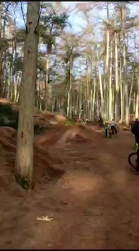
Popular Rushmere Trails Mountain Biking Trails
• 60 ★ 0.0 • 3,232 ft • 18 ft • 414 •
Moderately popular green difficulty singletrack. This multi-use trail can be used downhill primary and has a easy overall physical rating. It features berm. Trail visibility is sometimes hard to follow. On average it takes 5 minutes to complete this trail.
• 55 ★ 0.0 • 4,029 ft • 47 ft • 262 •
Easy trail, no obstacles or any technical challenges. Red route - Rushmere
• 100 ★ 1.0 • 541 ft • 49 ft • 158 •
Rushmere downhill park, steep ascent back up to trail.
• 80 ★ 4.0 • 1,115 ft • 7 ft • 148 •
Rushmere Mini Downhill trail. Nice berms, small jumps, and a big (but rollable) jump at the end.
• 35 ★ 0.0 • 2 miles • 300 ft • 30 •
Less popular green difficulty singletrack. This multi-use trail can be used downhill primary and has a easy overall physical rating. It features berm. Trail visibility is sometimes hard to follow.
• 75 ★ 0.0 • 692 ft • 2 ft • 28 •
As the name suggests is a beamed descent. Flowy and fast!
Videos of Rushmere Trails Mountain Bike

trail: Rushmere Cycle Trail
0:09 |
39 |
Feb 1, 2025
trail: Second Hand Shovel
0:12 |
131 |
Feb 6, 2024
Recent Trail Reports
| status | trail | date | condition | info | user |
|---|---|---|---|---|---|
| Rushmere Cycle Trail | Jul 23, 2025 @ 1:07pm Jul 23, 2025 | Ideal | CaptainCapricorn | ||
| Rushmere steep ascent | Jul 23, 2025 @ 1:07pm Jul 23, 2025 | Ideal | CaptainCapricorn | ||
| Curly Wurly | Jul 23, 2025 @ 1:07pm Jul 23, 2025 | Ideal | CaptainCapricorn | ||
| Rushmere Cycle Trail | Jul 23, 2025 @ 1:07pm Jul 23, 2025 | Ideal | CaptainCapricorn | ||
| Oakwood Trail | Jul 23, 2025 @ 1:07pm Jul 23, 2025 | Ideal | CaptainCapricorn | ||
| Return Track/Push Up | Jun 16, 2025 @ 1:09pm Jun 16, 2025 | Very Dry | CaptainCapricorn | ||
| Upper Red | Jun 16, 2025 @ 1:09pm Jun 16, 2025 | Very Dry | CaptainCapricorn | ||
| Red Rum/Enter Sandman | Jun 16, 2025 @ 1:09pm Jun 16, 2025 | Very Dry | CaptainCapricorn | ||
| Second Hand Shovel | Jun 16, 2025 @ 1:09pm Jun 16, 2025 | Very Dry | CaptainCapricorn | ||
| OG2 | Jun 16, 2025 @ 1:09pm Jun 16, 2025 | Very Dry | CaptainCapricorn |
Activity Feed
| username | action | type | title | date |
|---|---|---|---|---|
| hioYfc | wishlist | region | activity #76936641 | Jul 29, 2025 @ 12:22am Jul 29, 2025 |
| SteveubjPLd | wishlist | trail | activity #76797435 | Jul 27, 2025 @ 12:54am Jul 27, 2025 |
| CaptainCapricorn | add | report | activity #76528442 and 4 more | Jul 23, 2025 @ 7:57am Jul 23, 2025 |
| 1nqRoH | ridden | trail | activity #75896273 | Jul 14, 2025 @ 9:08am Jul 14, 2025 |
| CaptainCapricorn | add | report | activity #74810668 | Jun 29, 2025 @ 7:08am Jun 29, 2025 |
Recent Comments
| username | type | title | comment | date |
|---|---|---|---|---|
| report | Sticky | Nov 11, 2022 @ 9:50am Nov 11, 2022 |
Nearby Areas
| name | distance | ||||
|---|---|---|---|---|---|
| Back Wood | 3 km | ||||
| Woburn Bike Trails | 1 | 10 | 3.7 km | ||
| Woburn Bike Park | 1 | 1 | 4 km | ||
| Campbell Park | 19 | 7.5 km | |||
| Ashridge Estate | 2 | 10.6 km |
Activity Type Stats
| activitytype | trails | distance | descent | descent distance | total vertical | rating | global rank | state rank | photos | reports | routes | ridelogs |
|---|---|---|---|---|---|---|---|---|---|---|---|---|
| Mountain Bike | 15 | 5 miles | 607 ft | 2 miles | 180 ft | #8,200 | #278 | 12 | 194 | 1,466 | ||
| E-Bike | 14 | 5 miles | 564 ft | 2 miles | 180 ft | #5,089 | #222 | 68 | 237 | |||
| Hike | 5 | 4 miles | 456 ft | 2 miles | 180 ft | #11,254 | #319 | 188 | 4 | |||
| Trail Running | 5 | 4 miles | 456 ft | 2 miles | 180 ft | #10,213 | #296 | 188 | 31 |
Frequently Asked Questions About Rushmere Trails
▼
What are the highest rated mountain biking trails in Rushmere Trails?
The highest rated mountain biking trails in Rushmere Trails are:
- Second Hand Shovel (4/5)
- OG2 (4/5)
- Rushmere steep ascent (3.6/5)
- Upper Red (0/5)
- Rushmere Cycle Trail (0/5)
▼
What is the best time of the year to ride in Rushmere Trails?
Based on ride log data, the most popular months to ride in Rushmere Trails are:
- August (14 activities)
- September (8 activities)
- November (6 activities)
▼
Where can I park to ride in Rushmere Trails?
Check the Rushmere Trails trail map for trailhead and parking information. Community members regularly update access and parking details for trails in the area.
▼
What is the longest trail in Rushmere Trails?
The longest trail in Rushmere Trails is Rushmere Cycle Trail at 4.0 km. View all trails sorted by distance.
Activities
- By markholloway
 Trailforks Map Team & contributors
 - Admins: jamesmackeddie, Firecrest
- #39592 - 14,922 views
- rushmere trails activity log | embed map of Rushmere Trails mountain bike trails |
Downloading of trail gps tracks in kml & gpx formats is enabled for Rushmere Trails.
You must login to download files.