close
-
Layers w
- Weather Layers
- Pro
- Pro
- Pro
- Pro
- Pro
- Pro
- More Layers
- Pro
- Pro
- Pro
- Pro
-
Upgrade to

3D
Trail Conditions
- Unknown
- Snow Groomed
- Snow Packed
- Snow Covered
- Snow Cover Partial
- Freeze/thaw Cycle
- Icy
- Prevalent Mud
- Wet
- Variable
- Ideal
- Dry
- Very Dry
Trail Flow (Ridden Direction)
Trailforks scans users ridelogs to determine the most popular direction each trail is ridden. A good flowing trail network will have most trails flowing in a single direction according to their intension.
The colour categories are based on what percentage of riders are riding a trail in its intended direction.
The colour categories are based on what percentage of riders are riding a trail in its intended direction.
- > 96%
- > 90%
- > 80%
- > 70%
- > 50%
- < 50%
- bi-directional trail
- no data
Trail Last Ridden
Trailforks scans ridelogs to determine the last time a trail was ridden.
- < 2 days
- < 1 week
- < 2 weeks
- < 1 month
- < 6 months
- > 6 months
Trail Ridden Direction
The intended direction a trail should be ridden.
- Downhill Only
- Downhill Primary
- Both Directions
- Uphill Primary
- Uphill Only
- One Direction
Contribute Details
Colors indicate trail is missing specified detail.
- Description
- Photos
- Description & Photos
- Videos
Trail Popularity ?
Trailforks scans ridelogs to determine which trails are ridden the most in the last 9 months.
Trails are compared with nearby trails in the same city region with a possible 25 colour shades.
Think of this as a heatmap, more rides = more kinetic energy = warmer colors.
- most popular
- popular
- less popular
- not popular
ATV/ORV/OHV Filter
Max Vehicle Width
inches
US Cell Coverage
Legend

Radar Time
Activity Recordings
Trailforks uses anonymized public activity data.
?
Activity Recordings
Trailforks uses anonymized public activity data.
?
Personal Heatmap
▶
Activity Types
all
/
none
▶
Options
2
Date range
month
–
Winter Trails
Warning
A routing network for winter maps does not exist. Selecting trails using the winter trails layer has been disabled.
Missing Trails
Most Popular
Least Popular
Trails are colored based on popularity. The more popular a trail is, the more red. Less popular trails trend towards green.
Jump Magnitude Heatmap
Heatmap of where riders jump on trails. Zoom in to see individual jumps, click circles to view jump details.
BC Backroad Status
![map legend]()
Service Road Atlas is a free to use, community-driven service for viewing and creating reports on the numerous back-country service roads around B.C. and Alberta.

Slope Aspect
Direction the slope faces
Trails Deemphasized
Trails are shown in grey.
Only show trails with no bike usage.
Suggested Layers
Based on selected activity type
Save the current map location and zoom level as your default home location whenever this page is loaded.
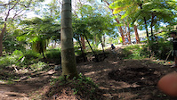
SaveThe Rydal trails are located in part of Lidsdale State Forest, nestled next to the small and unique village of Rydal.
Making use of a plethora of old 4x4 and moto trails in the area, the CTMBC have created a fantastic set of trails that make the use of this landscape and are worth the effort to stop in for a ride.
Making use of a plethora of old 4x4 and moto trails in the area, the CTMBC have created a fantastic set of trails that make the use of this landscape and are worth the effort to stop in for a ride.
Primary Trail Type: Cross-Country
Land Status: State Forest
Access Info:
From the highway come into Rydal, cross the train tracks and take a left before the Pub, following the signs towards the Showground.
The trailhead is located at the top of Market Street at the Rydal Showground. Trails leads out either side to the north of the showground.
The trailhead is located at the top of Market Street at the Rydal Showground. Trails leads out either side to the north of the showground.
Activities Click to view
- Mountain Bike
22 trails
- Hike
22 trails
- Trail Running
22 trails
Stats
- Avg Trail Rating
- Trails (view details)
- 22
- Trails Mountain Bike
- 22
- Trails E-Bike
- 1
- Trails Hike
- 22
- Trails Trail Running
- 22
- Total Distance
- 13 miles
- Total Descent
- 1,781 ft
- Total Vertical
- 465 ft
- Highest Trailhead
- 3,281 ft
- Reports
- 108
- Photos
- 1
- Ridden Counter
- 2,675
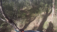
Popular Rydal Mountain Biking Trails
• 100 ★ 0.0 • 855 ft • 18 ft • 222 •
Popular blue difficulty singletrack. This mountain bike primary trail can be used both directions. On average it takes 1 minutes to complete this trail.
• 100 ★ 3.0 • 2,096 ft • 10 ft • 211 •
Clockwise you get a fast downhill with some technical off camber. Anti clockwise it's nice little climb to open the lungs up
• 75 ★ 4.0 • 2 miles • 193 ft • 202 •
A lovely sustained bit of single trail. Clockwise you get fast Downhill sections and long sections of false flat. Anticlockwise you get some shorter pinchier climbs followed by long flowy recovery section interspaced with a few sharp...
• 90 ★ 4.0 • 2,021 ft • 62 ft • 198 •
Popular blue difficulty singletrack. This mountain bike primary trail can be used both directions. On average it takes 2 minutes to complete this trail.
• 80 ★ 0.0 • 1,822 ft • 18 ft • 193 •
Popular blue difficulty singletrack. This mountain bike primary trail can be used both directions. On average it takes 1 minutes to complete this trail.
• 80 ★ 5.0 • 4,183 ft • 23 ft • 177 •
Popular blue difficulty singletrack. This mountain bike primary trail can be used both directions. It features drop and gap jump. On average it takes 6 minutes to complete this trail.
• 100 ★ 5.0 • 2,586 ft • 33 ft • 158 •
Popular green difficulty mixed. This mountain bike primary trail can be used both directions and has a easy overall physical rating with a 33 ft green climb. On average it takes 4 minutes to complete this trail.
• 70 ★ 5.0 • 2,349 ft • 13 ft • 152 •
Popular blue difficulty singletrack. This mountain bike primary trail can be used both directions. On average it takes 16 minutes to complete this trail.
Rydal Mountain Bike Routes
Videos of Rydal Mountain Bike
trail: link
0:07 |
138 |
Nov 19, 2020
trail: Hidden Valley
0:41 |
326 |
May 12, 2014

trail: Hazzard County
858 |
Aug 25, 2016 , Lithgow

450 |
Aug 25, 2016

500 |
Aug 25, 2016
Recent Trail Reports
| status | trail | date | condition | info | user |
|---|---|---|---|---|---|
| Hidden Valley | Jun 4, 2024 @ 11:17am Jun 4, 2024 | Dry | flynny CTMBC | ||
| Rydal Firebreak Trail | Mar 7, 2024 @ 1:15pm Mar 7, 2024 | Variable | Hazardman50 | ||
| The Hut Run | Dec 19, 2022 @ 3:50pm Dec 19, 2022 | Dry | flynny CTMBC | ||
| Snake Trail (Python) | Dec 19, 2022 @ 3:50pm Dec 19, 2022 | Dry | flynny CTMBC | ||
| Hazzard Extension | Dec 19, 2022 @ 11:50pm Dec 19, 2022 | Dry | flynny CTMBC | ||
| Python Extension | Dec 12, 2020 @ 11:18am Dec 12, 2020 | Dry | Hodgo1981 | ||
| Link Track | Dec 12, 2020 @ 11:18am Dec 12, 2020 | Dry | Hodgo1981 | ||
| Hazzard County | Dec 12, 2020 @ 11:18am Dec 12, 2020 | Dry | Hodgo1981 | ||
| Packed Lunch | Dec 12, 2020 @ 11:18am Dec 12, 2020 | Very Dry | Hodgo1981 | ||
| Robbies Run | Dec 12, 2020 @ 11:18am Dec 12, 2020 | Very Dry | Hodgo1981 |
Activity Feed
| username | action | type | title | date |
|---|---|---|---|---|
| b25moase | wishlist | region | activity #94680010 | May 14, 2026 @ 4:29am May 14, 2026 |
| Terrywhit | wishlist | region | activity #90419522 | Mar 11, 2026 @ 7:05pm Mar 11, 2026 |
| Explogo | wishlist | region | activity #80169011 | Sep 12, 2025 @ 5:40am Sep 12, 2025 |
| gracestyman | wishlist | region | activity #77373609 | Aug 4, 2025 @ 2:26am Aug 4, 2025 |
| RichardHRUtik | wishlist | trail | activity #64428614 | Jan 11, 2025 @ 12:08pm Jan 11, 2025 |
Recent Comments
| username | type | title | comment | date |
|---|---|---|---|---|
| trail | Yeeeha is over grown. Fires and storms have... | May 26, 2023 @ 5:34pm May 26, 2023 | ||
| trail | So fun to come down in the jetblack 24hr! | Dec 16, 2020 @ 2:14pm Dec 16, 2020 | ||
| trail | love the switch back climbs, perfectly built! | Dec 16, 2020 @ 2:12pm Dec 16, 2020 | ||
| trail | There is already a section named by the Trail... | Dec 13, 2020 @ 9:19pm Dec 13, 2020 | ||
| trail | Awesome berms lots of fun! Definitely a MUST... | Dec 25, 2017 @ 11:45pm Dec 25, 2017 |
Nearby Areas
| name | distance | ||||
|---|---|---|---|---|---|
| Hassans Walls | 2 | 6 | 3 | 6.9 km | |
| Newnes Forest | 1 | 2 | 8 km | ||
| Mount Victoria | 1 | 4 | 1 | 13.4 km | |
| Yetholme | 3 | 12 | 3 | 14 km | |
| Ridgewell Road | 8 | 8 | 7 | 17.6 km |
Local Badges
-

Completionist4 awarded
Activity Type Stats
| activitytype | trails | distance | descent | descent distance | total vertical | rating | global rank | state rank | photos | reports | routes | ridelogs |
|---|---|---|---|---|---|---|---|---|---|---|---|---|
| Mountain Bike | 22 | 13 miles | 1,781 ft | 6 miles | 466 ft | #8,445 | #402 | 1 | 108 | 1 | 1,582 | |
| E-Bike | 1 | 62 ft | 43 | 1 | 64 | |||||||
| Hike | 22 | 13 miles | 1,781 ft | 6 miles | 466 ft | #9,060 | 108 | 6 | ||||
| Trail Running | 22 | 13 miles | 1,781 ft | 6 miles | 466 ft | #8,208 | #288 | 108 | 4 |
Frequently Asked Questions About Rydal
▼
What are the highest rated mountain biking trails in Rydal?
The highest rated mountain biking trails in Rydal are:
- Hazzard County (4.4/5)
- Robbies Run (4.1/5)
- The Hut Run (4.1/5)
- Yeeeha (4/5)
- Hidden Valley (4/5)
▼
What is the best time of the year to ride in Rydal?
Based on ride log data, the most popular months to ride in Rydal are:
- November (12 activities)
- March (11 activities)
- September (9 activities)
▼
Where can I park to ride in Rydal?
Check the Rydal trail map for trailhead and parking information. Community members regularly update access and parking details for trails in the area.
▼
What is the longest trail in Rydal?
The longest trail in Rydal is Packed Lunch at 1.8 miles. View all trails sorted by distance.
- By Addzz
 TRAILFORKS NEMTB & contributors
 - Admins: CTMBC
- #14873 - 10,604 views
- rydal activity log | embed map of Rydal mountain bike trails |
Downloading of trail gps tracks in kml & gpx formats is enabled for Rydal.
You must login to download files.