close
-
Layers w
- Weather Layers
- Pro
- Pro
- Pro
- Pro
- Pro
- Pro
- More Layers
- Pro
- Pro
- Pro
- Pro
-
Upgrade to

3D
Trail Conditions
- Unknown
- Snow Groomed
- Snow Packed
- Snow Covered
- Snow Cover Partial
- Freeze/thaw Cycle
- Icy
- Prevalent Mud
- Wet
- Variable
- Ideal
- Dry
- Very Dry
Trail Flow (Ridden Direction)
Trailforks scans users ridelogs to determine the most popular direction each trail is ridden. A good flowing trail network will have most trails flowing in a single direction according to their intension.
The colour categories are based on what percentage of riders are riding a trail in its intended direction.
The colour categories are based on what percentage of riders are riding a trail in its intended direction.
- > 96%
- > 90%
- > 80%
- > 70%
- > 50%
- < 50%
- bi-directional trail
- no data
Trail Last Ridden
Trailforks scans ridelogs to determine the last time a trail was ridden.
- < 2 days
- < 1 week
- < 2 weeks
- < 1 month
- < 6 months
- > 6 months
Trail Ridden Direction
The intended direction a trail should be ridden.
- Downhill Only
- Downhill Primary
- Both Directions
- Uphill Primary
- Uphill Only
- One Direction
Contribute Details
Colors indicate trail is missing specified detail.
- Description
- Photos
- Description & Photos
- Videos
Trail Popularity ?
Trailforks scans ridelogs to determine which trails are ridden the most in the last 9 months.
Trails are compared with nearby trails in the same city region with a possible 25 colour shades.
Think of this as a heatmap, more rides = more kinetic energy = warmer colors.
- most popular
- popular
- less popular
- not popular
ATV/ORV/OHV Filter
Max Vehicle Width
inches
US Cell Coverage
Legend

Radar Time
Activity Recordings
Trailforks uses anonymized public activity data.
?
Activity Recordings
Trailforks uses anonymized public activity data.
?
Personal Heatmap
▶
Activity Types
all
/
none
▶
Options
2
Date range
month
–
Winter Trails
Warning
A routing network for winter maps does not exist. Selecting trails using the winter trails layer has been disabled.
Missing Trails
Most Popular
Least Popular
Trails are colored based on popularity. The more popular a trail is, the more red. Less popular trails trend towards green.
Jump Magnitude Heatmap
Heatmap of where riders jump on trails. Zoom in to see individual jumps, click circles to view jump details.
BC Backroad Status
![map legend]()
Service Road Atlas is a free to use, community-driven service for viewing and creating reports on the numerous back-country service roads around B.C. and Alberta.

Slope Aspect
Direction the slope faces
Trails Deemphasized
Trails are shown in grey.
Only show trails with no bike usage.
Suggested Layers
Based on selected activity type
Save the current map location and zoom level as your default home location whenever this page is loaded.
Save
No description for Sacramento has been added yet!
Login or register to submit one.
Activities Click to view
- Mountain Bike
80 trails
- E-Bike
7 trails
- Adaptive Bike
0 trails
- Hike
102 trails
- Trail Running
102 trails
Region Details
- 4
- 29
- 47
Region Status
Caution as of Jan 8, 2026Stats
- Trails (view details)
- 101
- Trails Mountain Bike
- 80
- Trails E-Bike
- 7
- Trails Horse
- 1
- Trails Hike
- 102
- Trails Trail Running
- 102
- Total Distance
- 85 miles
- Total Descent
- 503 ft
- Total Vertical
- 90 ft
- Highest Trailhead
- 91 ft
- Reports
- 17
- Photos
- 6
- Ridden Counter
- 2,640
Popular Sacramento Mountain Biking Trails
• 100 ★ 0.0 • 8 miles • 95 ft • 315 •
Popular white difficulty paved path. This mountain bike primary trail can be used both directions and has a easy overall physical rating with a 95 ft green climb. On average it takes 29 minutes to complete this trail.
• 95 ★ 0.0 • 1 mile • 22 ft • 124 •
Popular green difficulty singletrack. This multi-use trail can be used both directions. On average it takes 4 minutes to complete this trail.
• 100 ★ 0.0 • 489 ft • 0 ft • 115 •
Popular green difficulty singletrack. This multi-use trail can be used both directions. On average it takes 1 minutes to complete this trail.
• 100 ★ 0.0 • 2 miles • 33 ft • 96 •
Popular green difficulty singletrack. This multi-use trail can be used both directions. On average it takes 28 minutes to complete this trail.
• 90 ★ 0.0 • 4,816 ft • 3 ft • 93 •
Popular green difficulty singletrack. This multi-use trail can be used both directions. On average it takes 3 minutes to complete this trail.
• 100 ★ 0.0 • 3,261 ft • 13 ft • 88 •
Popular green difficulty singletrack. This multi-use trail can be used both directions. On average it takes 2 minutes to complete this trail.
• 95 ★ 0.0 • 2 miles • 16 ft • 84 •
Popular green difficulty singletrack. This multi-use trail can be used both directions. On average it takes 11 minutes to complete this trail.
• 95 ★ 0.0 • 2,621 ft • 19 ft • 60 •
Popular green difficulty singletrack. This multi-use trail can be used both directions. On average it takes 31 minutes to complete this trail.
Sacramento Mountain Bike Routes
32 miles • 634 ft • 2 •
44 miles • 799 ft • 2 •
10 miles • 76 ft • 2 •
3 miles • 8 ft • 2 •
3 miles • 14 ft • 1 •
8 miles • 91 ft • 4 •
Videos of Sacramento Mountain Bike
youtuber
![American River Bike Trail (Sacramento to...]()
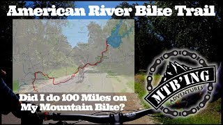
17:28 |
769 |
Jun 15, 2019 , Sacramento
Recent Trail Reports
| status | trail | date | condition | info | user |
|---|---|---|---|---|---|
| North Natomas East Trail | Jan 8, 2026 @ 10:24am (America/Los_Angeles) Jan 8, 2026 | Dry | VicAnts | ||
| American River Bike Trail Alternate | Oct 4, 2025 @ 11:04am (America/Los_Angeles) Oct 4, 2025 | Dry | yYxDPr | ||
| Jedediah Smith Memorial Trail (Sacramento) | May 17, 2025 @ 4:54pm May 17, 2025 | Dry | viper87 | ||
| Levee Path | May 23, 2024 @ 1:42pm May 23, 2024 | Ideal | dkkerr | ||
| Two Rivers Bike Trail | May 3, 2024 @ 7:37am May 3, 2024 | Unknown | JjMerchant | ||
| River Bend Park #1 | Jun 29, 2023 @ 6:43pm Jun 29, 2023 | Very Dry | aysnibagra | ||
| Granite Park Access | Dec 7, 2022 @ 3:50am Dec 7, 2022 | Unknown | Reeni4XnsLF | ||
| Granite Park North/South | Dec 7, 2022 @ 11:50am Dec 7, 2022 | Unknown | Reeni4XnsLF |
Activity Feed
| username | action | type | title | date |
|---|---|---|---|---|
| aaronec91 | wishlist | trail | activity #97037132 and 1 more | Jun 15, 2026 @ 6:33am Jun 15, 2026 |
| oranjeventana | ridden | trail | activity #94803833 | May 16, 2026 @ 5:04am May 16, 2026 |
| tikitychee | wishlist | route | activity #89114346 | Feb 18, 2026 @ 1:13am Feb 18, 2026 |
| VicAnts | add | report | activity #86876959 | Jan 8, 2026 @ 5:54pm Jan 8, 2026 |
| SamarLKp6vH | wishlist | route | activity #84663412 and 1 more | Nov 24, 2025 @ 11:05am Nov 24, 2025 |
Recent Comments
| username | type | title | comment | date |
|---|---|---|---|---|
| trail | All dirt singletrack trails below natomas dam... | Nov 10, 2023 @ 9:31am Nov 10, 2023 | ||
| trail | Lots of homeless encampments scattered just... | Aug 21, 2022 @ 9:15am Aug 21, 2022 |
Local Badges
-

10 Green Trails35 awarded -

Epic Mountain Bike Climb 2k1 awarded -

Climbing 10k Badge11 awarded -

Mountain Biking 100k Badge0 awarded -

Epic Ride Descent 2k1 awarded -

Descent 10k Badge11 awarded
Bike & Skill Parks
| name | type | city | rating |
|---|---|---|---|
| Township 9 | skill park | Sacramento |
Activity Type Stats
| activitytype | trails | distance | descent | descent distance | total vertical | rating | global rank | state rank | photos | reports | routes | ridelogs |
|---|---|---|---|---|---|---|---|---|---|---|---|---|
| Mountain Bike | 80 | 80 miles | 492 ft | 15 miles | 89 ft | #10,892 | #3,348 | 7 | 17 | 13 | 28,121 | |
| E-Bike | 7 | 13 miles | 98 ft | 3 miles | 75 ft | #5,626 | #1,738 | 15 | 2 | 650 | ||
| Horse | 1 | 1 mile | 7 ft | 1,352 ft | 7 ft | 2 | ||||||
| Hike | 102 | 85 miles | 502 ft | 16 miles | 89 ft | #2,571 | #1,003 | 17 | 21 | 446 | ||
| Trail Running | 102 | 85 miles | 502 ft | 16 miles | 89 ft | #2,210 | #692 | 17 | 21 | 2,186 |
Frequently Asked Questions About Sacramento
▼
What are the highest rated mountain biking trails in Sacramento?
The highest rated mountain biking trails in Sacramento are:
- Sacramento Northern Bike Trail (0/5)
- Parking Lot Access (0/5)
- Sacramento River Parkway (0/5)
- American River Bike Trail Alternate (0/5)
- Jedediah Smith Memorial Trail (Sacramento) (0/5)
▼
What is the best time of the year to ride in Sacramento?
Based on ride log data, the most popular months to ride in Sacramento are:
- July (40 activities)
- October (37 activities)
- August (34 activities)
▼
Where can I park to ride in Sacramento?
There are 22 parking locations listed in Sacramento. The most popular parking spots are: View all parking and trailhead locations on the map to plan your visit.
▼
What is the longest trail in Sacramento?
The longest trail in Sacramento is Sacramento Northern Bike Trail at 14.2 km. View all trails sorted by distance.
Activities
- By Privileged & contributors
- Admins: apply
- #20861 - 12,822 views
- sacramento activity log | embed map of Sacramento mountain bike trails | sacramento mountain biking points of interest
Downloading of trail gps tracks in kml & gpx formats is enabled for Sacramento.
You must login to download files.