close
-
Layers w
- Weather Layers
- Pro
- Pro
- Pro
- Pro
- Pro
- Pro
- More Layers
- Pro
- Pro
- Pro
- Pro
-
Upgrade to

3D
Trail Conditions
- Unknown
- Snow Groomed
- Snow Packed
- Snow Covered
- Snow Cover Partial
- Freeze/thaw Cycle
- Icy
- Prevalent Mud
- Wet
- Variable
- Ideal
- Dry
- Very Dry
Trail Flow (Ridden Direction)
Trailforks scans users ridelogs to determine the most popular direction each trail is ridden. A good flowing trail network will have most trails flowing in a single direction according to their intension.
The colour categories are based on what percentage of riders are riding a trail in its intended direction.
The colour categories are based on what percentage of riders are riding a trail in its intended direction.
- > 96%
- > 90%
- > 80%
- > 70%
- > 50%
- < 50%
- bi-directional trail
- no data
Trail Last Ridden
Trailforks scans ridelogs to determine the last time a trail was ridden.
- < 2 days
- < 1 week
- < 2 weeks
- < 1 month
- < 6 months
- > 6 months
Trail Ridden Direction
The intended direction a trail should be ridden.
- Downhill Only
- Downhill Primary
- Both Directions
- Uphill Primary
- Uphill Only
- One Direction
Contribute Details
Colors indicate trail is missing specified detail.
- Description
- Photos
- Description & Photos
- Videos
Trail Popularity ?
Trailforks scans ridelogs to determine which trails are ridden the most in the last 9 months.
Trails are compared with nearby trails in the same city region with a possible 25 colour shades.
Think of this as a heatmap, more rides = more kinetic energy = warmer colors.
- most popular
- popular
- less popular
- not popular
ATV/ORV/OHV Filter
Max Vehicle Width
inches
US Cell Coverage
Legend

Radar Time
Activity Recordings
Trailforks uses anonymized public activity data.
?
Activity Recordings
Trailforks uses anonymized public activity data.
?
Personal Heatmap
▶
Activity Types
all
/
none
▶
Options
2
Date range
month
–
Winter Trails
Warning
A routing network for winter maps does not exist. Selecting trails using the winter trails layer has been disabled.
Missing Trails
Most Popular
Least Popular
Trails are colored based on popularity. The more popular a trail is, the more red. Less popular trails trend towards green.
Jump Magnitude Heatmap
Heatmap of where riders jump on trails. Zoom in to see individual jumps, click circles to view jump details.
BC Backroad Status
![map legend]()
Service Road Atlas is a free to use, community-driven service for viewing and creating reports on the numerous back-country service roads around B.C. and Alberta.

Slope Aspect
Direction the slope faces
Trails Deemphasized
Trails are shown in grey.
Only show trails with no bike usage.
Suggested Layers
Based on selected activity type
Save the current map location and zoom level as your default home location whenever this page is loaded.
SaveLa région du Saguenay regroupe principalement les arrondissement de Jonquière, Chicoutimi, Laterrière et Labaie
Activities Click to view
- Mountain Bike
99 trails
- E-Bike
27 trails
- Gravel Bike
0 trails
- Adaptive Bike
0 trails
- Winter Fat Bike
0 trails
- Horse
2 trails
- Hike
87 trails
- Trail Running
90 trails
- Dirtbike/Moto
3 trails
- Observed Trials
2 trails
- ATV/ORV/OHV
3 trails
- Snowmobile
3 trails
- Snowshoe
13 trails
- Downhill Ski
1 trails
- Backcountry Ski
1 trails
- Nordic Ski
6 trails
Region Details
- 1
- 2
- 17
- 27
- 30
- 13
- 2
Region Status
Open as of Jun 6, 2026Local Trail Association
Stats
- Avg Trail Rating
- Trails (view details)
- 96
- Trails Mountain Bike
- 100
- Trails E-Bike
- 27
- Trails Horse
- 2
- Trails Hike
- 87
- Trails Trail Running
- 90
- Trails Dirtbike/Moto
- 3
- Trails Observed Trials
- 2
- Trails ATV/ORV/OHV
- 3
- Trails Snowmobile
- 3
- Trails Snowshoe
- 13
- Trails Downhill Ski
- 1
- Trails Backcountry Ski
- 1
- Trails Nordic Ski
- 6
- Total Distance
- 46 miles
- Total Descent
- 6,669 ft
- Total Vertical
- 494 ft
- Highest Trailhead
- 558 ft
- Reports
- 261
- Photos
- 56
- Ridden Counter
- 13,621
Sub Regions
-
Centre de Vélo de Montagne le Panoramique
- 2
- 10
- 24
- 24
- 10
- 2
-
Mont-Fortin
- 5
- 4
- 5
- 2
-
Parc de la Rivière-du-Moulin
- 1
Popular Saguenay Mountain Biking Trails
• 100 ★ 0.0 • 656 ft • 44 ft • 559 •
Popular blue difficulty singletrack. This mountain bike primary trail can be used both directions. On average it takes minutes to complete this trail.
• 100 ★ 0.0 • 1,378 ft • 3 ft • 513 •
Popular green difficulty machine groomed. This mountain bike primary trail can be used both directions. On average it takes 1 minutes to complete this trail.
• 100 ★ 4.0 • 1,512 ft • 14 ft • 509 •
Popular blue difficulty singletrack. This mountain bike primary trail can be used both directions. It features bridge. On average it takes 1 minutes to complete this trail.
• 95 ★ 4.8 • 2 miles • 126 ft • 450 •
Popular green difficulty machine groomed. This mountain bike primary trail. On average it takes 16 minutes to complete this trail.
• 95 ★ 4.7 • 4,117 ft • 47 ft • 433 •
Highly rated popular blue difficulty singletrack. This mountain bike primary trail can be used both directions with a 47 ft blue climb. It features bridge and skinny. On average it takes 8 minutes to complete this trail.
• 95 ★ 5.0 • 3,891 ft • 40 ft • 421 •
Popular green difficulty machine groomed. This mountain bike primary trail can be used both directions. On average it takes 6 minutes to complete this trail.
• 85 ★ 4.0 • 1 mile • 116 ft • 420 •
Popular green difficulty machine groomed. This mountain bike primary trail can be used both directions and has a easy overall physical rating with a 116 ft green climb. On average it takes 11 minutes to complete this trail.
• 90 ★ 3.7 • 1 mile • 8 ft • 396 •
Popular blue difficulty singletrack. This mountain bike primary trail can be used downhill primary and has a moderate overall physical rating with a 8 ft blue climb. It features bridge and skinny. On average it takes 8 minutes to complete this trail.
Saguenay Mountain Bike Routes
9 miles • 900 ft • 7 • Loop •
Tracé démarrant du Boulevard Saguenay Ouest. Bel échauffement en montée sur la rue ensuite passage sur...
2 miles • 252 ft • 12 • Race •
Parcours de course en trail pour le DuaTrail du Pano
• 14 miles • 975 ft • 12 •
• 5 miles • 351 ft • 14 •
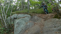
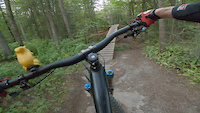
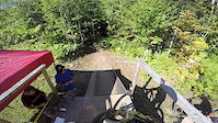
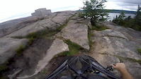
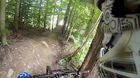
Photos of Saguenay Mountain Bike
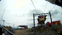
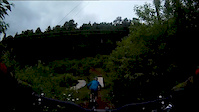
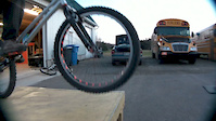
Videos of Saguenay Mountain Bike
trail: Tremblez
0:57 |
195 |
Sep 19, 2022
trail: Short & Sweet
0:41 |
86 |
Sep 13, 2022
trail: 22
3:05 |
342 |
Aug 23, 2015
trail: 22
3:23 |
362 |
Jul 23, 2015
trail: Un
3:20 |
328 |
Aug 7, 2014
trail: Un
6:22 |
453 |
May 20, 2013
trail: 24 (part 2)
4:20 |
247 |
Jul 7, 2012
trail: 24 (part 2)
4:39 |
744 |
Apr 23, 2012
Recent Trail Reports
| status | trail | date | condition | info | user |
|---|---|---|---|---|---|
| La chenille (Section1) | Jun 6, 2026 @ 10:32am (America/Moncton) Jun 6, 2026 | Ideal | DominicMqIS50 | ||
| 05A | Mar 31, 2026 @ 12:03pm (America/Los_Angeles) Mar 31, 2026 | Unknown | trailforks Trailforks | ||
| 04 | Sep 21, 2025 @ 10:18am (America/Toronto) Sep 21, 2025 | Ideal | MTBSKIERGAG | ||
| 01 | Sep 21, 2025 @ 10:18am (America/Toronto) Sep 21, 2025 | Ideal | MTBSKIERGAG | ||
| Montée Ultraviolet Sports | Sep 21, 2025 @ 10:18am (America/Toronto) Sep 21, 2025 | Ideal | MTBSKIERGAG | ||
| 3 part 1 (option) | Aug 18, 2025 @ 6:34pm Aug 18, 2025 | Variable | dalzhel | ||
| 3 part 1 | Aug 18, 2025 @ 6:34pm Aug 18, 2025 | Variable | dalzhel | ||
| 20 nord par 1 | Aug 18, 2025 @ 6:34pm Aug 18, 2025 | Variable | dalzhel | ||
| 3 connector | Aug 18, 2025 @ 6:34pm Aug 18, 2025 | Variable | dalzhel | ||
| 20 sud part 2 | Aug 18, 2025 @ 6:34pm Aug 18, 2025 | Variable | dalzhel |
Activity Feed
| username | action | type | title | date |
|---|---|---|---|---|
| maximebeaudoin | update | region | activity #96998212 | Jun 14, 2026 @ 12:58pm Jun 14, 2026 |
| nico-clement-trailbuilder | wishlist | trail | activity #96474093 | Jun 7, 2026 @ 10:07am Jun 7, 2026 |
| DallaireCedrickSportcycle | ridden | trail | activity #96473939 and 2 more | Jun 7, 2026 @ 10:06am Jun 7, 2026 |
| olivier5951 | wishlist | region | activity #96420752 | Jun 6, 2026 @ 6:08pm Jun 6, 2026 |
| DominicMqIS50 | add | report | activity #96408806 | Jun 6, 2026 @ 3:00pm Jun 6, 2026 |
Recent Comments
| username | type | title | comment | date |
|---|---|---|---|---|
| trail | Sentier très abrupte, beaucoup... | Aug 21, 2025 @ 10:21am Aug 21, 2025 | ||
| trail | Aucun obstacle majeur devrait etre un bleu | Aug 4, 2024 @ 10:18am Aug 4, 2024 | ||
| trail | Petit connecteur qui permet d'accéder aux... | Aug 23, 2023 @ 8:38am Aug 23, 2023 | ||
| trail | This trail is sick! \m/ | Dec 23, 2022 @ 5:20pm Dec 23, 2022 | ||
| report | Nouvelle flow trail « Signature » du... | Jan 9, 2022 @ 5:58am Jan 9, 2022 |
Local Badges
-

10 Blue Trails206 awarded -

10 Black Trails95 awarded -

Epic Ride Climb 2k3 awarded -

Climbing 10k Badge44 awarded -

Climbing 100k Badge0 awarded -

Epic Ride Descent 2k2 awarded
Bike & Skill Parks
| name | type | city | rating |
|---|---|---|---|
| BMX Pump Track Chicoutimi | skill park | Saguenay |
Activity Type Stats
| activitytype | trails | distance | descent | descent distance | total vertical | rating | global rank | state rank | photos | reports | routes | ridelogs |
|---|---|---|---|---|---|---|---|---|---|---|---|---|
| Mountain Bike | 99 | 38 miles | 5,958 ft | 18 miles | 459 ft | #1,141 | #14 | 56 | 261 | 5 | 16,753 | |
| E-Bike | 27 | 4 miles | 1,165 ft | 2 miles | 459 ft | #5,715 | #60 | 255 | 1 | 724 | ||
| Horse | 2 | 1,759 ft | 52 ft | 1,030 ft | 328 ft | #2,663 | #3 | 80 | ||||
| Hike | 87 | 35 miles | 5,358 ft | 16 miles | 459 ft | #1,300 | #10 | 259 | 577 | |||
| Trail Running | 90 | 35 miles | 5,361 ft | 16 miles | 459 ft | #3,861 | #21 | 259 | 1 | 938 | ||
| Dirtbike/Moto | 3 | 1 mile | 318 ft | 5,010 ft | 459 ft | #1,139 | #1 | 80 | 3 | |||
| Observed Trials | 2 | 1,906 ft | 108 ft | 1,001 ft | 98 ft | #258 | #1 | 4 | ||||
| ATV/ORV/OHV | 3 | 1 mile | 318 ft | 5,010 ft | 459 ft | #849 | #1 | 80 | 9 | |||
| Snowmobile | 3 | 1,759 ft | 52 ft | 1,030 ft | 328 ft | #355 | #4 | 5 | ||||
| Snowshoe | 13 | 3 miles | 466 ft | 1 mile | 407 ft | #964 | #40 | 104 | ||||
| Downhill Ski | 1 | 958 ft | 16 ft | 492 ft | 16 ft | #749 | #18 | 241 | ||||
| Backcountry Ski | 1 | 958 ft | 16 ft | 492 ft | 16 ft | #636 | #24 | 272 | ||||
| Nordic Ski | 6 | 7 miles | 495 ft | 3 miles | 328 ft | #835 | #37 | 889 |
Frequently Asked Questions About Saguenay
▼
What are the best places to ride in Saguenay?
Saguenay has 3 areas to explore for mountain biking. The top rated areas are:
▼
What are the highest rated mountain biking trails in Saguenay?
The highest rated mountain biking trails in Saguenay are:
- 09 (4.5/5)
- 00 (4.5/5)
- La trace de brake (4.4/5)
- 21 (4.4/5)
- 3 part 1 (4.3/5)
▼
What is the best time of the year to ride in Saguenay?
Based on ride log data, the most popular months to ride in Saguenay are:
- July (447 activities)
- June (433 activities)
- August (415 activities)
▼
Where can I park to ride in Saguenay?
There are 3 parking locations listed in Saguenay. The most popular parking spots are: View all parking and trailhead locations on the map to plan your visit.
Activities
- By frriv31
 & contributors
 - Admins: VQ, bigjay, StephaneMarceau, Canadmos, VS, Antoinemorin, maximebeaudoin
- #5100 - 8,529 views
- saguenay activity log | embed map of Saguenay mountain bike trails | saguenay mountain biking points of interest polygons
Downloading of trail gps tracks in kml & gpx formats is enabled for Saguenay.
You must login to download files.