close
-
Layers w
- Weather Layers
- Pro
- Pro
- Pro
- Pro
- Pro
- Pro
- More Layers
- Pro
- Pro
- Pro
- Pro
-
Upgrade to

3D
Trail Conditions
- Unknown
- Snow Groomed
- Snow Packed
- Snow Covered
- Snow Cover Partial
- Freeze/thaw Cycle
- Icy
- Prevalent Mud
- Wet
- Variable
- Ideal
- Dry
- Very Dry
Trail Flow (Ridden Direction)
Trailforks scans users ridelogs to determine the most popular direction each trail is ridden. A good flowing trail network will have most trails flowing in a single direction according to their intension.
The colour categories are based on what percentage of riders are riding a trail in its intended direction.
The colour categories are based on what percentage of riders are riding a trail in its intended direction.
- > 96%
- > 90%
- > 80%
- > 70%
- > 50%
- < 50%
- bi-directional trail
- no data
Trail Last Ridden
Trailforks scans ridelogs to determine the last time a trail was ridden.
- < 2 days
- < 1 week
- < 2 weeks
- < 1 month
- < 6 months
- > 6 months
Trail Ridden Direction
The intended direction a trail should be ridden.
- Downhill Only
- Downhill Primary
- Both Directions
- Uphill Primary
- Uphill Only
- One Direction
Contribute Details
Colors indicate trail is missing specified detail.
- Description
- Photos
- Description & Photos
- Videos
Trail Popularity ?
Trailforks scans ridelogs to determine which trails are ridden the most in the last 9 months.
Trails are compared with nearby trails in the same city region with a possible 25 colour shades.
Think of this as a heatmap, more rides = more kinetic energy = warmer colors.
- most popular
- popular
- less popular
- not popular
ATV/ORV/OHV Filter
Max Vehicle Width
inches
US Cell Coverage
Legend

Radar Time
Activity Recordings
Trailforks uses anonymized public activity data.
?
Activity Recordings
Trailforks uses anonymized public activity data.
?
Personal Heatmap
▶
Activity Types
all
/
none
▶
Options
2
Date range
month
–
Winter Trails
Warning
A routing network for winter maps does not exist. Selecting trails using the winter trails layer has been disabled.
Missing Trails
Most Popular
Least Popular
Trails are colored based on popularity. The more popular a trail is, the more red. Less popular trails trend towards green.
Jump Magnitude Heatmap
Heatmap of where riders jump on trails. Zoom in to see individual jumps, click circles to view jump details.
BC Backroad Status
![map legend]()
Service Road Atlas is a free to use, community-driven service for viewing and creating reports on the numerous back-country service roads around B.C. and Alberta.

Slope Aspect
Direction the slope faces
Trails Deemphasized
Trails are shown in grey.
Only show trails with no bike usage.
Suggested Layers
Based on selected activity type
Save the current map location and zoom level as your default home location whenever this page is loaded.
Save
No description for Saint Etienne has been added yet!
Login or register to submit one.
This region uses the Uk/Euro style trail grading system.
Activities Click to view
- Mountain Bike
334 trails
- E-Bike
301 trails
- Gravel Bike
0 trails
- Adaptive Bike
0 trails
- Winter Fat Bike
0 trails
- Horse
13 trails
- Hike
206 trails
- Trail Running
207 trails
- Dirtbike/Moto
2 trails
- Observed Trials
6 trails
- ATV/ORV/OHV
1 trails
Region Details
- 112
- 37
- 109
- 56
- 13
Region Status
Caution as of Jun 13, 2026Stats
- Avg Trail Rating
- Trails (view details)
- 329
- Trails Mountain Bike
- 338
- Trails E-Bike
- 301
- Trails Horse
- 13
- Trails Hike
- 206
- Trails Trail Running
- 207
- Trails Dirtbike/Moto
- 2
- Trails Observed Trials
- 6
- Trails ATV/ORV/OHV
- 1
- Trails Snowshoe
- 2
- Total Distance
- 186 miles
- Total Descent
- 81,316 ft
- Total Vertical
- 4,112 ft
- Highest Trailhead
- 4,659 ft
- Reports
- 1,102
- Photos
- 73
- Ridden Counter
- 6,413
Sub Regions
-
Parc Régional du Pilat
- 29
- 99
- 53
- 11
Popular Saint Etienne Mountain Biking Trails
• 90 ★ 4.2 • 2,254 ft • 0 ft • 75 •
Highly rated popular blue difficulty singletrack. This mountain bike primary trail. Trail visibility is always easy to follow. On average it takes 5 minutes to complete this trail.
• 90 ★ 4.8 • 1 mile • 0 ft • 66 •
Popular red difficulty singletrack. This mountain bike primary trail can be used downhill primary. It features jump. Trail visibility is sometimes hard to follow. On average it takes 7 minutes to complete this trail.
• 95 ★ 4.5 • 1,667 ft • 0 ft • 65 •
Popular green difficulty singletrack. This mountain bike primary trail can be used downhill only. Trail visibility is always easy to follow. On average it takes 4 minutes to complete this trail.
• 90 ★ 5.0 • 1,526 ft • 0 ft • 63 •
Tres fun dans le loam, eu de pente, quelques racines et cailloux
• 80 ★ 4.8 • 1,125 ft • 0 ft • 58 •
Descente assez technique (pour du bleu) mais bien roulante sur le .
Saint Etienne Mountain Bike Routes
10 miles • 264 ft • 1 • Out & Back •
Direction Ouest Face à la vallée du Rhône, descendre par la droite du parking Prendre tout de suite à...
4 miles • 97 ft • 1 •
Direction Ouest Face à la vallée du Rhône, descendre par la droite du parking Prendre tout de suite à...
4 miles • 209 ft • 1 • Out & Back •
Départ : Arrivée : Saint-Genest-Malifaux - Place du 19 mars 1962 Depuis le petit parking, partir plein...
23 miles • 339 ft • 0 • Point to Point •
Cette étape de ViaRhôna alterne vignobles en terrasse et vergers. Premier tronçon ardéchois en...
7 miles • 480 ft • 0 • Out & Back •
Départ : Le Bessat - Croix de Chaubouret Arrivée : Du parking, prendre la direction du Bessat par le...
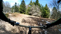
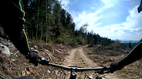
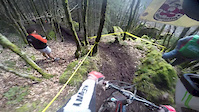
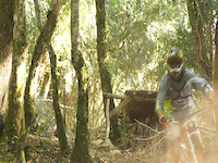
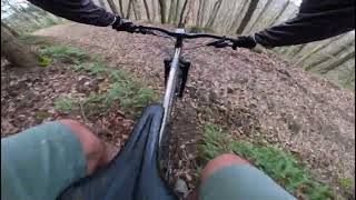
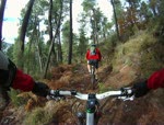
Photos of Saint Etienne Mountain Bike
Videos of Saint Etienne Mountain Bike
trail: Sous la Chèvre #2
3:29 |
106 |
Apr 3, 2019
trail: Sous la Chèvre #3
2:01 |
80 |
Apr 3, 2019
trail: Enduro du Breuil
7:46 |
824 |
Apr 5, 2015
trail: Caillasse
4:50 |
590 |
Sep 28, 2014
trail: Caillasse
6:12 |
175 |
Jul 16, 2013
trail: Le Salue
3:33 |
31 |
Feb 6, 2026 , Saint Etienne
trail: Caillasse
3:31 |
191 |
Nov 13, 2010

5:35 |
618 |
Sep 17, 2019 , Saint Etienne
Current Trail Warnings
| status | trail | date | condition | user | info |
|---|---|---|---|---|---|
| Le Salue | Jun 6, 2026 @ 10:09am (Europe/Paris) Jun 6, 2026 | Ideal | benjiiiq | Coupe de bois sur le haut, trace très... | |
| Airellier Upper | May 31, 2026 @ 8:50am (Europe/Monaco) May 30, 2026 | Unknown | mul0w Trailforks | E-Bike Terres privées, trail mort. | |
| Sous la Chèvre #3 | May 25, 2026 @ 9:37am (Europe/Paris) May 25, 2026 | Ideal | Davinzz | E-Bike |
Recent Trail Reports
Activity Feed
| username | action | type | title | date |
|---|---|---|---|---|
| jmarcvtt | add | report | activity #96855962 and 1 more | Jun 13, 2026 @ 2:24am Jun 13, 2026 |
| freerider48 | update | trail | activity #96729895 and 1 more | Jun 11, 2026 @ 5:10am Jun 11, 2026 |
| freerider48 | update | trail | activity #96729812 and 1 more | Jun 11, 2026 @ 5:08am Jun 11, 2026 |
| oli-vier | comment | trail | activity #96718346 | Jun 10, 2026 @ 9:52pm Jun 10, 2026 |
| oli-vier | ridden | trail | activity #96718319 | Jun 10, 2026 @ 9:50pm Jun 10, 2026 |
Recent Comments
| username | type | title | comment | date |
|---|---|---|---|---|
| trail | des jolis road gap qui demandent de... | Jun 10, 2026 @ 9:52pm Jun 10, 2026 | ||
| trail | Partie du haut reshappee avec des kick qui... | Jun 10, 2026 @ 2:42pm Jun 10, 2026 | ||
| report | @NSterz oups confondu avec low bob, et je ne... | May 25, 2026 @ 8:08am May 25, 2026 | ||
| report | Quelqu'un ( le propriétaire du terrain ?) à... | May 25, 2026 @ 7:57am May 25, 2026 | ||
| report | -- | Apr 28, 2026 @ 4:12am Apr 28, 2026 |
Local Badges
-

10 Blue Trails66 awarded -

Epic Ride Climb 2k139 awarded -

Climbing 10k Badge58 awarded -

Climbing 100k Badge6 awarded -

Epic Ride Descent 2k186 awarded -

Descent 10k Badge65 awarded
Activity Type Stats
| activitytype | trails | distance | descent | descent distance | total vertical | rating | global rank | state rank | photos | reports | routes | ridelogs |
|---|---|---|---|---|---|---|---|---|---|---|---|---|
| Mountain Bike | 334 | 180 miles | 80,502 ft | 123 miles | 4,111 ft | #572 | #4 | 72 | 1,102 | 10 | 6,759 | |
| E-Bike | 301 | 156 miles | 71,978 ft | 110 miles | 4,111 ft | #481 | #40 | 1 | 1,052 | 10 | 955 | |
| Horse | 13 | 2 miles | 102 ft | 3,619 ft | 456 ft | #741 | #32 | 12 | ||||
| Hike | 206 | 132 miles | 43,566 ft | 83 miles | 4,111 ft | #1,112 | #27 | 1,038 | 7 | 263 | ||
| Trail Running | 207 | 130 miles | 43,711 ft | 82 miles | 4,111 ft | #879 | #24 | 1,038 | 6 | 230 | ||
| Dirtbike/Moto | 2 | #505 | #18 | 12 | ||||||||
| Observed Trials | 6 | 2,776 ft | 531 ft | 2,776 ft | 531 ft | #150 | #19 | 10 | ||||
| ATV/ORV/OHV | 1 | #351 | #16 | 12 | ||||||||
| Snowshoe | 2 | 6 miles | 814 ft | 3 miles | 682 ft | 7 |
Frequently Asked Questions About Saint Etienne
▼
What are the best places to ride in Saint Etienne?
Saint Etienne has 1 areas to explore for mountain biking. The top rated areas are:
▼
What are the highest rated mountain biking trails in Saint Etienne?
The highest rated mountain biking trails in Saint Etienne are:
- Magic #2 (4.4/5)
- Entre Etançon et Rachat / Myrtille (4.4/5)
- Magic #1 (4.3/5)
- Sous la Chèvre #3 (4.3/5)
- Bob (4.3/5)
▼
What is the best time of the year to ride in Saint Etienne?
Based on ride log data, the most popular months to ride in Saint Etienne are:
- October (52 activities)
- September (25 activities)
- July (24 activities)
▼
Where can I park to ride in Saint Etienne?
Activities
Trails
- By SiMSJdC & contributors
- Admins: Whipperman, provencemb
- #5704 - 7,994 views
- saint etienne activity log | embed map of Saint Etienne mountain bike trails | saint etienne mountain biking points of interest
Downloading of trail gps tracks in kml & gpx formats is enabled for Saint Etienne.
You must login to download files.