close
-
Layers w
- Weather Layers
- Pro
- Pro
- Pro
- Pro
- Pro
- Pro
- More Layers
- Pro
- Pro
- Pro
- Pro
-
Upgrade to

3D
Trail Conditions
- Unknown
- Snow Groomed
- Snow Packed
- Snow Covered
- Snow Cover Partial
- Freeze/thaw Cycle
- Icy
- Prevalent Mud
- Wet
- Variable
- Ideal
- Dry
- Very Dry
Trail Flow (Ridden Direction)
Trailforks scans users ridelogs to determine the most popular direction each trail is ridden. A good flowing trail network will have most trails flowing in a single direction according to their intension.
The colour categories are based on what percentage of riders are riding a trail in its intended direction.
The colour categories are based on what percentage of riders are riding a trail in its intended direction.
- > 96%
- > 90%
- > 80%
- > 70%
- > 50%
- < 50%
- bi-directional trail
- no data
Trail Last Ridden
Trailforks scans ridelogs to determine the last time a trail was ridden.
- < 2 days
- < 1 week
- < 2 weeks
- < 1 month
- < 6 months
- > 6 months
Trail Ridden Direction
The intended direction a trail should be ridden.
- Downhill Only
- Downhill Primary
- Both Directions
- Uphill Primary
- Uphill Only
- One Direction
Contribute Details
Colors indicate trail is missing specified detail.
- Description
- Photos
- Description & Photos
- Videos
Trail Popularity ?
Trailforks scans ridelogs to determine which trails are ridden the most in the last 9 months.
Trails are compared with nearby trails in the same city region with a possible 25 colour shades.
Think of this as a heatmap, more rides = more kinetic energy = warmer colors.
- most popular
- popular
- less popular
- not popular
ATV/ORV/OHV Filter
Max Vehicle Width
inches
US Cell Coverage
Legend

Radar Time
Activity Recordings
Trailforks uses anonymized public activity data.
?
Activity Recordings
Trailforks uses anonymized public activity data.
?
Personal Heatmap
▶
Activity Types
all
/
none
▶
Options
2
Date range
month
–
Winter Trails
Warning
A routing network for winter maps does not exist. Selecting trails using the winter trails layer has been disabled.
Missing Trails
Most Popular
Least Popular
Trails are colored based on popularity. The more popular a trail is, the more red. Less popular trails trend towards green.
Jump Magnitude Heatmap
Heatmap of where riders jump on trails. Zoom in to see individual jumps, click circles to view jump details.
BC Backroad Status
![map legend]()
Service Road Atlas is a free to use, community-driven service for viewing and creating reports on the numerous back-country service roads around B.C. and Alberta.

Slope Aspect
Direction the slope faces
Trails Deemphasized
Trails are shown in grey.
Only show trails with no bike usage.
Suggested Layers
Based on selected activity type
Save the current map location and zoom level as your default home location whenever this page is loaded.
Save
No description for Saint John has been added yet!
Login or register to submit one.
Activities Click to view
- Mountain Bike
93 trails
- E-Bike
10 trails
- Gravel Bike
0 trails
- Adaptive Bike
1 trails
- Hike
117 trails
- Trail Running
117 trails
- ATV/ORV/OHV
4 trails
- Snowshoe
4 trails
Region Details
- 9
- 6
- 19
- 34
- 15
- 6
- 1
Region Status
Open as of Oct 19, 2025Stats
- Avg Trail Rating
- Trails (view details)
- 104
- Trails Mountain Bike
- 97
- Trails E-Bike
- 10
- Trails Adaptive Bike
- 1
- Trails Winter Fat Bike
- 1
- Trails Horse
- 2
- Trails Hike
- 117
- Trails Trail Running
- 117
- Trails Dirtbike/Moto
- 2
- Trails ATV/ORV/OHV
- 4
- Trails Snowmobile
- 2
- Trails Snowshoe
- 4
- Trails Downhill Ski
- 1
- Trails Backcountry Ski
- 1
- Trails Nordic Ski
- 3
- Total Distance
- 79 miles
- Total Descent
- 8,356 ft
- Total Vertical
- 327 ft
- Highest Trailhead
- 327 ft
- Reports
- 374
- Photos
- 218
- Ridden Counter
- 11,454
Sub Regions
-
Rockwood Park
- 5
- 12
- 25
- 14
- 6
- 1
-
The Rez
- 1
Popular Saint John Mountain Biking Trails
• 100 ★ 3.9 • 3,832 ft • 74 ft • 264 •
Popular blue difficulty singletrack. This multi-use trail can be used both directions. On average it takes 8 minutes to complete this trail.
• 80 ★ 5.0 • 2 miles • 186 ft • 249 •
Wet sensitive. A gorgeous flow trail built in 2017 by the SJ Trail Miners. Follows a beauty ridge. Probably best ridden starting at the end. A mountain of work when into this one!
• 95 ★ 5.0 • 1,086 ft • 3 ft • 249 •
Rockwood's newest trail. was built due to the erosion on the 3 steep hills of . This alternate route was designed to be ridden up or down. Downward it starts with 3 large berms and a flowy section. The trail is open but expect further...
• 80 ★ 3.4 • 2,447 ft • 60 ft • 233 •
A fairly wide, open, and easy trail that loops around . If you start riding from the Old Ski Hill parking lot you can use to connect to It's Gotta Go, to . Then follow the main trail back to and stay on it until you can turn off into ....
• 90 ★ 5.0 • 1,555 ft • 3 ft • 232 •
Wet sensitive. This trail has been recently revitalized with an amazing installation of stone work.
• 90 ★ 4.2 • 3,061 ft • 73 ft • 228 •
Short fast trail, usually ridden from the Power Line end and linked with or . Can be ridden either direction. Trail runs along a fault line and has some interesting rock formations to ride along, around and over.
• 75 ★ 4.5 • 2,139 ft • 30 ft • 222 •
The newest construction of the SJ Trail Miners. is a machine built flow trail with fun twists, turns, and jumps. Everything is optional so this trail will please new riders as well as seasoned pros.
• 95 ★ 0.0 • 1,835 ft • 18 ft • 215 •
Popular green difficulty gravel path. This multi-use trail can be used both directions. On average it takes 7 minutes to complete this trail.
Saint John Mountain Bike Routes
8 miles • 536 ft • 9 • Loop •
It's a fun fat bike route when the trails are in peak winter conditions. It can be shortened at multiple...
68 miles • 5,434 ft • 14 • Point to Point •
Two day bikepacking route.. begins downtown Saint John and ends at the Welsford Irving. Camp overnight on...
★ 1.0 • 10 miles • 818 ft • 51 •
Park at the gate adjacent to Peacock's Lane. Covers some of the park's nicest riding with minimal...
6 miles • 452 ft • 21 •
quick loop of good trails in the current winter conditions.
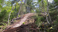
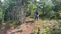
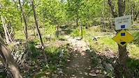
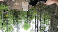
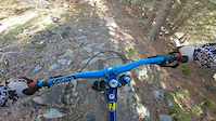
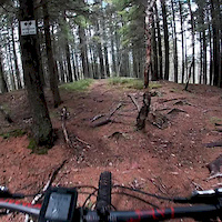
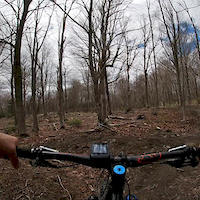
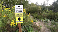
Photos of Saint John Mountain Bike
Videos of Saint John Mountain Bike
trail: Riptide
0:11 |
205 |
Aug 12, 2023
trail: Riptide
0:09 |
105 |
Aug 12, 2023
trail: Jedi Academy
0:20 |
34 |
Jun 13, 2023
trail: High Tide
0:54 |
121 |
Jun 13, 2023
trail: Bunny Rampage
3:01 |
510 |
Mar 20, 2020
trail: Skywalker
0:58 |
487 |
May 13, 2019
trail: Reid's Ridge
0:35 |
415 |
May 13, 2019
trail: Mama I'm Comin Home
4:50 |
515 |
Sep 15, 2018
Recent Trail Reports
| status | trail | date | condition | info | user |
|---|---|---|---|---|---|
| MacKay Skyway | Aug 14, 2025 @ 9:34pm Aug 14, 2025 | Unknown | jt51172 | ||
| Renforth Trail | May 25, 2025 @ 5:21pm May 25, 2025 | Variable | KimP2 | ||
| Pugsley | May 11, 2025 @ 3:11pm May 11, 2025 | Dry | ReneeHB | ||
| Deer Trax | May 11, 2025 @ 3:10pm May 11, 2025 | Icy | ReneeHB | ||
| Golf Trek | Apr 28, 2025 @ 4:41pm Apr 28, 2025 | Ideal | willtriv | ||
| 18th Hole | Apr 28, 2025 @ 4:39pm Apr 28, 2025 | Ideal | willtriv | ||
| Bunny Rampage | Apr 28, 2025 @ 1:03pm Apr 28, 2025 | Ideal | yoinked | ||
| Sponge Bob | Apr 28, 2025 @ 12:58pm Apr 28, 2025 | Variable | yoinked | ||
| Carnage | Apr 28, 2025 @ 12:57pm Apr 28, 2025 | Ideal | yoinked | ||
| Mayflower Lake - "Barking Dog" | Apr 16, 2025 @ 2:12pm Apr 16, 2025 | Variable | yoinked |
Activity Feed
| username | action | type | title | date |
|---|---|---|---|---|
| WillieJacobsz | update | directory | activity #96731269 | Jun 11, 2026 @ 5:47am Jun 11, 2026 |
| Martinp303 | update | directory | activity #96729413 | Jun 11, 2026 @ 4:59am Jun 11, 2026 |
| Pkantel18 | wishlist | region | activity #95570503 | May 26, 2026 @ 9:35am May 26, 2026 |
| Martinp303 | add | trail | activity #95524055 and 1 more | May 25, 2026 @ 2:31pm May 25, 2026 |
| Teresa80FgUZ | ridden | trail | activity #94971949 | May 18, 2026 @ 6:26am May 18, 2026 |
Recent Comments
| username | type | title | comment | date |
|---|---|---|---|---|
| trail | I'm sorry, but this is not a blue. This is a... | Jul 23, 2025 @ 9:15am Jul 23, 2025 | ||
| trail | this was hike with a bike for me. scout it... | Jul 15, 2024 @ 5:24am Jul 15, 2024 | ||
| report | B-e-a-utiful! | May 20, 2023 @ 6:47pm May 20, 2023 | ||
| trail | This trail is unforgiving Blue Tech. Rocks and... | Sep 16, 2022 @ 6:22am Sep 16, 2022 | ||
| trail | In my opinion not really MT bike rideable... | Jul 22, 2022 @ 12:33pm Jul 22, 2022 |
Local Badges
-

SJC - 5 Blacks128 awarded -

Completionist2 awarded -

Big Ride 30k386 awarded -

Epic Ride 50k176 awarded -

Top 10 Trails1 awarded -

Descent 100k Badge2 awarded
Bike & Skill Parks
| name | type | city | rating |
|---|---|---|---|
| Rockwood Skills Park | skill park | Saint John |
Activity Type Stats
| activitytype | trails | distance | descent | descent distance | total vertical | rating | global rank | state rank | photos | reports | routes | ridelogs |
|---|---|---|---|---|---|---|---|---|---|---|---|---|
| Mountain Bike | 93 | 62 miles | 5,938 ft | 26 miles | 328 ft | #1,378 | #4 | 214 | 380 | 7 | 12,641 | |
| E-Bike | 10 | 19 miles | 1,394 ft | 7 miles | 253 ft | #4,555 | #6 | 284 | 1 | 199 | ||
| Adaptive Bike | 1 | #348 | #34 | 4 | ||||||||
| Winter Fat Bike | 1 | #601 | #2 | 1 | 5 | |||||||
| Horse | 2 | 7 miles | 49 ft | 1 mile | 118 ft | 68 | ||||||
| Hike | 117 | 79 miles | 8,353 ft | 33 miles | 328 ft | #2,272 | #3 | 6 | 379 | 1,338 | ||
| Trail Running | 117 | 79 miles | 8,353 ft | 33 miles | 328 ft | #1,807 | #2 | 379 | 2,147 | |||
| Dirtbike/Moto | 2 | 4 miles | 410 ft | 2 miles | 187 ft | 68 | 1 | |||||
| ATV/ORV/OHV | 4 | 11 miles | 459 ft | 4 miles | 197 ft | #694 | #4 | 68 | 1 | |||
| Snowmobile | 2 | 7 miles | 49 ft | 1 mile | 118 ft | |||||||
| Snowshoe | 4 | 8 miles | 125 ft | 2 miles | 187 ft | #925 | #6 | 5 | 43 | |||
| Downhill Ski | 1 | 5 miles | 49 ft | 1 mile | 105 ft | 1 | ||||||
| Backcountry Ski | 1 | 5 miles | 49 ft | 1 mile | 105 ft | |||||||
| Nordic Ski | 3 | 8 miles | 85 ft | 2 miles | 184 ft | 5 | 20 |
Frequently Asked Questions About Saint John
▼
What are the best places to ride in Saint John?
Saint John has 3 areas to explore for mountain biking. The top rated areas are:
▼
What are the highest rated mountain biking trails in Saint John?
The highest rated mountain biking trails in Saint John are:
- Sasquatch Run (4.6/5)
- Carnage (4.5/5)
- Bunny Rampage (4.4/5)
- Our Compliments (4.4/5)
- Skywalker (4.4/5)
▼
What is the best time of the year to ride in Saint John?
Based on ride log data, the most popular months to ride in Saint John are:
- August (176 activities)
- July (167 activities)
- September (164 activities)
▼
Where can I park to ride in Saint John?
There are 23 parking locations listed in Saint John. The most popular parking spots are: View all parking and trailhead locations on the map to plan your visit.
Activities
Trails
- By canadaka
 Trailforks & contributors
 - Admins: ChrisNorfolk, themikekowalski, alexisberube, Trail Miners
- #4562 - 15,503 views
- saint john activity log | embed map of Saint John mountain bike trails | saint john mountain biking points of interest
Downloading of trail gps tracks in kml & gpx formats is enabled for Saint John.
You must login to download files.