close
-
Layers w
- Weather Layers
- Pro
- Pro
- Pro
- Pro
- Pro
- Pro
- More Layers
- Pro
- Pro
- Pro
- Pro
-
Upgrade to

3D
Trail Conditions
- Unknown
- Snow Groomed
- Snow Packed
- Snow Covered
- Snow Cover Partial
- Freeze/thaw Cycle
- Icy
- Prevalent Mud
- Wet
- Variable
- Ideal
- Dry
- Very Dry
Trail Flow (Ridden Direction)
Trailforks scans users ridelogs to determine the most popular direction each trail is ridden. A good flowing trail network will have most trails flowing in a single direction according to their intension.
The colour categories are based on what percentage of riders are riding a trail in its intended direction.
The colour categories are based on what percentage of riders are riding a trail in its intended direction.
- > 96%
- > 90%
- > 80%
- > 70%
- > 50%
- < 50%
- bi-directional trail
- no data
Trail Last Ridden
Trailforks scans ridelogs to determine the last time a trail was ridden.
- < 2 days
- < 1 week
- < 2 weeks
- < 1 month
- < 6 months
- > 6 months
Trail Ridden Direction
The intended direction a trail should be ridden.
- Downhill Only
- Downhill Primary
- Both Directions
- Uphill Primary
- Uphill Only
- One Direction
Contribute Details
Colors indicate trail is missing specified detail.
- Description
- Photos
- Description & Photos
- Videos
Trail Popularity ?
Trailforks scans ridelogs to determine which trails are ridden the most in the last 9 months.
Trails are compared with nearby trails in the same city region with a possible 25 colour shades.
Think of this as a heatmap, more rides = more kinetic energy = warmer colors.
- most popular
- popular
- less popular
- not popular
ATV/ORV/OHV Filter
Max Vehicle Width
inches
US Cell Coverage
Legend

Radar Time
Activity Recordings
Trailforks uses anonymized public activity data.
?
Activity Recordings
Trailforks uses anonymized public activity data.
?
Personal Heatmap
▶
Activity Types
all
/
none
▶
Options
2
Date range
month
–
Winter Trails
Warning
A routing network for winter maps does not exist. Selecting trails using the winter trails layer has been disabled.
Missing Trails
Most Popular
Least Popular
Trails are colored based on popularity. The more popular a trail is, the more red. Less popular trails trend towards green.
Jump Magnitude Heatmap
Heatmap of where riders jump on trails. Zoom in to see individual jumps, click circles to view jump details.
BC Backroad Status
![map legend]()
Service Road Atlas is a free to use, community-driven service for viewing and creating reports on the numerous back-country service roads around B.C. and Alberta.

Slope Aspect
Direction the slope faces
Trails Deemphasized
Trails are shown in grey.
Only show trails with no bike usage.
Suggested Layers
Based on selected activity type
Save the current map location and zoom level as your default home location whenever this page is loaded.
Save
No description for Salardu has been added yet!
Login or register to submit one.
This region uses the Uk/Euro style trail grading system.
Activities Click to view
- Mountain Bike
32 trails
- E-Bike
33 trails
- Gravel Bike
0 trails
- Adaptive Bike
0 trails
- Hike
30 trails
- Trail Running
30 trails
Region Details
- 13
- 5
- 8
- 5
Region Status
Open as of Jun 8, 2026Stats
- Avg Trail Rating
- Trails (view details)
- 32
- Trails Mountain Bike
- 33
- Trails E-Bike
- 33
- Trails Hike
- 30
- Trails Trail Running
- 30
- Trails Backcountry Ski
- 1
- Total Distance
- 49 miles
- Total Descent
- 20,273 ft
- Total Vertical
- 5,493 ft
- Highest Trailhead
- 9,115 ft
- Reports
- 645
- Photos
- 251
- Ridden Counter
- 8,018
Sub Regions
-
Enduromies
- 1
- 2
- 3
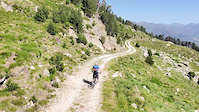
Popular Salardu Mountain Biking Trails
• 90 ★ 4.7 • 3 miles • 202 ft • 478 •
alpine trail with amazing landscapes over the Aran Valley!! 6kilometers uphill and then 4 flat kilometers in amazing trail and finish with a narrow trail. Sendero sin mucha dificultad técnica, salvo un par de pasos, pero eso si, muy,...
• 75 ★ 4.9 • 4,925 ft • 0 ft • 376 •
fun trail a little bit step. combyn roots , with rock gardens and closed turns
• 65 ★ 2.8 • 3,094 ft • 165 ft • 271 •
Sendero con algún repecho potente, si se hace sentido Gessa. Enlace desde Salardu a la pista de acceso a Enduromies. Ojo, este trail pasa por fincas privadas . Respetar a los vecinos.
• 100 ★ 4.4 • 584 ft • 0 ft • 258 •
Popular green difficulty singletrack. This multi-use trail can be used both directions. Trail visibility is always easy to follow. On average it takes 1 minutes to complete this trail.
• 65 ★ 4.9 • 2,057 ft • 0 ft • 201 •
trail que en mojado es un poco tecnico.Tiene un par de saltos, uno de ellos con Gap pero con chicken line alternativa.
• 95 ★ 4.9 • 4,134 ft • 4 ft • 174 •
Trail muy trabajado gracias a Aran Bike Park, de arriba abajo es flow, parte inicial de pompear, terreno exquisito, peraltes bien hechos, zonas contrapedaltadas y algunos pequeños saltos.
Salardu Mountain Bike Routes
7 miles • 1,927 ft • 2 • Loop •
The Sanglièr descent is the first to open in the Enduromies sector and it has become a classic for many...
16 miles • 3,602 ft • 4 • Loop •
Fantastic route, not only for the quality of the descents, which are very good, but also in terms of...
23 miles • 5,756 ft • 2 • Loop •
A long easy ascend that will be rewarded with a unbelievable trail hanging next to a cliff through old...
18 miles • 4,616 ft • 6 • Loop •
A proposal for cyclo-mountaineering in the northern valleys of Aran, with a very high percentage of...
6 miles • 1,747 ft • 2 • Loop •
The historic path that went up from Salardú to Beret has been recently recovered, and offers a fun, easy...
★ 3.0 • 13 miles • 1,127 ft • 2 • Shuttled •
Descenso desde La Bonaigua a Vielha.Ruta con remonte de coches
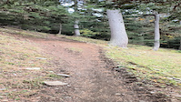
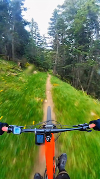
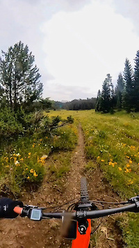
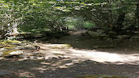
Photos of Salardu Mountain Bike
Videos of Salardu Mountain Bike
trail: Acceso Pruedo
0:24 |
1 |
Nov 14, 2025
trail: Pruedo
3:15 |
|
Oct 15, 2024
trail: Eth Taro
0:13 |
55 |
Sep 16, 2023
trail: Eth Sanglier
0:32 |
30 |
Sep 16, 2023

trail: Obaga Arties Gessa
0:18 |
|
Aug 13, 2023
trail: Obaga Arties Gessa
0:18 |
|
Aug 13, 2023

trail: Obaga Arties Gessa
0:18 |
|
Aug 13, 2023
trail: Eth Taro
0:07 |
39 |
Oct 17, 2021
Recent Trail Reports
| status | trail | date | condition | info | user |
|---|---|---|---|---|---|
| Enllaç Eth Sanglier | Jun 8, 2026 @ 9:20am (Europe/Madrid) Jun 8, 2026 | Ideal | marcosmart | ||
| Obaga Arties Gessa | Jun 8, 2026 @ 1:13am (Europe/Madrid) Jun 7, 2026 | Ideal | marcosmart | ||
| Eth Taro | Jun 8, 2026 @ 1:12am (Europe/Madrid) Jun 7, 2026 | Ideal | marcosmart | ||
| Green Rocks | Jun 8, 2026 @ 1:03am (Europe/Madrid) Jun 7, 2026 | Ideal | marcosmart | ||
| Ribera de Rius - Acceso Pruedo | May 30, 2026 @ 10:55pm (Europe/Madrid) May 30, 2026 | Unknown | Josep1984 | ||
| Eth Sanglier 2.0 | May 30, 2026 @ 10:52pm (Europe/Madrid) May 30, 2026 | Dry | Josep1984 | ||
| Pruedo | May 30, 2026 @ 10:51pm (Europe/Madrid) May 30, 2026 | Ideal | Josep1984 | ||
| Eth Sanglier | May 24, 2026 @ 6:17pm (Europe/Madrid) May 24, 2026 | Ideal | JORDIVT | ||
| Camin des Conhasses | May 18, 2026 @ 8:53pm (Europe/Madrid) May 18, 2026 | Wet | dterri Lo Podall | ||
| Bagergue - Unha | May 17, 2026 @ 11:24am (Europe/Andorra) May 17, 2026 | Ideal | dterri Lo Podall |
Activity Feed
| username | action | type | title | date |
|---|---|---|---|---|
| Atzucat | wishlist | trail | activity #97306345 | Jun 19, 2026 @ 3:52am 43 mins |
| marcosmart | add | report | activity #96524570 | Jun 8, 2026 @ 12:20am Jun 8, 2026 |
| marcosmart | add | report | activity #96505572 | Jun 7, 2026 @ 4:13pm Jun 7, 2026 |
| marcosmart | add | report | activity #96504879 and 1 more | Jun 7, 2026 @ 4:03pm Jun 7, 2026 |
| marcosmart | like | directory | activity #96395133 | Jun 6, 2026 @ 12:07pm Jun 6, 2026 |
Recent Comments
| username | type | title | comment | date |
|---|---|---|---|---|
| trail | Perfecte estat tota la pujada | May 30, 2026 @ 1:49pm May 30, 2026 | ||
| report | Sense neu ja a la part alta | May 24, 2026 @ 9:17am May 24, 2026 | ||
| report | Gracias por avisar! Deseando poder ir | Apr 25, 2026 @ 2:52pm Apr 25, 2026 | ||
| report | Por lo demás qué tal está?? | Apr 23, 2026 @ 11:56pm Apr 23, 2026 | ||
| trail | super aussicht, zuerst lange den höhenlinien... | Aug 25, 2025 @ 7:40am Aug 25, 2025 |
Local Badges
-

Epic Mountain Bike Climb 2k226 awarded -

Climbing 10k Badge27 awarded -

Mountain Biking 100k Badge0 awarded -

Epic Ride Descent 2k226 awarded -

Descent 10k Badge31 awarded -

Descent 100k Badge0 awarded
Bike & Skill Parks
| name | type | city | rating |
|---|---|---|---|
| Pumptrack Arties | skill park | Salardu |
Activity Type Stats
| activitytype | trails | distance | descent | descent distance | total vertical | rating | global rank | state rank | photos | reports | routes | ridelogs |
|---|---|---|---|---|---|---|---|---|---|---|---|---|
| Mountain Bike | 32 | 47 miles | 17,379 ft | 24 miles | 4,524 ft | #2,696 | #209 | 262 | 670 | 14 | 3,229 | |
| E-Bike | 33 | 47 miles | 17,379 ft | 24 miles | 4,524 ft | #581 | #167 | 639 | 14 | 835 | ||
| Hike | 30 | 42 miles | 12,503 ft | 20 miles | 4,524 ft | #4,553 | #301 | 563 | 768 | |||
| Trail Running | 30 | 42 miles | 12,503 ft | 20 miles | 4,524 ft | #3,945 | #293 | 563 | 301 | |||
| Backcountry Ski | 1 | 2 miles | 2,894 ft | 2 miles | 2,897 ft | 407 |
Frequently Asked Questions About Salardu
▼
What are the best places to ride in Salardu?
Salardu has 1 areas to explore for mountain biking. The top rated areas are:
▼
What are the highest rated mountain biking trails in Salardu?
The highest rated mountain biking trails in Salardu are:
- Eth Sanglier 2.0 (4.6/5)
- Green Rocks (4.6/5)
- Eth Sanglier (4.6/5)
- 25598 (4.5/5)
- Pruedo (4.5/5)
▼
What is the best time of the year to ride in Salardu?
Based on ride log data, the most popular months to ride in Salardu are:
- June (52 activities)
- August (42 activities)
- July (40 activities)
▼
Where can I park to ride in Salardu?
There are 1 parking locations listed in Salardu. The most popular parking spots are:
Activities
Trails
- By Marcscan
 OCB & contributors
 - Admins: snaker4, kai-bcn, OCB, Kalamarrrrrdo
- #15797 - 2,295 views
- salardu activity log | embed map of Salardu mountain bike trails | salardu mountain biking points of interest
Downloading of trail gps tracks in kml & gpx formats is enabled for Salardu.
You must login to download files.