close
-
Layers w
- Weather Layers
- Pro
- Pro
- Pro
- Pro
- Pro
- Pro
- More Layers
- Pro
- Pro
- Pro
- Pro
-
Upgrade to

3D
Trail Conditions
- Unknown
- Snow Groomed
- Snow Packed
- Snow Covered
- Snow Cover Partial
- Freeze/thaw Cycle
- Icy
- Prevalent Mud
- Wet
- Variable
- Ideal
- Dry
- Very Dry
Trail Flow (Ridden Direction)
Trailforks scans users ridelogs to determine the most popular direction each trail is ridden. A good flowing trail network will have most trails flowing in a single direction according to their intension.
The colour categories are based on what percentage of riders are riding a trail in its intended direction.
The colour categories are based on what percentage of riders are riding a trail in its intended direction.
- > 96%
- > 90%
- > 80%
- > 70%
- > 50%
- < 50%
- bi-directional trail
- no data
Trail Last Ridden
Trailforks scans ridelogs to determine the last time a trail was ridden.
- < 2 days
- < 1 week
- < 2 weeks
- < 1 month
- < 6 months
- > 6 months
Trail Ridden Direction
The intended direction a trail should be ridden.
- Downhill Only
- Downhill Primary
- Both Directions
- Uphill Primary
- Uphill Only
- One Direction
Contribute Details
Colors indicate trail is missing specified detail.
- Description
- Photos
- Description & Photos
- Videos
Trail Popularity ?
Trailforks scans ridelogs to determine which trails are ridden the most in the last 9 months.
Trails are compared with nearby trails in the same city region with a possible 25 colour shades.
Think of this as a heatmap, more rides = more kinetic energy = warmer colors.
- most popular
- popular
- less popular
- not popular
ATV/ORV/OHV Filter
Max Vehicle Width
inches
US Cell Coverage
Legend

Radar Time
Activity Recordings
Trailforks uses anonymized public activity data.
?
Activity Recordings
Trailforks uses anonymized public activity data.
?
Personal Heatmap
▶
Activity Types
all
/
none
▶
Options
2
Date range
month
–
Winter Trails
Warning
A routing network for winter maps does not exist. Selecting trails using the winter trails layer has been disabled.
Missing Trails
Most Popular
Least Popular
Trails are colored based on popularity. The more popular a trail is, the more red. Less popular trails trend towards green.
Jump Magnitude Heatmap
Heatmap of where riders jump on trails. Zoom in to see individual jumps, click circles to view jump details.
BC Backroad Status
![map legend]()
Service Road Atlas is a free to use, community-driven service for viewing and creating reports on the numerous back-country service roads around B.C. and Alberta.

Slope Aspect
Direction the slope faces
Trails Deemphasized
Trails are shown in grey.
Only show trails with no bike usage.
Suggested Layers
Based on selected activity type
Save the current map location and zoom level as your default home location whenever this page is loaded.
Save
No description for Salem has been added yet!
Login or register to submit one.
Activities Click to view
- Mountain Bike
111 trails
- E-Bike
5 trails
- Gravel Bike
0 trails
- Adaptive Bike
0 trails
- Winter Fat Bike
0 trails
- Horse
7 trails
- Hike
143 trails
- Trail Running
142 trails
Region Details
- 18
- 2
- 19
- 41
- 4
Region Status
Caution as of 2 daysStats
- Avg Trail Rating
- Trails (view details)
- 95
- Trails Mountain Bike
- 111
- Trails E-Bike
- 5
- Trails Horse
- 7
- Trails Hike
- 143
- Trails Trail Running
- 142
- Total Distance
- 142 miles
- Total Descent
- 24,239 ft
- Total Vertical
- 5,386 ft
- Highest Trailhead
- 5,492 ft
- Reports
- 2,254
- Photos
- 244
- Ridden Counter
- 15,354
Sub Regions
-
Bull of the Woods / Opal Creek Wilderness
- 18
-
Croisan Creek
- 1
- 3
-
Geer Bike Park
-
Shellburg Mountain Bike Area
- 3
- 5
- 3
-
Silver Falls State Park
- 2
- 7
- 13
- 1
-
Spring Valley State Park
- 6
- 1
-
Willamette Mission State Park
- 2
Popular Salem Mountain Biking Trails
• 100 ★ 4.4 • 2 miles • 114 ft • 921 •
This trail runs through beautiful ancient forests, passes huge fallen trees, crosses several streams, and offers a very unique riding experience to a wide range of riders. While intended to be ridden downhill, east to west, the trail...
• 95 ★ 4.7 • 3,556 ft • 0 ft • 801 •
This upper portion of is mostly smooth and flowy, with only a few rocky patches. Several camel humps that are easy and fun to roll or catch small air if that is your thing.
• 95 ★ 4.3 • 3,547 ft • 43 ft • 533 •
This two-way trail not only adds a new trail (in some lovely terrain!) to the system , but also provides easy access to a second parking option in addition to the TH. is relatively steep in a few spots, but for the most part is a...
• 95 ★ 4.0 • 833 ft • 3 ft • 444 •
There are three short trails along this line. Each trail is designed to help beginners (green circle), intermediate (blue square), and expert riders (black diamond) hone their rock-drop and rock up-and-over skills. All three are...
• 95 ★ 3.0 • 394 ft • 16 ft • 437 •
Skills station featuring four wooden drops that vary in height (approx. 1', 2', 3', and 4').
• 90 ★ 4.0 • 1 mile • 113 ft • 430 •
Packed dirt single track with mellow climbs, descents, corners, and small sections of cobble. The loop is perfect for families new to mountain biking or laps in the beautiful woods. It is also the entrance to .
• 90 ★ 5.0 • 797 ft • 0 ft • 429 •
Series of switchbacks designed to practice banked turns.
Salem Mountain Bike Routes
★ 4.7 • 9 miles • 1,268 ft • 11 • Loop •
Park at the Conference Center Parking Lot (as mapped), clockwise direction recommended. Alternatively,...
★ 5.0 • 8 miles • 969 ft • 2 • Loop •
Leg pumping goodness. Park at Howard Creek Horse Camp or at the Campground Entrance. Ride the Connector...
11 miles • 1,196 ft • 9 • Loop •
This route is rated aMTB1 - No Support Needed. It skips Catamount Trail (Mid) and , where adaptive riders...
13 miles • 1,559 ft • 12 • Loop •
This route is rated aMTB2 - Support recommended. Be sure to have a support rider the first attempt. Riders...
★ 2.0 • 8 miles • 746 ft • 14 • Loop •
Park at TH 214 and ride up the gravel road. Enter Catamount at the top and ride it down. State Park may...
214-Reroute Hidden
3 miles • 122 ft • 0 •
This trail is being researched in conjunction with Salem Area Trail alliance and Silver Falls State Park....
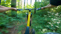
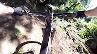
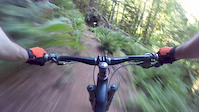
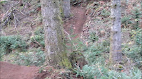
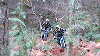
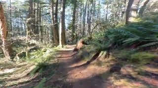
Photos of Salem Mountain Bike
Videos of Salem Mountain Bike
trail: Catamount Trail (Upper)
3:29 |
16 |
May 11, 2026
trail: Payback
2:09 |
305 |
Aug 17, 2020
trail: Pusher
0:50 |
390 |
Aug 2, 2018
trail: Bobblehead
3:04 |
1058 |
Jul 28, 2018
trail: Payback
0:47 |
355 |
Dec 17, 2014
trail: Payback
0:52 |
760 |
Dec 7, 2014

trail: Payback
2:18 |
1031 |
May 15, 2014
trail: Roemer's
10:46 |
63 |
Feb 6, 2026 , Salem
Recent Trail Reports
| status | trail | date | condition | info | user |
|---|---|---|---|---|---|
| Access Smith Creek | Jun 24, 2026 @ 2:01pm (America/Vancouver) 2 days | Dry | StevenwyMZrG | ||
| Rabbit Hole | Jun 24, 2026 @ 2:01pm (America/Vancouver) 2 days | Dry | StevenwyMZrG | ||
| Skills Area | Jun 24, 2026 @ 2:01pm (America/Vancouver) 2 days | Dry | StevenwyMZrG | ||
| Skills Connector | Jun 24, 2026 @ 2:01pm (America/Vancouver) 2 days | Dry | StevenwyMZrG | ||
| Catamount Trail (Lower) | Jun 24, 2026 @ 2:01pm (America/Vancouver) 2 days | Dry | StevenwyMZrG | ||
| Catamount Trail (Mid) | Jun 24, 2026 @ 2:01pm (America/Vancouver) 2 days | Dry | StevenwyMZrG | ||
| Access Road | Jun 24, 2026 @ 2:01pm (America/Vancouver) 2 days | Dry | StevenwyMZrG | ||
| Access Road | Jun 24, 2026 @ 2:01pm (America/Vancouver) 2 days | Dry | StevenwyMZrG | ||
| Link Trail | Jun 24, 2026 @ 2:01pm (America/Vancouver) 2 days | Dry | StevenwyMZrG | ||
| Lost Creek Trail | Jun 24, 2026 @ 2:01pm (America/Vancouver) 2 days | Dry | StevenwyMZrG |
Activity Feed
| username | action | type | title | date |
|---|---|---|---|---|
| jamieNUtUv1 | comment | trail | activity #97810545 and 1 more | Jun 25, 2026 @ 7:25pm 16 hours |
| jamieNUtUv1 | vote | trail | activity #97810523 and 1 more | Jun 25, 2026 @ 7:24pm 16 hours |
| jamieNUtUv1 | ridden | trail | activity #97810520 and 4 more | Jun 25, 2026 @ 7:24pm 16 hours |
| StevenwyMZrG | add | report | activity #97743776 and 1 more | Jun 24, 2026 @ 7:59pm 2 days |
| StevenwyMZrG | add | report | activity #97743673 and 10 more | Jun 24, 2026 @ 7:57pm 2 days |
Recent Comments
| username | type | title | comment | date |
|---|---|---|---|---|
| trail | Would not do again. I would climb another route. | Jun 25, 2026 @ 7:29pm 16 hours | ||
| trail | Ten out of ten. Would do again! | Jun 25, 2026 @ 7:25pm 16 hours | ||
| trail | Best description mtn bike joy! It has... | Jun 13, 2026 @ 8:01am Jun 13, 2026 | ||
| trail | Brushy, tall grass hides tread issues. Trail... | Jun 3, 2026 @ 12:02pm Jun 3, 2026 | ||
| trail | This is a nice trail and the conditions were... | Mar 30, 2026 @ 9:00am Mar 30, 2026 |
Local Badges
-

10 Green Trails63 awarded -

10 Blue Trails199 awarded -

Epic Ride Climb 2k18 awarded -

Climbing 10k Badge38 awarded -

Climbing 100k Badge3 awarded -

Epic Ride Descent 2k16 awarded
Bike & Skill Parks
| name | type | city | rating |
|---|---|---|---|
| Paved Pumptrack | skill park | Salem | |
| Kids Pumptrack | skill park | Salem |
Activity Type Stats
| activitytype | trails | distance | descent | descent distance | total vertical | rating | global rank | state rank | photos | reports | routes | ridelogs |
|---|---|---|---|---|---|---|---|---|---|---|---|---|
| Mountain Bike | 111 | 130 miles | 22,257 ft | 55 miles | 5,387 ft | #1,172 | #452 | 241 | 2,250 | 5 | 12,604 | |
| E-Bike | 5 | #8,942 | #2,735 | 1,879 | 600 | |||||||
| Horse | 7 | 7 miles | 285 ft | 1 mile | 942 ft | #2,381 | #1,318 | 147 | 1 | |||
| Hike | 143 | 140 miles | 22,838 ft | 58 miles | 5,387 ft | #1,220 | #561 | 6 | 2,195 | 1 | 1,965 | |
| Trail Running | 142 | 139 miles | 22,795 ft | 58 miles | 5,387 ft | #1,106 | #404 | 2,195 | 500 |
Frequently Asked Questions About Salem
▼
What are the best places to ride in Salem?
Salem has 7 areas to explore for mountain biking. The top rated areas are:
▼
What are the highest rated mountain biking trails in Salem?
The highest rated mountain biking trails in Salem are:
- Bobblehead (4.5/5)
- Catamount Trail (Upper) (4.4/5)
- Roemer's (4.3/5)
- Catamount Trail (Mid) (4.3/5)
- Dewaynes World (4.2/5)
▼
What is the best time of the year to ride in Salem?
Based on ride log data, the most popular months to ride in Salem are:
- July (247 activities)
- August (126 activities)
- June (108 activities)
▼
Where can I park to ride in Salem?
There are 27 parking locations listed in Salem. The most popular parking spots are: View all parking and trailhead locations on the map to plan your visit.
Activities
Trails
Points of Interest
- Gold Butte Lookout Cabin
- North Falls Viewpoint
- Henline Falls Sight
- Henline Mountain Viewpoint
- Silver Falls Campground Camping
- Upper Butte Creek Falls Sight
- Butte Creek Falls Sight
- Lower Butte Creek Falls Viewpoint Sight
- Falls Butte Campground Camping
- Camp Silver Creek Camping
- Hell Cat Rock (4,337 ft)
- Sweet Spring Mountain (4,078 ft)
- Hell Cat Rock (4,003 ft)
- By trailforks
 Trailforks & contributors
 - Admins: SATA, NWTA, SATA
- #6725 - 15,797 views
- salem activity log | embed map of Salem mountain bike trails | salem mountain biking points of interest
Downloading of trail gps tracks in kml & gpx formats is enabled for Salem.
You must login to download files.